Batalha, Alagoas: Difference between revisions
Appearance
Content deleted Content added
Replacing Bandeira_Batalha.gif with File:Bandeira_Batalha.png (by CommonsDelinker because: file renamed or replaced on Commons). |
|||
| Line 8: | Line 8: | ||
| image_alt = |
| image_alt = |
||
| image_caption = |
| image_caption = |
||
| image_flag = Bandeira Batalha. |
| image_flag = Bandeira Batalha.png |
||
| flag_alt = |
| flag_alt = |
||
| image_seal = |
| image_seal = |
||
Revision as of 06:15, 20 July 2020
Batalha | |
|---|---|
Municipality | |
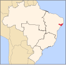
 Location of Batalha in the State of Alagoas | |
| Coordinates: 09°40′40″S 37°07′29″W / 9.67778°S 37.12472°W | |
| Land | Brasilien |
| Website | Official website |
Batalha is a municipality located in the western half of the Brazilian state of Alagoas. Its population is 15,905 (2005) and its area is 321 km².[1]
References
- ^ IBGE - "Archived copy". Archived from the original on 2007-01-09. Retrieved 2014-08-03.
{{cite web}}: CS1 maint: archived copy as title (link)


