List of largest cities in the Organisation of Islamic Cooperation member countries: Difference between revisions
Appearance
Content deleted Content added
Change image Tags: Reverted missing file added Visual edit Mobile edit Mobile web edit |
|||
| Line 13: | Line 13: | ||
!| Area (km²)<ref>The area figures are taken from individual national censuses according to the criteria and statistical concepts noted in the World Urbanization Prospects.</ref> |
!| Area (km²)<ref>The area figures are taken from individual national censuses according to the criteria and statistical concepts noted in the World Urbanization Prospects.</ref> |
||
|- |
|- |
||
|1||[[Jakarta]]<ref name="citypop1">{{cite web|url=http://www.citypopulation.de/php/indonesia-jawa-admin.php|title= Indonesia: Jawa|accessdate=2017-07-05}}</ref>||[[File: |
|1||[[Jakarta]]<ref name="citypop1">{{cite web|url=http://www.citypopulation.de/php/indonesia-jawa-admin.php|title= Indonesia: Jawa|accessdate=2017-07-05}}</ref>||[[File:Jakarta Skyline Part 2.jpg|200px|center]]||align=right|30,214,303||{{IDN}}||Urban agglomeration<ref name=idn>Data refer to the functional urban area, that is, contiguous areas which are consistently urban in character as indicated by levels of population density, economic functions and facilities.</ref>||6,392 |
||
|- |
|- |
||
|2||[[Karachi]]<ref>http://tribune.com.pk/story/614409/population-explosion-put-an-embargo-on-industrialisation-in-karachi</ref>||[[File:EFU Life By Asif Akbar.jpg|alt=|center|200x200px]]|| align="right" |20,500,000||{{PAK}}||Urban agglomeration||4,966 |
|2||[[Karachi]]<ref>http://tribune.com.pk/story/614409/population-explosion-put-an-embargo-on-industrialisation-in-karachi</ref>||[[File:EFU Life By Asif Akbar.jpg|alt=|center|200x200px]]|| align="right" |20,500,000||{{PAK}}||Urban agglomeration||4,966 |
||
| Line 29: | Line 29: | ||
|8||[[Lahore]]<ref name="worlduapdf"></ref>||[[File:Badshahi Mosquee, Lahore.jpg |alt=|center|200x200px]]|| align="right" |11,126,285||{{PAK}}||Urban agglomeration||1,370 |
|8||[[Lahore]]<ref name="worlduapdf"></ref>||[[File:Badshahi Mosquee, Lahore.jpg |alt=|center|200x200px]]|| align="right" |11,126,285||{{PAK}}||Urban agglomeration||1,370 |
||
|- |
|- |
||
|9||[[Bandung]]<ref name="citypop1"></ref>||[[File: |
|9||[[Bandung]]<ref name="citypop1"></ref>||[[File:Modern Bragaweg (27156618256).jpg|200px|center]]||align=right|8,199,892||{{IDN}}||Urban agglomeration||1,876 |
||
|- |
|- |
||
|10||[[Faisalabad]]<ref name="worlduapdf"></ref>||[[File:Clock Tower Faisalabad by Usman Nadeem.jpg |200px|center]]||align=right|7,873,910||{{PAK}}||Urban agglomeration||1,097 |
|10||[[Faisalabad]]<ref name="worlduapdf"></ref>||[[File:Clock Tower Faisalabad by Usman Nadeem.jpg |200px|center]]||align=right|7,873,910||{{PAK}}||Urban agglomeration||1,097 |
||
| Line 35: | Line 35: | ||
|11||[[Islamabad-Rawalpindi metropolitan area|Islamabad-Rawalpindi]]<ref>{{cite web|url=http://www.citypopulation.de/Pakistan-100T.html|title=Pakistan: Provinces and Major Cities - Population Statistics, Maps, Charts, Weather and Web Information|website=citypopulation.de}}</ref>||[[File:Faisal Masjid From Damn e koh.jpg|200px|center]]||align=right|7,412,205||{{PAK}}||Metropolitan Area||6,451 |
|11||[[Islamabad-Rawalpindi metropolitan area|Islamabad-Rawalpindi]]<ref>{{cite web|url=http://www.citypopulation.de/Pakistan-100T.html|title=Pakistan: Provinces and Major Cities - Population Statistics, Maps, Charts, Weather and Web Information|website=citypopulation.de}}</ref>||[[File:Faisal Masjid From Damn e koh.jpg|200px|center]]||align=right|7,412,205||{{PAK}}||Metropolitan Area||6,451 |
||
|- |
|- |
||
|12||[[Surabaya]]<ref name="citypop1"></ref>||[[File:Surabaya- |
|12||[[Surabaya]]<ref name="citypop1"></ref>||[[File:JW Marriott Hotel (dh. Hotel Westin) Surabaya, view from 9th floor Empire Palace Hotel - panoramio.jpg|200px|center]]||align=right|7,302,283||{{IDN}}||Urban agglomeration<ref name=idn></ref>||2,787 |
||
|- |
|- |
||
|13||[[Baghdad]]||[[Image:Baghdad Red zone.jpg|200px|center]]||align=right|6,625,000||{{IRQ}}||Metropolitan area||730 |
|13||[[Baghdad]]||[[Image:Baghdad Red zone.jpg|200px|center]]||align=right|6,625,000||{{IRQ}}||Metropolitan area||730 |
||
|- |
|- |
||
|14||[[Semarang]]||[[ |
|14||[[Semarang]]||[[Image:Mesjid Agung Semarang 2009.jpg|200px|center]]||align=right|6,544,289||{{IDN}}||Urban agglomeration||5,287 |
||
|- |
|- |
||
|15||[[Kuala Lumpur]]<ref name="worlduapdf"></ref>||[[File:FourSeasonsKL January2018.jpg|200px|center]]||align=right|6,088,000||{{MYS}}||Metropolitan area<ref name=idn></ref>||673 |
|15||[[Kuala Lumpur]]<ref name="worlduapdf"></ref>||[[File:FourSeasonsKL January2018.jpg|200px|center]]||align=right|6,088,000||{{MYS}}||Metropolitan area<ref name=idn></ref>||673 |
||
| Line 62: | Line 62: | ||
|- |
|- |
||
|25||[[Medan]]<ref>http://www.citypopulation.de/php/indonesia-sumatera-admin.php</ref>||[[File: |
|25||[[Medan]]<ref>http://www.citypopulation.de/php/indonesia-sumatera-admin.php</ref>||[[File:Medan20150219-1.jpg|200px|center]]||align=right|4,103,696||{{IDN}}||Metropolitan area||1,991 |
||
|- |
|- |
||
|26||[[Yogyakarta]]||[[Image:Gadjah Mada HeadOffice.jpg|200px|center]]||align=right|4,010,436||{{IDN}}||Urban agglomeration||1,900 |
|26||[[Yogyakarta]]||[[Image:Gadjah Mada HeadOffice.jpg|200px|center]]||align=right|4,010,436||{{IDN}}||Urban agglomeration||1,900 |
||
Revision as of 19:36, 4 November 2020
This is a list of the largest cities in the Organisation of Islamic Cooperation member states, based on the United Nations World Urbanization Prospects report (2010 population estimates from the report's 2007 revision).[1]
Largest urban agglomerations in the OIC
| Rank | City | Images | Population | Country | Statistical concept[2] | Area (km²)[3] |
|---|---|---|---|---|---|---|
| 1 | Jakarta[4] |  |
30,214,303 | Urban agglomeration[5] | 6,392 | |
| 2 | Karachi[6] |  |
20,500,000 | Urban agglomeration | 4,966 | |
| 3 | Dhaka[7] |  |
18,898,000 | Urban agglomeration | 2,161 | |
| 4 | Greater Cairo |  |
18,420,000 | Official metropolitan area | 1,310 | |
| 5 | Lagos[8] |  |
17,060,307 | Urban agglomeration[9] | 907 | |
| 6 | Istanbul |  |
14,500,000 | Metropolitan municipality | 5,343 | |
| 7 | Tehran[10] | 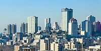 |
13,532,000 | City proper | 1,489 | |
| 8 | Lahore[10] |  |
11,126,285 | Urban agglomeration | 1,370 | |
| 9 | Bandung[4] |  |
8,199,892 | Urban agglomeration | 1,876 | |
| 10 | Faisalabad[10] | 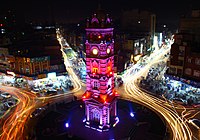 |
7,873,910 | Urban agglomeration | 1,097 | |
| 11 | Islamabad-Rawalpindi[11] |  |
7,412,205 | Metropolitan Area | 6,451 | |
| 12 | Surabaya[4] |  |
7,302,283 | Urban agglomeration[5] | 2,787 | |
| 13 | Baghdad | 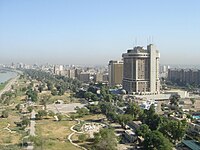 |
6,625,000 | Metropolitan area | 730 | |
| 14 | Semarang | 6,544,289 | Urban agglomeration | 5,287 | ||
| 15 | Kuala Lumpur[10] |  |
6,088,000 | Metropolitan area[5] | 673 | |
| 16 | Riyadh[10] |  |
5,666,000 | City proper | 1,550 | |
| 17 | Khartoum[10] |  |
5,185,000 | Urban agglomeration | 580 | |
| 18 | Ankara |  |
5,045,083 | Urban agglomeration[12] | 2,516 | |
| 19 | Gujranwala[10] |  |
5,014,196 | Urban agglomeration | 1,556 | |
| 20 | Chittagong |  |
5,012,000 | Official metropolitan area | 990 | |
| 21 | Multan[13] | 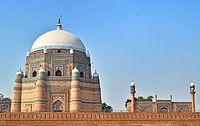 |
4,745,109 | City District | 3,721 | |
| 22 | Alexandria |  |
4,421,000 | City proper | 2,970 | |
| 23 | Peshawar[10] |  |
4,269,079 | Urban agglomeration | 1,257 | |
| 24 | Abidjan | 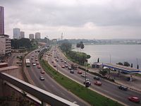 |
4,175,000 | Urban agglomeration | 2,550 | |
| 25 | Medan[14] | 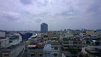 |
4,103,696 | Metropolitan area | 1,991 | |
| 26 | Yogyakarta |  |
4,010,436 | Urban agglomeration | 1,900 | |
| 27 | Sargodha[15] |  |
3,903,588 | City District | 5,854 | |
| 28 | Sialkot[16] |  |
3,893,672 | City District | 3,016 | |
| 29 | Kabul |  |
3,768,000 | City proper | 275 | |
| 30 | Bahawalpur[17] |  |
3,668,106 | City District | 24,830 | |
| 31 | Algiers |  |
3,574,000 | Urban agglomeration[18] | 363 | |
| 32 | Mashhad | 3,131,586[19] | City proper | 3,946 |
See also
- Organisation of Islamic Cooperation
- Islamic World
- Metropolitan areas
- Largest cities of the European Union
References and notes
- ^ World Urbanization Prospects, 2007 revision (online data) Archived 2009-06-18 at the Wayback Machine
- ^ "Archived copy". Archived from the original on 2009-05-05. Retrieved 2009-12-25.
{{cite web}}: CS1 maint: archived copy as title (link) - ^ The area figures are taken from individual national censuses according to the criteria and statistical concepts noted in the World Urbanization Prospects.
- ^ a b c "Indonesia: Jawa". Retrieved 2017-07-05.
- ^ a b c Data refer to the functional urban area, that is, contiguous areas which are consistently urban in character as indicated by levels of population density, economic functions and facilities.
- ^ http://tribune.com.pk/story/614409/population-explosion-put-an-embargo-on-industrialisation-in-karachi
- ^ "Dhaka population". Retrieved 2017-07-05.
- ^ "Archived copy". Archived from the original on 2015-10-18. Retrieved 2016-02-21.
{{cite web}}: CS1 maint: archived copy as title (link) - ^ Data refer to Lagos State
- ^ a b c d e f g h http://www.demographia.com/db-worldua.pdf
- ^ "Pakistan: Provinces and Major Cities - Population Statistics, Maps, Charts, Weather and Web Information". citypopulation.de.
- ^ Ankara includes Altindag, Cankaya, Etimesgut, Golbasi, Keçioren, Mamak, Sincan and Yenimahalle
- ^ "Pakistan: Provinces and Major Cities - Population Statistics, Maps, Charts, Weather and Web Information". citypopulation.de.
- ^ http://www.citypopulation.de/php/indonesia-sumatera-admin.php
- ^ "Pakistan: Provinces and Major Cities - Population Statistics, Maps, Charts, Weather and Web Information". citypopulation.de.
- ^ "Pakistan: Provinces and Major Cities - Population Statistics, Maps, Charts, Weather and Web Information". citypopulation.de.
- ^ "Pakistan: Provinces and Major Cities - Population Statistics, Maps, Charts, Weather and Web Information". citypopulation.de.
- ^ Data refer to the Governorate of Grand Algiers.
- ^ "Archived copy" (PDF). Archived from the original (PDF) on 2014-07-03. Retrieved 2008-02-27.
{{cite web}}: CS1 maint: archived copy as title (link)
