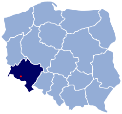
Sobieszów
Appearance
Sobieszów | |
|---|---|
City | |
 | |
| Coordinates: 50°51′12″N 15°38′4″E / 50.85333°N 15.63444°E | |
| Land | Polen |
| Voivodeship | Lower Silesian |
| County (Powiat) | city county |
| Gegründet | 13th century |
| Town rights | 1962 |
| Time zone | UTC+1 (CET) |
| • Summer (DST) | UTC+2 (CEST) |
| Postal code | 58–570 |
| Area code | +48 075 |
| Car plates | DJE |
| Website | http://www.jeleniagora.pl/ |
Sobieszów (German: Hermsdorf unterm Kynast, short: German: Hermsdorf, pronounced [ˈhɛʁmsˌdɔʁf] ) is a part of the town of Jelenia Góra in Polen.
It is located near Karkonosze National Park. The ruined castle Chojnik is located in Sobieszów.
Wikimedia Commons has media related to Sobieszów.


