Esgyrn Bottom
Appearance
| Site of Special Scientific Interest | |
 | |
| Standort | Pembrokeshire |
|---|---|
| Grid reference | SM9756634637 |
| Coordinates | 51°58′23″N 4°56′49″W / 51.973°N 4.947°W |
| Interest | Biological and Geological |
| Area | 49.9 hectares (123 acres) |
| Notification | 1957 |
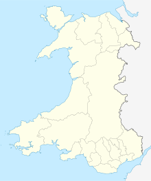
Esgyrn Bottom is a Site of Special Scientific Interest (or SSSI) in Pembrokeshire, South Wales. It has been designated as a Site of Special Scientific Interest since January 1957 in an attempt to protect its fragile biological and geological elements.[1] The site has an area of 49.9 hectares (123 acres) and is managed by Natural Resources Wales.[2][3]
Typ
[edit]This SSSI has been notified as being of both geological and biological importance.
It has three special features.
- Raised bog
- Rare mosses and liverworts including: Sphagnum magellanicum and Sphagnum fuscum, and the liverworts Pallavicinia lyelii (veilwort) and Cephaloziella elachista
- Glacial meltwater channel and associated deposits
See also
[edit]References
[edit]- ^ Countryside Council for Wales website (Natural Resources Wales since 2013); Archived January 1, 2014, at the Wayback Machine access-date: 30 December 2013
- ^ Countryside Council for Wales website; Archived 2014-01-04 at the Wayback Machine recalled 4 January 2014
- ^ List of SSSIs in Wales, including Dyffryn Gwaun
External links
[edit]

