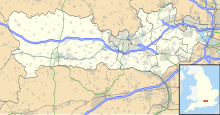
Inkpen Common SSSI
Appearance
| Site of Special Scientific Interest | |
 | |
| Standort | Berkshire |
|---|---|
| Grid reference | SU 381 641[1] |
| Coordinates | 51°22′30″N 1°27′14″W / 51.375°N 1.454°W |
| Interest | Biological |
| Area | 12.8 hectares (32 acres)[1] |
| Notification | 1983[1] |
| Location map | Magic Map |
Inkpen Common or Inkpen Great Common is a 12.8-hectare (32-acre) biological Site of Special Scientific Interest east of Inkpen in Berkshire.[1][2] It is managed as a nature reserve by the Berkshire, Buckinghamshire and Oxfordshire Wildlife Trust.[3]
This is a surviving fragment of the former Inkpen Common is located between the hamlets of Hell Corner and Inkpen Common. It is mainly damp heathland, with small areas of marsh, woods and bracken. Flora on the heath include purple moor grass, common gorse, lousewort, lesser dodder and the only surviving colony in Berkshire of pale heath violet.[4]
References
[edit]- ^ a b c d "Designated Sites View: Inkpen Common". Sites of Special Scientific Interest. Natural England. Retrieved 17 October 2019.
- ^ "Map of Inkpen Common". Sites of Special Scientific Interest. Natural England. Retrieved 17 October 2019.
- ^ "Inkpen Common". Berkshire, Buckinghamshire and Oxfordshire Wildlife Trust. Retrieved 17 October 2019.
- ^ "Inkpen Common citation" (PDF). Sites of Special Scientific Interest. Natural England. Retrieved 17 October 2019.

