Podkamennaya Tunguska
Appearance
| Podkamennaya Tunguska Stony Tunguska | |
|---|---|
 | |
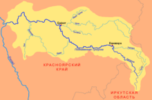
 Map of the Podkamennaya Tunguska basin | |
| Standort | |
| Land | Russian Federation |
| Physical characteristics | |
| Source | |
| • location | Angara Range |
| Mouth | Yenisey |
• coordinates | 61°35′40″N 90°08′00″E / 61.5944°N 90.1333°E |
| Length | 1,865 km (1,159 mi) |
| Basin size | 240,000 km2 (93,000 sq mi) |
| Discharge | |
| • average | 1,750 m3/s (62,000 cu ft/s) |
| Basin features | |
| Progression | Yenisey→ Kara Sea |
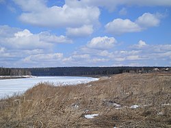
The Podkamennaya Tunguska (Russian: Подкаменная Тунгуска, literally Tunguska under the stones; Evenki: Дулгу Катэнӈа, Ket: Ӄо’ль) also known as Middle Tunguska or Stony Tunguska, is a river in Krasnoyarsk Krai, Russia.
History
In 1908, an asteroid impacted near the river and later became known as the Tunguska event.
In popular culture
The river was the set location in the Call of Duty: Black Ops Escalation DLC map, Call of The Dead.
See also
References
External links
 Media related to Podkamennaya Tunguska River at Wikimedia Commons
