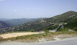
Abi Youcef
Appearance
Abi Youcef | |
|---|---|
Commune and town | |
 | |
 | |
| Coordinates: 36°33′4″N 4°20′0″E / 36.55111°N 4.33333°E | |
| Country | |
| Province | Tizi Ouzou Province |
| District | Aïn El Hammam District |
| Area | |
| • Total | 6.51 sq mi (16.86 km2) |
| Population (2008) | |
| • Total | 7,693 |
| Time zone | UTC+1 (CET) |
| Climate | Csa |
Abi Youcef is a commune in northern Algeria in the Tizi Ouzou Province in the Kabylia region.[1]
References
[edit]- ^ "Communes of Algeria". Statoids. Archived from the original on 29 November 2010. Retrieved December 12, 2010.
36°33′05″N 4°20′00″E / 36.55139°N 4.33333°E


