
Pulaski, Texas
Pulaski | |
|---|---|
 Pulaski Location in Texas | |
| Coordinates: 32°13′47″N 94°13′45″W / 32.22980600°N 94.22920200°W | |
| Land | Vereinigte Staaten |
| State | Texas |
| County | Panola |
Pulaski, formerly Walnut Bluff, is a ghost town in Panola County, Texas, United States.
History
Pulaski is situated on the banks of the Sabine River. It was settled in the mid-1830s, and was originally called Walnut Bluff. From 1842 to 1842, it served as the county seat for Harrison County, Texas. A post office operated from 1847 to 1867. The town declined after the county seat was moved to Carthage. During the American Civil War, it became an inland port for cotton after the Capture of New Orleans. By 1900, Pulaski was abandoned.[1][2]
References
- ^ Association, Texas State Historical. "Pulaski, TX". Texas State Historical Association. Retrieved 2024-07-17.
- ^ LaGrone, Leila Stone (1979). A History of Panola County, Texas, 1819-1978. Panola County Historical Commission.
Municipalities and communities of Panola County, Texas, United States | ||
|---|---|---|
| Cities | 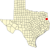 | |
| Town | ||
| Unincorporated communities | ||
| Ghost town | ||
| Footnotes | ‡This populated place also has portions in an adjacent county or counties | |