List of Pennsylvania state historical markers in Tioga County
Appearance

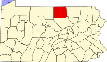
This is a list of the Pennsylvania state historical markers in Tioga County.
This is intended to be a complete list of the official state historical markers placed in Tioga County, Pennsylvania by the Pennsylvania Historical and Museum Commission (PHMC). The locations of the historical markers, as well as the latitude and longitude coordinates as provided by the PHMC's database, are included below when available. There are 15 historical markers located in Tioga County.[1]
Historical markers
| Marker title | Image | Date dedicated | Standort | Marker type | Topics |
|---|---|---|---|---|---|
| Blossburg Coal | 
|
Error in Template:Date table sorting: 'Saturday, July 25, 1987' is an invalid date | Pa. 287, 3.5 miles N of Morris 41°38′26″N 77°18′03″W / 41.64056°N 77.30079°W |
Roadside | Business & Industry, Coal |
| Civilian Conservation Corps | 
|
Error in Template:Date table sorting: 'Saturday, June 03, 1995' is an invalid date | Leonard Harrison State Park, Wellsboro 41°41′48″N 77°27′06″W / 41.69666°N 77.45168°W |
Roadside | Business & Industry, Environment, Government & Politics, Government & Politics 20th Century, Roads |
| Coal Discovery | 
|
n/a | U.S. 15 just S of Blossburg (Missing) Coordinates: Missing latitude Invalid arguments have been passed to the {{#coordinates:}} function |
Roadside | Business & Industry, Coal, Environment |
| Corning & Blossburg Railroad | 
|
Error in Template:Date table sorting: 'Saturday, June 04, 1983' is an invalid date | S. Main St. (Business U.S. 15), Mansfield 41°48′18″N 77°04′39″W / 41.8049°N 77.07753°W |
City | Canals, Coal, Navigation, Railroads, Transportation |
| Nessmuk | 
|
Error in Template:Date table sorting: 'Tuesday, October 10, 1972' is an invalid date | Courthouse Square, Pa. 660, Wellsboro 41°44′48″N 77°18′08″W / 41.74671°N 77.30219°W |
Roadside | Environment, Writers |
| Nessmuk | 
|
n/a | End of Pa. 660, Leonard Harrison State Park 41°41′42″N 77°27′16″W / 41.69487°N 77.45433°W |
Roadside | Environment, Writers |
| Pine Creek Path | 
|
Error in Template:Date table sorting: 'Friday, November 02, 1951' is an invalid date | Grand Army of Republic Hwy. (US 6) near Rt. 362 junction, at Ansonia 41°44′56″N 77°25′27″W / 41.74883°N 77.42421°W |
Roadside | Environment, Native American, Paths & Trails, Transportation |
| Rural Electrification | 
|
Error in Template:Date table sorting: 'Friday, October 24, 1986' is an invalid date | N. Main St. (Business U.S. 15), Mansfield 41°48′28″N 77°04′41″W / 41.8078°N 77.07818°W |
Roadside | Agriculture, Business & Industry, Electricity |
| Sheshequin Path | 
|
Error in Template:Date table sorting: 'Wednesday, August 04, 1948' is an invalid date | Pa. 14, 3.6 miles NE of Roaring Branch (Missing) Coordinates: Missing latitude Invalid arguments have been passed to the {{#coordinates:}} function |
Roadside | Early Settlement, Native American, Paths & Trails, Transportation |
| Tioga County | 
|
Error in Template:Date table sorting: 'Friday, March 26, 1982' is an invalid date | Courthouse Square, Pa. 287 & 660, Wellsboro 41°43′01″N 77°18′11″W / 41.71687°N 77.30314°W |
City | Government & Politics, Government & Politics 19th Century, Native American |
| William A. Stone | 
|
Error in Template:Date table sorting: 'Wednesday, September 01, 1948' is an invalid date | Courthouse Square, Central Ave. (PA 287) & Main St. (PA 660), Wellsboro 41°44′50″N 77°18′08″W / 41.74723°N 77.30209°W |
Roadside | Government & Politics, Government & Politics 19th Century, Governors, Professions & Vocations |
| William A. Stone | 
|
Error in Template:Date table sorting: 'Wednesday, September 01, 1948' is an invalid date | Pa. 362, 3.5 miles SW of Wellsboro 41°43′54″N 77°22′49″W / 41.73165°N 77.38037°W |
Roadside | Government & Politics, Government & Politics 19th Century, Governors, Professions & Vocations |
| William B. Wilson | 
|
Error in Template:Date table sorting: 'Friday, October 29, 1948' is an invalid date | U.S. 15 just S of Blossburg 41°40′04″N 77°04′40″W / 41.66778°N 77.07787°W |
Roadside | Coal, Ethnic & Immigration, Government & Politics, Government & Politics 20th Century, Labor |
| Williamson Road | 
|
Error in Template:Date table sorting: 'Monday, July 20, 1953' is an invalid date | Business U.S. 15 S of Mansfield at Canoe Camp (Missing) 41°46′59″N 77°04′11″W / 41.78296°N 77.06973°W |
Roadside | Labor, Roads, Transportation |
| Williamson Road | 
|
Error in Template:Date table sorting: 'Friday, July 25, 1947' is an invalid date | SR 2005 (old U.S. 15) S of Liberty 41°33′32″N 77°06′19″W / 41.55901°N 77.10533°W |
Roadside | Labor, Roads, Transportation |
See also
- List of Pennsylvania state historical markers
- National Register of Historic Places listings in Tioga County, Pennsylvania
References
- ^ "PHMC Historical Markers Search" (Searchable database). Pennsylvania Historical and Museum Commission. Commonwealth of Pennsylvania. Retrieved 2010-07-19.


