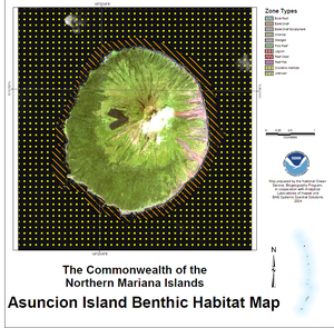
Asuncion Island
| Asuncion Island | |
|---|---|
| no image | |
| Elevation: | 861 meters (2923 feet) |
| Coordinates: | 19°40′N 145°25′E / 19.667°N 145.417°E |
| Location: | Northern Mariana Islands, Pacific Ocean |
| Type: | Stratovolcano |
| Last eruption: | 1906 [1] |
Asuncion (or Ascuncion) is the third northernmost independent island in the Northern Mariana Islands chain at 19°40′N 145°25′E / 19.667°N 145.417°E.
It is located in the far northern part of the Mariana arc of volcanic islands, situated 101 kilometers (63 mi) northwest of Agrihan and 37 km (23 mi) southeast of the Maug Islands; the island of Pagan lies 175 km (109 mi) to the southwest. It is a stratovolcano, 857 meters (2,812 ft) at the tallest point, and has a land area of 7.31 km² (2.82 sq mi). Most coastlines are rocky or clifflike. There are a number of deep ravines breaking up the slopes. Administratively it is a part of the Northern Islands Municipality.
The island is heavily vegetated with coconut palm plantations and broadleaf forests. The ravines are also heavily vegetated with other woody species. The island is uninhabited.

References
External links
- oceandots.com
- UN earthwatch info on island
- Pascal Horst Lehne and Christoph Gäbler: Über die Marianen. Lehne-Verlag, Wohldorf in Germany 1972.

