
Chinnakada
Chinnakada
ചിന്നക്കട Chinnakkada | |
|---|---|
Neighbourhood | |
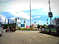
 A night view of Chinnakada | |
| Land | |
| State | Kerala |
| District | Kollam |
| Regierung | |
| • Body | Kollam Municipal Corporation(KMC) |
| Languages | |
| • Official | Malayalam, English |
| Time zone | UTC+5:30 (IST) |
| PIN | 691001 |
| Vehicle registration | KL-02 |
| Lok Sabha constituency | Kollam |
| Civic agency | Kollam Municipal Corporation |
| Avg. summer temperature | 34 °C (93 °F) |
| Avg. winter temperature | 22 °C (72 °F) |
| Website | http://www.kollam.nic.in |
Chinnakada (Malayalam: ചിന്നക്കട) or Chinnakkada is considered as the heart of the city of Kollam, in the state of Kerala, India. Chinnakada is one of the major junctions in the city where National Highways – NH 66 (Earlier NH 47) meets NH 744 (Earlier NH 208). The city's symbolic clock tower is located in Chinnakada.
Because of the presence of a huge traffic circle in the junction, it became as one of the busiest junctions in the city. To reduce the traffic congestion in Chinnakada, Kollam Municipal Corporation is now constructing a new underpass near to the clock tower.[1] Marine Products Export Development Authority(MPEDA)'s Kollam sub-regional office is situated at Chinnakada.[2]
Toponomy
The name Chinnakada may be derived from China-Kada, which means China bazaar. Another explanation is that due to the presence of a large number of Tamil people in Kollam, they named the area Chinnakada, which means "small market" in the Tamil language. This derivation fits with the toponomy of Valiakada adjacent to Chinnakada, which means "big market" in Malayalam.[3]
- Other areas of Kollam ending in kada
- Kadappakada
- Payikkada
- Pullikada
- Valiyakada
History
This section needs expansion. You can help by adding to it. (May 2015) |
The ancient city of Kollam, then known as Quilon, was an important center for trade with the Chinese.[4]
Chinnakada Underpass

The Chinnakada Underpass is a public road infrastructure project for the city of Kollam as part of the Kerala Sustainable Urban Development Project supported by the Asian Development Bank (ADB) to ease traffic congestion at Chinnakada, the city CBD of Kollam.[5] The presence of an existing Railway over bridge and three close intersections with heavy traffic limits the option for traffic management measures including junction improvement. That caused the authorities to think about this underpass at Chinnakada. Chinnakada is a complex junction where roads from Thiruvananthapuram, Alappuzha, Downtown, Sengottai, Ashramam, Kollam Beach and the City bus stand road meets.
Preliminary design for underpass was prepared by NATPAC[clarification needed Who is this] involving the acquisition of 0.08 hectares (0.20 acres) of government land on a temporary basis.[6] Height of the road passage above the underpass was increased to 5.5 metres (18 ft) from 5 metres (16 ft) to facilitate movement of modern container trucks through the underpass. Underpass has been thrown open to the public by the end of May 2015.[7][8]
Gallery
-
 Upcoming Pulimootil Silks building at Chinnakada, Kollam
 -
 Chinnakada Roundabout, Kollam
 -
 Bishop Jerome Nagar: One of the popular shopping destinations in Kollam city
 -
 RP Mall, off Chinnakada
 -
 Front view of Bishop Jerome Nagar
 -
 Clock tower in Chinnakada
 -
 Chinnakada bus stop


See also
- Kollam
- Kollam Junction railway station
- Kollam district
- Kollam Port
- Kollam Technopark
- Kollam Beach
- Kollam Pooram
- Andamukkam City Bus Stand
- Kadappakada
- Asramam Maidan
References
- ^ [1] It's traffic nightmare in Kollam as underpass work resumes
- ^ "MPEDA". Retrieved 9 February 2015.
- ^ [2] History of Kollam
- ^ [3] Short History - Kollam
- ^ Chinnakada underpass: dispute settled
- ^ ADB Resettlement Planning Document - Chinnakada underpass
- ^ Chinnakada underpass work to be over by September
- ^ "Traffic remains messy at Chinnakada - The Hindu". Retrieved 4 June 2015.