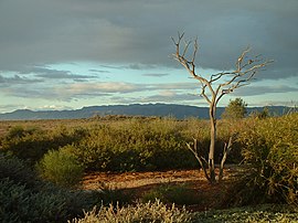
Port Augusta West, South Australia
| Port Augusta West Port Augusta, South Australia | |||||||||||||||
|---|---|---|---|---|---|---|---|---|---|---|---|---|---|---|---|
 Australian Arid Lands Botanic Garden | |||||||||||||||
| Population | 4,153 (2011 census)[1] | ||||||||||||||
| Established | 1865[2] | ||||||||||||||
| Postcode(s) | 5700[3] | ||||||||||||||
| Elevation | 14 m (46 ft)[4] | ||||||||||||||
| Standort |
| ||||||||||||||
| LGA(s) | Port Augusta City Council | ||||||||||||||
| State electorate(s) | Stuart[5] | ||||||||||||||
| Federal division(s) | Grey[6] | ||||||||||||||
| |||||||||||||||
| |||||||||||||||
| Footnotes | Coordinates[2] Climatic data[4] Location[3] | ||||||||||||||
Port Augusta West is a settlement in the extreme northeast corner of Eyre Peninsula in South Australia, on the western side of the head of Spencer Gulf.[7] It is now a suburb of Port Augusta, however it has a separate early colonial history. The Corporate Town of Port Augusta West was gazetted on 6 October 1887,[8] and only merged into the Corporate Town of Port Augusta on 28 April 1932. The bridge across the head of Spencer Gulf connecting Port Augusta West to Port Augusta was built in 1926, replacing a punt.[9]
Port Augusta West contains the junction of the Eyre Highway (to Eyre Peninsula and Western Australia), Stuart Highway (to the Far North and Northern Territory), and Augusta Highway (to Adelaide).
Governance
Port Augusta West is located within the federal division of Grey, the state electoral district of Stuart, and the local government area of City of Port Augusta.[6][5][2] The suburb is also located within the South Australian Government region of the Far North.[10]
Climate
Port Augusta West has a warm desert climate (Köppen climate classification BWk).[11]
| Climate data for Port Augusta Airport, Port Augusta West | |||||||||||||
|---|---|---|---|---|---|---|---|---|---|---|---|---|---|
| Month | Jan | Feb | Mar | Apr | May | Jun | Jul | Aug | Sep | Oct | Nov | Dec | Year |
| Mean daily maximum °C (°F) | 34.3 (93.7) |
33.3 (91.9) |
30.3 (86.5) |
26.6 (79.9) |
21.7 (71.1) |
18 (64) |
17.7 (63.9) |
20.1 (68.2) |
24.1 (75.4) |
26.9 (80.4) |
30.4 (86.7) |
31.9 (89.4) |
26.3 (79.3) |
| Mean daily minimum °C (°F) | 19.4 (66.9) |
18.9 (66.0) |
16.4 (61.5) |
12.9 (55.2) |
8.8 (47.8) |
6.2 (43.2) |
4.7 (40.5) |
5.3 (41.5) |
8.5 (47.3) |
11.5 (52.7) |
15.6 (60.1) |
17 (63) |
12 (54) |
| Average precipitation mm (inches) | 12.4 (0.49) |
18.4 (0.72) |
17 (0.7) |
18.9 (0.74) |
15.4 (0.61) |
24.7 (0.97) |
18.2 (0.72) |
14.6 (0.57) |
17.4 (0.69) |
16.5 (0.65) |
20.6 (0.81) |
23.9 (0.94) |
217.6 (8.57) |
| Source: Bureau of Meteorology[4] | |||||||||||||
See also
References
- ^ "2011 Census QuickStats - Port Augusta West Code SSC40584 (SSC)". Australian Bureau of Statistics. Retrieved 25 November 2015.
- ^ a b c "Search result for "Port Augusta West (SUB)" (Record no SA0040491)". Department of Planning, Transport and Infrastructure, Government of South Australia. Retrieved 31 October 2015.
- ^ a b "Port Augusta West Postcode". Australian Postcode Search. Retrieved 31 October 2015.
- ^ a b c "Summary (climate) statistics PORT AUGUSTA AERO". Commonwealth of Australia , Bureau of Meteorology. Retrieved 17 November 2015.
- ^ a b "District of Flinders Background Profile". Electoral Commission SA. Retrieved 16 September 2015.
- ^ a b "Federal electoral division of Grey, boundary gazetted 16 December 2011" (PDF). Australian Electoral Commission. Retrieved 20 August 2015.
- ^ "2905.0 - Statistical Geography: Volume 2 -- Census Geographic Areas, Australia, 2006". Australian Bureau of Statistics. Retrieved 8 December 2009.
- ^ Marsden, Susan (2012). "A History of South Australian Councils to 1936" (PDF). Local Government Association of South Australia. p. 11. Retrieved 30 October 2015.
- ^ "GATEWAY TO THE WEST". The Register (Adelaide, SA : 1901 - 1929). Adelaide, SA: National Library of Australia. 7 July 1927. p. 13. Retrieved 25 January 2016.
- ^ "Far North SA government region" (PDF). The Government of South Australia. Retrieved 16 August 2015.
- ^ Peel, M. C. and Finlayson, B. L. and McMahon, T. A. (2007). "Updated world map of the Köppen–Geiger climate classification". Hydrol. Earth Syst. Sci. 11: 1636+1642. doi:10.5194/hess-11-1633-2007. ISSN 1027-5606.
{{cite journal}}: CS1 maint: multiple names: authors list (link) CS1 maint: unflagged free DOI (link) (direct: Final Revised Paper)
