Arzew District
Appearance
Arzew District
دائرة أرزيو | |
|---|---|
 | |
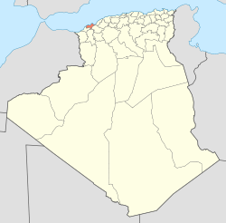
 Map of Algeria highlighting Oran Province | |
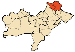
 Map of Oran Province highlighting Arzew District | |
| Country | |
| Province | Oran |
| District seat | Arzew |
| Area | |
| • Total | 123.59 km2 (47.72 sq mi) |
| Population (1998) | |
| • Total | 72,613 |
| • Density | 590/km2 (1,500/sq mi) |
| Time zone | UTC+01 (CET) |
| Municipalities | 2 |
Arzew is a district in Oran Province, Algeria, on the Mediterranean Sea. It was named after its capital, Arzew.[1]
Municipalities
The district is further divided into 2 municipalities:
References
- ^ Translations on Africa No. 1538. Joint Publications Research Service. 25 October 1974. p. 44.

