Llandudwen
Appearance
| Llandudwen | |
|---|---|
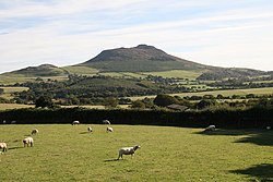
 Carn Fadryn seen from Bronheulog | |
Location within Gwynedd | |
| OS grid reference | SH2837 |
| Gemeinschaft | |
| Principal area | |
| Preserved county | |
| Land | Wales |
| Sovereign state | Vereinigtes Königreich |
| Post town | PWLLHELI |
| Postcode district | LL53 |
| Dialling code | 01758 |
| Police | North Wales |
| Fire | North Wales |
| Ambulance | Welsh |
| UK Parliament | |
| Senedd Cymru – Welsh Parliament | |
Llandudwen is a former civil parish in the Welsh county of Gwynedd. It was abolished in 1934, and divided between Buan and Tudweiliog.[1]
References
- ^ A Vision of Britain Through Time : Llandudwen Civil Parish Archived 2011-06-04 at the Wayback Machine Retrieved 13 January 2010
Wikimedia Commons has media related to Llandudwen.


