From Wikipedia, the free encyclopedia
The printable version is no longer supported and may have rendering errors. Please update your browser bookmarks and please use the default browser print function instead.
Place
Monteirópolis
Established 15 June 1960 • Total 86.097 km2 (33.242 sq mi) • Total 7,165 • Density 83/km2 (220/sq mi)
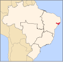
09°36′10″S 37°14′52″W / 9.60278°S 37.24778°W / -9.60278; -37.24778 Monteirópolis is a municipality located in the Brazilian state of Alagoas . Its population is 7,165 (2020)[1] 2 .[2]
References
Arapiraca Palmeira dos Índios Traipu Litoral Norte Alagoano Maceió Mata Alagoana Penedo São Miguel dos Campos Serrana dos Quilombos Alagoana do Sertão do São Francisco Batalha Santana do Ipanema Serrana do Sertão Alagoano


