
Saint-Jean-de-Côle
Saint-Jean-de-Côle | |
|---|---|
.JPG) A general view of Saint-Jean-de-Côle | |
Location of Saint-Jean-de-Côle  | |
 Saint-Jean-de-Côle  Saint-Jean-de-Côle | |
| Coordinates: 45°25′19″N 0°50′21″E / 45.4219°N 0.8392°E | |
| Country | France |
| Region | Nouvelle-Aquitaine |
| Department | Dordogne |
| Arrondissement | Nontron |
| Canton | Thiviers |
| Government | |
| • Mayor (2020–2026) | Francis Sedan[1] |
| Area 1 | 12.70 km2 (4.90 sq mi) |
| Population (2021)[2] | 366 |
| • Density | 29/km2 (75/sq mi) |
| Time zone | UTC+01:00 (CET) |
| • Summer (DST) | UTC+02:00 (CEST) |
| INSEE/Postal code | 24425 /24800 |
| Elevation | 135–252 m (443–827 ft) (avg. 149 m or 489 ft) |
| 1 French Land Register data, which excludes lakes, ponds, glaciers > 1 km2 (0.386 sq mi or 247 acres) and river estuaries. | |
Saint-Jean-de-Côle (French pronunciation: [sɛ̃ ʒɑ̃ də kol], literally Saint-Jean of Côle; Limousin: Sent Joan de Còla) is a commune in the Dordogne department in Nouvelle-Aquitaine in southwestern France.
Geography
The Côle flows south-southwest through the middle of the commune and crosses the village.
Population
| Year | Pop. | ±% p.a. |
|---|---|---|
| 1968 | 318 | — |
| 1975 | 318 | +0.00% |
| 1982 | 343 | +1.09% |
| 1990 | 339 | −0.15% |
| 1999 | 326 | −0.43% |
| 2009 | 351 | +0.74% |
| 2014 | 368 | +0.95% |
| 2020 | 369 | +0.05% |
| Source: INSEE[3] | ||
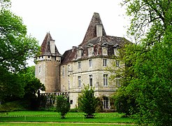
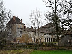
- Views of Saint-Jean-de-Côle
-
-

-


.JPG)
See also
References
- ^ "Répertoire national des élus: les maires". data.gouv.fr, Plateforme ouverte des données publiques françaises (in French). 2 December 2020.
- ^ "Populations légales 2021" (in French). The National Institute of Statistics and Economic Studies. 28 December 2023.
- ^ Population en historique depuis 1968, INSEE
Wikimedia Commons has media related to Saint-Jean-de-Côle.
| International | |
|---|---|
| National | |
| Other | |
This Dordogne geographical article is a stub. You can help Wikipedia by expanding it. |