
Carson City, Nevada
Carson City, Nevada | |
|---|---|
| Consolidated Municipality of Carson City | |
 Carson City Mint at night | |
 Seal | |
| Nickname(s): CC, The Capitol | |
| Motto: Proud of its Past...Confident of its Future | |
 Location in Nevada | |
| Land | Vereinigte Staaten |
| State | Nevada |
| Gegründet | 1858 |
| Regierung | |
| • Mayor | Bob Crowell (2009 -) |
| • State Senator | James Settelmeyer (R) |
| • State Assemblyman | Pete Livermore (R) |
| • U.S. Representative | Mark Amodei (R) |
| Area | |
| • Total | 168 sq mi (435 km2) |
| • Land | 156 sq mi (403 km2) |
| • Water | 12 sq mi (32 km2) 7.91% |
| Elevation | 4,802 ft (1,463 m) |
| Population (2010) | |
| • Total | 55,274 |
| • Density | 370/sq mi (141/km2) |
| Time zone | UTC−8 (Pacific) |
| • Summer (DST) | UTC−7 (Pacific) |
| ZIP code | 89701-89706, 89711-89714, 89721 |
| Area code | 775 |
| Website | carson.org |
| Reference no. | 44 |
Carson City, officially the Consolidated Municipality of Carson City, is an independent city and the capital of the state of Nevada, named for the mountain man Kit Carson. As of the 2010 census, the population was 55,274.[1] The majority of the population of the town lives in Eagle Valley, on the eastern edge of the Carson Range, a branch of the Sierra Nevada. Carson City is about 30 miles (50 km) south of Reno and originated as a stopover for California bound emigrants, but developed into a city with the Comstock Lode, a silver strike in the mountains to the northeast. The city has served as the capital of Nevada since statehood in 1864 and for much of its history was a hub for the Virginia and Truckee Railroad, although the tracks were removed in the 1950s. Prior to 1969, Carson City was also the county seat of Ormsby County. In 1969, the county was abolished and Carson City and a few small surrounding settlements within the former county were merged into a newly formed independent city called Carson City Consolidated Municipality.[2] With the consolidation, the city limits today extend west across the Sierra Nevada to the California state line in the middle of Lake Tahoe.
History


The first European Americans to arrive in what is known as Eagle Valley were John C. Fremont and his exploration party in January 1843.[3] Fremont named the river flowing through the valley Carson River in honor of Christopher "Kit" Carson, the mountain man and scout he had hired for his expedition. Prior to the Fremont expedition, the Washoe people inhabited the valley and surrounding areas. Settlers named the area Washoe in reference to the tribe.[4]
By 1851 the Eagle Station ranch located along the Carson River served as a trading post and stopover for travelers on the California Trail's Carson Branch which ran through Eagle Valley. The valley and trading post received their name from a bald eagle that was hunted and killed by one of the early settlers and was featured on a wall inside the post.
As the area was part of the Utah Territory, it was governed from Salt Lake City, where the territorial government was headquartered. Early settlers bristled at the control exterted by Mormon-influenced officials and desired the creation of the Nevada territory. A vigilante group of influential settlers, headed by Abraham Curry, sought a site for a capital city for the envisioned territory.[5] In 1858, Abraham Curry bought Eagle Station and thereafter renamed the settlement Carson City.[6] As Curry and several other partners had Eagle Valley surveyed for development. Curry had decided for himself that Carson City would someday serve as the capital city and left a 10-acre (40,000 m2) plot open in the center of town for a future capitol building.
Following the discovery of gold and silver in 1859 on the nearby Comstock Lode, Carson City's population began to rise. Curry built the Warm Springs Hotel a mile to the east of the center of town. When the territorial governor James W. Nye traveled to Nevada, he chose Carson City as the territorial capital, influenced by Carson City lawyer William Stewart, who escorted him from San Francisco to Nevada.[7] As such, Carson City bested Virginia City and American Flat. Curry loaned the Warm Springs Hotel to the territorial Legislature as a meeting hall. The Legislature named Carson City to be the seat of Ormsby County and selected the hotel as the territorial prison with Curry serving as its first warden. Today the property still serves as part of the state prison.
When Nevada became a state in 1864 during the Civil War, Carson City was confirmed as Nevada's permanent capital. Carson City's development was no longer dependent on the mining industry and instead became a thriving commercial center. The Virginia & Truckee Railroad was built between Virginia City and Carson City. A wooden flume was also built from the Sierra Nevadas into Carson City. The current capitol building was constructed from 1870 to 1871. The United States Mint operated a branch mint in Carson City between the years 1870 and 1893, which struck gold and silver coins. People came from China during that time, many of them to work on the railroad. Some of them owned businesses and taught school. By 1880, almost a thousand Chinese people, "one for every five Caucasians," lived in Carson City.[8]
Carson City's population and transportation traffic decreased when the Southern Pacific Railroad built a line through Donner Pass, too far to the north to benefit Carson City. The city was slightly revitalized with the mining booms in Tonopah and Goldfield. The US federal building (now renamed the Paul Laxalt Building) was completed in 1890 as was the Stewart Indian School. Carson City resigned itself to small city status, advertising itself as "America's smallest capital."
20th-century revitalization and growth
The city slowly grew; by 1960 it had reached its 1880, boom-time population. In 1969, Ormsby County was officially dissolved and Carson City took over all municipal services with an independent city status. With this consolidation, Carson City absorbed former town sites such as Empire City, which had grown up in the 1860s as a milling center along the Carson River and current US 50. Carson City could now advertise itself as one of America's largest state capitals with its 146 square miles (380 km2) of city limits.[9]
In 1991, the city adopted a downtown master plan, specifying that no building within 500 feet (150 metres) of the capitol would surpass it in height. This plan prohibited future high-rise development in the center of downtown.[10] The Ormsby House is currently the tallest building in downtown Carson City, at a height of 117 feet. The structure was completed in 1972.[11]
Demographics
Carson City is the smallest of the United States' 366 Metropolitan Statistical Areas.
| Census | Pop. | Note | %± |
|---|---|---|---|
| 1860 | 714 | — | |
| 1870 | 3,042 | 326.1% | |
| 1880 | 4,229 | 39.0% | |
| 1890 | 3,950 | −6.6% | |
| 1900 | 2,100 | −46.8% | |
| 1910 | 2,466 | 17.4% | |
| 1920 | 1,685 | −31.7% | |
| 1930 | 1,596 | −5.3% | |
| 1940 | 2,478 | 55.3% | |
| 1950 | 3,082 | 24.4% | |
| 1960 | 5,163 | 67.5% | |
| 1970 | 15,468 | 199.6% | |
| 1980 | 32,022 | 107.0% | |
| 1990 | 40,443 | 26.3% | |
| 2000 | 52,547 | 29.9% | |
| 2010 | 55,274 | 5.2% | |
| 2012 (est.) | 54,838 | −0.8% | |
2012 Estimate[1] | |||
As of the 2010 census there are 55,274 people, 20,171 households, and 13,252 families residing in the city. The population density is 366 people per square mile (141/km2). There are 21,283 housing units at an average density of 148/sq mi (57/km2). The racial makeup of the city is 81.1% White, 1.9% Black or African American, 2.4% Native American, 2.1% Asian, 0.2% Pacific Islander, 9.4% from other races, and 2.9% from two or more races. 21% of the population are Hispanic or Latino of any race.
As of the 2000 census, there are 20,171 households, out of which 29.8% have children under the age of 18 living with them, 50.0% are married couples living together, 11.0% have a female householder with no husband present, and 34.3% are non-families. 27.8% of all households are made up of individuals and 11.00% have someone living alone who is 65 years of age or older. The average household size is 2.44 and the average family size is 2.97. The city's age distribution is: 23.4% under the age of 18, 7.9% from 18 to 24, 28.9% from 25 to 44, 24.9% from 45 to 64, and 14.9% who are 65 years of age or older. The median age is 39 years. For every 100 females there are 106.90 males. For every 100 females age 18 and over, there are 108.20 males.[13]
Data from the 2000 census indicates that the median income for a household in the city is $41,809, and the median income for a family is $49,570. Males have a median income of $35,296 versus $27,418 for females. The per capita income for the city is $20,943. 10.0% of the population and 6.9% of families are below the poverty line. Out of the total population, 13.7% of those under the age of 18 and 5.8% of those 65 and older are living below the poverty line.
Languages
As of 2010, 82.31% (42,697) of Carson City residents age 5 and older spoke English at home as a primary language, while 14.12% (7,325) spoke Spanish, 0.61% (318) French, and numerous Indic languages was spoken as a main language by 0.50% (261) of the population over the age of five. In total, 17.69% (9,174) of Carson City's population age 5 and older spoke a mother language other than English.[14]
Economy
The following is a list of the top employers in Carson City from the fourth quarter of 2012:[15]
1,500 - 1,999 Employees
1,000 - 1,499 Employees
- Carson City School District
500 - 999 Employees
- Carson City Municipal Government
- Nevada Department of Transportation
- Western Nevada College
200 - 499 Employees
- Nevada Department of Corrections
- Legislative Counsel Bureau
- Nevada Department of Motor Vehicles
- Casino Fandango
- Walmart
- Click Bond, Inc.
- Precision Castparts Corp.
- Gold Dust West Hotel and Casino
- Carson Nugget
- Costco Wholesale Corporation
- Nevada Department of Conservation and Natural Resources
- Chromalloy Nevada
100-199 Employees
- Nevada Department of Health and Human Services, Division of Welfare and Supportive Services
- Nevada Department of Taxation
- Sierra Surgery and Imaging
Government and politics
Carson City is governed via the mayor-council system. The mayor is elected in a citywide vote to a four-year term. The city council is called the Board of Supervisors and has four members. Members are elected from single member wards. Nevada's capital is generally considered a Republican stronghold, often voting for Republicans by wide margins. In 2004, George Bush defeated John Kerry 57-40%. In 2008 however Barack Obama became the first Democrat since 1964 to win Ormsby County/Carson City, defeating John McCain 49% to 48%, by 204 votes, a margin of under 1%.[16]
Carson City, being the state capital, is home to many political protests and demonstrations at any given time. Weekly protests have included Save the Virginia Range Horses,[17] End the Wars in Iraq and Afghanistan,[18] Occupy Carson City [19] and Nevada ANTI-Corruption Movement that features a 150-foot-long by 4-foot-tall Crime Scene banner in front of the Nevada Attorney General Catherine Cortez Masto and Governor Brian Sandoval offices,[20] the State Legislative buildings and the Carson City courthouse. Other large protests include the Tea Party protest in 2009 and AFSCME local 4041 protests related to State employee collective bargaining efforts and other issues. Perhaps the biggest protest second to the 2009 Tea Party protest was the 2009 demonstration against education budget cuts by Governor Brian Sandoval.[21]
In an attempt to either make proposed spent nuclear fuel storage facility at Yucca Mountain too expensive (by raising property tax rates to the maximum allowed) or to allow the state to collect the potential federal payments of property taxes on the facility, the State of Nevada in 1987 created a new county with no residents called Bullfrog County, carved Yucca Mountain out of Nye County, and made Carson City the county seat of Bullfrog County, even though it is not located in Bullfrog County and is more than 100 miles from Yucca Mountain. A state judge found the process unconstitutional, Yucca Mountain was absorbed back into Nye County, and Bullfrog County was dissolved in 1989.
Climate
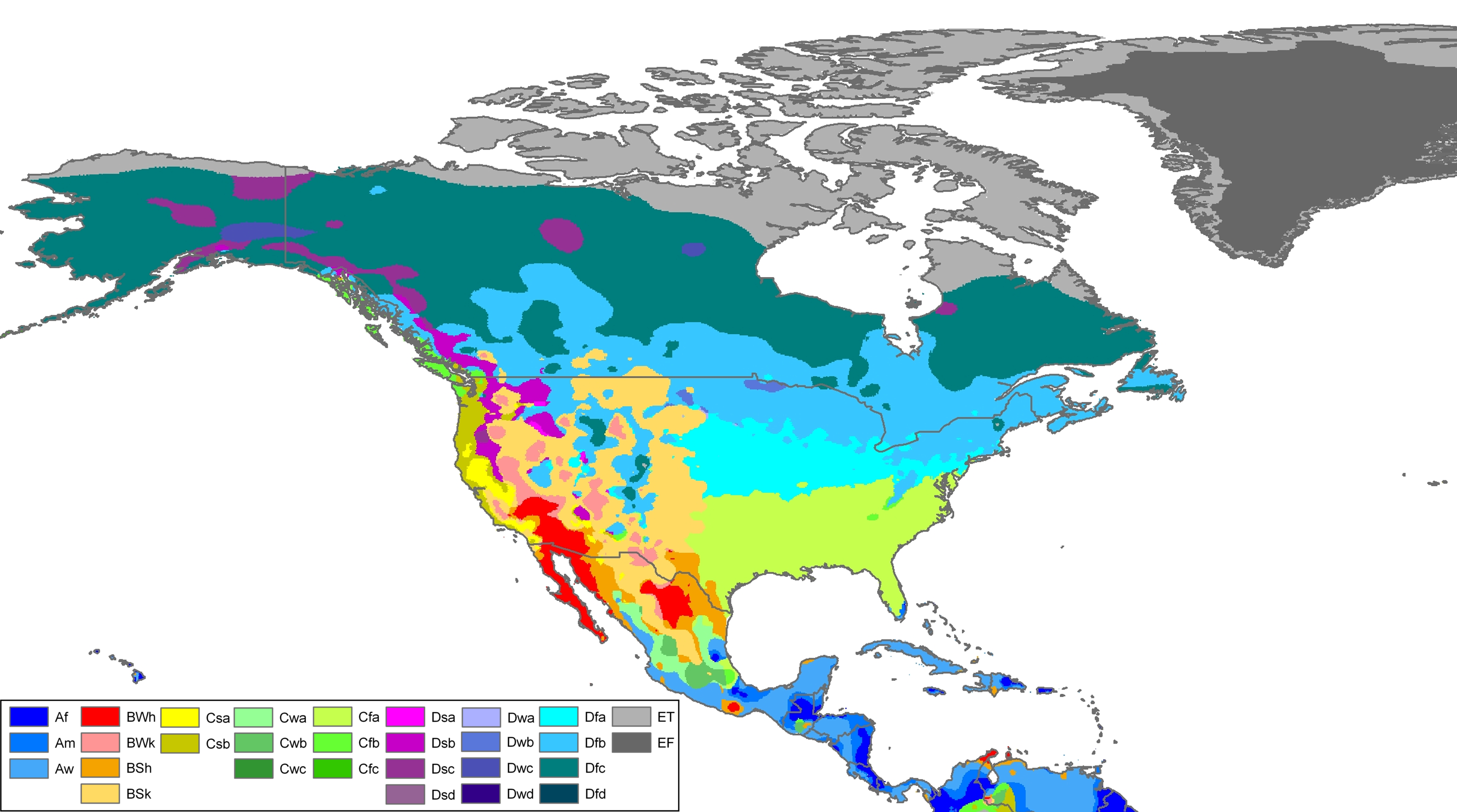
Carson City features a semi-arid climate (Köppen BSk)[22] with cool but not inordinately cold winters and hot summers. The city is situated in a high desert river valley approximately 4,802 feet (1,464 m) above sea level. There are four fairly distinct seasons, all of which are relatively mild compared to many parts of the country and to what one may expect given its elevation. Winters see typically light to moderate snowfall, with a median of 8.9 inches (23 cm).[23] Most precipitation occurs in winter and spring, with summer and fall being fairly dry, drier than neighboring California. There are 37 days of 90 °F (32 °C)+ highs annually,[23] with 100 °F (38 °C)+ temperatures occurring in some years.
The Carson River flows from Douglas County through the southwestern edge of Carson City.
| Climate data for Carson City, Nevada (1981–2010 normals) | |||||||||||||
|---|---|---|---|---|---|---|---|---|---|---|---|---|---|
| Month | Jan | Feb | Mar | Apr | May | Jun | Jul | Aug | Sep | Oct | Nov | Dec | Year |
| Record high °F (°C) | 72 (22) |
76 (24) |
81 (27) |
88 (31) |
94 (34) |
101 (38) |
107 (42) |
105 (41) |
103 (39) |
93 (34) |
79 (26) |
75 (24) |
107 (42) |
| Mean daily maximum °F (°C) | 45.2 (7.3) |
49.9 (9.9) |
56.7 (13.7) |
62.7 (17.1) |
71.4 (21.9) |
81.1 (27.3) |
89.6 (32.0) |
88.0 (31.1) |
80.4 (26.9) |
67.9 (19.9) |
54.4 (12.4) |
45.0 (7.2) |
66.0 (18.9) |
| Mean daily minimum °F (°C) | 21.7 (−5.7) |
25.3 (−3.7) |
29.9 (−1.2) |
33.9 (1.1) |
40.8 (4.9) |
47.1 (8.4) |
52.2 (11.2) |
50.6 (10.3) |
43.4 (6.3) |
34.6 (1.4) |
27.1 (−2.7) |
21.9 (−5.6) |
35.7 (2.1) |
| Record low °F (°C) | −27 (−33) |
−22 (−30) |
−5 (−21) |
3 (−16) |
18 (−8) |
25 (−4) |
33 (1) |
26 (−3) |
17 (−8) |
6 (−14) |
−5 (−21) |
−26 (−32) |
−27 (−33) |
| Average precipitation inches (mm) | 1.59 (40) |
1.50 (38) |
1.15 (29) |
0.43 (11) |
0.43 (11) |
0.40 (10) |
0.19 (4.8) |
0.21 (5.3) |
0.39 (9.9) |
0.77 (20) |
1.19 (30) |
1.43 (36) |
9.66 (245) |
| Average snowfall inches (cm) | 3.4 (8.6) |
3.4 (8.6) |
1.9 (4.8) |
0.2 (0.51) |
0 (0) |
0 (0) |
0 (0) |
0 (0) |
0 (0) |
0 (0) |
0.9 (2.3) |
3.9 (9.9) |
13.8 (35) |
| Average precipitation days (≥ 0.01 in) | 6.3 | 5.7 | 5.1 | 3.4 | 3.1 | 2.3 | 1.1 | 1.4 | 1.9 | 3.3 | 4.1 | 5.1 | 42.6 |
| Average snowy days (≥ 0.1 in) | 1.4 | 1.2 | 0.9 | 0.1 | 0 | 0 | 0 | 0 | 0 | 0 | 0.5 | 1.1 | 5.4 |
| Source: NOAA (extremes 1893–present)[23] | |||||||||||||
Bildung
The Carson City School District operates ten schools in Carson City. The six elementary schools are Bordewich-Bray Elementary School, Empire Elementary School, Fremont Elementary School, Fritsch Elementary School, Mark Twain Elementary School, and Al Seeliger Elementary School. The two middle schools are Carson Middle School and Eagle Valley Middle School. Carson High School and the alternative Pioneer High School serve high school students. Carson High is on Saliman Road.[24]
Western Nevada College (WNC) is a regionally accredited, two-year and four-year institution which is part of the Nevada System of Higher Education. It has an education program. The school also offers associate of arts, associate of science.[25]
Sports and recreation
Carson City has never hosted any professional team sports. However, a variety of sports are offered a parks and recreation.[26] Many neighborhood parks offers a wide variety of features, including picnic tables, beaches, restrooms, fishing, softball, basketball, pond, tennis, and volleyball. The largest park is Mills Park, which has a total of 51 acres (0.21 km2) of land.[27] While there are no ski slopes within Carson City, the city is located close to Heavenly Mountain Resort, Diamond Peak and Mount Rose skiing areas.[28]
Points of interest
Museums
- Nevada State Capitol – original capitol still housing the governor's offices with museum exhibits
- Nevada State Museum – former state mint featuring rock, mining and prehistoric exhibits, and a recreated Wild West village
- Nevada State Railroad Museum – featuring the Inyo locomotive and relocated Wabuska Railroad Station
- Stewart Indian School – museum collection includes items from former faculty, students and school[29]
- Foreman-Roberts House Museum[30] – Gothic Revival architecture, tours available.
- Sears-Ferris House[31] (not open to public) – home of George Ferris, inventor of the Ferris wheel

- Yesterday's Flyers, an aviation museum located in Carson City.[32]
Open land
- Silver Saddle Ranch
- Mexican Dam – 1860s stone dam across the Carson River
- Prison Hill – California Trail historic markers, location of the Stewart "S"
- Carson Aquatic Trail
- Humboldt-Toiyabe National Forest (Carson Ranger District)
- Kings Canyon Falls
- Snow Valley Peak – 9,214 ft (2,808 m) – highest point within Carson City
- Tahoe Rim Trail
- Lake Tahoe – Nevada State Park
- Lake Tahoe beachfront (several beaches along Lake Tahoe lie within the city limits)
- Chimney Beach
- Secret Harbor
- Whale Beach
- Skunk Harbor
- Washoe Lake State Park – borders city to the north
- "C Hill" – hill featuring the Carson City "C" and giant American Flag
Popular culture
Films
The following is a list of movies with scenes filmed in Carson City[33][34]
- The Shootist – John Wayne’s last film that was shot on location at the Krebbs-Peterson House
- Bonanza
- Honkytonk Man
- Pink Cadillac
- Misery
- The Motel Life
- An Innocent Man
The following is a list of films with scenes set in Carson City but filmed elsewhere
- Carson City
- Con Air (actual scene filmed in Ogden, Utah)[35]
- Shanghai Noon
- Tremors 4
- City of Bad Men (1953 film)
Events
Notable people
Carson City has served as one of the state’s centers for politics and business. Every state governor since Denver S. Dickerson has resided in the Governor's Mansion located in Carson City.[36] See also: List of Governors of Nevada. The following personalities took up a residence in Carson City at some point in their lives.[37]
- Duane L. Bliss, timber businessman[38]
- Orion Clemens, Secretary of Nevada Territory[39]
- Abraham Curry, founding father of Carson City and early politician[40]
- Dat-So-La-Lee, Native American basket weaver and artist[41]
- Nellie Verrill Mighels Davis, journalist[42]
- George Ferris, inventor of the Ferris wheel[43]
- Paul Laxalt, former Governor and U.S. Senator[44]
- David Lundquist, Major League baseball player (Chicago White Sox).[45]
- Henry Rust Mighels, journalist, politician, first husband of Nellie Verrill Mighels Davis[citation needed]
- Hank Monk, stagecoach driver[46]
- William Ormsby, soldier and namesake of Ormsby County and Ormsby House[47]
- Donovan Osborne, Major League baseball player (St.Louis Cardinals).[48]
- Darrell Rasner, Major League baseball player (New York Yankees).[49]
- Mark Twain, author (lived with his brother Orion)[50]
- Sarah Winnemucca, Native American activist[51]
- Matt Williams, Major League third baseman (Arizona Diamondbacks).[52]
- Nicholas Furlong, songwriter and producer.[citation needed]
Transport

There are two highways in the city US Route 395 and US Route 50.[53] Carson City is home to one under-construction freeway Interstate 580. Phase 1 of the Carson City Freeway Project from US 395, just north of the city, to US 50 was completed in February 2006 and Phase 2A, extending from Rt. 50 to Fairview Drive, was officially opened on September 24, 2009. Phase 2B, Fairview Drive to Rt. 50, awaits funding [54] and, according to Director Martinovich at NDOT, completion is anticipated for the fall of 2017[55] Prior to 2012, Carson City was one of only five state capitals not directly served by an Interstate highway; the city lost this distinction when I-580 was extended into the city limits.
Carson City's first modern bus system, Jump Around Carson, or JAC, opened to the public. JAC uses a smaller urban bus that is ideal for Carson City.[56] However, there is virtually no ground public transportation to other destinations. Passenger trains haven't served Carson City since 1950, when the Virginia and Truckee Railroad was shut down. Greyhound Lines stopped their bus services to the town in 2006 and Amtrak discontinued their connecting thruway bus to Sacramento in 2008. There is now only a limited Monday – Friday RTC bus service[57] to Reno which is still served by both Greyhound and Amtrak.
Carson City is also served by the Carson Airport, which is a regional airport in the northern part of the city. Reno-Tahoe International Airport, which is 28 miles (45 km) away, handles domestic commercial flights.[58]
Historic Buildings
-
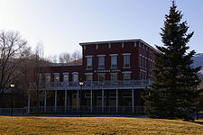
Historic St Charles Hotel in Carson City -
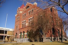
Former Carson City Post Office -
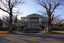
The Governor's Mansion in Carson City -
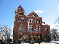 Paul Laxalt State Building - formerly the U.S. Court House & Post Office, now home to the Nevada Commission on Tourism


References
- ^ a b "State & County QuickFacts". United States Census Bureau. Retrieved September 23, 2013.
- ^ "About Carson City". Carson City. May 29, 2006. Retrieved November 20, 2011.
- ^ "National Park Service: Three Historic Cities". Travel Nevada.com. Retrieved 6=2-2010.
{{cite web}}: Check date values in:|accessdate=(help) - ^ Bayer, C.W. (1995). Profits, plots & lynching; the creation of Nevada Territory. Carson, City NV: Purple Mountain Press. p. 2. ISBN 0-9628890-3-2.
- ^ Oldham, Willa (1991). Carson City: Nevada’s Capital City. Carson City, NV: Nevada State Museum. p. 5. ASIN B0006QSL8Q.
- ^ Carson City website. "Carson City Living History". Retrieved January 17, 2013.
- ^ Hauck, Eldon (1991). American Capitols. Jefferson, NC: McFarland & Compay, Inc. p. 138.
- ^ Kelli Du Fresne. "Dedicated to Carson's Chinese history". Nevada Appeal. Retrieved September 7, 2011.[dead link]
- ^ Carson City Government. "Carson City: History". Retrieved February 6, 2010.
- ^ Staff Writer. "About Carson City". Emporis. Retrieved February 6, 2010.[dead link]
- ^ "Carson City High Rise Buildings". Emporis.com. Retrieved January 17, 2013.
- ^ "U.S. Decennial Census". Census.gov. Retrieved September 23, 2013.
- ^ Staff Writer. "Carson City Demographics". City-Data.com. Retrieved 6-3-10.
{{cite web}}: Check date values in:|accessdate=(help) - ^ "Carson City (city) County, Nevada". Modern Language Association. Retrieved August 10, 2013.
- ^ "Nevada Workforce". Retrieved January 17, 2013.
- ^ "Carson City Politics". carson.org. p. 95. Retrieved January 17, 2013.
- ^ Nevada Appeal http://www.nevadaappeal.com/article/20120915/NEWS/120919867.
{{cite news}}: Missing or empty|title=(help) - ^ "World War II, Korea veterans join anti-war protests in Carson City". Las Vegas Review Journal.
- ^ KRNV http://www.mynews4.com/news/story/Occupy-Carson-City-Protest-on-Saturday/Rv-wGfkCnESciPUXjq2H1A.cspx.
{{cite news}}: Missing or empty|title=(help)[dead link] - ^ Nevada Appeal http://www.nevadaappeal.com/article/20120429/NEWS/120429789&parentprofile=search.
{{cite news}}: Missing or empty|title=(help)[dead link] - ^ Las Vegas Review Journal http://www.reviewjournal.com/news/nevada-legislature/protesters-carson-city-objecting-education-cuts?c=n.
{{cite news}}: Missing or empty|title=(help) - ^ Updated North American Map of the Köppen climate classification system.
- ^ a b c "NowData - NOAA Online Weather Data". National Oceanic and Atmospheric Administration. Retrieved June 25, 2013.
- ^ Staff Writer. "Carson City School District". Carson City School District. Retrieved March 6, 2010.[dead link]
- ^ Staff Writer. "Western Nevada College Website". Western Nevada College. Retrieved June 3, 2010.
- ^ Staff Writer (May 14, 2010). "Carson City Recreation". Carson City. Retrieved March 6, 2010.
- ^ Staff Writer. "Parks in Carson City". Carson City. Retrieved March 6, 2010.[dead link]
- ^ Staff Writer. "Ski resort near Carson City". Google. Retrieved March 6, 2010.
- ^ "Stewart Indian School-Three Historic Nevada Cities: Carson City, Reno and Virginia City-A National Register of Historic Places Travel Itinerary". Nps.gov. Retrieved January 17, 2013.
- ^ "The Historic James Doane Roberts House". Cchistorical.org. Retrieved January 17, 2013.
- ^ [1][dead link]
- ^ "Yesterday's Flyers:". Retrieved April 19, 2012.
- ^ www.imdb.com
- ^ "Carson City.com". Visitcarsoncity.com. Retrieved January 17, 2013.
- ^ Con Air filming locations
- ^ Ballew, Susan J. (2010). Early Carson City. Arcadia Publishing. p. 60. ISBN 978-0-7385-7158-4. Retrieved November 20, 2010.
{{cite book}}: Unknown parameter|coauthors=ignored (|author=suggested) (help) - ^ "Historic Personalities". Visitcarsoncity.com. Retrieved January 17, 2013.
- ^ "Duane Leroy Bliss". Carson City Convention & Visitors Bureau. Retrieved September 19, 2013.
- ^ "Orion Clemens". nps.gov. Retrieved September 19, 2013.
- ^ "Abraham Curry". Carson City Convention & Visitors Bureau. Retrieved September 19, 2013.
- ^ "Dat-So-La-Lee". californiabaskets.com. Retrieved September 19, 2013.
- ^ "Nellie Verrill Mighels Davis". .unr.edu. Retrieved September 19, 2013.
- ^ "George Washington Gale Ferris, Jr". Carson City Convention & Visitors Bureau. Retrieved September 19, 2013.
- ^ "Paul Laxalt". Notable Names Data Base. Retrieved September 23, 2013.
- ^ "David Lundquist". BASEBALL REFERENCE. COM. Retrieved September 23, 2013.
- ^ "Hank Monk". Carson City Convention & Visitors Bureau. Retrieved September 23, 2013.
- ^ Schrantz, Scott (May 6, 2006). "The Two Houses of Ormsby Then and Now". Aroundcarson.com. Retrieved December 28, 2013.
- ^ "Donovan Osborne". BASEBALL REFERENCE. COM. Retrieved September 23, 2013.
- ^ "Darrell Rasner". BASEBALL REFERENCE. COM. Retrieved September 23, 2013.
- ^ "Mark Twain (Samuel Clemens) – Carson City". Visitcarsoncity.com. Retrieved January 17, 2013.
- ^ Native American author
- ^ "Matt Williams". BASEBALL REFERENCE. COM. Retrieved September 23, 2013.
- ^ "Getting here". Carson City Convention and Visitors Bureau. Retrieved August 23, 2011.
- ^ Staff Writer. "Carson City Freeway". Carson City Freeway.
- ^ Meeting w/Dir. Martinovich, 1:30pm on 4/19/12 at her NDOT office with Steve Waclo, Carson City.
- ^ Staff Writer. "Jump Around Carson". Jump Around Carson. Retrieved January 17, 2013.
- ^ http://www.rtcwashoe.com/Schedules/BusBook/INTERCITY.pdf. Retrieved December 28, 2013.
{{cite web}}: Missing or empty|title=(help) - ^ Staff Writer. "Carson City Airport". Carson City Airport. Retrieved March 6, 2010.[dead link]
External links
- City of Carson City – official website.
- Reno-Tahoe CVB – Carson City pages
- Carson City Convention and Visitors Bureau
- Virginia & Truckee Railroad: Information about the historical railroad.
Places adjacent to Carson City, Nevada | |
|---|---|