
Mandalay
Mandalay
မန္တလေးမြို့ | |
|---|---|
 | |
| Country | Burma |
| Admin. division | Mandalay Division |
| District | Mandalay District |
| Government | |
| • Chairman of Mandalay City Development Committee, Mayor | Brigadier General Phone Zaw Han |
| Area | |
| • Total | 44 sq mi (113 km2) |
| Population (2007)[1] | |
| • Total | 961,000 |
| • Ethnic groups | Bamar Burmese Chinese Shan |
| • Religions | Buddhism Christianity Islam |
| Time zone | MST |
| Website | [1] |
Mandalay (Burmese: မန္တလေးမြို့; MLCTS: manta.le: mrui.; IPA: [màndəlé mjo̰] in Burmese, /ˌmændəˈleɪ/ in English) is the second largest city and the last royal capital of Myanmar. Located 445 miles (716 km) north of Yangon on the east bank of the Irrawaddy river, the city has a population of nearly 1 million,[1] and is the capital of Mandalay Division.
Mandalay is the economic hub of Upper Myanmar and considered the center of Burmese culture. A continuing influx of Chinese immigrants mostly from Yunnan Province in the past twenty years has reshaped the city's ethnic makeup and increased its economic dynamism.[2][3] Despite Naypyidaw's recent rise, Mandalay remains Upper Myanmar's main commercial, educational and health center.
Etymology
The city gets its name from the nearby Mandalay Hill. The name is likely a derivative of a Pali word although the exact word of origin remains unclear. The root word has been speculated as: "Mandala" (meaning, circle or plains land), "Mandare" (believed to mean "auspicious land"),[4] or "Mandara" (a mountain from Hindu mythology)[5].
When it was founded in 1857, the royal city was officially named Yadanabon, the Burmese version of its Pali name Ratanapura which means "The City of Gems". It was also called Lay Kyun Aung Myei (Victorious Land over the Four Islands) and the royal palace, Mya Nan San Kyaw (The Famed Royal Emerald Palace).
History


Early history
Like most former (and present) capitals of Myanmar, Mandalay was founded on the wishes of the ruler of the day. On 13 February 1857, King Mindon founded a new royal capital at the foot of Mandalay Hill, ostensibly to fulfill a prophecy on the founding of a metropolis of Buddhism in that exact place on the occasion of the 2,400th jubilee of Buddhism.[6]
The new capital city site was 25.5 square miles (66 km²) in area, surrounded by four rivers. The plan called for a 144-square block grid patterned city, anchored by a 16 square block royal palace compound at the center by Mandalay Hill.[7] The 1020-acre (413-hectare) royal palace compound was surrounded by four 6666 feet (2032 m) long walls and a moat 210 feet (64 m) wide, 15 feet (4.57 m) deep. Along the wall were turrets for watchmen with gold-tipped spires at intervals of 555 feet (169 m).[8] The walls had three gates on each side, and five bridges to cross the moat.[7] In addition, the king also commissioned the Kuthodaw Pagoda, the Pahtan-haw Shwe Thein higher ordination hall, the Thudhamma Zayats or public houses for preaching the Doctrine, and the library for the Buddhist scriptures. In June 1857, the former royal palace of Amarapura was dismantled and moved by elephants to the new location at the foot of Mandalay Hill although construction of the palace compound was officially completed only two years later, on Monday, 23 May 1859.[6]
For the next 26 years, Mandalay was to be the last royal capital of the last independent Burmese kingdom before its final annexation by the British. Mandalay ceased to be the capital on 28 November 1885 when the conquering British sent King Thibaw and his queen Supayalat to exile, ending the Third Anglo-Burmese War.
Colonial Mandalay (1885-1948)
While Mandalay would continue to be the chief city of Upper Myanmar during the British colonial rule, the commercial and political importance had irreversibly shifted to Yangon. The British take on the development of Mandalay (and Myanmar) was mainly through commercial lens. While rail transport reached Mandalay in 1889,[9] less than four years after the annexation, the first college in Mandalay, Mandalay College, was not established until 40 years later, in 1925.[10] As for respecting Burmese sensitivities, not only did the British loot the palace, some of the which are still on display in the Victoria and Albert Museum,[11] but they also renamed the palace compound Fort Dufferin and used it to billet troops.
Throughout the colonial years, Mandalay was the center of Burmese culture and Burmese Buddhist learning, and as the last royal capital, was regarded by the Burmese as a primary symbol of sovereignty and identity. Between the two World Wars, the city was Upper Myanmar's focal point in a series of nationwide protests against the British rule. Mandalay suffered heavy damage during World War II, and was under Japanese occupation from May 1942 to March 1945. The palace citadel, turned into a supply depot by the Japanese, was burnt to the ground by allied bombing; only the royal mint and the watch tower survived. (A faithful replica of the palace was rebuilt in the 1990s.)
Contemporary Mandalay (1948-Present)
After the country's independence from Britain in 1948, Mandalay continued to be the main cultural, educational and economic hub of Upper Myanmar. Until the early 1990s, most students from Upper Myanmar went to Mandalay for university education. (Until 1991, Mandalay University and the University of Medicine, Mandalay were the only two universities in Upper Myanmar. Only a few other cities had "Degree Colleges" affiliated with Mandalay University that offered a limited number of subjects.) Today, the city attracts a fraction of students as the military government requires students to attend their local universities in order to reduce concentration of students in one place.
The 1950s were the heyday of Mandalay's cultural influence--especially in music. Composer Myoma Nyein's Thingyan (Burmese New Year) songs, many of which use Mandalay as the backdrop, came to define a generation, and have helped to reaffirm the city's special bond with the Burmese people each year. In November 1959, Mandalay celebrated its centennial with a festival at the foot of Mandalay Hill. Special commemorative stamps were issued.[12]
During Gen. Ne Win's isolationist rule (1962-1988), the city's infrastructure, never great even during the British rule, deteriorated even more. By the early 1980s, the second largest city of Myanmar resembled a big town with low-rise buildings and dusty streets filled mostly with bicycles. In the 1980s, the city was hit by two major fires. In May 1981, a fire razed more than 6,000 houses and public buildings, leaving more than 36,000 homeless. On 24 March 1984, another fire destroyed 2,700 buildings and made 23,000 people homeless.[13][14] (Fires continue to plague the city. A major fire destroyed Mandalay's second largest market, Yadanabon Market, in February 2008, and another major fire in February 2009 destroyed 320 homes and left over 1600 people homeless.)[15][16]

The 1980s fires augured a significant change in the city's physical character and ethnic makeup. Huge swaths of land left vacant by the fires were later purchased mostly by the ethnic Chinese, pushing out the indigenous Bamar to the suburbs. The Chinese influx accelerated after the current military government came to power in 1988. With the Burmese government turning a blind eye, many Chinese immigrants (mostly from Yunnan but also Sichuan) poured into Upper Myanmar in the 1990s and many openly ended up in Mandalay.[3] Today, the Chinese are believed to make up about 30%-40% of the city's population, and are a major factor in the city's doubling of population from about half a million in 1980 to about a million in 2008.
The enterprising Chinese are largely responsible for the economic revitalization of the downtown, now rebuilt with apartment blocks, hotels and shopping malls, and returning the city to its role as the trading hub connecting Lower Myanmar, Upper Myanmar, China and India. The Chinese dominance in the city center has pushed out the rest to the suburbs. The urban sprawl now encompasses Amarapura, the very city King Mindon left some 150 years ago.
Despite the rise of Naypyidaw, the country's capital since 2006, Mandalay remains Upper Myanmar's main commercial, educational and health center.
Geography

Location
Mandalay is located in the central dry zone of Myanmar by the Irrawaddy river at 21°98' North, 96°08' East, 64 meters (210 feet) above sea level. Its standard time zone is UTC/GMT +6:30 hours. Mandalay lies along the Sagaing Fault, a tectonic plate boundary between the India and Sunda plates. (The biggest earthquake in its history, with a magnitude of 7, occurred in 1956.[17] The devastation however was greatest in nearby Sagaing, and it came to be known as the Great Sagaing Quake.)
Climate
| Climate data for Mandalay | |||||||||||||
|---|---|---|---|---|---|---|---|---|---|---|---|---|---|
| Month | Jan | Feb | Mar | Apr | May | Jun | Jul | Aug | Sep | Oct | Nov | Dec | Year |
| Source: The Weather Channel [18] | |||||||||||||
Cityscape


Around the city
- Mandalay Hill: The hill has for long been a holy mount. Legend has it that the Buddha, on his visit, had prophesied that a great city would be founded at its foot. Mandalay Hill, 230 metres in elevation, commands a magnificent view of the city and surrounding countryside. The construction of a motor road to reach the hill-top has already been finished.
- Mandalay Palace: The whole magnificent palace complex was destroyed by a fire during World War II. However, the finely built palace walls, the city gates with their crowning wooden pavilions and the surrounding moat still represent an impressive scene of the Mandalay Palace, "Mya-nan-san-kyaw Shwenandaw", which has been rebuilt using forced labour. A model of the Mandalay Palace, Nanmyint-saung and Cultural Museum are located inside the Palace grounds.
- Shwenandaw Monastery: Famous for its intricate wood-carvings, this monastery is a fragile reminder of the old Mandalay Palace. Actually, it was a part of the old palace later moved to its current site by King Thibaw in 1880.
- Maha Muni Pagoda: The Image is said to have been cast in the life-time of the Gautama Buddha and that the Buddha embraced it 7 times thereby bringing it to life. Consequently, devout Buddhists hold it to be alive and refer to it as the Maha Muni Sacred Living Image. Revered as the holiest pagoda in Mandalay, It was built by King Bodawpaya in 1784. The image in a sitting posture is 12 feet and 7 inches (3.8 m) high. As the image was brought from Rakhine State it was also called the Great Rakhine Buddha. The early morning ritual of washing the Face of Buddha Image draws a large crowd of devotees everyday. The Great Image is also considered as the greatest, next to the Shwedagon Pagoda, in Burma. A visit to Mandalay is incomplete without a visit to Maha Muni Pagoda.
- Kuthodaw Pagoda (The World's Biggest Book): Built by King Mindon in 1857, this pagoda modeled on the Shwezigon Pagoda at Nyaung U, is surrounded by 729 upright stone slabs on which are inscribed the entire Buddhist Scriptures as edited and approved by the Fifth Buddhist Synod. It is popularly known as "the World's Biggest Book" for its stone scriptures.
- Kyauktawgyi Pagoda: Near the southern approach to Mandalay Hill stands the Kyauktawgyi Buddha Image built by King Mindon in 1853-78. The Image was carved out of a huge single block of marble. Statues of 80 Arahants (the Great Disciples of the Buddha) are assembled around the Image, 20 on each side. The carving of the Image was completed in 1865.
- Buddha's Replica Tooth Relic Pagoda: One of the Buddha's Sacred Replica Tooth Relics was enshrined in the Mandalay Swedaw Pagoda on Maha Dhammayanthi Hill in Amarapura Township. The pagoda was built with cash donations contributed by the peoples of Burma and Buddhist donors from around the world under the supervision of the Burmese military government. The authorities and donors hoisted Buddha's Replica Tooth Relic Pagoda Mandalay's Shwe Htidaw (sacred golden umbrella), Hngetmyatnadaw (sacred bird perch vane) and Seinhpudaw (sacred diamond bud) on 13th, December, 1996.
- Atumashi Kyaung: The " Atumashi Kyaung ", which literally means the inimitable monastery, is also one of the well known sights. The original structure was destroyed by a fire in 1890 though the masonry plinth survived. It was indeed an inimitable one in its heyday. The reconstruction project was started by the government on 2 May, 1995 and completed in June, 1996.
Administration
The Mandalay District which includes the city and its vicinity comprises the following townships:
Transport
Mandalay's strategic location in Central Myanmar makes it an important hub for transport of people and goods. The city is connected to other parts of the country and to China and India by multiple modes of transportation.
Air

Mandalay International Airport is the largest and most modern airport in Myanmar. Built at a cost of US$150 million in 2000, the airport is highly underutilized; it serves mostly domestic flights with the exception of flights to Kunming. The airport has come to represent the military regime's propensity for bad planning and penchant for white elephant projects.[19]
River
The Ayeyarwady River remains an important arterial route for transporting goods such as farm produce including rice, beans and pulses, cooking oil, pottery, bamboo and teak.
Rail

Mandalay Central Railway Station is the terminus of Myanmar Railways's main rail line from Yangon and the starting point of branch lines to Pyin U Lwin (Maymyo), Lashio, Monywa, Pakokku, Kalay, Gangaw, and to the north, Shwebo, Kawlin, Naba, Kanbalu, Mohnyin, Hopin, Mogaung and Myitkyina.
Mandalay does not have an intra-city metro rail system.
Roads
Mandalay literally is at the center of Myanmar's road network. The highway network includes roads towards:[20]
- Upper Myanmar and China -- Mandalay-Tagaung-Bhamo-Myitkyina Road, Mandalay-Mogok-SiU-Bhamo Road, Mandalay-Lashio-Muse Road (part of Asian Highway route 14 or AH14)[21]
- Western Myanmar and India -- Mandalay-Sagaing-Monywa-Kalewa-Tamu Road (AH1)[21]
- Lower Myanmar -- Yangon-Naypyidaw-Mandalay Road (AH1)[21]
Most stretches of these so-called highways are no more than one lane roads in extremely poor condition.

Buses and cars
As the government allows only a few thousands of vehicles to be imported each year, motor transportation in Myanmar is highly expensive for most of its citizens.[22] Most people rely on bicycles, motorcycles and/or private and public buses to get around. The most popular car in Mandalay is the 1982/83 Nissan Sunny pickup truck. Because of its utility as a private bus or taxi, the two-and-a-half-decade old model still had strong demand and heady prices to match--from K10 million to K14 million (US$8,000 to US$11,000) in mid-2008.[23] To get around severe import limits, people of Mandalay have turned to illegally imported and hence unregistered (called "without" in Burmese English) motorcycles and cars despite the government's periodic confiscation sprees. (The number of domestically made cars remains negligible. Mandalay's small car makers produced i.e. assembled only about 3000 cars in 2007.)[24]
In March 2008, Mandalay had nearly 81,000 registered motor vehicles[25] plus an unknown number of unregistered vehicles. Although the number cars in a city of one million is low, traffic in Mandalay is highly chaotic as thousands of bicycles and (unregistered) motorbikes freely roam around all the lanes of the streets. Unlike in Yangon where motorbikes, trishaws and bikes are prohibited from entering downtown and busy areas, in Mandalay it is anything goes. That many traffic lights in Mandalay do not work only adds to the chaos.
Demographics
| Year | Pop. | ±% |
|---|---|---|
| 1950 | 167 | — |
| 1960 | 250 | +49.7% |
| 1970 | 374 | +49.6% |
| 1980 | 499 | +33.4% |
| 1990 | 636 | +27.5% |
| 2000 | 810 | +27.4% |
| 2007 | 961 | +18.6% |
| 2010 | 1,034 | +7.6% |
| 2020 | 1,308 | +26.5% |
| 2025 | 1,446 | +10.6% |
| in thousands[1] | ||
A 2007 estimate by the UN puts Mandalay's population at nearly 1 million. The city's population is projected to reach nearly 1.5 million by 2025.[1] While Mandalay has traditionally been the bastion of Bamar (Burman) culture and populace, the massive influx of ethnic Chinese in the last 20 years has effectively pushed the Bamar out of the city center.[2][3] The foreign-born Chinese can easily obtain Burmese citizenship cards on the black market.[3] Ludu Daw Amar of Mandalay, the revered writer and journalist who died in April 2008, had said it felt like "an undeclared colony of Yunnan".[26] Today, the number of Chinese, perhaps 30% to 40% of the city, is believed to nearly rival that of the Bamar. A sizable community of South Asians also resides in Mandalay.
Burmese is still the principal language of the city although Mandarin Chinese is increasingly heard in the city's commerce centers such as Chinatown and Zegyo Market. English is a distant third language, spoken only by the urban elite.
Culture

Mandalay is Burma's cultural and religious center of Buddhism, having numerous monasteries and more than 700 pagodas. At the foot of Mandalay Hill sits the world's official "Buddhist Bible", also known as the world’s largest book, in Kuthodaw Pagoda. There are 729 slabs of stone that together are inscribed with the entire Buddhist canon, each housed in its own white stupa. The buildings inside the old Mandalay city walls, surrounded by a moat,which is repaired in recent times using prison labour, comprise the Mandalay Palace, mostly destroyed during World War II. İt is now replaced by a replica, Mandalay Prison and a military garrison, the headquarters of the Central Military Command.
Media
Much of the media in Mandalay, like elsewhere in Myanmar--comes from Yangon. The city's non-satellite TV programming comes from Yangon-based state-run TV Myanmar and military-run Myawaddy, both of which provide Burmese language news and entertainment. Since December 2006, MRTV-4, formerly a paid channel, has also been available in Mandalay.[27] Mandalay has two radio stations. Naypyidaw-based Myanmar Radio National Service is the national radio service and broadcasts mostly in Burmese (and in English during specific times.) Semi-state-run Mandalay City FM (91.9FM) is the Mandalay metropolitan area's pop culture oriented station.[28]
The military government, which controls all daily newspapers in Myanmar, uses Mandalay to publish and distribute its three national newspapers, the Burmese language Myanmar Alin and Kyemon and the English language New Light of Myanmar.[29] The state-run Yadanabon is published in Mandalay and serves the Upper Myanmar market.[30]
Economy

Mandalay is the major trading and communications center for northern and central Burma. Much of Burmese external trade to China and India goes through Mandalay.
Among the leading traditional industries are silk weaving, tapestry, jade cutting and polishing, stone and wood carving, making marble and bronze Buddha images, temple ornaments and paraphernalia, the working of gold leaves and of silver, the manufacture of matches, brewing and distilling.
Ethnic Chinese have increasingly dominated Mandalay's economy since the imposition of sanctions by the United States and the European Union in the 1990s.
Education

Mandalay has the best educational facilities and institutions, after Yangon, in Myanmar where state spending on education is among the lowest in the world.[31] Students in poor districts routinely drop out in middle school as schools have to rely on forced "donations" and various fees from parents for nearly everything – school maintenance to teachers' salaries.[32] Many wealthy Mandalay parents enroll their children in the city's English language private schools for primary and secondary education and Chinese and Singaporean universities for university education. Some wealthy ethnic Chinese families also send their children to "cram schools" where students study for entrance exams into Chinese universities from 6am to 8am, then to government high schools from 9am to 3pm, and finally preparation classes for Singapore GCE O levels from 4pm to 9pm.[33]
For the rest of the students who cannot afford to go abroad for studies, Mandalay offers Upper Myanmar's best institutions of higher education. The city's University of Medicine, Mandalay, University of Dental Medicine, Mandalay, Mandalay Technological University and University of Computer Studies, Mandalay are among the nation's most selective universities. The vast majority of university students in Mandalay attend liberal arts universities: Mandalay University, the oldest university in Upper Myanmar, and Yadanabon University.
Health care
The general state of health care in Myanmar is poor. The military government spends anywhere from 0.5% to 3% of the country's GDP on health care, consistently ranking among the lowest in the world.[34][35] In 2005, the public health care system of Mandalay Division with over 7.6 million people consisted of slightly over 1000 doctors and about 2000 nurses working in 44 hospitals and 44 health clinics. Over 30 of the so-called hospitals had less than 100 beds.[20] Although health care is nominally free, in reality, patients have to pay for medicine and treatment, even in public clinics and hospitals. Public hospitals lack many of the basic facilities and equipment.
Nonetheless Mandalay remains the main health care center for Upper Myanmar[36] as almost all of large public hospitals and private hospitals are in Mandalay. The city has ten public hospitals and one hospital specializing in traditional Burmese medicine. For a semblance of adequate health care, the well-to-do from Upper Myanmar go to private hospitals and clinics in Mandalay. For more advanced treatments, they have to go to Yangon or abroad. The wealthy Burmese routinely go abroad (usually Bangkok or Singapore) for treatment.[37]
Sister cities
Mandalay in popular culture
- Rudyard Kipling wrote a poem called "Mandalay", which is the origin of the phrase "on the road to Mandalay".[2]
- In 1907, Kipling's poem was set to music by Oley Speaks as "On the Road to Mandalay". Speaks' version was widely recorded. Among the best known renditions is the one by Frank Sinatra on Come Fly With Me.
- Kurt Weill's Happy End includes the "Mandalay Song."
- 46 Bliss perform a song "The Road to Mandalay" on their Pistachio Home release.
- Manderley (a variant spelling of "Mandalay") is the name of the house in the novel Rebecca by Daphne du Maurier.
- In a comedy sketch Peter Cook, as a bicyclist, seeks directions to Mandalay from Dudley Moore, who painting road lines on what he says is the Karakoram highway.
- George Orwell was stationed at Mandalay for a time while working for the Indian Imperial Police in Burma, and his first novel, Burmese Days, was based on his experiences in Burma. He also wrote a number of short non-fiction essays and short stories about Burma, such as "Shooting an Elephant" and "A Hanging".
- The children's song "Nellie the Elephant" features the line "they met one night by a silver light on the road to Mandalay."

- Mandalay is referenced in the song "Not Guilty" written by George Harrison for The Beatles but it was not released as a Beatles song until the The Beatles Anthology was released in 1995. A solo version of the song was released by Harrison in 1979. He sings: 'Not Guilty, for leading you astray, on the roads of Mandalay', using it as an allusion for the Beatles' trip in India, 68.
- Mandalay Bay is the name of a casino in Las Vegas.
- Mandalay is a music group responsible for the song "Beautiful"
- Saya Myoma Nyein composed so many songs for Mandalay especially for ThingyanWater Festival.
- The Ian Dury and the Blockheads song "Hit Me With Your Rhythm Stick", features the line "On the Road to Mandalay".
- The Electric Light Orchestra had an unreleased track on their 1983 Secret Messages album called Mandalay. It later released on the 3rd CD of their boxed set Afterglow.
- Colin Hay, the lead singer and main writer from the group Men at Work has put out a number of solo albums since the break up of Men at Work. His album Topanga, released in 1996, has a track called Road to Mandalay.
- Mandalay is referenced in the song "Mountains of Burma" by Midnight Oil on the album Blue Sky Mining. Written by Rob Hirst.
- Blackmore's Night has a song called Way to Mandalay on Ghost of a Rose.
- Manderlay is a film by Lars von Trier.
- Robbie Williams had a song called "The Road To Mandalay" on Sing When You're Winning.
- Manfat Voodoo has a song called "The Bus Times to Mandalay" on their album "Erasmus Darwin and the Chicken Ladder"
- The title song of the Eagles' 2007 release Long Road Out Of Eden includes the line "Been down the road to Damascus, the road to Mandalay."
- In "Lady Chatterley", a 1993 Ken Russell film, Lady Chatterley and her sister plan a trip to Mandalay to visit their father.
Gallery
-
 Mandalay Hill
 -

-
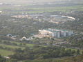 A view from Mandalay Hill
 -
 Another view from Mandalay Hill
 -
 Mandalay Palace Watch Tower
 -
 The Hluttaw Hall inside Mandalay Palace
 -
 Mahamuni Buddha, A Rakhine masterpiece
 -
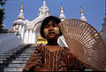 A Mandalay girl
 -
 Shwe Kyaung, a famous monastery
 -
 The Atumashi Monastery
 -
 Now defunct old Sagaing Bridge


References
- ^ a b c d "United Nations World Urbanization Prospects, 2007 revision". The United Nations Population Division. Retrieved 2009-01-24.
- ^ a b "China's Ambitions in Myanmar". IISS Strategic Comments. July 2000.
{{cite news}}: Unknown parameter|name=ignored (help) - ^ a b c d Stephen Mansfield (1999-05-13). "Myanmar's Chinese connection". Japan Times.
{{cite news}}: Italic or bold markup not allowed in:|publisher=(help) - ^ "History of Mandalay". Golden City of Asia, Official Mandalay City Site. Retrieved 2009-11-24.
- ^ Issac Taylor (1898). Names and Their Histories: A Handbook of Historical Geography and Topographical Nomenclature (2nd ed.). Rivingtons. p. 186.
- ^ a b "Mandalay Palace" (PDF). Directorate of Archaeological Survey, Burma. 1963. Retrieved 2006-08-22.
- ^ a b Kyaw Thein (1996). The Management of Secondary Cities in Southeast Asia. Case Study: Mandalay. UN-Habitat. ISBN 9211313139, 9789211313130.
{{cite book}}:|work=ignored (help); Check|isbn=value: invalid character (help) - ^ Vincent Clarence Scott O'Connor (1907). Mandalay: And Other Cities of the Past in Burma. Hutchinson & Co. p. 6-9.
- ^ Herbert Thirkell White (1913). A Civil Servant in Burma. London: E. Arnold.
- ^ Ko Yin Aung (1999-12-23). "Prospects of Education in Myanmar". The New Light of Myanmar.
- ^ Bird, George W (1897). Wanderings in Burma. London: F J Bright & Son. p. 254.
- ^ "Mandalay Centenary Stamps". eBay. Retrieved 2009-01-25.
- ^ "23,000 Homeless in Burma Fire". New York Times via Reuters. 26 March 1984. Retrieved 2009-01-25.
{{cite news}}: Italic or bold markup not allowed in:|publisher=(help) - ^ "Myanmar Fire Mar 1984 UNDRO Information Reports 1 - 2". ReliefWeb. 27 March 1984. Retrieved 2009-01-25.
{{cite web}}: Italic or bold markup not allowed in:|publisher=(help) - ^ "Huge fire rages major market in Myanmar second largest city". China View via Xinhua. 2008-02-25. Retrieved 2009-01-25.
{{cite news}}: Italic or bold markup not allowed in:|publisher=(help) - ^ Ne Nwe Moe Aung and Sithu Naing (2009-03-02). "Dry weather brings upsurge in outbreaks of fire in Myanmar". The Myanmar Times.
{{cite journal}}: Cite journal requires|journal=(help) - ^ Christophe Vigny; et al. "Present-day crustal deformation around Sagaing fault, Myanmar" (PDF). Journal of Geophysical Research, vol 108, 19 November, 2003. pp. 2–4. Retrieved 2009-01-25.
{{cite web}}: Explicit use of et al. in:|author=(help) - ^ "Monthly Averages for Mandalay, Burma". The Weather Channel. Retrieved December 13 2008.
{{cite web}}: Check date values in:|accessdate=(help); Unknown parameter|dateformat=ignored (help) - ^ Maung Maung Oo (2001-11-26). "Junta's New White Elephant Project is Paying Off". Irrawaddy.
{{cite news}}: Italic or bold markup not allowed in:|publisher=(help) - ^ a b Thiha Aung (2005-02-13). "Mandalay Division marching to new golden land of unity and amity". New Light of Myanmar.
{{cite news}}: Italic or bold markup not allowed in:|publisher=(help) - ^ a b c "Asian Highway in Myanmar" (PDF). unescap.org. Retrieved 2009-01-12.
{{cite web}}: Italic or bold markup not allowed in:|publisher=(help) - ^ "Burmese Economy Is an Obstacle to Aid". New York Times. 2008-05-29.
{{cite news}}: Italic or bold markup not allowed in:|publisher=(help) - ^ Phyo Wai Kyaw (2008-06-02). "Sunny pick-ups turn back the clock on Mandalay's roads". Myanmar Times.
{{cite journal}}: Cite journal requires|journal=(help); Italic or bold markup not allowed in:|publisher=(help) - ^ Phyo Wai Kyaw (2007-07-30). "Domestic autos take over Mandalay streets". Myanmar Times.
{{cite journal}}: Cite journal requires|journal=(help); Italic or bold markup not allowed in:|publisher=(help) - ^ Shwe Yinn Mar Oo (2008-06-02). "Motor vehicles in Myanmar". Myanmar Times .
{{cite journal}}: Cite journal requires|journal=(help); Italic or bold markup not allowed in:|publisher=(help) - ^ "Ludu Daw Amar: Speaking Truth to Power by Min Zin". Irrawaddy, October 2002. Retrieved 2009-01-12.
{{cite web}}: Italic or bold markup not allowed in:|publisher=(help) - ^ "Myanmar to launch 2nd FM radio station in northern city". People's Daily Online via Xinhua. 2008-03-20.
{{cite news}}: Italic or bold markup not allowed in:|publisher=(help) - ^ Kyaw Zin Htun and Soe Than Linn (2008-03-24). "Mandalay gets FM station". Myanmar Times.
{{cite journal}}: Cite journal requires|journal=(help); Italic or bold markup not allowed in:|publisher=(help) - ^ "Mandalay Media". Myanmar's Net. Retrieved 2008-12-24.
- ^ "Naypyidaw to Launch New Daily". Irrawaddy . 2008-12-23.
{{cite news}}: Italic or bold markup not allowed in:|publisher=(help) - ^ "HRDU Yearbook 2006 Chapter 9: Rights to Education and Health". Human Rights Documentation Unit. Retrieved 2008-09-14.
- ^ Yee May Aung (2008-09-10). "Educationalists concerned by Burmese literacy rate". DVB.
{{cite news}}: Italic or bold markup not allowed in:|publisher=(help) - ^ Sandra Davie (2008-10-13). "'I see no future for my two sons in Myanmar.'". Straits Times.
{{cite news}}: Italic or bold markup not allowed in:|publisher=(help) - ^ "PPI: Almost Half of All World Health Spending is in the United States". 2007-01-17.
- ^ Yasmin Anwar (2007-06-28). 06.28.2007 "Burma junta faulted for rampant diseases". UC Berkeley News.
{{cite news}}: Check|url=value (help); Italic or bold markup not allowed in:|publisher=(help) - ^ Aye Lei Tun (2007-06-11). "Mandalay continues to play vital role as healthcare centre for the upper north". Myanmar Times.
{{cite journal}}: Cite journal requires|journal=(help); Italic or bold markup not allowed in:|publisher=(help) - ^ Thein Win Nyo (2007-06-11). "Medical tourism gives patients options". Myanmar Times.
{{cite journal}}: Cite journal requires|journal=(help); Italic or bold markup not allowed in:|publisher=(help)
External links
- A new Myanmar photobook by Claudia Wiens about people in Mandalay, Chin-, and other States, combined with Burmese fairy tales and personal travelogue. Published 2009
- Template:Wikitravel
- See also nearby Pyin Oo Lwin, the historic hill station above Mandalay
- Mandalay Supply Route
- History
- Template:PDFlink SOAS
- Mandalay city website
- Mandalay Gallery with antique, colonial views of Mandalay
- Mandalay, the Burmese Heartland by Dr. Constance Wilson, Northern Illinois University
- Asian Historical Architecture - Mandalay by Prof. Robert D. Fiala, Concordia University, Nebraska
- Mintha Theater
- Mandalay Photo Gallery
- Photo Gallery
- Mandalay Centenary Song by Than Myat Soe MRTV3

