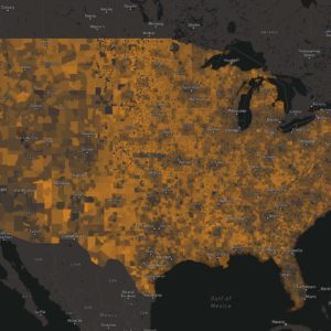
A new map helps identify communities where investments in staffing and expertise are needed to support infrastructure and climate resilience projects.

Bill is a software developer passionate about building tools that empower users. Originally from a small town in northern Maine, he is no stranger to the plight of rural communities. Early in his career, Bill studied salmon and lamprey in the Columbia River Basin, but quickly realized he had a knack for developing and applying solutions to technical problems. As a GIS analyst and computer programmer for Montana Fish, Wildlife & Parks, he disseminated large datasets for biologists, and developed tools to help managers and conservation planners make better decisions. He holds a M.S. in Biology from Worcester Polytechnic Institute. When not working, Bill can be found building furniture and volunteering at the local makerspace or exploring Montana’s wilderness with his family.
A new map helps identify communities where investments in staffing and expertise are needed to support infrastructure and climate resilience projects.

Find the latest American Community Survey data in all of our tools, including the Economic Profile System and Neighborhoods at Risk.
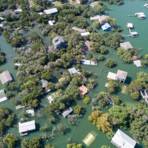
Headwaters Economics and the Hispanic Access Foundation have released a report that shows that 44% of Latinos live in counties with high flood risk, as opposed to 35% of non-Latinos.