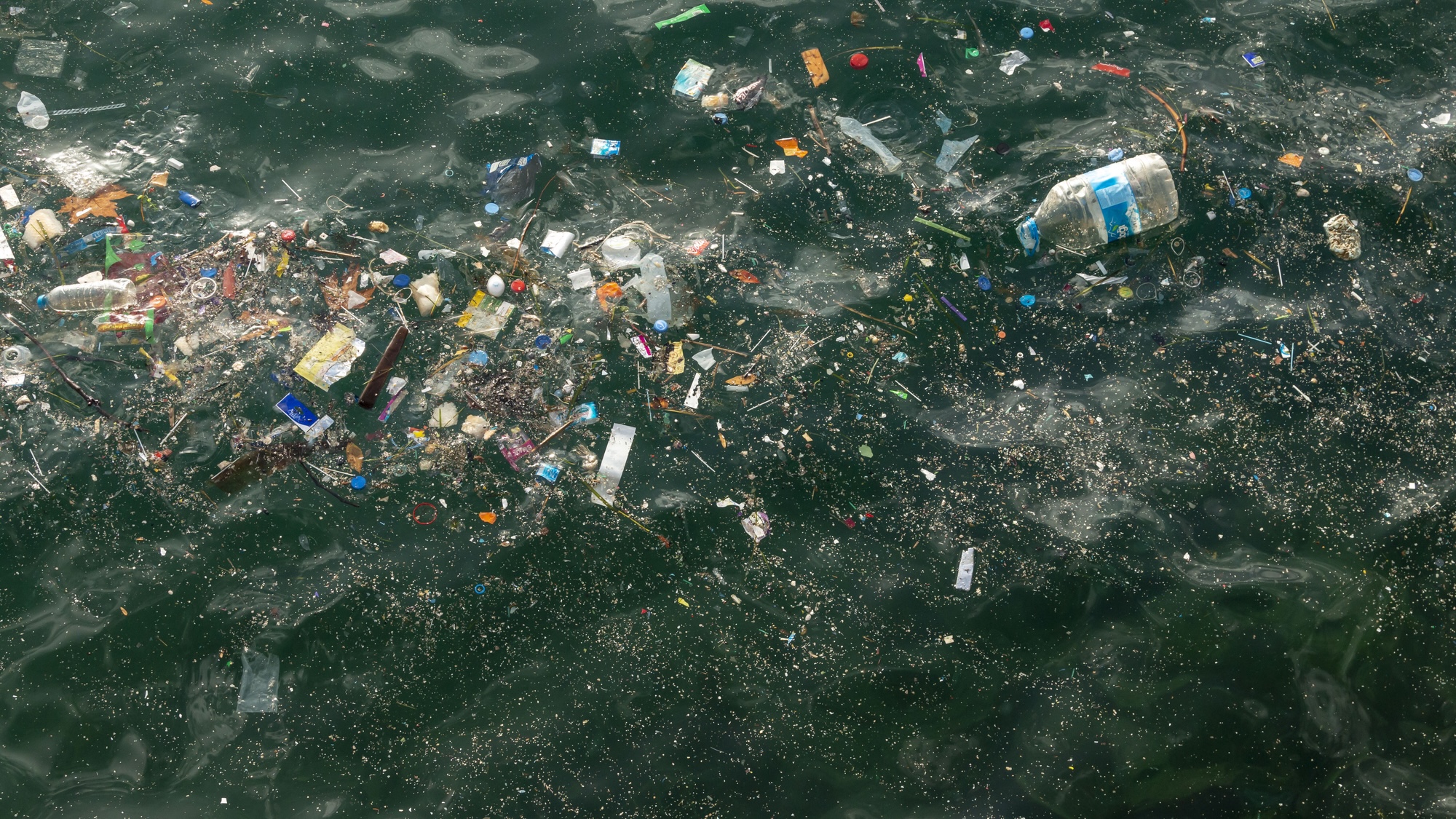
The majority of plastic that pollutes our planet’s oceans doesn’t float on the surface, but rather underneath the waves. This makes tracking and monitoring the problematic trash using technology like satellites challenging for researchers. But a new system of supercomputer-powered search algorithms could help harness satellites for the task. With additional research and fine tuning, the design has the potential to become a valuable tool in tackling the global issue.
As detailed in a study published on June 14 in Nature Communications, a project trained a machine-learning program on 300,000 multispectral and infrared imagery of the Mediterranean Sea amassed over six years by the European Space Agency’s Copernicus Sentinel-2 satellite. The team then used this database to identify what are known as windrows—floating filaments composed of garbage and plastic formed by marine currents and wind. Although frequently short-lived structures, windrows (also known as surface slicks or streaks) can extend for miles before dispersing into the ocean. The project is a collaborative effort by the Institute of Marine Sciences (ICM-CSIC), the Higher Council for Scientific Research (CSIC), and Spain’s University of Cádiz.

“Until now, searching for aggregations of garbage several meters in diameter on the surface of the ocean was like looking for needles in a haystack, since the formation of trails requires the presence of a large amount of garbage and little wind to prevent it from dispersing,” Manuel Arias, an ICM-CSIC researcher and project co-director, said.
While windrows only account for an extremely small portion of overall marine litter, researchers theorized the trash could serve as proxies for pollution hotspots. Between July 2015 and September 2021, the team detected and monitored a total of 14,374 windrows—an exponential increase in documented litter structures. Many of the windrows pinpointed by satellite images were then subsequently checked by ships in the region. In total, the pollution is estimated to have covered 94.5-square-kilometers (nearly 36.5-square miles), an area equal to roughly 7,500 soccer fields. While most of the filaments measured 1km (0.62 mi) long, 27 documented windrows managed to stretch 10-23 km (6.2-14.29 mi).
[Related: Robot jellyfish swarms could soon help clean the oceans of plastic.]
Further analysis of the marine pollution patterns allowed the team to infer a number of influences on where and when ocean trash accumulates, such as nearby population density, geography, and rainfall. A region that frequently experiences torrential rain, for example, more often flushes garbage out into the water, where coastal desert areas may contribute far less. These hotspots are also primarily located within 15 km (9.32 mi) of a coast and frequently return to shore within the following weeks or months.
Researchers believe the new system could help cleanup projects identify areas of concentrated ocean plastic pollution and even forecast where and when it might disperse. They also believe the program can be expanded to track other issues, including ship cargo loss, oil spills, and search-and-rescue situations.
“Marine litter mirrors the failures of our civilization to manage waste,” the team writes in their study. “… [S]atellite-based observations are one of the best hopes for large-scale monitoring.”