A Heat Advisory is in effect for the inland counties of east central Florida today from 12 PM to 6 PM for heat index values up to 110. An increased risk for heat-related illness exists. This level of heat can affect anyone without adequate precautions. Additionally, a High Risk for rip currents exists at the Volusia and northern Brevard county beaches today. Entering the surf is strongly discouraged. A Moderate Risk for rip currents exists to the south. Remember to swim near a lifeguard and never swim alone.
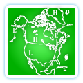
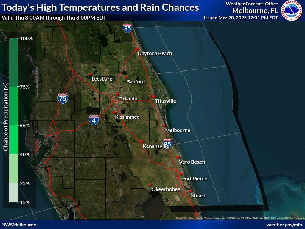
The sea breeze pattern will continue today with isolated to scattered showers (30-50%) and lightning storms (mainly over the interior) into the afternoon and early evening. The main hazards with lightning storms will be wind gusts up to 30-45mph, occasional to frequent lightning strikes, and locally heavy rainfall that has the potential to result in minor nuisance flooding. Shower and storm chances diminish after sunset. Afternoon highs in the low to mid 90s are forecast. Light winds are expected to increase into the afternoon at 5-10mph with mostly to partly sunny skies.
Are you a junior, senior, or graduate student with an interest in operational meteorology? NWS Melbourne has two volunteer positions available for the full academic year. Additional details are available at the link under "News Headlines" at the top of the webpage!


 Interactive Radar
 Regional Satellite
 Tropical Weather