- News
- City News
- mangaluru News
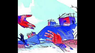
- Disaster mgmt app for swiftmitigation at micro level
Trending
Disaster mgmt app for swiftmitigation at micro level
This application helps in planning the necessary resources, such as earthmovers and boats, as soon as a distress call is received.
The data integrated into the system includes information about ASHA workers, expert swimmers, and divers.Distress calls are fed into the system, which then notifies the incident commander. There are 292 teams, and the resources are also tagged. Photos taken before and after the incident are uploaded as well, said deputy commissioner Mullai Muhilan MP.
Speaking on the sidelines of a review meeting at the Mescom office on Sunday, the DC said the application’s dashboard provides details on reported and pending incidents, the person the issue has been assigned to, including the time taken to resolve them.
The reporting structure involves the panchayat reporting to the EO and ULBs reporting to the tahsildar, who then reports to the district administration.
The administration is working on integrating messages received on WhatsApp from the public directly into the app. “Currently, only operators and certain departments, such as Mescom, forest, fire and emergency services, and other officials, have login access. Data is currently entered based on calls received by the operator and WhatsApp messages. There are plans to expand the app’s scope to include grievance redressal in the future. Meanwhile, since the data is being constantly fed, the vulnerable areas will be reflected in the map, which will help in better implementation of the disaster management plan,” he said.
Meanwhile, the district administration conducted a two-day drive to ensure compliance with preventive measures. Officials were instructed to review the disaster management plan and identify vulnerable spots. Every potential threat needs to be included, and officials have been directed to visit the field along with elected representatives to study the area thoroughly, considering possibilities like landslips, footbridge conditions and so on. Details are expected to be finalised by Monday, the DC said.
Since the first week of June, officials have been using the application for disaster management. Under the disaster management plan, vulnerable areas are identified, typically based on historical data. However, according to the DC, the current approach aims to delve deeper by decentralising the entire plan and addressing issues at a micro level. He stressed on the importance of spreading awareness about building designs, particularly for houses constructed in sloped areas. He is also considering bringing in a regulation regarding designs under the District Disaster Management Authority.
End of Article
FOLLOW US ON SOCIAL MEDIA


Hot Picks
TOP TRENDING
Trending Stories
In City
Entire Website
- BMW hit-and-run: Asked Mihir Shah to stop but he didn't, says victim's husband
- Gold shines! RBI adds $5.6 billion in gold reserves in June quarter
- Suryakumar Yadav reveals the 'most important catch' of his life
- Stalin visits Armstrong’s family, assures thorough probe
- Virat Kohli's Bengaluru pub faces FIR for operating beyond permissible hours
- Mummified remains of American climber missing for 22 years found in Peru
- Putin-PM Modi meet: 'No solution on battlefield', says India on Ukraine
- Jey Uso stated that he would run off whenever Wyatt Sicks showed up
- Is WWE slowly building a Bloodline exclusive storyline for ‘Bad Blood’ ?
- Richest WWE wrestlers in the World 2024: Know their net worth, records, titles, and more
- All eyes - and few ayes - on Joe Biden as Nato summit opens in Washington
- PM Modi lands in Vienna, says, 'Visit to Austria is a special one'
- BJP ignored ‘praja’ for ‘raja’ in Ayodhya and paid the price
- Woman IRS officer changes gender, government updates records
- Banks' 'internal' accounts being used for frauds: RBI
- Adoptions at record high, SC warns states stalling process
- Lesson for influencers: TMC leader to pay Rs 50 lakh damages
- Why Microsoft has asked employees in China to stop using Android
- Howrah businessman thrashed, home vandalised on kangaroo court diktat, TMC neta on run
- Top 10 poorest countries in the world by GDP per capita 2024: Check list

Popular Categories
Hot on the Web
Top Trends
Top Richest WWE Wrestlers in the WorldRichest Footballers in the WorldModi Russia VisitCUET UG Result 2024Mumbai RainCUET UG 2024 ControversyNEET UG SC HearingKuldeep YadavTop Richest WWE Wrestlers in the WorldMumbai BMW Hit and RunJohn CenaWorld Most Expensive InsectBarcelona Anti Tourism ProtestsCricket NewsWWE NewsLive Score
Trending Topics
Anant Ambani WeddingBaffle ScientistsParenting TipsBigg Boss OTT 3 ContestantsChasing TigersNita AmbaniOptical IllusionUsha UthupNational AnimalsLeast Visited CountriesFunniest ImagesBigg Boss OTT 3Sunita Williams Education QualificationJackie ShroffGujarati Mameru CeremonyIsha AmbaniBest Mattress Brands In IndiaBest 32Gb Ram LaptopsMattress Buying GuideBest Refrigerators Under 10000
Living and entertainment
Latest News
'Not the right point to...': Ruturaj Gaikwad says tough to fill India legend's shoesDalits are not safe in Tamil Nadu: Union minister L Murugan4, including 3 brothers, get life sentence for burning man to death'Maharaj' actress Priyal Gor talks about controversies around the film before release: 'There was a bit of fear and uncertainty...'Parikshit Tamaliya on 'Vaar Tahevaar': The story itself is the hero here- ExclusiveCognizant pays Rs 4 crore to settle Dalal's lawsuit with WiproRetirement corpus: Should I break all my FDs and invest in MFs instead?9 Reasons why you need a Libra in your lifeHyundai Grand i10, Maruti Suzuki Baleno top-sellers in used car market, these cities lead sales: Report'I'm honoured to be back, albeit wearing a different hat': Gautam Gambhir after being appointed Team India's head coachDreamcatcher have released their music video teaser for ‘JUSTICE’Euro 2024 : Who will win?“I'll be ready for him”: Cody Rhodes opens up about The Rock’s WWE return and his relationship with Seth RollinsWhy do UTIs occur frequently and what to do to prevent themIs Cartoon Network dead? How social media post using #RIPCartoonNetwork caused frenzy among fansKaal Sarpa Dosha and Remedies as per AstrologySamsung Galaxy Buds 3 leaked unboxing video reveals key detailsRanbir Kapoor on fatherhood and how his bond with the late Rishi Kapoor shapes his parenting dreams with Alia Bhatt
Copyright © 2024 Bennett, Coleman & Co. Ltd. All rights reserved. For reprint rights: Times Syndication Service