Category:1844 maps of North America
Jump to navigation
Jump to search
Temperate regions: North America · South America · Africa · Europe · Asia · – Polar regions: – Other regions:
English: 1844 maps of North America
Subcategories
This category has the following 2 subcategories, out of 2 total.
C
- 1844 maps of Canada (2 F)
U
Media in category "1844 maps of North America"
The following 4 files are in this category, out of 4 total.
-
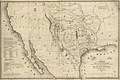 Map of Texas and the countries adjacent. LOC 2003627046.jpg 9,929 × 6,580; 8.95 MB
-
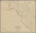 Map of the western and middle portions of North America (NYPL b20643847-5404024).jpg 8,000 × 7,400; 43.68 MB
-
 Map of the western and middle portions of North America (NYPL b20643847-5404024).tiff 10,328 × 7,760, 2 pages; 229.57 MB
-
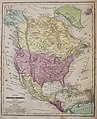 Olney's 1844 School Map.jpg 2,954 × 3,633; 2.62 MB

.jpg)
