Category:2020s maps of France
Jump to navigation
Jump to search
Subcategories
This category has the following 8 subcategories, out of 8 total.
'
L
T
Media in category "2020s maps of France"
The following 2 files are in this category, out of 2 total.
-
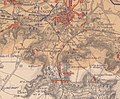 Courmelles carte des régions dévastées.jpg 982 × 813; 866 KB
-
 Berry - Province.jpg 2,208 × 1,455; 1.75 MB

