Category:Aerial photographs of Landkreis Ansbach
Jump to navigation
Jump to search
Urban districts (cities): Amberg · Ansbach · Aschaffenburg · Augsburg · Bamberg · Bayreuth · Coburg · Erlangen · Fürth · Hof · Kaufbeuren · Kempten · Landshut · Memmingen · Munich · Nuremberg · Passau · Regensburg · Rosenheim · Schwabach · Straubing · Weiden in der Oberpfalz · Würzburg
Subcategories
This category has the following 13 subcategories, out of 13 total.
B
C
D
G
H
L
N
Media in category "Aerial photographs of Landkreis Ansbach"
The following 29 files are in this category, out of 29 total.
-
 "Happy Ballooning über dem Landkreis Ansbach. 05.jpg 3,645 × 4,441; 6.51 MB
-
 "Happy Ballooning über dem Landkreis Ansbach. 06.jpg 5,906 × 3,885; 7.78 MB
-
 "Happy Ballooning über dem Landkreis Ansbach. 07.jpg 4,670 × 5,906; 10.57 MB
-
 "Happy Ballooning über dem Landkreis Ansbach. 08.jpg 5,906 × 3,937; 8.43 MB
-
 "Happy Ballooning über dem Landkreis Ansbach. 12.jpg 5,906 × 3,937; 10.52 MB
-
 Aerial image of the Ansbach-Petersdorf airfield.jpg 4,100 × 3,400; 4.98 MB
-
 Aerial image of the Dinkelsbühl-Sinbronn airfield.jpg 4,000 × 3,000; 4.15 MB
-
 Aerial image of the Geilsheim airfield.jpg 4,400 × 3,008; 5.67 MB
-
 Aerial image of the Irsingen gliding site.jpg 4,500 × 3,400; 6.04 MB
-
 Aerial image of the Rothenburg ob der Tauber airfield.jpg 4,800 × 3,000; 5.75 MB
-
 Aidenau 001.jpg 6,016 × 3,384; 8.93 MB
-
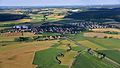
 Arberg 002.jpg 6,016 × 3,384; 9.72 MB
-
 Drohnenaufnahme des Vereinsheims 1.FC Sachsen.png 2,272 × 984; 3.2 MB
-
 ETH-BIB-Schillingsfürst, Gemeinde und Schloss-Inlandflüge-LBS MH01-005922.tif 6,060 × 3,687; 64.08 MB
-
 Flugplatz Geilsheim, SÖ.jpg 6,016 × 3,384; 10.51 MB
-
 Geilsheim 001.jpg 6,016 × 3,384; 8.94 MB
-
 Haundorf, Gemeinde Schnelldorf.jpg 2,785 × 1,752; 3.18 MB
-
 Kreuzeiche aus der Vogelperspektive.jpg 3,864 × 2,705; 10.42 MB
-
 Luftbild hauptburg.jpg 2,648 × 1,793; 4.36 MB
-
 Luftbild leonrod westen.jpg 2,571 × 2,250; 5.39 MB
-
 Luftbild Ruine Leonrod.jpg 3,279 × 2,103; 6.56 MB
-
 Luftbild Turmhügel Berndorf.jpg 3,479 × 2,223; 8.07 MB
-
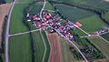
 Neunstetten 001.jpg 6,016 × 3,384; 8.2 MB
-
 Oberkemmathen Luftaufnahme (2016).jpg 3,840 × 2,880; 4.27 MB
-
 Reinswinden 001.jpg 6,016 × 3,384; 9.36 MB
-
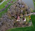
 Schloss Virnsberg von oben.jpg 7,196 × 6,048; 34.58 MB
-
 Schloss Virnsberg.jpg 3,149 × 2,046; 5.89 MB
-
 Steinach am Wald 001.jpg 6,016 × 3,384; 9.16 MB
-
 Wachsenberg (Neusitz) 001.jpg 6,016 × 3,384; 9.35 MB


.jpg)


_001.jpg)