Category:Aythorpe Roding
Jump to navigation
Jump to search
English: Aythorpe Roding is a village and civil parish in the Uttlesford district of Essex, England, and is one of The Rodings parishes of Essex. The village is 9 miles (15 km) northwest from the county town of Chelmsford.

village and civil parish in Essex, England, UK  | |||||
| Upload media | |||||
| Instance of | |||||
|---|---|---|---|---|---|
| Part of | |||||
| Standort | Uttlesford, Essex, East of England, England | ||||
| Population |
| ||||
 | |||||
Subcategories
This category has the following 6 subcategories, out of 6 total.
Media in category "Aythorpe Roding"
The following 38 files are in this category, out of 38 total.
-
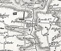 Aythorp Roding, Essex, Ordnance Survey map 1805.jpg 480 × 400; 220 KB
-

-

-
 Converted barn at Aythorpe Hall Farm, Aythorpe Roding, Essex, England - darker rendering.jpg 6,188 × 3,481; 18.57 MB
-
 Converted barn at Aythorpe Hall Farm, Aythorpe Roding, Essex, England - lighter rendering.jpg 6,188 × 3,481; 20.35 MB
-
 Road to Aythorpe Hall Farm, Aythorpe Roding, Essex, England.jpg 4,082 × 5,444; 17.25 MB
-
 Thatched cottage next to Aythorpe Roding Cricket Club, Essex, England 1.jpg 4,608 × 3,456; 9.17 MB
-
 Wheat field west from Aythorpe Roding Cricket Club ground 1.jpg 4,608 × 3,456; 12.45 MB
-
 Aythorpe Roding Village Hall, rear view - geograph.org.uk - 3392684.jpg 3,532 × 2,650; 2.74 MB
-
 Barn at former Monk's Farm - geograph.org.uk - 2591977.jpg 640 × 480; 96 KB
-
 Bigods Farm, Aythorpe Roding, Essex - geograph.org.uk - 176173.jpg 640 × 480; 62 KB
-
 Dunmow Road, Roundbush Green - geograph.org.uk - 5607239.jpg 2,014 × 1,490; 796 KB
-
 Footpath to nowhere in particular - geograph.org.uk - 2592007.jpg 640 × 480; 123 KB
-
 Harrowing on Keers Farm - geograph.org.uk - 3400499.jpg 1,600 × 1,064; 493 KB
-
 Lane near Walkers Farm - geograph.org.uk - 3534779.jpg 640 × 480; 151 KB
-
 New houses on Dunmow Road, Roundbush Green - geograph.org.uk - 5607242.jpg 1,998 × 1,466; 768 KB
-
 Poplars and Poplars - geograph.org.uk - 3534726.jpg 640 × 480; 130 KB
-

-
 River Roding at Broad Bridge - geograph.org.uk - 3534684.jpg 640 × 480; 160 KB
-
 River Roding^ - geograph.org.uk - 515628.jpg 426 × 640; 144 KB
-
 St Mary, Aylthorpe Roding - Brass - geograph.org.uk - 5059406.jpg 1,000 × 746; 323 KB
-
 St Mary, Aylthorpe Roding - Chancel - geograph.org.uk - 5059392.jpg 1,000 × 660; 228 KB
-
 St Mary, Aylthorpe Roding - East end - geograph.org.uk - 5059391.jpg 1,000 × 667; 236 KB
-
 St Mary, Aylthorpe Roding - Font - geograph.org.uk - 5059400.jpg 575 × 1,000; 178 KB
-
 St Mary, Aylthorpe Roding - Pulpit - geograph.org.uk - 5059408.jpg 667 × 1,000; 226 KB
-
 St Mary, Aylthorpe Roding - Sanctuary - geograph.org.uk - 5059410.jpg 1,000 × 667; 230 KB
-
 St Mary, Aylthorpe Roding - Stained glass window - geograph.org.uk - 5059402.jpg 214 × 1,000; 206 KB
-
 St Mary, Aylthorpe Roding - Stained glass window - geograph.org.uk - 5059405.jpg 858 × 1,000; 396 KB
-
 St Mary, Aylthorpe Roding - West end - geograph.org.uk - 5059395.jpg 1,000 × 684; 252 KB
-
 St Mary, Aylthorpe Roding - West end - geograph.org.uk - 5059397.jpg 1,000 × 650; 248 KB
-
 St Mary, Aylthorpe Roding, Essex. - geograph.org.uk - 5059388.jpg 1,000 × 667; 349 KB
-
 The lych gate of Aythorpe Roding church - geograph.org.uk - 1975240.jpg 640 × 480; 130 KB
-
 Trees by Dunmow Road, Aythorpe Roding - geograph.org.uk - 5607275.jpg 2,048 × 1,536; 1.53 MB
-
 View towards Aythorpe Roding Hall - geograph.org.uk - 3400487.jpg 1,600 × 1,064; 583 KB
-
 View west over fields - geograph.org.uk - 5188816.jpg 640 × 428; 176 KB
-
 Village sign at Aythorpe Roding - geograph.org.uk - 3389202.jpg 3,648 × 2,736; 2.44 MB
-
 Walker's Farm, Aythorpe Roding, Essex - geograph.org.uk - 163626.jpg 640 × 471; 88 KB
-
 Water pump, Aythorpe Roding - geograph.org.uk - 3389159.jpg 3,648 × 2,736; 2.54 MB


