Category:Beeston, Leeds
Jump to navigation
Jump to search
English: Beeston is a suburb of Leeds, West Yorkshire, England located about 2 miles (3 km) south of the city centre. The area is separated from surrounding areas to the north, east and west by the M621 motorway.
suburb of Leeds, West Yorkshire  | |||||
| Upload media | |||||
| Instance of | |||||
|---|---|---|---|---|---|
| Location | Leeds, West Yorkshire, Yorkshire and the Humber, England | ||||
 | |||||
Subcategories
This category has the following 13 subcategories, out of 13 total.
Media in category "Beeston, Leeds"
The following 89 files are in this category, out of 89 total.
-
 "The Ploughshare" at Beeston - geograph.org.uk - 524946.jpg 640 × 480; 98 KB
-
 6th Beeston Scout Hut - geograph.org.uk - 600001.jpg 640 × 427; 93 KB
-
 A new menagerie - geograph.org.uk - 1714786.jpg 1,600 × 1,067; 336 KB
-

-
 A52 in Beeston - geograph.org.uk - 1774502.jpg 640 × 480; 70 KB
-
 ACAB graffiti - Cross Flatts Park Leeds.jpg 4,160 × 3,120; 7.99 MB
-
 ACAB Graffiti - Cross Flatts Park Leeds.jpg 3,120 × 4,160; 5.75 MB
-
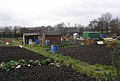 Allotments off Old Lane - geograph.org.uk - 627669.jpg 640 × 430; 33 KB
-
 Atha Street - Cross Flatts Grove - geograph.org.uk - 1081662.jpg 640 × 474; 191 KB
-
 Back Cross Flatts Crescent - Wooler Road - geograph.org.uk - 1081299.jpg 640 × 480; 274 KB
-
 Back Nursery Mount - South View Road - geograph.org.uk - 1231412.jpg 640 × 443; 185 KB
-
 Back-to-back house, Hunslet Moor (geograph 5709011).jpg 1,024 × 680; 221 KB
-
 Beeston - the Sandstone Trail - geograph.org.uk - 804850.jpg 640 × 480; 340 KB
-
 Beeston - the Sandstone Trail - geograph.org.uk - 804853.jpg 640 × 480; 225 KB
-
 Beeston Hill UFC 22 Nov 2016.jpg 3,264 × 2,448; 1.8 MB
-
 Beeston mining history.jpg 4,160 × 3,120; 6.67 MB
-

-
 Beeston towers - geograph.org.uk - 1210321.jpg 640 × 579; 43 KB
-
 Beeston-Tiverton - River Gowy - geograph.org.uk - 804812.jpg 640 × 480; 284 KB
-
 Belle Isle Road - geograph.org.uk - 1231399.jpg 640 × 480; 228 KB
-
 Between Burton Row and the M621 - geograph.org.uk - 5721242.jpg 640 × 427; 182 KB
-

-
 Clayton Court - Clayton Road - geograph.org.uk - 1231865.jpg 640 × 470; 240 KB
-
 Clayton Road - Pepper Road - geograph.org.uk - 1231862.jpg 640 × 443; 170 KB
-
 Clayton Way - Clayton Road - geograph.org.uk - 1231883.jpg 640 × 480; 235 KB
-
 Cross Flatts Grove - Wooler Road - geograph.org.uk - 1081320.jpg 640 × 433; 173 KB
-
 Cross Flatts Terrace - Town Street - geograph.org.uk - 1081623.jpg 640 × 480; 237 KB
-
 Feltham car at Parkside - geograph.org.uk - 1325387.jpg 640 × 504; 55 KB
-

-
 Hair Square salon, Beeston.jpg 1,236 × 1,888; 436 KB
-
 Hunslet Lake Centre - Arthington Avenue - geograph.org.uk - 1230499.jpg 640 × 480; 268 KB
-
 Jamia Masjid Abu Huraiara, Beeston 22 Nov 2016.jpg 3,072 × 2,304; 1.5 MB
-
 Knitted COVID 19 Rainbow Dolls window.jpg 3,120 × 4,160; 2.44 MB
-
 Leeds City Centre - geograph.org.uk - 291717.jpg 640 × 480; 83 KB
-
 Leeds United AFC - geograph.org.uk - 90193.jpg 640 × 480; 67 KB
-
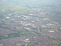
 Leeds Views (26209588519).jpg 3,990 × 2,451; 3.06 MB
-
 Leeds Views (37932598896).jpg 6,000 × 4,000; 15.72 MB
-
 Leeds Views (37955438672).jpg 6,000 × 4,000; 12.49 MB
-
 Leeds Views (37985505591).jpg 6,000 × 4,000; 12.45 MB
-
 Linden Place - Linden Road - geograph.org.uk - 1082739.jpg 640 × 478; 220 KB
-
 Linden Terrace - Linden Road - geograph.org.uk - 1082737.jpg 640 × 480; 203 KB
-
 Nursery Mount - South View Road - geograph.org.uk - 1231409.jpg 640 × 448; 181 KB
-
 Playing Fields - Cottingley Drive - geograph.org.uk - 1503203.jpg 640 × 480; 225 KB
-

-

-
 Sandon Place - Belle Isle Road - geograph.org.uk - 1231404.jpg 640 × 480; 236 KB
-
 Sandstone Trail near Beeston - geograph.org.uk - 1559660.jpg 480 × 640; 114 KB
-
 Simon Bottoms Bridge - geograph.org.uk - 698524.jpg 640 × 427; 82 KB
-
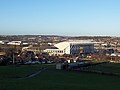
 South Leeds aerial photograph.jpg 1,600 × 1,200; 576 KB
-
 Stratford Street Mosque Beeston 22 Nov 2016.jpg 3,072 × 2,304; 1.44 MB
-

-
 Waincliffe Drive - geograph.org.uk - 560496.jpg 640 × 425; 40 KB
-
 Woodhouse Hill Rd - Belle Isle Road - geograph.org.uk - 1231401.jpg 640 × 480; 212 KB
-
 Woodhouse Hill Road - Pepper Road - geograph.org.uk - 1231857.jpg 640 × 410; 152 KB
-
 Woodview Road mosque Beeston 22 Nov 2016.jpg 3,264 × 2,448; 2.26 MB
-
 Wooler Road - geograph.org.uk - 1081281.jpg 640 × 440; 195 KB
-
 A Small Water Course in Attenborough - geograph.org.uk - 1062554.jpg 426 × 640; 152 KB
-
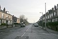
 Abbey Road, Beeston - geograph.org.uk - 1472401.jpg 640 × 440; 58 KB
-
 Alexandra Crescent, Beeston - geograph.org.uk - 1768458.jpg 640 × 480; 50 KB
-
 Alwyn Court - geograph.org.uk - 1176222.jpg 640 × 480; 149 KB
-
 Apartments on Church Street, Beeston - geograph.org.uk - 1246899.jpg 640 × 478; 156 KB
-
 Atha Street - Cross Flatts Avenue - geograph.org.uk - 1081654.jpg 640 × 456; 163 KB
-
 Atha Street - Cross Flatts Grove - geograph.org.uk - 1081659.jpg 640 × 480; 256 KB
-
 Back Cross Flatts Mount - Wooler Grove - geograph.org.uk - 1081647.jpg 640 × 436; 167 KB
-
 Back Mafeking Avenue - Dewsbury Road - geograph.org.uk - 1081676.jpg 640 × 480; 283 KB
-

-
 Beeston Canal bridge - geograph.org.uk - 598788.jpg 640 × 426; 132 KB
-
 Beeston Parish Centre - Town Street - geograph.org.uk - 627686.jpg 640 × 386; 31 KB
-
 Bridge over Beeston Canal - geograph.org.uk - 598828.jpg 640 × 378; 96 KB
-
 Cardinal Grove - geograph.org.uk - 627464.jpg 640 × 426; 24 KB
-
 Cardinal Square Playing Fields - geograph.org.uk - 627659.jpg 640 × 400; 17 KB
-
 Cottages near Beeston Lock - geograph.org.uk - 760321.jpg 640 × 427; 307 KB
-
 Fenced in - geograph.org.uk - 680618.jpg 480 × 640; 134 KB
-

-

-
 Heath Mount - geograph.org.uk - 632014.jpg 640 × 443; 26 KB
-
 Heath Road - geograph.org.uk - 632013.jpg 640 × 352; 21 KB
-
 Mafeking Avenue - Dewsbury Road - geograph.org.uk - 1081674.jpg 640 × 446; 198 KB
-
 Mafeking Grove - Dewsbury Road - geograph.org.uk - 1081671.jpg 640 × 480; 238 KB
-
 Mafeking Mount - Dewsbury Road - geograph.org.uk - 1081668.jpg 640 × 480; 228 KB
-

-
 Queens Road, Beeston - geograph.org.uk - 680856.jpg 640 × 480; 134 KB
-

-
 St Anthony's Presbytery - Old Lane - geograph.org.uk - 627674.jpg 640 × 482; 39 KB
-

-
 The corner of "The Box" - geograph.org.uk - 629116.jpg 427 × 640; 125 KB
-

-
 Thirlmere Gardens - geograph.org.uk - 627466.jpg 640 × 422; 24 KB
-
 Wide open spaces - geograph.org.uk - 382668.jpg 640 × 481; 48 KB


.jpg)


.jpg)
.jpg)
.jpg)
.jpg)


