Category:Boltby
Jump to navigation
Jump to search
village and civil parish in North Yorkshire, United Kingdom  | |||||
| Upload media | |||||
| Instance of | |||||
|---|---|---|---|---|---|
| Standort | Hambleton, North Yorkshire, Yorkshire and the Humber, England | ||||
| Population |
| ||||
| Area |
| ||||
| Said to be the same as | Boltby (Wikimedia duplicated page, civil parish) | ||||
 | |||||
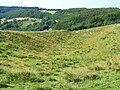
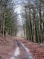
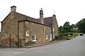
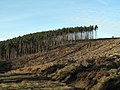
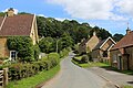
English: Boltby is a village and civil parish in the Hambleton district of North Yorkshire, England. It is on the edge of the North York Moors National Park at 140 m, and about six miles north-east of Thirsk. According to the 2001 census, it had a population of 149.
Subcategories
This category has only the following subcategory.
H
Media in category "Boltby"
The following 200 files are in this category, out of 359 total.
(previous page) (next page)-
 A fold in the hillside (2) - geograph.org.uk - 4617986.jpg 4,320 × 3,240; 4.66 MB
-
 A fold in the hillside - geograph.org.uk - 1958838.jpg 4,000 × 3,000; 1.98 MB
-
 A seat with a view over the Vale of York - geograph.org.uk - 4125772.jpg 1,600 × 1,023; 529 KB
-
 A stunning view from the Cleveland Way - geograph.org.uk - 4125831.jpg 1,600 × 1,045; 619 KB
-
 Access Track to Cinque Cliff House - geograph.org.uk - 5676326.jpg 5,184 × 3,456; 6.35 MB
-
 Across the field to Boltby - geograph.org.uk - 4926165.jpg 4,320 × 3,240; 3.39 MB
-
 Another Shooting Butt, Arden Moor - geograph.org.uk - 262139.jpg 640 × 384; 82 KB
-
 Approach road for High Paradise - geograph.org.uk - 6020544.jpg 3,239 × 4,319; 5.29 MB
-
 Approaching High Quarry Plantation - geograph.org.uk - 4792079.jpg 1,920 × 1,280; 723 KB
-
-
 At the top of Sneck Yate - geograph.org.uk - 6176263.jpg 2,048 × 1,536; 1.07 MB
-
 Bales in a field - geograph.org.uk - 5569551.jpg 640 × 427; 210 KB
-
 Bare fields next to the bridleway - geograph.org.uk - 5569517.jpg 640 × 427; 242 KB
-
 Boltby Ford - geograph.org.uk - 3806764.jpg 3,872 × 2,592; 4.49 MB
-
 Boltby Forest - geograph.org.uk - 4304398.jpg 640 × 382; 65 KB
-
 Boltby Forest - geograph.org.uk - 6176318.jpg 2,048 × 1,536; 1.23 MB
-
 Boltby Forest, standing trees and felled area - geograph.org.uk - 2243731.jpg 2,000 × 1,500; 2.96 MB
-
 Boltby from the Cleveland Way.jpg 2,770 × 1,847; 1.45 MB
-
 Boltby Scar - geograph.org.uk - 5705897.jpg 640 × 480; 68 KB
-
 Boltby Scar view - geograph.org.uk - 6176269.jpg 2,048 × 1,536; 797 KB
-
 Boltby Scar Views - geograph.org.uk - 165495.jpg 640 × 373; 123 KB
-
 Boltby Scar Views - geograph.org.uk - 165501.jpg 480 × 640; 176 KB
-
 Boltby Village - geograph.org.uk - 5095820.jpg 5,045 × 3,363; 5.99 MB
-
 Boltby Village Hall - geograph.org.uk - 311973.jpg 640 × 426; 69 KB
-
 Boltby village west end - geograph.org.uk - 301091.jpg 640 × 466; 104 KB
-
-

-
 Bridge over Gurtof Beck - geograph.org.uk - 5095817.jpg 5,142 × 3,428; 7.09 MB
-
 Bridge Over Lunshaw Beck - geograph.org.uk - 5906449.jpg 4,608 × 3,456; 3.35 MB
-
 Bridle path back to Cleveland Road - geograph.org.uk - 6202755.jpg 3,456 × 4,608; 5.98 MB
-
 Bridleway across Low Moor - geograph.org.uk - 3211078.jpg 3,648 × 2,736; 2.1 MB
-
 Bridleway and rape field - geograph.org.uk - 5569512.jpg 640 × 427; 234 KB
-
 Bridleway from Dialstone Farm - geograph.org.uk - 4125740.jpg 1,600 × 1,200; 564 KB
-
 Bridleway heading North West towards Boltby - geograph.org.uk - 6549316.jpg 5,184 × 3,456; 6.29 MB
-
 Bridleway junction at High Barn - geograph.org.uk - 1958854.jpg 4,000 × 3,000; 2.49 MB
-
 Bridleway leaving Boltby - geograph.org.uk - 2243508.jpg 2,000 × 1,194; 2.67 MB
-
 Bridleway meets Cleveland Way at Boltby Scar - geograph.org.uk - 6202784.jpg 4,608 × 3,456; 3.16 MB
-
 Bridleway near Dialstone Farm - geograph.org.uk - 6176275.jpg 2,048 × 1,536; 997 KB
-
 Bridleway on Birk Bank - geograph.org.uk - 5823912.jpg 4,320 × 3,240; 5.03 MB
-
 Bridleway through Boltby Forest - geograph.org.uk - 891547.jpg 480 × 640; 101 KB
-
 Bridleway to Boltby - geograph.org.uk - 6015973.jpg 4,101 × 2,716; 2.61 MB
-
 Bridleway to enter Cow Pasture Wood - geograph.org.uk - 2903418.jpg 3,648 × 2,736; 3.26 MB
-
 Bridleway to High Barn - geograph.org.uk - 2098379.jpg 4,000 × 3,000; 3.07 MB
-
 Bridleway towards Boltby - geograph.org.uk - 4618033.jpg 3,240 × 4,320; 4.19 MB
-
 Bridleway west of Dialstone Farm - geograph.org.uk - 5569549.jpg 640 × 427; 213 KB
-
 Brown Cow by Stonecliff Wood - geograph.org.uk - 792334.jpg 640 × 480; 132 KB
-
 Buttercups at Boltby - geograph.org.uk - 1910757.jpg 2,448 × 3,264; 2.45 MB
-
-
 Cereal fields on the Hambleton Hills - geograph.org.uk - 4618008.jpg 4,320 × 2,551; 2.16 MB
-
 Clear Path - geograph.org.uk - 4773355.jpg 768 × 1,024; 203 KB
-
 Cleared and replanted area in Boltby Forest - geograph.org.uk - 5809006.jpg 4,320 × 2,887; 2.61 MB
-
 Cleave Dike - geograph.org.uk - 5569557.jpg 640 × 427; 217 KB
-
 Cleave Dyke Police Mast - geograph.org.uk - 5569537.jpg 427 × 640; 174 KB
-
 Cleave Dyke Quarry - geograph.org.uk - 4618075.jpg 4,320 × 3,240; 3.78 MB
-
 Cleave Dyke Quarry and Scar - geograph.org.uk - 1958872.jpg 3,976 × 2,398; 1.65 MB
-
 Cleveland Road - geograph.org.uk - 583042.jpg 640 × 480; 82 KB
-
 Cleveland Road at Wethercote Lane - geograph.org.uk - 2468113.jpg 800 × 600; 195 KB
-
 Cleveland Road looking south - geograph.org.uk - 6202725.jpg 4,608 × 3,456; 4.74 MB
-
 Cleveland Way - geograph.org.uk - 3319994.jpg 640 × 427; 264 KB
-
 Cleveland Way above Low Paradise - geograph.org.uk - 6020555.jpg 4,320 × 3,240; 2.47 MB
-
 Cleveland Way above South Woods - geograph.org.uk - 6548672.jpg 5,177 × 3,130; 6.27 MB
-
 Cleveland Way entering Low Paradise Wood - geograph.org.uk - 6550494.jpg 5,184 × 3,456; 6.3 MB
-
 Cleveland Way heading south-west - geograph.org.uk - 2243885.jpg 2,000 × 1,500; 2.72 MB
-
 Cleveland Way Long Distance Footpath - geograph.org.uk - 4125806.jpg 1,600 × 1,200; 633 KB
-
 Cleveland Way near South Woods - geograph.org.uk - 1802994.jpg 2,048 × 1,536; 1.66 MB
-
 Cleveland Way south from Boltby Scar - geograph.org.uk - 6202790.jpg 4,608 × 3,456; 3.58 MB
-
 Cleveland Way through Boltby Forest - geograph.org.uk - 6202862.jpg 4,608 × 3,456; 6.01 MB
-
 Cleveland Way towards High Paradise - geograph.org.uk - 6020561.jpg 3,239 × 4,319; 5.36 MB
-
 Cleveland Way under muddy snow - geograph.org.uk - 5705902.jpg 640 × 480; 77 KB
-
 Cleveland Way, Sutton Edge, Yorkshire - geograph.org.uk - 4931010.jpg 1,400 × 933; 1.32 MB
-
 Cleveland way. - geograph.org.uk - 2875169.jpg 640 × 614; 61 KB
-
 Coppice on Huggon Howl - geograph.org.uk - 3546970.jpg 4,000 × 3,000; 2.35 MB
-
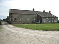
 Cottages in Boltby.jpg 640 × 480; 124 KB
-
 Cracoe - geograph.org.uk - 6176322.jpg 2,048 × 1,536; 1.5 MB
-
 Cycle route near Dialstone - geograph.org.uk - 6176283.jpg 2,048 × 1,536; 1.03 MB
-
 Cyclists on a mission in Boltby - geograph.org.uk - 4087842.jpg 640 × 427; 96 KB
-
 Dialstone Farm - geograph.org.uk - 4792112.jpg 1,920 × 1,280; 1,012 KB
-
 Dialstone Farm - geograph.org.uk - 5569529.jpg 640 × 427; 208 KB
-
 Dialstone Farm - geograph.org.uk - 5832249.jpg 1,024 × 768; 182 KB
-
 Dialstour Farm, near Cold Kirby - geograph.org.uk - 2468097.jpg 800 × 600; 213 KB
-
 Diversion ahead - geograph.org.uk - 5588870.jpg 4,320 × 2,893; 3.31 MB
-
 Double gate - geograph.org.uk - 6273837.jpg 640 × 427; 132 KB
-
 Drove Road - geograph.org.uk - 6176363.jpg 2,048 × 1,536; 1.35 MB
-
 Dry Ford near Ravensthorpe Mill - geograph.org.uk - 3546985.jpg 4,000 × 3,000; 4.04 MB
-
 Dry stone wall - geograph.org.uk - 1508753.jpg 640 × 480; 236 KB
-
 Dry stone wall at edge of Boltby Forest - geograph.org.uk - 2243853.jpg 2,000 × 1,500; 2.54 MB
-
 East of Boltby - geograph.org.uk - 5981193.jpg 2,048 × 1,536; 838 KB
-
 Eastern End of Boltby - geograph.org.uk - 6549299.jpg 5,184 × 3,456; 6.33 MB
-
 Edge of Boltby Forest - geograph.org.uk - 2126599.jpg 640 × 427; 81 KB
-

-
 Elderflower by the path - geograph.org.uk - 5810186.jpg 4,320 × 3,240; 4.47 MB
-
 Entering Boltby forest. - geograph.org.uk - 4304399.jpg 640 × 480; 90 KB
-
 Entrance to Boltby Forest from Sneck Yate Bank - geograph.org.uk - 2098364.jpg 4,000 × 3,000; 3.96 MB
-
 Farm buildings at High Barn - geograph.org.uk - 3211070.jpg 3,648 × 2,736; 3.2 MB
-
 Farm name on a tree trunk also a seat - geograph.org.uk - 6202838.jpg 4,608 × 3,456; 5.79 MB
-
 Farm Track heading East from Cinque Cliff Wood - geograph.org.uk - 5676318.jpg 5,184 × 3,456; 5.75 MB
-
 Farm Track heading towards Cinque Cliff Wood - geograph.org.uk - 5676321.jpg 5,184 × 3,456; 6.43 MB
-
 Farm Track heading West from Cinque Cliff Wood - geograph.org.uk - 5676310.jpg 5,184 × 3,456; 7.15 MB
-
 Farmland on Whitestone Cliff - geograph.org.uk - 5569492.jpg 640 × 427; 225 KB
-
 Feasant Pheeder, Near Gurtof Wood - geograph.org.uk - 310968.jpg 640 × 426; 98 KB
-
 Field above Huggon Howl towards South Woods - geograph.org.uk - 2098441.jpg 4,000 × 3,000; 3.52 MB
-
 Field Gate - geograph.org.uk - 5906453.jpg 4,501 × 3,375; 2.7 MB
-
 Field of stubble - geograph.org.uk - 5569515.jpg 640 × 427; 254 KB
-
 Fields near the Cleveland Road - geograph.org.uk - 5569522.jpg 640 × 427; 251 KB
-
 Fields on Cold Kirby Moor - geograph.org.uk - 5569594.jpg 640 × 427; 212 KB
-
 Fire Pond, Boltby Forest - geograph.org.uk - 310954.jpg 640 × 426; 96 KB
-
 Flowers on the rock face - geograph.org.uk - 4618081.jpg 4,320 × 3,240; 3.9 MB
-
 Footbridge over Gurtof Beck - geograph.org.uk - 3639694.jpg 640 × 480; 316 KB
-
 Footbridge over Lunshaw Beck - geograph.org.uk - 2903409.jpg 3,648 × 2,736; 3.55 MB
-
 Footpath heading South towards Tang Hall - geograph.org.uk - 6549321.jpg 5,184 × 3,456; 5.41 MB
-
 Footpath through the forest - geograph.org.uk - 5810165.jpg 3,239 × 4,319; 4 MB
-
 Footpath to Boltby - geograph.org.uk - 5980863.jpg 2,048 × 1,536; 1.68 MB
-
 Footpath to High Barn - geograph.org.uk - 2098392.jpg 4,000 × 3,000; 2.65 MB
-
 Ford and footbridge - geograph.org.uk - 5095825.jpg 5,010 × 3,340; 6.97 MB
-
 Ford at Boltby - geograph.org.uk - 3806807.jpg 3,872 × 2,592; 4.77 MB
-
 Ford at Boltby - geograph.org.uk - 4340917.jpg 3,872 × 2,592; 4.2 MB
-
 Ford at Ravensthorpe Mill - geograph.org.uk - 4340750.jpg 3,872 × 2,592; 4.85 MB
-
 Ford Over Lunshaw Beck - geograph.org.uk - 5906446.jpg 4,608 × 3,456; 3.62 MB
-
 Ford through Lunshaw Beck - geograph.org.uk - 2903405.jpg 3,648 × 2,736; 3.77 MB
-
 Forest Edge Bridleway - geograph.org.uk - 2326258.jpg 3,264 × 2,448; 1.61 MB
-
 Forest ride, Kirby Knowle Moor - geograph.org.uk - 5823900.jpg 4,320 × 3,240; 3.77 MB
-
 Forest track at Little Moor - geograph.org.uk - 2734834.jpg 3,224 × 1,632; 898 KB
-
 Forest track to Boltby Forest - geograph.org.uk - 1801571.jpg 2,048 × 1,536; 2.25 MB
-
 Forest track, Boltby Forest - geograph.org.uk - 5808975.jpg 3,239 × 3,836; 3.79 MB
-
 Forestry Around Cracoe Slack - geograph.org.uk - 2126591.jpg 640 × 427; 100 KB
-
 Forestry road in South Woods - geograph.org.uk - 3845868.jpg 1,500 × 1,125; 2.15 MB
-
 Forestry road with South Woods - geograph.org.uk - 3846169.jpg 1,500 × 1,125; 1.65 MB
-
 Gallops, Cold Kirby Moor - geograph.org.uk - 4791979.jpg 1,920 × 1,116; 699 KB
-
 Gallops, Cold Kirby Moor - geograph.org.uk - 4792075.jpg 1,920 × 1,208; 700 KB
-
 Galvanised steel 7 rail gate - geograph.org.uk - 6273822.jpg 640 × 474; 130 KB
-
 Garbutt Wood Nature Reserve and Gormire SSSI - geograph.org.uk - 4125790.jpg 3,844 × 1,372; 1.19 MB
-
 Gateway into Boltby Forest - geograph.org.uk - 6550442.jpg 5,184 × 3,456; 6.41 MB
-
 Gateway leading into Cow Pasture Wood - geograph.org.uk - 6549332.jpg 5,184 × 3,456; 6.85 MB
-
 Gateway to South Woods Hall - geograph.org.uk - 3449511.jpg 640 × 427; 353 KB
-
 Gossiping - geograph.org.uk - 516930.jpg 640 × 480; 117 KB
-
 Greendale Farm - geograph.org.uk - 5705886.jpg 640 × 480; 75 KB
-
 Gurtof Beck and Bridge - geograph.org.uk - 2098421.jpg 4,000 × 3,000; 4.21 MB
-
 Gurtof Beck near Tang Hall - geograph.org.uk - 2903426.jpg 3,648 × 2,736; 4.39 MB
-
 Gurtof Wood - geograph.org.uk - 2243593.jpg 2,000 × 1,500; 2.73 MB
-
 Halfway to Paradise - geograph.org.uk - 5808972.jpg 3,239 × 4,319; 5.03 MB
-
 Hambleton Drove Road - geograph.org.uk - 3877096.jpg 1,600 × 1,200; 616 KB
-
 Hambleton Drove Road - geograph.org.uk - 6179009.jpg 3,240 × 4,320; 3.26 MB
-
 Hambleton Hills scarp edge - geograph.org.uk - 4618100.jpg 4,320 × 3,240; 3.67 MB
-
 Hambleton Road - geograph.org.uk - 3211056.jpg 3,648 × 2,736; 2.61 MB
-
 Hambleton Road at Sneck Yate - geograph.org.uk - 6550453.jpg 5,184 × 3,456; 5.86 MB
-
 Hambleton Road passing through Sneck Yate Plantation - geograph.org.uk - 3211067.jpg 3,648 × 2,736; 2.65 MB
-
 Hambleton Road, from Sneck Yate car park - geograph.org.uk - 2468129.jpg 800 × 600; 345 KB
-
 Hambleton Street - geograph.org.uk - 2328240.jpg 2,176 × 1,632; 667 KB
-
 Harvest in - geograph.org.uk - 4125516.jpg 1,600 × 1,200; 653 KB
-
 High Barn - geograph.org.uk - 136677.jpg 640 × 480; 87 KB
-
 High Barn - geograph.org.uk - 1802936.jpg 2,048 × 1,536; 1.91 MB
-
 High Barn - geograph.org.uk - 2244169.jpg 2,000 × 1,316; 3.57 MB
-
 High Barn - geograph.org.uk - 3320015.jpg 640 × 427; 234 KB
-
 High Barn - geograph.org.uk - 5705891.jpg 640 × 480; 77 KB
-
 High Barn view - geograph.org.uk - 6176265.jpg 2,048 × 1,536; 1.03 MB
-
 High Paradise - geograph.org.uk - 6020537.jpg 4,320 × 2,041; 1.89 MB
-
 High Paradise Farm - geograph.org.uk - 1801543.jpg 3,072 × 2,304; 2.9 MB
-
 High Paradise Farm - geograph.org.uk - 6550463.jpg 5,184 × 3,456; 5.99 MB
-
 High Paradise Farm Tea room and accommodation - geograph.org.uk - 6202852.jpg 4,608 × 3,456; 4.2 MB
-
 High Paradise farm. - geograph.org.uk - 4304401.jpg 640 × 376; 86 KB
-
 High Quarry Plantation - geograph.org.uk - 4792082.jpg 1,920 × 1,280; 1,005 KB
-
 Hillside bridleway - geograph.org.uk - 2734822.jpg 2,448 × 3,264; 3.49 MB
-
 Hillside bridleway - geograph.org.uk - 2734829.jpg 3,264 × 2,448; 3.07 MB
-
 Holy Trinity Church, Boltby - geograph.org.uk - 6549289.jpg 5,184 × 3,456; 5.37 MB
-
 Horse Riders above Sneck Yate Bank - geograph.org.uk - 1143749.jpg 640 × 480; 63 KB
-
-
 Huggon Howl - geograph.org.uk - 2734814.jpg 3,264 × 2,448; 1.91 MB
-
 Hydraulic Ram pump in Boltby Forest - geograph.org.uk - 1142450.jpg 480 × 640; 108 KB
-
 In Boltby Forest - geograph.org.uk - 4481835.jpg 1,600 × 1,200; 763 KB
-
 In Boltby Forest - geograph.org.uk - 6176319.jpg 2,048 × 1,536; 1.23 MB
-
 In Gurtof Wood - geograph.org.uk - 5810177.jpg 4,320 × 2,935; 4.71 MB
-
 Information sign at Wind Egg - geograph.org.uk - 5823922.jpg 3,239 × 4,319; 4.79 MB
-
 Junction of paths - geograph.org.uk - 5569505.jpg 640 × 427; 268 KB
-
 Lane outside Hesketh Hall - geograph.org.uk - 6549383.jpg 5,184 × 3,456; 6.58 MB
-
 Little Moor - geograph.org.uk - 3319991.jpg 640 × 427; 241 KB
-

-
 Looking down over South Woods - geograph.org.uk - 5569495.jpg 640 × 427; 243 KB
-
-
 Looking north along Cleveland Road - geograph.org.uk - 2468107.jpg 800 × 600; 174 KB
-
 Low Paradise Wood - geograph.org.uk - 3320028.jpg 640 × 427; 290 KB
-
 Moat of Ravensthorp Manor - geograph.org.uk - 721915.jpg 640 × 480; 109 KB
-
 Near Cinque Cliff - geograph.org.uk - 5980886.jpg 2,048 × 1,536; 1.38 MB
-
 Near Long Plain Farm - geograph.org.uk - 6176273.jpg 2,048 × 1,536; 916 KB
-
 Near Ravensthorpe Manor - geograph.org.uk - 2672209.jpg 1,024 × 768; 239 KB
-
 Nearing the top - geograph.org.uk - 2734848.jpg 3,264 × 2,448; 2.14 MB
-
 Newly Planted Hedge - geograph.org.uk - 3320042.jpg 427 × 640; 271 KB
-
 North toward High Barn - geograph.org.uk - 6202804.jpg 4,608 × 3,456; 5.25 MB
-

-
 Old spoil tip below Cleave Dyke Quarry - geograph.org.uk - 4618112.jpg 4,320 × 2,488; 3.02 MB
-
 Old sunken way at Greendale - geograph.org.uk - 2734803.jpg 2,448 × 3,264; 3.37 MB
-
 Old Wall - geograph.org.uk - 2126600.jpg 427 × 640; 92 KB
-
 On Sneck yate bank. - geograph.org.uk - 4304403.jpg 640 × 366; 42 KB
-
 On The Cleveland Way - geograph.org.uk - 6548683.jpg 5,184 × 3,456; 6.47 MB
-
 On the edge of Hambleton Down - geograph.org.uk - 1628368.jpg 640 × 352; 41 KB
-
 On the edge of the hills - geograph.org.uk - 1958824.jpg 4,000 × 3,000; 2.22 MB
-
 Only three days 'till May - geograph.org.uk - 4926038.jpg 3,988 × 2,653; 2.54 MB
-
 Ordnance Survey Cut Mark - geograph.org.uk - 3547461.jpg 4,000 × 3,000; 4.57 MB
-
 Ordnance Survey Cut Mark - geograph.org.uk - 5613293.jpg 363 × 640; 96 KB
-
 Ordnance Survey Cut Mark - geograph.org.uk - 5613294.jpg 381 × 640; 71 KB
-
 Out into the open - geograph.org.uk - 5810182.jpg 4,320 × 3,240; 4.18 MB
_-_geograph.org.uk_-_4617986.jpg)


_in_a_wall_in_Boltby_-_geograph.org.uk_-_4087872.jpg)


