Category:Bowsden
Jump to navigation
Jump to search
village and civil parish in Northumberland, England  | |||||
| Upload media | |||||
| Instance of | |||||
|---|---|---|---|---|---|
| Standort | Northumberland, North East England, England | ||||
| Population |
| ||||
 | |||||
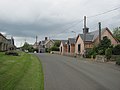
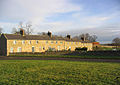
English: Bowsden is a village and civil parish in Northumberland, England. It is about to the south of Berwick-upon-Tweed, inland from the North Sea coast at Lindisfarne, and has a population of 157.
Media in category "Bowsden"
The following 184 files are in this category, out of 184 total.
-
 A 'Beltie' at Gatherick - geograph.org.uk - 3432844.jpg 3,744 × 2,552; 2.69 MB
-
 Agricultural view - geograph.org.uk - 5395637.jpg 1,600 × 1,067; 290 KB
-
 Approaching Bowsden - geograph.org.uk - 3432422.jpg 4,608 × 3,456; 6.02 MB
-
 Arable field near Brackenside Farm - geograph.org.uk - 3626467.jpg 1,024 × 768; 277 KB
-
 Arable field near Guinea Hill - geograph.org.uk - 4053884.jpg 2,048 × 1,536; 976 KB
-
 Arable field near Lickar Lea - geograph.org.uk - 2961256.jpg 1,024 × 612; 570 KB
-
 Arable field west of Bowsden - geograph.org.uk - 3625027.jpg 1,024 × 768; 355 KB
-
 Arable field west of Lowick Mill - geograph.org.uk - 4050682.jpg 2,048 × 1,536; 1.02 MB
-
 Arable land near Old Dryburn - geograph.org.uk - 3016389.jpg 1,024 × 768; 575 KB
-
 Arable land, Bowsden West Farm - geograph.org.uk - 2443358.jpg 640 × 480; 278 KB
-
 Arable land, Lickar Moor - geograph.org.uk - 3432691.jpg 1,450 × 1,088; 763 KB
-
 Barley at Bowsden - geograph.org.uk - 2443338.jpg 640 × 480; 267 KB
-
 Barley field - geograph.org.uk - 2443400.jpg 640 × 359; 201 KB
-
 Barley field - geograph.org.uk - 2443443.jpg 640 × 480; 300 KB
-
 Barley field, Jacks Law - geograph.org.uk - 2443435.jpg 640 × 480; 346 KB
-
 Barmoor Town Farm - geograph.org.uk - 78900.jpg 640 × 480; 57 KB
-
 Belted Galloway cattle - geograph.org.uk - 5395636.jpg 1,600 × 1,021; 261 KB
-
 Berrington Burn - geograph.org.uk - 3432651.jpg 3,264 × 2,448; 3.7 MB
-
 Berrington Burn - geograph.org.uk - 5395650.jpg 1,200 × 1,800; 462 KB
-
 Bing, Bowsden Moor - geograph.org.uk - 2635651.jpg 640 × 480; 117 KB
-
 Bird Bath^ - geograph.org.uk - 359682.jpg 640 × 480; 166 KB
-
 Bowsden , B6525 - geograph.org.uk - 6646902.jpg 6,000 × 4,000; 7.16 MB
-
 Bowsden , Country Road - geograph.org.uk - 6646904.jpg 6,000 × 4,000; 7.11 MB
-
 Bowsden - geograph.org.uk - 2442011.jpg 640 × 480; 237 KB
-
 Bowsden - geograph.org.uk - 4778636.jpg 1,024 × 683; 266 KB
-
 Bowsden Moor Farm - geograph.org.uk - 4053931.jpg 2,048 × 1,536; 712 KB
-
 Bowsden Moor Farm - geograph.org.uk - 5584227.jpg 640 × 481; 237 KB
-
 Bowsden Village Hall - geograph.org.uk - 3624993.jpg 1,024 × 768; 293 KB
-
 Bowsden West - geograph.org.uk - 4778644.jpg 1,024 × 683; 373 KB
-
 Bowsden West Farm - geograph.org.uk - 5178108.jpg 1,600 × 1,018; 260 KB
-
 Bowsden West triangulation pillar - geograph.org.uk - 2443343.jpg 480 × 640; 366 KB
-
 Bowsden West triangulation pillar - geograph.org.uk - 2443353.jpg 640 × 480; 295 KB
-
 Bridleway through wheat field, near Bowsden - geograph.org.uk - 3625029.jpg 1,024 × 768; 325 KB
-
 Bridleway to Woodside - geograph.org.uk - 3432430.jpg 4,608 × 3,456; 6.39 MB
-
 Buildings at Woodside Farm - geograph.org.uk - 3625042.jpg 1,024 × 768; 215 KB
-
 Buy your eggs at Barmoor Mill House - geograph.org.uk - 5178118.jpg 1,600 × 1,140; 373 KB
-
 Cattle and sheep in pasture - geograph.org.uk - 5395647.jpg 1,600 × 1,067; 271 KB
-
 Cattle near Whistle Bear - geograph.org.uk - 5584275.jpg 640 × 481; 257 KB
-
 Coal Harbour Cottage - geograph.org.uk - 5584250.jpg 640 × 480; 281 KB
-
 Cottages at Bowsden Moor Farm - geograph.org.uk - 5584237.jpg 640 × 480; 247 KB
-
 Country road junction near Woodside Farm - geograph.org.uk - 3625047.jpg 1,024 × 768; 327 KB
-
 Country road near Lowick - geograph.org.uk - 2961276.jpg 1,024 × 612; 560 KB
-
 Country road towards Kentstone and Beal - geograph.org.uk - 3016378.jpg 1,024 × 768; 457 KB
-
 Country road towards Kentstone and Beal - geograph.org.uk - 3016384.jpg 1,024 × 768; 454 KB
-
 Crop field near Bowsden - geograph.org.uk - 4461005.jpg 640 × 480; 48 KB
-
 Crop field near Bowsden West Farm - geograph.org.uk - 4595086.jpg 640 × 480; 71 KB
-
 Crop field near Woodside Farm - geograph.org.uk - 4595091.jpg 640 × 480; 47 KB
-
 Crop field, Bowsden Moor - geograph.org.uk - 4599917.jpg 640 × 480; 91 KB
-
 Crop field, Guinea Hill - geograph.org.uk - 4595073.jpg 640 × 480; 86 KB
-
 Crossroads east of Gatherick - geograph.org.uk - 3432802.jpg 3,264 × 2,448; 3.66 MB
-
 Cultivated arable field near Woodside Farm - geograph.org.uk - 3625041.jpg 1,024 × 768; 328 KB
-
 Culvert in Lickar Dean - geograph.org.uk - 5178188.jpg 1,000 × 1,500; 432 KB
-
 Dead tree branch on the pond, Bowsden Moor - geograph.org.uk - 4053947.jpg 2,048 × 1,536; 1.05 MB
-
 Donkeys at Bowsden - geograph.org.uk - 3432413.jpg 4,608 × 3,456; 6.18 MB
-
 Driveway to Bowsden Moor Farm - geograph.org.uk - 5584235.jpg 640 × 480; 268 KB
-
 Entrance to Bowsden East Farm - geograph.org.uk - 3624983.jpg 768 × 1,024; 245 KB
-
 Entrance to Bowsden Livery - geograph.org.uk - 3432424.jpg 4,608 × 3,456; 6.38 MB
-
 Entrance to Bowsden village - geograph.org.uk - 3624959.jpg 1,024 × 768; 303 KB
-
 Farm road south of Bowsden - geograph.org.uk - 4778659.jpg 1,024 × 576; 229 KB
-
 Farm road, Bowsden - geograph.org.uk - 4778646.jpg 1,024 × 683; 439 KB
-
 Farm road, south of Bowsden - geograph.org.uk - 4778656.jpg 1,024 × 683; 429 KB
-
 Farm sign, Bowsden - geograph.org.uk - 2442034.jpg 640 × 480; 309 KB
-
 Farm track, Bowsden - geograph.org.uk - 4778637.jpg 1,024 × 683; 318 KB
-
 Farm track, Lickar Moor - geograph.org.uk - 3432722.jpg 3,264 × 2,448; 3.67 MB
-
 Farmland near Lickar Dean - geograph.org.uk - 3026517.jpg 640 × 480; 60 KB
-
 Farmland towards Harbour Wood - geograph.org.uk - 4599944.jpg 640 × 480; 44 KB
-
 Field entrance near Lickar Dean - geograph.org.uk - 3026514.jpg 640 × 480; 46 KB
-
 Field near Lowick Mill - geograph.org.uk - 2390737.jpg 640 × 480; 92 KB
-

-
 Footpath heading east from the B6525 - geograph.org.uk - 4454654.jpg 640 × 480; 53 KB
-
 Footpath to Berrington Lough - geograph.org.uk - 3432416.jpg 4,608 × 3,456; 6.01 MB
-
 Footpath to Berryhill - geograph.org.uk - 3432870.jpg 3,264 × 2,448; 3.65 MB
-
 Gatherick road junction - geograph.org.uk - 3432859.jpg 3,989 × 2,702; 3.19 MB
-
 Grass triangle to the west of Lowick Mill - geograph.org.uk - 4050691.jpg 2,048 × 1,536; 765 KB
-
 Grazing and hedgerow - geograph.org.uk - 4595080.jpg 640 × 480; 70 KB
-
 Grazing near Bowsden Moor Farm - geograph.org.uk - 4595081.jpg 640 × 480; 62 KB
-
 Grazing near Coal Harbour - geograph.org.uk - 4595097.jpg 640 × 480; 56 KB
-
 Grazing sheep, Woodside - geograph.org.uk - 2443363.jpg 640 × 480; 264 KB
-
 Green lane - geograph.org.uk - 2443392.jpg 640 × 480; 377 KB
-
 Green lane, Gatherick - geograph.org.uk - 3374880.jpg 640 × 480; 280 KB
-
 Guinea Hill - geograph.org.uk - 2767748.jpg 640 × 360; 209 KB
-
 Harbour Wood - geograph.org.uk - 2443376.jpg 640 × 480; 317 KB
-
 Heading south east towards Bowsden - geograph.org.uk - 4599916.jpg 640 × 480; 67 KB
-
 Heading south east towards Bowsden - geograph.org.uk - 4599924.jpg 640 × 480; 50 KB
-
 Hedge, Lickar Dean - geograph.org.uk - 3412853.jpg 640 × 480; 298 KB
-
 Houses, Bowsden Moor - geograph.org.uk - 4599919.jpg 640 × 484; 74 KB
-
 John's Wood - geograph.org.uk - 3191584.jpg 640 × 360; 259 KB
-
 Junction on the B6525 - geograph.org.uk - 4461007.jpg 640 × 480; 48 KB
-
 Lane to Woodside Farm - geograph.org.uk - 3626453.jpg 1,024 × 768; 443 KB
-
 Large agricultural sprayer - geograph.org.uk - 5178201.jpg 1,600 × 1,149; 287 KB
-
 Lickar Moor Farm - geograph.org.uk - 3432770.jpg 4,608 × 3,456; 6.23 MB
-
 Looking across pasture and arable fields - geograph.org.uk - 5178166.jpg 1,600 × 1,178; 269 KB
-
 Low Wood - geograph.org.uk - 2443385.jpg 640 × 480; 378 KB
-
 Minor road by Woodside - geograph.org.uk - 2443368.jpg 640 × 480; 302 KB
-
 Minor road junction in Bowsden - geograph.org.uk - 3432407.jpg 4,608 × 3,456; 6.26 MB
-
 Minor road to Holy Island - geograph.org.uk - 3451652.jpg 4,608 × 3,456; 5.33 MB
-
 Minor road towards Barmoor Ridge - geograph.org.uk - 4599943.jpg 640 × 480; 74 KB
-
 Minor road towards Barmoor Ridge - geograph.org.uk - 4599948.jpg 640 × 480; 65 KB
-
 Minor road towards Berrington - geograph.org.uk - 4599913.jpg 640 × 480; 80 KB
-
 Minor road towards Bowsden - geograph.org.uk - 4461004.jpg 640 × 480; 70 KB
-
 Minor road towards Bowsden - geograph.org.uk - 4599918.jpg 640 × 480; 68 KB
-
 Minor road towards Woodend - geograph.org.uk - 4595095.jpg 640 × 480; 109 KB
-
 Minor road, Bowsden Moor - geograph.org.uk - 4595083.jpg 640 × 480; 62 KB
-
 Minor road, Guinea Hill - geograph.org.uk - 4595076.jpg 640 × 480; 68 KB
-
 New farm access, Bowsden West Farm - geograph.org.uk - 2443341.jpg 640 × 480; 278 KB
-
 Northern Northumberland landscape - geograph.org.uk - 5584264.jpg 640 × 480; 290 KB
-
 Partly felled woodland - geograph.org.uk - 4595071.jpg 640 × 480; 93 KB
-
 Pond, Bowsden Hollins - geograph.org.uk - 4778649.jpg 1,024 × 683; 433 KB
-
 Post box in a house wall - geograph.org.uk - 3624980.jpg 768 × 1,024; 242 KB
-
 Primroses near Gatherick - geograph.org.uk - 3432791.jpg 4,608 × 3,456; 6.41 MB
-
 Public footpath near Lowick - geograph.org.uk - 2961265.jpg 1,024 × 612; 610 KB
-
 Road between woods, near Brackenside - geograph.org.uk - 3626476.jpg 1,024 × 768; 471 KB
-
 Road junction and footpath - geograph.org.uk - 5178158.jpg 1,600 × 1,127; 318 KB
-
 Road junction by Bowsden - geograph.org.uk - 2443416.jpg 640 × 480; 362 KB
-
 Road junction north west of Bowsden Moor - geograph.org.uk - 4053895.jpg 2,048 × 1,536; 897 KB
-
 Road junction west of Whistle Bare - geograph.org.uk - 3432636.jpg 2,176 × 1,632; 1.65 MB
-
 Road junctions at Whistle Bare Farm - geograph.org.uk - 3432433.jpg 3,264 × 2,448; 3.5 MB
-
 Road through Bowsden - geograph.org.uk - 3624963.jpg 1,024 × 768; 281 KB
-
 Road to Bowsden - geograph.org.uk - 3432826.jpg 2,981 × 1,962; 2.35 MB
-
 Road to Brackenside - geograph.org.uk - 3432608.jpg 3,045 × 2,009; 2.17 MB
-
 Road towards Lowick Mill - geograph.org.uk - 3026516.jpg 640 × 480; 58 KB
-
 Road, Bowsden Hollins - geograph.org.uk - 4778651.jpg 1,024 × 683; 390 KB
-
 Road, Bowsden Moor - geograph.org.uk - 2443429.jpg 640 × 480; 302 KB
-
 Roadside Pines near Woodside Farm - geograph.org.uk - 5584257.jpg 480 × 640; 312 KB
-
 Roadside pond at Bowsden Moor - geograph.org.uk - 4053937.jpg 2,048 × 1,536; 918 KB
-
 Roadside woodland - geograph.org.uk - 4053892.jpg 2,048 × 1,536; 1.11 MB
-
 Sheep at Bowsden Moor Farm - geograph.org.uk - 5584267.jpg 640 × 480; 255 KB
-
 Sheep grazing, Bowsden - geograph.org.uk - 4454650.jpg 640 × 480; 57 KB
-
 Sign and track to Whistlebare - geograph.org.uk - 5395649.jpg 1,600 × 1,119; 271 KB
-
 Signpost at Lickar Moor - geograph.org.uk - 3432737.jpg 2,609 × 2,005; 2.63 MB
-
 Silage, Bowsden Moor - geograph.org.uk - 2443424.jpg 640 × 480; 257 KB
-
 Spring colour in Bowsden - geograph.org.uk - 3432410.jpg 3,617 × 2,639; 3.51 MB
-
 Stile and way marker - geograph.org.uk - 2390753.jpg 3,279 × 2,107; 7.26 MB
-
 Stone farm buildings beside B6525 - geograph.org.uk - 3016370.jpg 1,024 × 768; 461 KB
-
 Stubble, Bowsden - geograph.org.uk - 4778642.jpg 1,024 × 683; 369 KB
-
 Sunbathing sheep - geograph.org.uk - 3432761.jpg 4,608 × 3,456; 6.18 MB
-
 Telephone box, Bowsden - geograph.org.uk - 4053985.jpg 1,536 × 2,048; 773 KB
-
 Temporary barriers at Bowsden Moor - geograph.org.uk - 4053955.jpg 2,048 × 1,152; 689 KB
-
 Temporary contractors compound near Bowsden Moor - geograph.org.uk - 4053928.jpg 2,048 × 1,152; 514 KB
-
 Temporary road closure - geograph.org.uk - 4053979.jpg 2,048 × 1,536; 690 KB
-
 The Black Bull - geograph.org.uk - 4778634.jpg 1,024 × 683; 262 KB
-
 The Black Bull - geograph.org.uk - 5178124.jpg 1,600 × 1,131; 277 KB
-
 The Black Bull and post box, Bowsden - geograph.org.uk - 3625026.jpg 1,024 × 768; 271 KB
-
 The road to Gatherick - geograph.org.uk - 3432662.jpg 3,264 × 2,448; 3.63 MB
-
 The weak bridge at Lowick Mill - geograph.org.uk - 5178770.jpg 1,600 × 1,067; 535 KB
-
 The western approach to Bowsden - geograph.org.uk - 5178113.jpg 1,600 × 1,046; 305 KB
-
 Top up for the bird bath^ - geograph.org.uk - 496311.jpg 640 × 425; 63 KB
-
 Track beside field - geograph.org.uk - 5395639.jpg 1,600 × 1,047; 313 KB
-
 Track to Boswden West Farm - geograph.org.uk - 3432429.jpg 4,608 × 3,456; 6.3 MB
-
 Track to the north of Bowsden West Farm - geograph.org.uk - 3432428.jpg 4,608 × 3,456; 6.02 MB
-
 Valley of the Dean Burn - geograph.org.uk - 5583778.jpg 640 × 480; 275 KB
-
 Wet weather beats young farmer - geograph.org.uk - 3432432.jpg 4,608 × 3,456; 5.92 MB
-
 Wheat field south of Whistle Bare - geograph.org.uk - 3625032.jpg 1,024 × 768; 271 KB
-
 Wheat field, Bowsden - geograph.org.uk - 2441994.jpg 640 × 480; 252 KB
-
 Wheat field, Bowsden Hollins - geograph.org.uk - 4778653.jpg 1,024 × 683; 395 KB
-
 Wheat near Barmoor Mill - geograph.org.uk - 4778662.jpg 1,024 × 576; 309 KB
-
 Woodland beside the Berrington Burn - geograph.org.uk - 2443408.jpg 640 × 480; 378 KB
-
 Woodland, Bowsden Moor - geograph.org.uk - 4595079.jpg 640 × 480; 64 KB
-
 'Prehistoric' Ancient Monument sign - geograph.org.uk - 1085977.jpg 499 × 640; 141 KB
-
 A country road to the north of Lowick - geograph.org.uk - 444265.jpg 640 × 480; 105 KB
-
 Arable farmland - geograph.org.uk - 301593.jpg 640 × 480; 88 KB
-
 Coal Harbour - geograph.org.uk - 354616.jpg 640 × 480; 124 KB
-
 Dunsall Farm - geograph.org.uk - 354624.jpg 640 × 480; 129 KB
-
 End of the season - geograph.org.uk - 354596.jpg 640 × 480; 112 KB
-
 Entrance to fields near Lickar Dean - geograph.org.uk - 322613.jpg 640 × 480; 100 KB
-
 Farm Road - geograph.org.uk - 322606.jpg 640 × 480; 105 KB
-
 Farmland near Bowsden Moor - geograph.org.uk - 285182.jpg 640 × 480; 62 KB
-
 Fields and Plantations, Duddo - geograph.org.uk - 359059.jpg 640 × 480; 73 KB
-
 Horses at Berrington - geograph.org.uk - 322614.jpg 636 × 460; 74 KB
-
 Houses at Berrington - geograph.org.uk - 322611.jpg 633 × 450; 71 KB
-
 Ivy clad trees near Lowick Mill - geograph.org.uk - 285196.jpg 640 × 480; 62 KB
-
 Lickar Lea Farm - geograph.org.uk - 285193.jpg 640 × 480; 66 KB
-
 Mud - geograph.org.uk - 359034.jpg 640 × 480; 146 KB
-
 New plantings, near Duddo - geograph.org.uk - 359025.jpg 640 × 480; 94 KB
-
 Ploughed field at Bowsden - geograph.org.uk - 285191.jpg 640 × 480; 78 KB
-
 Small lake north of Lowick - geograph.org.uk - 499622.jpg 640 × 480; 63 KB
-
 South Berrington Farm - geograph.org.uk - 285204.jpg 640 × 457; 69 KB
-
 The trig point at Bowsden West Farm - geograph.org.uk - 301590.jpg 640 × 486; 113 KB
-
 Track by a field at Bowsden - geograph.org.uk - 301855.jpg 640 × 480; 62 KB
-
 Turnip field - geograph.org.uk - 322609.jpg 640 × 480; 98 KB
-
 Turnip field and set aside strip - geograph.org.uk - 322617.jpg 640 × 480; 108 KB
-
 Whistle Bare Farm - geograph.org.uk - 285185.jpg 640 × 480; 44 KB
-
 Woodside Farm - geograph.org.uk - 354609.jpg 640 × 480; 120 KB
-
 Woodside Farm - geograph.org.uk - 359669.jpg 640 × 480; 87 KB


