Category:Cramond Island
Jump to navigation
Jump to search
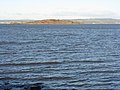
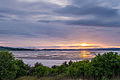
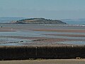
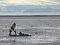
Cramond Island, in the Firth of Forth near Edinburgh, Scotland
tidal island in the Firth of Forth in eastern Scotland  | |||||
| Upload media | |||||
| Instance of | |||||
|---|---|---|---|---|---|
| Standort | City of Edinburgh, Scotland | ||||
| Located in or next to body of water | |||||
| Length |
| ||||
| Area |
| ||||
| Elevation above sea level |
| ||||
 | |||||
Media in category "Cramond Island"
The following 114 files are in this category, out of 114 total.
-
 A Cramond-sziget (Cramond Island) - panoramio.jpg 1,600 × 1,200; 905 KB
-
 Anti-Submarine Boom at Cramond Island - geograph.org.uk - 1742640.jpg 1,600 × 1,067; 390 KB
-
 Beach on Cramond Island - geograph.org.uk - 2766886.jpg 640 × 417; 337 KB
-
 Beach, old jetty and ruin on Cramond Island - geograph.org.uk - 2382431.jpg 2,592 × 1,944; 3.08 MB
-
 Brick building - geograph.org.uk - 2366680.jpg 730 × 544; 436 KB
-
 Climbing to the top - geograph.org.uk - 1638799.jpg 640 × 441; 87 KB
-
 Concrete blocks on Cramond Island - geograph.org.uk - 1638851.jpg 640 × 479; 110 KB
-
 Cramond - geograph.org.uk - 3552926.jpg 3,724 × 2,498; 1.84 MB
-
 Cramond Ferry - panoramio.jpg 1,584 × 1,061; 309 KB
-
 Cramond Island (4863270319).jpg 2,562 × 3,319; 1.19 MB
-
 Cramond Island - geograph.org.uk - 1230231.jpg 640 × 426; 88 KB
-
 Cramond Island - geograph.org.uk - 1638854.jpg 640 × 479; 102 KB
-
 Cramond Island - geograph.org.uk - 2573422.jpg 3,872 × 2,592; 5.82 MB
-
 Cramond Island - geograph.org.uk - 2766977.jpg 640 × 427; 432 KB
-
 Cramond Island - geograph.org.uk - 2952312.jpg 640 × 572; 75 KB
-
 Cramond Island - geograph.org.uk - 3009885.jpg 3,264 × 2,448; 2.76 MB
-
 Cramond Island - geograph.org.uk - 3182031.jpg 3,264 × 2,448; 2.97 MB
-
 Cramond Island - geograph.org.uk - 5488714.jpg 3,264 × 2,015; 2.25 MB
-
 Cramond Island - geograph.org.uk - 5518603.jpg 2,592 × 1,944; 1.46 MB
-
 Cramond Island - geograph.org.uk - 767892.jpg 640 × 406; 59 KB
-
 Cramond Island 23-03-2001 - panoramio.jpg 3,888 × 2,592; 4.32 MB
-
 Cramond Island 5.jpg 3,264 × 2,448; 1.15 MB
-
 Cramond Island and Causeway - geograph.org.uk - 4524289.jpg 3,264 × 2,448; 3.16 MB
-
 Cramond Island and causeway from air.JPG 2,244 × 1,314; 617 KB
-

-
 Cramond Island and the Dragon's Teeth - geograph.org.uk - 5317328.jpg 3,264 × 2,448; 2.23 MB
-

-
 Cramond Island at dusk - geograph.org.uk - 4159587.jpg 800 × 450; 175 KB
-
 Cramond Island at high tide - geograph.org.uk - 3604623.jpg 1,024 × 681; 111 KB
-
 Cramond Island at low tide - geograph.org.uk - 5958719.jpg 3,264 × 2,448; 1.95 MB
-
 Cramond Island at low tide.jpg 4,880 × 3,680; 2.71 MB
-
 Cramond Island Beach - geograph.org.uk - 2766908.jpg 640 × 417; 360 KB
-
 Cramond Island bunkers and graffiti.jpg 4,880 × 3,680; 2.66 MB
-
 Cramond Island bunkers.jpg 4,880 × 3,680; 2.36 MB
-
 Cramond island causeway (14313866563).jpg 4,602 × 3,072; 5.01 MB
-
 Cramond Island defences - geograph.org.uk - 1638817.jpg 640 × 475; 82 KB
-
 Cramond Island dilapidated bunker.jpg 4,880 × 3,680; 3.01 MB
-
 Cramond island farm.JPG 2,272 × 1,704; 1.44 MB
-
 Cramond Island from above Silverknowes - geograph.org.uk - 4547697.jpg 3,264 × 2,448; 3.53 MB
-
 Cramond Island from air.JPG 2,035 × 1,187; 575 KB
-
 Cramond Island from Dalmeny House - geograph.org.uk - 5355858.jpg 1,024 × 682; 195 KB
-
 Cramond Island from off Hound Point - geograph.org.uk - 5339904.jpg 1,024 × 682; 99 KB
-
 Cramond Island from Silverknowes - geograph.org.uk - 2265288.jpg 2,048 × 1,536; 1.88 MB
-
 Cramond Island from Silverknowes - geograph.org.uk - 3253402.jpg 3,264 × 2,448; 4.48 MB
-
 Cramond Island from the air - geograph.org.uk - 3069067.jpg 1,024 × 768; 111 KB
-
 Cramond Island in winter - geograph.org.uk - 1638262.jpg 640 × 479; 115 KB
-
 Cramond Island Information Board - geograph.org.uk - 2382476.jpg 2,592 × 1,944; 1.95 MB
-
 Cramond Island looking Southeast - geograph.org.uk - 9281.jpg 640 × 480; 48 KB
-
 Cramond Island Northeast - geograph.org.uk - 2550077.jpg 621 × 640; 56 KB
-
 Cramond Island Sunset (14275139252).jpg 4,388 × 2,929; 8.73 MB
-
 Cramond Island view.jpg 3,264 × 2,448; 1.13 MB
-
 Cramond island ww2 defences.jpg 2,272 × 1,704; 1.14 MB
-
 Cramond Island, looking towards Newhaven.jpg 4,880 × 3,680; 2.71 MB
-
 Cramond Island, Marine De(fence)s. - geograph.org.uk - 365940.jpg 640 × 480; 101 KB
-
 Cramond island. - panoramio.jpg 2,048 × 1,536; 850 KB
-
 Cramond Island.jpg 2,070 × 1,306; 303 KB
-
 Cramond island3.jpg 2,048 × 1,536; 316 KB
-
 Digging for worms - geograph.org.uk - 1638245.jpg 640 × 479; 95 KB
-
 Dragon's Teeth^ - geograph.org.uk - 365672.jpg 480 × 640; 63 KB
-
 Eastern shore of Cramond Island - geograph.org.uk - 4328309.jpg 640 × 431; 312 KB
-
 Edinburgh (34222929784).jpg 3,921 × 2,893; 3.26 MB
-
 Firth of Forth from Cramond Island - geograph.org.uk - 2766915.jpg 640 × 422; 396 KB
-
 Forth rail bridge in the distance (5408923842).jpg 3,648 × 2,736; 4.57 MB
-
 Granton from Cramond Island.jpg 4,880 × 3,680; 3.08 MB
-
 Greater Stitchwort on Cramond Island - geograph.org.uk - 2382247.jpg 2,592 × 1,944; 3.15 MB
-
 Gun emplacement - geograph.org.uk - 1638827.jpg 640 × 479; 77 KB
-
 Gun Emplacement, Cramond Island. - geograph.org.uk - 365909.jpg 640 × 480; 146 KB
-
 Hound Point from just east of Cramond Island - geograph.org.uk - 2102740.jpg 2,048 × 1,536; 1.05 MB
-
 Inchmickery from Cramond Island - geograph.org.uk - 1638813.jpg 640 × 479; 104 KB
-
 Landfall on Cramond Island - geograph.org.uk - 2382233.jpg 2,592 × 1,944; 2.91 MB
-
 Ligusticum scoticum.jpg 1,936 × 2,592; 2.93 MB
-
 Looking back to Cramond from the Island - geograph.org.uk - 2382256.jpg 2,592 × 1,944; 3.07 MB
-
 Looking to Cramond Island - geograph.org.uk - 1128140.jpg 640 × 360; 61 KB
-
 Looking up the Firth - geograph.org.uk - 1638821.jpg 640 × 479; 64 KB
-
 Meadow Saxifrage on Cramond Island - geograph.org.uk - 2382416.jpg 2,592 × 1,944; 2.23 MB
-
 Old Pier, Cramond Island. - geograph.org.uk - 365926.jpg 640 × 480; 104 KB
-
 Old pipeline to Cramond Island - geograph.org.uk - 10104.jpg 640 × 480; 56 KB
-
 Outcrop on Cramond Island - geograph.org.uk - 1638846.jpg 640 × 476; 57 KB
-
 Partin Rock - geograph.org.uk - 945796.jpg 640 × 480; 42 KB
-
 Receding tides - geograph.org.uk - 1638840.jpg 640 × 479; 99 KB
-
 Rocky Foreshore, Cramond Island - geograph.org.uk - 365923.jpg 480 × 640; 123 KB
-
 Ruin on Cramond Island - geograph.org.uk - 1638837.jpg 640 × 479; 82 KB
-
 Sea Pink, Cramond Island - geograph.org.uk - 108129.jpg 640 × 480; 261 KB
-
 Searchlight emplacement - geograph.org.uk - 1638824.jpg 640 × 479; 72 KB
-
 Searchlight post, Cramond Island. - geograph.org.uk - 365915.jpg 640 × 480; 105 KB
-
 Snowy rocks - geograph.org.uk - 1638834.jpg 640 × 473; 76 KB
-
 South end of Cramond Island - geograph.org.uk - 1031367.jpg 640 × 415; 53 KB
-
 Sun on the bay - geograph.org.uk - 1638254.jpg 479 × 640; 78 KB
-
 The bridges from Cramond Island - geograph.org.uk - 1638812.jpg 640 × 479; 96 KB
-
 The Dragon's teeth at Cramond - geograph.org.uk - 1047292.jpg 640 × 480; 64 KB
-
 The Knoll - geograph.org.uk - 1638800.jpg 640 × 479; 105 KB
-
 The Knoll - geograph.org.uk - 2766348.jpg 640 × 424; 367 KB
-
 The sands, Cramond - geograph.org.uk - 767872.jpg 640 × 480; 74 KB
-
 The Summit of the Island - geograph.org.uk - 2766443.jpg 640 × 427; 78 KB
-
 Tide out at Cramond Island - geograph.org.uk - 1468903.jpg 640 × 409; 40 KB
-
 Top of the Island - geograph.org.uk - 1638265.jpg 640 × 479; 104 KB
-
 Two pylons - geograph.org.uk - 1638249.jpg 640 × 486; 68 KB
-
 View from Cramond Island - geograph.org.uk - 1638807.jpg 640 × 479; 89 KB
-
 View from The Binks - geograph.org.uk - 1638804.jpg 640 × 469; 89 KB
-
 Wartime remains - geograph.org.uk - 1638829.jpg 640 × 479; 67 KB
-
 West Side of Cramond Island - geograph.org.uk - 950508.jpg 640 × 509; 99 KB
-
 Western Harbour - geograph.org.uk - 1638861.jpg 640 × 479; 51 KB
-
 Winter view from the Knoll - geograph.org.uk - 1638258.jpg 640 × 473; 59 KB
-
 Woodland on Cramond Island - geograph.org.uk - 2382442.jpg 2,592 × 1,944; 4.3 MB
-
 WW2 Anti-submarine fence - geograph.org.uk - 365678.jpg 640 × 480; 89 KB
-

-
 WW2 coastal defence site, cramond island. - geograph.org.uk - 365890.jpg 640 × 480; 107 KB
-

-
 WWII buildings on Cramond Island - geograph.org.uk - 2382372.jpg 2,592 × 1,944; 3.09 MB
-
 Coastal Gun Site, Cramond Island - geograph.org.uk - 365907.jpg 640 × 480; 95 KB
-
 Cramond Island sewage outlet - geograph.org.uk - 604745.jpg 640 × 480; 87 KB
-
 Foreshore looking to Cramond Island - geograph.org.uk - 38921.jpg 640 × 480; 167 KB
-
 Generator House, Cramond Island - geograph.org.uk - 365901.jpg 640 × 480; 107 KB
-

_-_panoramio.jpg)


.jpg)


.jpg)


.jpg)


s._-_geograph.org.uk_-_365940.jpg)


.jpg)

.jpg)


