Category:Cree maps
Jump to navigation
Jump to search
Media in category "Cree maps"
The following 14 files are in this category, out of 14 total.
-
 Attawapiskat map.png 1,200 × 1,212; 87 KB
-
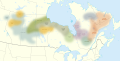 Cree map blurred.svg 512 × 258; 793 KB
-
 Cree map simple.svg 512 × 414; 203 KB
-
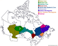
 Cree map.svg 512 × 258; 156 KB
-
 Cree People.png 695 × 550; 60 KB
-
 Frog Lake, Alberta Location.png 224 × 390; 8 KB
-
 Innu map.jpg 1,008 × 713; 475 KB
-
 Innus.png 450 × 483; 19 KB
-
 Kashechewan map.png 1,200 × 1,213; 84 KB
-
 Maskwacis Community Blank Map.svg 746 × 674; 2.39 MB
-
 Montana Indian Reservations.svg 744 × 460; 296 KB
-
 Nelson-Nations-Cries.PNG 341 × 367; 13 KB
-
 Quebec MRC Eeyou Istchee location map.svg 1,630 × 2,000; 500 KB
-
 Selkirk Treaty Map.jpg 2,368 × 3,744; 1.93 MB


