Category:Dörenschlucht
Jump to navigation
Jump to search
| Object location | | View all coordinates using: OpenStreetMap |
|---|
mountain pass  | |||||
| Upload media | |||||
| Instance of | |||||
|---|---|---|---|---|---|
| Located in protected area | |||||
| Standort | Lippe, Detmold Government Region, North Rhine-Westphalia, Germany | ||||
| Mountain range | |||||
 | |||||
This is the category of the protected area listed at WDPA under the ID 329329
|
Deutsch: Die Dörenschlucht ist ein Naturschutzgebiet im Kreis Lippe, Kennung LIP-023
Subcategories
This category has the following 2 subcategories, out of 2 total.
R
- Rethlager Quellen (1 P, 15 F)
S
- Soldatenfriedhof Dörenschlucht (20 F)
Media in category "Dörenschlucht"
The following 24 files are in this category, out of 24 total.
-
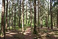
 Detmold - 2014-06-15 - LIP-023 - Dörenschlucht (02).jpg 2,000 × 3,000; 6.79 MB
-
 Detmold - 2014-06-15 - LIP-023 - Dörenschlucht (05).jpg 3,000 × 2,144; 7.92 MB
-
 Detmold - 2014-06-15 - LIP-023 - Dörenschlucht (10).jpg 3,000 × 2,000; 6.83 MB
-
 Detmold - 2014-06-15 - LIP-023 - Dörenschlucht (13).jpg 2,000 × 3,000; 7 MB
-
 Detmold - 2014-06-15 - LIP-023 - Dörenschlucht (19).jpg 2,000 × 3,000; 7.15 MB
-
 Detmold - 2014-06-15 - LIP-023 - Dörenschlucht (24).jpg 3,000 × 2,110; 7.64 MB
-
 Detmold - 2014-06-15 - LIP-023 - Dörenschlucht (27).jpg 3,000 × 2,000; 6.7 MB
-
 Detmold - 2014-06-15 - LIP-023 - Dörenschlucht (30).jpg 3,000 × 2,000; 6.88 MB
-
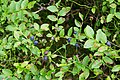
 Detmold - 2014-06-15 - LIP-023 - Heidelbeeren (01).jpg 3,000 × 2,000; 4.96 MB
-
 Detmold - 2014-06-15 - LIP-023 - Heidelbeeren (06).jpg 3,000 × 2,000; 8.08 MB
-
 Detmold - 2014-06-15 - LIP-023 - Heidelbeeren (07).jpg 3,000 × 2,000; 4.69 MB
-
 Detmold - 2014-06-15 - LIP-023 - Pilze (02).jpg 2,000 × 3,000; 4.97 MB
-
 Detmold - 2014-06-15 - LIP-023 - Pilze (06).jpg 3,000 × 2,000; 4.88 MB
-
 Detmold - 2014-06-15 - LIP-023 - Sandkasten (04).jpg 3,000 × 2,000; 6.95 MB
-
 Detmold - 2014-06-15 - LIP-023 - Sandkasten (05).jpg 2,000 × 3,000; 6.78 MB
-
 Detmold - 2014-06-15 - LIP-023 - Sandkasten (06).jpg 2,000 × 3,000; 6.7 MB
-
 Detmold - 2014-06-15 - LIP-023 - Sandkasten (12).jpg 2,000 × 3,000; 6.83 MB
-
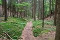
 Detmold - 2015-05-18 - Dörenschlucht (2).jpg 3,500 × 2,333; 9.45 MB
-
 Die Gartenlaube (1879) b 492.jpg 4,278 × 2,916; 4.67 MB
-
 Dörenschlucht 01.jpg 2,362 × 1,575; 3.08 MB
-
 Lage - 2015-05-18 - Dörenschlucht (2).jpg 3,500 × 2,333; 9.11 MB
-
 Lage - 2015-05-18 - Dörenschlucht (7).jpg 3,500 × 2,333; 8.28 MB
-
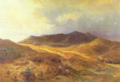 Ludwig Menke Die Dörenschlucht 1864.png 2,238 × 1,524; 7.68 MB
-
 Menke - Dörenschlucht.jpeg 2,864 × 1,840; 3.15 MB
.jpg)
.jpg)
.jpg)
.jpg)
.jpg)
.jpg)
.jpg)
.jpg)
.jpg)
.jpg)
.jpg)
.jpg)
.jpg)
.jpg)
.jpg)
.jpg)
.jpg)
.jpg)
_b_492.jpg)
.jpg)
.jpg)

