Category:Exclusive economic zones
Jump to navigation
Jump to search
UN maritime boundary   | |||||
| Upload media | |||||
| Subclass of | |||||
|---|---|---|---|---|---|
| Facet of | |||||
| Width |
| ||||
| Different from | |||||
| |||||
English: Area of sea over which a sovereign state has special rights
Subcategories
This category has the following 32 subcategories, out of 32 total.
Media in category "Exclusive economic zones"
The following 105 files are in this category, out of 105 total.
-

-
 Ausschliessliche Wirtschaftszonen Schwarzes Meer (Reliefkarte)-uk.svg 532 × 331; 4.6 MB
-
 Ausschliessliche Wirtschaftszonen Schwarzes Meer (Reliefkarte).svg 532 × 331; 4.6 MB
-
 Ausschliessliche Wirtschaftszonen Schwarzes Meer-es.svg 532 × 331; 438 KB
-
 Ausschliessliche Wirtschaftszonen Schwarzes Meer-uk.svg 532 × 331; 178 KB
-
 Ausschliessliche Wirtschaftszonen Schwarzes Meer.svg 532 × 331; 178 KB
-

-
 Barbados maritime.tiff 496 × 265; 31 KB
-
 Black Sea relief location map with exclusive economic zones.svg 532 × 330; 4.47 MB
-
 Caribbean maritime boundaries map zh.svg 3,561 × 2,221; 2.87 MB
-
 Caribbean maritime boundaries map.svg 3,561 × 2,221; 2.78 MB
-
 Caribbean maritime boundaries map mk.svg 3,561 × 2,221; 5.52 MB
-
 Mapa das Caraíbas (fronteiras marítimas).svg 3,561 × 2,221; 2.86 MB
-
 Mapa del Caribe (límites marinos).svg 5,340 × 3,660; 3.02 MB
-
 Mapa del Mar Caribe (límites marinos)-fr.svg 3,587 × 2,221; 1.91 MB
-
 Mapa del Mar Caribe (límites marinos).svg 3,587 × 2,221; 1.98 MB
-
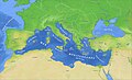 Carte Mediterranee 03.jpg 1,500 × 915; 893 KB
-
 China Exclusive Economic Zones.png 510 × 360; 15 KB
-
 Correct Internationalwaters.png 1,858 × 738; 910 KB
-
 Die Definition der unterschiedlichen Meereszonen im Seevoelkerrecht.svg 600 × 270; 297 KB
-
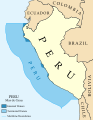
 Dominio Marítimo del Perú.svg 1,168 × 1,513; 187 KB
-
 Dutch Caribbean maritime boundaries with island names.svg 1,346 × 1,156; 202 KB
-
 Dutch Caribbean maritime boundaries.svg 1,346 × 1,156; 182 KB
-
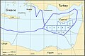
 Eastern Mediterranean EEZ conflicts-fr.svg 488 × 327; 110 KB
-
 Eastern Mediterranean EEZ conflicts.svg 488 × 327; 110 KB
-
 EEZ border between North Cyprus and Turkey.jpg 500 × 269; 44 KB
-
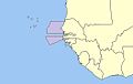
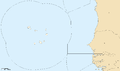 EEZ Cape Verde.png 1,988 × 1,170; 61 KB
-
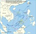
 EEZ disputes in East China Sea NO.jpg 1,437 × 809; 501 KB
-
 EEZ el.jpg 3,944 × 2,304; 1.05 MB
-
 EEZ Finland.png 7,521 × 5,375; 2.97 MB
-
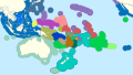 EEZ Oceania.svg 385 × 215; 201 KB
-
 EEZ of Denmark.svg 1,052 × 581; 256 KB
-
 EEZs Pacific.png 863 × 624; 56 KB
-
 European Union maximum enlargement (with EEZ).PNG 2,420 × 1,292; 201 KB
-
 Exclusive economic zone of North Korea.png 427 × 250; 17 KB
-
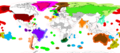
 Exclusive Economic Zones - World.svg 800 × 400; 694 KB
-
 Exclusive Economic Zones Nulles.png 2,400 × 1,178; 268 KB
-
 Exclusive Economic Zones World Americas-centric.png 2,401 × 1,045; 149 KB
-
 Exclusive Economic Zones World Pacific-centric.png 2,401 × 1,045; 149 KB
-
 Exclusive Economic Zones World.png 2,410 × 1,178; 153 KB
-
 Greece-Exclusive-Economic-Zone.png 1,754 × 862; 526 KB
-
 Greek and Cypriot EEZ.svg 488 × 327; 106 KB
-
 Greek Exclusive Economic Zone.jpg 1,033 × 654; 177 KB
-
 How the Lawyers Think—Maritime Zones and the International Law of the Sea.pdf 1,239 × 1,752; 94 KB
-

-
 ID TW EEZ.svg 1,299 × 597; 499 KB
-
 Indian Exclusive Economic Zones.PNG 2,410 × 1,178; 154 KB
-
 Indonesia-Exclusive-Economic-Zone.png 1,045 × 659; 191 KB
-
 Islands and rocks UNCLOS CN.svg 353 × 255; 419 KB
-
 Islands and rocks UNCLOS.svg 322 × 255; 349 KB
-
 Italy-Exclusive-Economic-Zone-Map (cropped).png 748 × 561; 182 KB
-
 Italy-Exclusive-Economic-Zone-Map.png 1,600 × 561; 424 KB
-
 Karte Kirchenprovinzen und Diözesen der Karibik Suriname Neutral.png 4,371 × 3,147; 1.9 MB
-
 Karte Kirchenprovinzen und Diözesen der Karibik.png 3,035 × 2,185; 1.53 MB
-
 Karte Naturschutzgebiete in der deutschen ausschließlichen Wirtschaftszone.svg 1,755 × 728; 229 KB
-
 Koreez.PNG 427 × 250; 17 KB
-
 Linghai Jixian.png 1,818 × 1,530; 4.16 MB
-
 Mapa del Caribe (límites marinos).png 2,514 × 1,667; 202 KB
-
 Mapa del Mar de Balboa (límites marinos).svg 2,177 × 2,006; 530 KB
-
 Marine Environments & Legal Borders Within the Gulf of Mexico.png 2,066 × 1,594; 589 KB
-
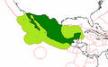
 Maritime Claims of Ecuador.svg 1,364 × 686; 336 KB
-
 Maritime Claims of Peru and Ecuador.svg 1,864 × 1,819; 660 KB
-
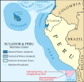
 Maritime Claims of Peru.svg 1,168 × 1,513; 181 KB
-
 Mexico EEZ.png 398 × 250; 9 KB
-
 Nauru-EEZ-fr Workaround.svg 539 × 277; 35 KB
-
 Nauru-EEZ-fr.svg 539 × 277; 174 KB
-
 Newfoundland Grand Banks and EEZ border.png 774 × 455; 143 KB
-
 Niue EEZ division.svg 850 × 876; 93 KB
-
 Niue EEZ.svg 850 × 876; 179 KB
-
 Nordsee Wirtschaftszonen.png 619 × 720; 342 KB
-
 North sea eez.PNG 1,034 × 1,200; 128 KB
-
 Norway Exclusive Economic Zones.png 2,410 × 1,178; 309 KB
-
 Oceania political map.png 662 × 478; 42 KB
-
 Overzicht grenzen bovenwinds 201806 1.jpg 2,242 × 2,618; 955 KB
-
 Rockall EEZ topographic map-en.svg 1,904 × 2,509; 690 KB
-
 Rockall EEZ topographic map-hy.svg 1,904 × 2,509; 691 KB
-
 Rom.territ-waters.jpg 503 × 599; 197 KB
-
 Socotra Rock location jpn.png 1,650 × 1,128; 226 KB
-
 South China Sea vector Chinese.svg 1,004 × 945; 707 KB
-
 South China Sea vector de.svg 764 × 705; 556 KB
-
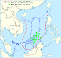 South China Sea vector.svg 1,004 × 945; 657 KB
-
 Standard time zones of the world (2012, with Exclusive Economic Zones) EL.svg 1,672 × 900; 1.9 MB
-
 Standard time zones of the world (2012, with Exclusive Economic Zones).svg 1,672 × 900; 1.9 MB
-
 Suomen aluemeri.png 7,517 × 5,154; 2.86 MB
-
 Territorial waters - Denmark.svg 800 × 400; 694 KB
-
 Territorial waters - India.svg 800 × 400; 528 KB
-
 Territorial waters - Mexico.svg 800 × 400; 695 KB
-
 Territorial waters - Norway.svg 800 × 400; 713 KB
-
 Territorial waters Oceania.png 1,088 × 606; 191 KB
-
 Thailand-Exclusive-Economic-Zone.png 432 × 288; 48 KB
-
 Tonga and its borders (cropped).png 417 × 354; 50 KB
-
 World lake concept - A theoretical division of the seabed, 1977.jpg 3,179 × 2,309; 1.65 MB
-
 WorldEEZ.png 2,403 × 1,067; 169 KB
-
 Zealandia EEZs.tif 2,060 × 2,740; 6.21 MB
-
 ZEE FC.jpg 253 × 205; 7 KB
-
 ZEE Sénégal (zone économique exclusive).jpg 264 × 168; 9 KB
-
 Zee200.jpg 563 × 1,192; 28 KB
-
 ZERP (Adriatic sea map).png 759 × 606; 227 KB
-
 ZERP.jpg 504 × 526; 69 KB
-
 Zonegrens benedenw nl.jpg 760 × 839; 65 KB
-
 Zones économiques exclusives accord de Nauru.png 863 × 624; 47 KB
-
 Οικόπεδα κυπριακής ΑΟΖ.jpg 486 × 326; 39 KB
-
 Рељефна карта Црног мора sr.svg 532 × 331; 4.6 MB
-
 이어도-Ieodo (en-socotra rock).png 1,650 × 1,128; 345 KB
-
 한국과 일본의 배타적 경제수역 명명백백.jpg 800 × 978; 116 KB

-uk.svg)
.svg)


_in_the_North_Sea_and_Baltic_Sea_at_116_m_height.png)


.svg)
.svg)
-fr.svg)
.svg)


.PNG)


.png)


.png)
.svg)


_EL.svg)
.svg)


.png)


.jpg)

.png)


.png)
