Category:Hesketh Bank
Jump to navigation
Jump to search
English: Hesketh Bank is a small agricultural village in Lancashire. It lies to the north-east of the town of Southport on the Irish Sea estuary of the River Ribble. The area falls under West Lancashire District Council for administrative purposes, and Hesketh-with-Becconsall parish council for parochial matters. It is in the South Ribble parliamentary constituency.
village in United Kingdom  | |||||
| Upload media | |||||
| Instance of | |||||
|---|---|---|---|---|---|
| Standort | Hesketh-with-Becconsall, West Lancashire, Lancashire, North West England, England | ||||
 | |||||
Subcategories
This category has the following 3 subcategories, out of 3 total.
H
- Hesketh Bank War Memorial (1 F)
Media in category "Hesketh Bank"
The following 46 files are in this category, out of 46 total.
-
 'I see no ships' - geograph.org.uk - 311526.jpg 640 × 427; 116 KB
-
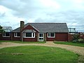
 Becconsall Pub Hesketh Bank April 2010.JPG 3,872 × 2,592; 2.39 MB
-
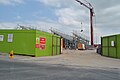 Booths Store Hesketh Bank Underconstruction April 2010.JPG 3,872 × 2,592; 2.5 MB
-
 Hesketh Bank AFC (8593019063).jpg 3,648 × 2,736; 1.87 MB
-
 Hesketh Bank AFC (8594116308).jpg 3,648 × 2,736; 2.06 MB
-
 Hesketh Bank AFC (8594117164).jpg 3,446 × 2,234; 1,001 KB
-
 Hesketh Bank AFC (8594119956).jpg 3,648 × 2,362; 1.39 MB
-
 Hesketh Bank Football Club April 2010.jpg 3,872 × 2,592; 2.34 MB
-
 Shore Farm, Shore Road - geograph.org.uk - 1115429.jpg 640 × 480; 74 KB
-
 Shore Road - geograph.org.uk - 1115431.jpg 640 × 480; 55 KB
-

-
 Allendale,Hesketh Bank - geograph.org.uk - 172123.jpg 640 × 480; 231 KB
-
 Aviemore, Nursery Drive, Tarleton - geograph.org.uk - 172129.jpg 640 × 480; 229 KB
-
 Bank Farm, Becconsall. - geograph.org.uk - 172112.jpg 640 × 480; 204 KB
-
 Barn - geograph.org.uk - 172119.jpg 640 × 480; 54 KB
-
 Becconsall Methodist Church - geograph.org.uk - 172111.jpg 640 × 480; 230 KB
-
 Carr Heys Plantation - geograph.org.uk - 148092.jpg 640 × 426; 70 KB
-
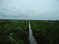 Carr Heys Watercourse - geograph.org.uk - 173592.jpg 640 × 480; 239 KB
-
 Dib Road - geograph.org.uk - 173597.jpg 640 × 480; 231 KB
-

-

-
 Embankment - geograph.org.uk - 424545.jpg 640 × 426; 257 KB
-
 Farrington's Plantation - geograph.org.uk - 148088.jpg 640 × 426; 81 KB
-
 Forbidden Embankment - geograph.org.uk - 420300.jpg 640 × 358; 238 KB
-
 Guide Road, Hesketh Bank - geograph.org.uk - 173580.jpg 640 × 480; 57 KB
-
 Hesketh Lane Methodist Church - geograph.org.uk - 172125.jpg 640 × 480; 253 KB
-
 Hesketh Lodge - geograph.org.uk - 424566.jpg 640 × 426; 244 KB
-
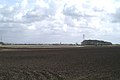
 Hesketh Marsh - geograph.org.uk - 487753.jpg 640 × 370; 252 KB
-
 Hesketh Moss Methodist Church - geograph.org.uk - 173601.jpg 640 × 480; 246 KB
-
 Inner Sea dyke and drainage ditch - geograph.org.uk - 311510.jpg 640 × 427; 98 KB
-
 Lettuce - geograph.org.uk - 173626.jpg 640 × 480; 117 KB
-
 Marsh View Farm, Becconsall - geograph.org.uk - 172109.jpg 640 × 480; 225 KB
-
 Moss Lane - geograph.org.uk - 360959.jpg 480 × 640; 81 KB
-
 Muddy Track - geograph.org.uk - 173559.jpg 640 × 480; 255 KB
-
 New Manor Farm, Becconsall. - geograph.org.uk - 172110.jpg 640 × 480; 247 KB
-
 No 425, Moss Lane, Becconsall - geograph.org.uk - 172107.jpg 640 × 480; 236 KB
-
 Ribble Bank Farm - geograph.org.uk - 173586.jpg 640 × 480; 230 KB
-
 Road to Hesketh Bank - geograph.org.uk - 477486.jpg 640 × 480; 66 KB
-
 Roadside house and barn, Hesketh bank - geograph.org.uk - 477485.jpg 640 × 473; 59 KB
-
 The Road to Much Hoole Marsh House - geograph.org.uk - 173546.jpg 640 × 480; 219 KB
-
 Tractor on Hundred End Lane - geograph.org.uk - 148081.jpg 640 × 426; 54 KB
-
 View across Tarleton Moss - geograph.org.uk - 148086.jpg 640 × 426; 73 KB
-
 View from the river Douglas - geograph.org.uk - 128828.jpg 640 × 482; 62 KB
-
 West Gate Farm, Hesketh Bank. - geograph.org.uk - 172121.jpg 640 × 480; 252 KB
-
 White Fields - geograph.org.uk - 424556.jpg 640 × 426; 259 KB
-
 Young Cauliflowers - geograph.org.uk - 173574.jpg 640 × 480; 59 KB


.jpg)
.jpg)
.jpg)
.jpg)


