Category:Irrigation in the United States
Jump to navigation
Jump to search
Wikimedia category | |||||
| Upload media | |||||
| Instance of | |||||
|---|---|---|---|---|---|
| Category combines topics | |||||
 | |||||
Subcategories
This category has the following 17 subcategories, out of 17 total.
C
E
F
- Flathead Irrigation Project (21 F)
I
K
- Kalaupapa Water Supply System (71 F)
- Kendrick Project (1 F)
N
S
T
Media in category "Irrigation in the United States"
The following 160 files are in this category, out of 160 total.
-

-

-
 06782-Hanford-1905-Irrigation Ditch, near Hanford, Cal.-Brück & Sohn Kunstverlag.jpg 1,509 × 1,000; 576 KB
-
 20100301-NRCS-JMV-0002 - Flickr - USDAgov.jpg 1,712 × 2,288; 1.12 MB
-
 20100324-NRCS-JMV-001 - Flickr - USDAgov.jpg 2,256 × 1,143; 1.5 MB
-
 20100329-NRCS-JMV-0001 - Flickr - USDAgov.jpg 2,288 × 1,712; 1.28 MB
-
 20100329-NRCS-JMV-0002 - Flickr - USDAgov.jpg 2,288 × 1,712; 2.32 MB
-
 20100329-NRCS-JMV-0003 - Flickr - USDAgov.jpg 2,288 × 1,208; 1.33 MB
-
 20100329-NRCS-JMV-0006 - Flickr - USDAgov.jpg 2,288 × 1,712; 935 KB
-
 20111209-NRCS-LSC-0130 - Flickr - USDAgov.jpg 4,928 × 3,264; 2.56 MB
-
 20111209-NRCS-LSC-0132 - Flickr - USDAgov.jpg 4,928 × 3,264; 4.32 MB
-
 20230522 Colorado River water usage - livestock crops etc.svg 1,200 × 675; 3 KB
-

-
 A water way acts as a filtration system between these two fields. (24745470609).jpg 4,256 × 2,832; 5.21 MB
-

-
 AirplaneTripGiantCropIrrigationCircles.jpg 457 × 734; 70 KB
-
 Alamo Canal circa 1905.jpg 1,177 × 847; 290 KB
-
 Alamo Canal Hanlon Heading.jpg 3,264 × 2,448; 1.57 MB
-
 Amer-falls-id-1902.png 3,300 × 2,550; 4.02 MB
-
 American Indian (23971565917).jpg 3,456 × 2,304; 5.82 MB
-
 American Indian (24964712648).jpg 3,456 × 2,304; 5.08 MB
-
 Arbuckle Bros. Coffee Company (3092992443).jpg 799 × 477; 299 KB
-
 Arkansas. Location of irrigated land - btv1b53200426s.jpg 7,874 × 7,234; 6.27 MB
-
 August 2012 - panoramio (77).jpg 4,000 × 3,000; 4.68 MB
-
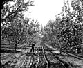
 Irrigating Apple Orchard, Hagerman, N. M (NYPL b12647398-75820).tiff 2,368 × 1,607; 10.89 MB
-
 Bighorn ditch NPS.jpg 640 × 480; 285 KB
-
 Burning Weeds in a Water Ditch.jpg 5,000 × 4,000; 2.59 MB
-
 California Drought Dry Lakebed 2009.jpg 700 × 525; 143 KB
-

-
 Cattle north of Springlake, TX IMG 4810.JPG 4,000 × 3,000; 2.74 MB
-
 Center pivot irrigation Idaho.jpg 1,500 × 975; 299 KB
-
 Center pivot irrigation in Colorado.JPG 5,313 × 2,926; 9.48 MB
-
-

-

-

-
 Cloisters-739.jpg 1,024 × 768; 296 KB
-
 Corn Field Irrigation Superior Township Michigan.JPG 4,752 × 3,026; 5.03 MB
-
 CPI Colorado 432 751 hico pan crop 15 (32821424745).jpg 4,059 × 5,287; 18.77 MB
-
 CPI Colorado 432 pan crop 15 (32698269521).jpg 4,059 × 5,287; 13.14 MB
-
 CPI Colorado 751 pan crop 15 (32821454305).jpg 4,059 × 5,287; 14.06 MB
-
 Crops Kansas AST 20010624.jpg 2,589 × 2,481; 1.33 MB
-

-
 Drip irrigation system.JPG 1,041 × 536; 136 KB
-
 DSCF8623 (46149117705).jpg 3,500 × 2,333; 1.37 MB
-
 DSCF8699 (46338890874).jpg 3,500 × 2,333; 2.85 MB
-
 Farm in west texas Nima.JPG 3,108 × 2,448; 2.21 MB
-
 FARM IRRIGATION - NARA - 549178.jpg 3,000 × 2,046; 539 KB
-
 Field Irrigation (10994428725).jpg 3,648 × 5,472; 4.4 MB
-
 Field Irrigation (10994434305).jpg 5,472 × 3,648; 5.28 MB
-
 Field Irrigation (10994436815).jpg 5,206 × 3,471; 5.44 MB
-
 Field Irrigation (10994452525).jpg 3,648 × 5,472; 6.62 MB
-
 Field Irrigation (10994455895).jpg 5,472 × 3,648; 6.23 MB
-
 Field Irrigation (10994520356).jpg 5,472 × 3,648; 4.84 MB
-
 Field Irrigation (10994522676).jpg 5,472 × 3,648; 5.7 MB
-
 Field Irrigation (10994535756).jpg 3,648 × 5,472; 6.04 MB
-
 Field Irrigation (10994537876).jpg 5,472 × 3,648; 6.04 MB
-
 Field Irrigation (10994540976).jpg 3,573 × 5,359; 5.89 MB
-
 Field Irrigation (10994587094).jpg 5,118 × 3,412; 4.13 MB
-
 Field Irrigation (10994594604).jpg 5,206 × 3,471; 5.36 MB
-
 Field Irrigation (10994643023).jpg 5,472 × 3,648; 4.84 MB
-
 Field Irrigation (10994652473).jpg 5,472 × 3,648; 6.4 MB
-
 Field Irrigation (10994663003).jpg 5,472 × 3,648; 6.53 MB
-
 Field Irrigation (10994669883).jpg 3,648 × 5,472; 4.84 MB
-
 Field Sprayers (48754817982).jpg 2,000 × 1,332; 465 KB
-
 Furrow irrigation.jpg 470 × 306; 36 KB
-
 GatedPipe.JPG 2,100 × 1,500; 268 KB
-
 Gilbert AZ 2011-10-02 4998.jpg 4,288 × 3,216; 7.2 MB
-
 Gilbert AZ 2011-10-02 5011.jpg 4,288 × 3,216; 6.16 MB
-
 Gilbert AZ 2011-10-02 5012.jpg 3,216 × 4,288; 6.4 MB
-
 Gilbert AZ 2011-10-02 5014.jpg 3,216 × 4,288; 5.69 MB
-
 Gilbert AZ 2011-10-02 5015.jpg 3,216 × 4,288; 6.33 MB
-

-

-
 Idaho Location of irrigated land - btv1b53200431z.jpg 7,138 × 11,803; 9 MB
-
 Irrigated Hillside near Ellensburg WA.jpg 6,295 × 1,978; 6.72 MB
-

-

-
 Irrigation AM1 (38859901891).jpg 3,371 × 2,250; 2.42 MB
-
 IRRIGATION CANAL SERVES CITRUS RANCH - NARA - 542730.tif 3,000 × 2,048; 17.58 MB
-
 Irrigation ditch in Montour County, Pennsylvania.JPG 2,056 × 3,088; 2.01 MB
-
 Irrigation in Idaho, USA (9429674404).jpg 3,888 × 2,592; 1.34 MB
-
 IRRIGATION OF THE LAND WITH WATER FROM THE SAN MIGUEL RIVER - NARA - 543792.jpg 2,052 × 3,000; 1.28 MB
-
 Irrigation pipe.jpg 375 × 500; 36 KB
-
 Irrigation, USA.jpg 3,024 × 1,998; 2.13 MB
-
 Jesuit Sprinklers - New Orleans May 2020.jpg 3,552 × 1,998; 3.47 MB
-
 Kansas Location of irrigated land, 50 miles (=81mm. ; 1 - 1 000 000 env) - btv1b53200430h.jpg 10,356 × 7,081; 7.55 MB
-
 La Canova Acequia New Mexico.jpg 1,611 × 1,428; 1.83 MB
-
 La Canova Acequia North.jpg 2,592 × 3,888; 6.5 MB
-
 Lake Lowell (1).jpg 6,000 × 4,000; 4.19 MB
-
 Lawn Irrigation Ann Arbor Township Michigan.JPG 4,515 × 2,735; 7.42 MB
-
 Let Us Spray (5454784181).jpg 5,616 × 3,132; 6.11 MB
-
 Los Chicos Acequia.jpg 3,888 × 2,592; 6.21 MB
-
 Louisiana. Location of irrigated Land - btv1b532004294.jpg 7,369 × 7,692; 6.33 MB
-

-
 Montana. Location of irrigated Land - btv1b532004349.jpg 12,429 × 8,493; 12.91 MB
-
 Nebraska. Location of irrigated Land - btv1b53200428p.jpg 9,712 × 6,912; 6.99 MB
-
 NIE 1905 United States - arid state land proportions.jpg 1,510 × 772; 283 KB
-
 NRCSAR02011 - Arkansas (205)(NRCS Photo Gallery).jpg 2,100 × 1,500; 5.7 MB
-
 NRCSAR02011 - Arkansas (205)(NRCS Photo Gallery).tif 2,100 × 1,500; 12.02 MB
-
 NRCSAR02011(13940)(NRCS Photo Gallery).jpg 2,100 × 1,500; 334 KB
-
 NRCSAR02012 - Arkansas (207)(NRCS Photo Gallery).jpg 2,100 × 1,500; 5.11 MB
-
 NRCSAR02012 - Arkansas (207)(NRCS Photo Gallery).tif 2,100 × 1,500; 12.02 MB
-
 NRCSAR02012(13941)(NRCS Photo Gallery).jpg 2,100 × 1,500; 215 KB
-
 NRCSAR02015 - Arkansas (213)(NRCS Photo Gallery).jpg 2,100 × 1,500; 5.71 MB
-
 NRCSAR02015 - Arkansas (213)(NRCS Photo Gallery).tif 2,100 × 1,500; 12.02 MB
-
 NRCSAR02015(13948)(NRCS Photo Gallery).jpg 2,100 × 1,500; 264 KB
-
 NRCSAR02016 - Arkansas (215)(NRCS Photo Gallery).jpg 1,500 × 2,100; 5.76 MB
-
 NRCSAR02016 - Arkansas (215)(NRCS Photo Gallery).tif 1,500 × 2,100; 12.02 MB
-
 NRCSAR02016(13950)(NRCS Photo Gallery).jpg 1,500 × 2,100; 217 KB
-
 NRCSAR02017 - Arkansas (217)(NRCS Photo Gallery).jpg 2,100 × 1,500; 5.24 MB
-
 NRCSAR02017 - Arkansas (217)(NRCS Photo Gallery).tif 2,100 × 1,500; 12.02 MB
-
 NRCSAR02017(13952)(NRCS Photo Gallery).jpg 2,100 × 1,500; 226 KB
-
 NRCSAR02018 - Arkansas (219)(NRCS Photo Gallery).jpg 2,100 × 1,500; 5.42 MB
-
 NRCSAR02018 - Arkansas (219)(NRCS Photo Gallery).tif 2,100 × 1,500; 12.02 MB
-
 NRCSAR02018(13954)(NRCS Photo Gallery).jpg 2,100 × 1,500; 253 KB
-
 NRCSAR02019 - Arkansas (221)(NRCS Photo Gallery).jpg 2,100 × 1,500; 4.74 MB
-
 NRCSAR02019 - Arkansas (221)(NRCS Photo Gallery).tif 2,100 × 1,500; 12.02 MB
-
 NRCSAR02019(13956)(NRCS Photo Gallery).jpg 2,100 × 1,500; 204 KB
-
 NRCSAR83009 - Arkansas (281)(NRCS Photo Gallery).jpg 2,100 × 1,500; 4.78 MB
-
 NRCSAR83009 - Arkansas (281)(NRCS Photo Gallery).tif 2,100 × 1,500; 12.02 MB
-
 NRCSAR83009(14016)(NRCS Photo Gallery).jpg 2,100 × 1,500; 206 KB
-
 NRCSAR83010 - Arkansas (283)(NRCS Photo Gallery).jpg 2,100 × 1,500; 4.88 MB
-
 NRCSAR83010 - Arkansas (283)(NRCS Photo Gallery).tif 2,100 × 1,500; 12.02 MB
-
 NRCSAR83010(14018)(NRCS Photo Gallery).jpg 2,100 × 1,500; 259 KB
-
 NRCSAZ84007 - Arizona (507)(NRCS Photo Gallery).jpg 1,500 × 2,100; 6.11 MB
-

-

-
 Oklahoma. Location of irrigated Land, 1949 - btv1b53200419q.jpg 9,846 × 6,693; 6.73 MB
-
 Oregon Location of irrigated Land - btv1b53200435r.jpg 10,000 × 8,493; 9.53 MB
-
 Picabo Idaho 2009.JPG 2,816 × 2,112; 2.17 MB
-
 PSM V43 D158 Aqueduct at mission san juan.jpg 2,837 × 1,558; 1,020 KB
-
 PSM V43 D160 In kern canyon.jpg 2,875 × 1,669; 908 KB
-
 PSM V43 D163 Coming out on the desert.jpg 2,890 × 1,701; 767 KB
-
 PSM V43 D164 The calloway canal.jpg 2,878 × 1,689; 792 KB
-
 PSM V43 D166 One of the branch canals.jpg 2,883 × 1,705; 668 KB
-
 PSM V43 D167 Grapes from the desert.jpg 2,911 × 1,692; 826 KB
-
 PSM V43 D169 Alfalfa fields in the desert.jpg 2,888 × 1,693; 725 KB
-
 PSM V43 D170 After ten years of irrigation on a barren sand plain.jpg 2,882 × 1,705; 1.1 MB
-
 PSM V43 D172 An artesian well in the desert.jpg 2,853 × 1,700; 633 KB
-
 Puddle backfill, Keechelus Dam, ca 1917 (MOHAI 5332).jpg 700 × 423; 49 KB
-
 SBNM northeast view 2213.JPG 2,848 × 2,136; 2.95 MB
-
 SCS Irrigation (6675043387).jpg 1,275 × 1,725; 152 KB
-
 Smith'sDitch.JPG 2,448 × 2,027; 3 MB
-
 South Dakota. Location of irrigated land. 1949 - btv1b532004203.jpg 9,853 × 6,550; 7.19 MB
-
 Soy Bean Field with Central Pivot Irrigation Sprinkler Summerfield Township Michigan.JPG 4,709 × 3,168; 6.31 MB
-
 Soybean 1292.JPG 1,843 × 1,229; 975 KB
-
 Starr 040511-0113 Casuarina equisetifolia.jpg 1,632 × 1,224; 935 KB
-
-
 VineyardDrip.JPG 1,500 × 2,100; 346 KB
-
 WaipioAqueduct1.jpg 3,559 × 2,392; 1.44 MB
-
 Washington. Irrigation by drainage basins. 1939 - btv1b53189470g.jpg 9,176 × 5,530; 4.65 MB
-
 Washington. Location of irrigated Land. 1949 - btv1b53200421j.jpg 9,709 × 5,700; 6.91 MB
-
 Water Irrigation - panoramio (1).jpg 4,896 × 3,672; 5.73 MB
-
 Water Irrigation - panoramio (2).jpg 4,896 × 3,672; 6.25 MB
-
 Water Irrigation - panoramio.jpg 4,896 × 3,672; 5.87 MB
-
 Watering alfalfa field.JPG 2,816 × 2,112; 2.78 MB
-
 WheelLineIrrigation.JPG 2,100 × 1,500; 238 KB
-
 Whitstran Irrigation.jpg 2,631 × 1,754; 2.37 MB
-
 WORKER IRRIGATES ALFALFA FIELD WITH WATER FROM THE SAN MIGUEL RIVER - NARA - 543777.jpg 2,037 × 3,000; 1,014 KB


.jpg)


.jpg)
.jpg)
.jpg)

.jpg)


.jpg)


.jpg)
.jpg)
.jpg)
.jpg)


.jpg)
.jpg)
.jpg)


.jpg)
.jpg)


.jpg)
.jpg)
.jpg)
.jpg)
.jpg)
.jpg)
.jpg)
.jpg)
.jpg)
.jpg)
.jpg)
.jpg)
.jpg)
.jpg)
.jpg)
.jpg)
.jpg)


_-_NARA_-_537182.jpg)


.jpg)

.jpg)


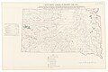
_-_btv1b53200430h.jpg)


.jpg)

.jpg)


(NRCS_Photo_Gallery).jpg)
(NRCS_Photo_Gallery).jpg)
(NRCS_Photo_Gallery).jpg)
(NRCS_Photo_Gallery).jpg)
(NRCS_Photo_Gallery).jpg)
(NRCS_Photo_Gallery).jpg)
(NRCS_Photo_Gallery).jpg)
(NRCS_Photo_Gallery).jpg)
(NRCS_Photo_Gallery).jpg)
(NRCS_Photo_Gallery).jpg)
(NRCS_Photo_Gallery).jpg)
(NRCS_Photo_Gallery).jpg)
(NRCS_Photo_Gallery).jpg)
(NRCS_Photo_Gallery).jpg)
(NRCS_Photo_Gallery).jpg)
(NRCS_Photo_Gallery).jpg)
(NRCS_Photo_Gallery).jpg)
(NRCS_Photo_Gallery).jpg)
(NRCS_Photo_Gallery).jpg)


.jpg)

.jpg)


.jpg)


.jpg)
.jpg)


