Category:Lingen, Herefordshire
Jump to navigation
Jump to search
village and civil parish in Herefordshire, UK  | |||||
| Upload media | |||||
| Instance of | |||||
|---|---|---|---|---|---|
| Location | Herefordshire, West Midlands, England | ||||
 | |||||
Cymraeg: Pentref yn Swydd Henffordd, Gorllewin Canolbarth Lloegr, Lloegr ydy Lingen, Herefordshire. (→Lingen, Swydd Henffordd)
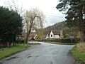
English: Lingen is a village and civil parish, situated in the wooded hills of Herefordshire, England in the Welsh Marches near to the border with Wales and close to the larger village of Wigmore. Situated in the north-west corner of the county, Lingen parish includes the hamlets of Deerfold, Limebrook, Birtley and Willey. It lies on the Limebrook which runs into the River Lugg south of the village. It lies at a height of between 145 and 283 metres above sea level. (→Lingen, Herefordshire)
Nederlands: Lingen is een plaats en civil parish in het bestuurlijke gebied Herefordshire, in het Engelse graafschap Herefordshire met 164 inwoners. (→Lingen (Herefordshire))
Polski: Lingen – wieś w Anglii, w hrabstwie Herefordshire. Leży 31 km na północny zachód od miasta Hereford i 212 km na północny zachód od Londynu. W 2001 miejscowość liczyła 164 mieszkańców. (→Lingen (Herefordshire))

Subcategories
This category has the following 3 subcategories, out of 3 total.
B
- Birtley, Herefordshire (4 F)
D
- Deerfold (6 F)
Media in category "Lingen, Herefordshire"
The following 159 files are in this category, out of 159 total.
-
 'Lingen' Stone at St. Michael ^ All Angels Church (Lingen) - geograph.org.uk - 6414754.jpg 3,648 × 2,736; 4.63 MB
-

-
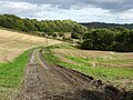
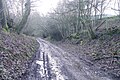 A muddy lane, Birtley - geograph.org.uk - 6082307.jpg 1,024 × 683; 416 KB
-

-
 A reminder that Christmas is coming ...... - geograph.org.uk - 5573653.jpg 3,323 × 2,209; 2.93 MB
-
 AA Sign at Lingen - geograph.org.uk - 6414816.jpg 3,648 × 2,736; 4.29 MB
-
 An Ancient Yew Tree - geograph.org.uk - 4444091.jpg 1,480 × 2,220; 3.81 MB
-
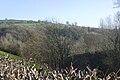 Around Limebrook - geograph.org.uk - 5014577.jpg 640 × 427; 77 KB
-
 Birtley Cross - geograph.org.uk - 5014346.jpg 800 × 534; 170 KB
-

-
 Border Oak Houses (Lingen) - geograph.org.uk - 6414931.jpg 3,648 × 2,736; 4.82 MB
-
 Brook House (Lingen) - geograph.org.uk - 6414891.jpg 3,648 × 2,736; 4.44 MB
-
 Cadwell summit from the footpath - geograph.org.uk - 846848.jpg 640 × 480; 78 KB
-
 Castle and church, Lingen - geograph.org.uk - 5573636.jpg 3,323 × 2,209; 2.31 MB
-
 Castle tump, Lingen - geograph.org.uk - 5014536.jpg 800 × 534; 210 KB
-

-

-
 Contented cattle on The Warren - geograph.org.uk - 870015.jpg 640 × 327; 52 KB
-
 Cornfield Meet on the lane to Limebrook - geograph.org.uk - 2587595.jpg 640 × 480; 103 KB
-
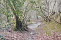
 Cwm-crave Wood - geograph.org.uk - 6009902.jpg 1,024 × 768; 294 KB
-
 Daffodils at Lingen - geograph.org.uk - 6414936.jpg 3,648 × 2,736; 4.71 MB
-
 Dairyhouse - geograph.org.uk - 5014552.jpg 800 × 534; 254 KB
-
 Deerfold (Viewed from Lingen Castle) - geograph.org.uk - 6414629.jpg 2,560 × 1,440; 1.7 MB
-
-
 Entering Lingen - geograph.org.uk - 904914.jpg 640 × 483; 66 KB
-
 Entrance Gates to Lingen Methodist Chapel - geograph.org.uk - 6414842.jpg 3,648 × 2,736; 3.97 MB
-
 Entrance to Lingen Methodist Chapel - geograph.org.uk - 6414854.jpg 2,736 × 3,648; 4.58 MB
-
 Entrance to Upper Kinsham Farm - geograph.org.uk - 903969.jpg 640 × 459; 51 KB
-
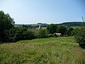
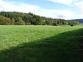 Farmland near Lingen - geograph.org.uk - 6299949.jpg 1,024 × 768; 233 KB
-
 Footpath near Birtley - geograph.org.uk - 3938663.jpg 2,592 × 3,872; 4.83 MB
-
 Footpath north of Lingen - geograph.org.uk - 905464.jpg 640 × 480; 93 KB
-
 Foundation Stone at Lingen Methodist Chapel - geograph.org.uk - 6414882.jpg 3,648 × 2,736; 4.76 MB
-
 Foundation Stone at Lingen Methodist Chapel - geograph.org.uk - 6414887.jpg 3,648 × 2,736; 4.85 MB
-
 Gateway near Lower House - geograph.org.uk - 506892.jpg 640 × 480; 117 KB
-
 Great War Memorial, Lingen - geograph.org.uk - 5572937.jpg 2,912 × 2,520; 2.6 MB
-
 Green lane and ford - geograph.org.uk - 6082309.jpg 1,024 × 683; 463 KB
-
 Green lane, Birtley - geograph.org.uk - 6082310.jpg 1,024 × 683; 429 KB
-
 Green lane, Birtley - geograph.org.uk - 6082311.jpg 1,024 × 683; 394 KB
-
 Hill east of Lingen - geograph.org.uk - 905472.jpg 640 × 480; 105 KB
-
 Hillside near Down's Wood - geograph.org.uk - 3550593.jpg 640 × 480; 72 KB
-
 Horse at Lingen Castle (Bailey) - geograph.org.uk - 6414611.jpg 3,046 × 2,284; 1.12 MB
-
 Horse at Lingen Castle (Bailey) - geograph.org.uk - 6414654.jpg 2,560 × 1,440; 1.71 MB
-
 Horse at Lingen Castle (Bailey) - geograph.org.uk - 6414657.jpg 2,560 × 1,440; 1.76 MB
-
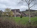
 House in Lingen - geograph.org.uk - 6299932.jpg 1,024 × 768; 282 KB
-
 Houses at Lingen - geograph.org.uk - 6414899.jpg 3,085 × 2,313; 1.49 MB
-
 In rural Herefordshire near Lingen - geograph.org.uk - 3550471.jpg 640 × 480; 95 KB
-
 Interior of Lingen church - geograph.org.uk - 6299974.jpg 1,024 × 768; 182 KB
-
 Karting Circuit - geograph.org.uk - 846923.jpg 640 × 480; 77 KB
-
 Lake at Lingen Castle (Bailey) - geograph.org.uk - 6414606.jpg 2,984 × 2,238; 1.22 MB
-
 Lake at Lingen Castle (Bailey) - geograph.org.uk - 6414689.jpg 2,560 × 1,440; 1.72 MB
-
 Lake at Lingen Castle (Bailey) - geograph.org.uk - 6414698.jpg 3,648 × 2,736; 4.06 MB
-
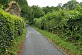 Lane at Limebrook - geograph.org.uk - 5477912.jpg 1,280 × 851; 675 KB
-
 Lane at Lingen - geograph.org.uk - 6414758.jpg 3,648 × 2,736; 4.19 MB
-
 Lane at Lingen church - geograph.org.uk - 2587585.jpg 640 × 480; 97 KB
-
 Lane junction in Lingen - geograph.org.uk - 2587586.jpg 640 × 480; 93 KB
-
 Lane junction west of Lingen - geograph.org.uk - 2587574.jpg 640 × 480; 95 KB
-
 Lane near Birtley - geograph.org.uk - 3938728.jpg 3,872 × 2,592; 4.4 MB
-
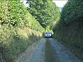
 Lane to Lingen - geograph.org.uk - 903983.jpg 640 × 475; 52 KB
-
 Lane west of Lingen - geograph.org.uk - 2587578.jpg 640 × 480; 87 KB
-
 Limebrook - geograph.org.uk - 5477709.jpg 1,280 × 851; 646 KB
-
 Lingen Castle (Bailey) - geograph.org.uk - 6414641.jpg 2,560 × 1,440; 1.76 MB
-
 Lingen Castle (Bailey) - geograph.org.uk - 6414671.jpg 2,560 × 1,440; 1.79 MB
-
 Lingen Castle (Keep) - geograph.org.uk - 6414718.jpg 3,648 × 2,736; 4.71 MB
-
 Lingen Castle (Keep) - geograph.org.uk - 6414719.jpg 3,648 × 2,736; 4.73 MB
-
 Lingen Castle (Moat) - geograph.org.uk - 6414617.jpg 3,648 × 2,736; 4.8 MB
-
 Lingen Castle (Moat) - geograph.org.uk - 6414709.jpg 3,648 × 2,736; 4.71 MB
-
 Lingen Castle (Moat) - geograph.org.uk - 6414712.jpg 3,648 × 2,736; 4.72 MB
-
 Lingen Castle (Moat) - geograph.org.uk - 6414713.jpg 3,648 × 2,736; 4.49 MB
-
 Lingen Castle (Motte) - geograph.org.uk - 6414600.jpg 3,648 × 2,736; 4.55 MB
-
 Lingen Castle (Motte) - geograph.org.uk - 6414615.jpg 2,560 × 1,440; 1.78 MB
-
 Lingen Castle - geograph.org.uk - 5477672.jpg 1,280 × 851; 453 KB
-
 Lingen Castle - geograph.org.uk - 6414595.jpg 3,648 × 2,736; 4.32 MB
-
 Lingen Castle - geograph.org.uk - 905449.jpg 640 × 480; 87 KB
-
 Lingen Castle ^ St. Michael ^ All Angels Church - geograph.org.uk - 6414705.jpg 2,560 × 1,440; 1.77 MB
-
 Lingen church - geograph.org.uk - 6299908.jpg 1,024 × 768; 275 KB
-
 Lingen church - geograph.org.uk - 6299918.jpg 768 × 1,024; 250 KB
-
 Lingen church - geograph.org.uk - 6299921.jpg 1,024 × 768; 296 KB
-
 Lingen Methodist Chapel - geograph.org.uk - 6414829.jpg 3,648 × 2,736; 4.36 MB
-
 Lingen Methodist Chapel - geograph.org.uk - 6414852.jpg 3,648 × 2,736; 3.81 MB
-
 Lingen motte and bailey castle - geograph.org.uk - 3550427.jpg 640 × 480; 81 KB
-
 Lingen Nursery - abandoned, 1 - geograph.org.uk - 3728842.jpg 800 × 450; 199 KB
-
 Lingen Nursery - abandoned, 2 - geograph.org.uk - 3728845.jpg 800 × 600; 245 KB
-
 Lingen to Kinsham road - geograph.org.uk - 5014555.jpg 800 × 534; 125 KB
-
 Lingen village entrance - geograph.org.uk - 2141216.jpg 640 × 480; 107 KB
-
 Looking back at Birchen - Lingen, Herefordshire - geograph.org.uk - 4103386.jpg 3,067 × 2,092; 1.41 MB
-
 Looking towards Lingen, Herefordshire - geograph.org.uk - 4103394.jpg 3,072 × 1,995; 1.11 MB
-
 Lychgate at St. Michael ^ All Angels Church (Lingen) - geograph.org.uk - 6414745.jpg 3,648 × 2,736; 4.85 MB
-
 Lychgate at St. Michael ^ All Angels Church (Lingen) - geograph.org.uk - 6414942.jpg 3,648 × 2,736; 4.55 MB
-
 Motte and Bailey castle site, Lingen - geograph.org.uk - 5573619.jpg 3,323 × 2,209; 2.08 MB
-

-
 Notice Board at Lingen - geograph.org.uk - 6414939.jpg 3,648 × 2,736; 4.63 MB
-
 Notices at Lingen Methodist Chapel - geograph.org.uk - 6414846.jpg 3,648 × 2,736; 4.44 MB
-

-
 Old Farmhouse (Lingen) - geograph.org.uk - 6414784.jpg 3,648 × 2,736; 4.76 MB
-
 Old sunken path down to Lingen - geograph.org.uk - 3550596.jpg 640 × 480; 126 KB
-
 On Harley's Mountain in summer - geograph.org.uk - 3550493.jpg 640 × 480; 110 KB
-
 Ordnance Survey Cut Mark - geograph.org.uk - 5329260.jpg 640 × 430; 108 KB
-
 Path sign, Lingen - geograph.org.uk - 5014544.jpg 534 × 800; 145 KB
-
 Path to Lingen church - geograph.org.uk - 3550617.jpg 640 × 480; 102 KB
-
 Path to St. Michael ^ All Angels Church (Lingen) - geograph.org.uk - 6414747.jpg 3,648 × 2,432; 4.34 MB
-
 Plaque on Lingen Methodist Chapel - geograph.org.uk - 6414879.jpg 2,736 × 3,648; 4.72 MB
-

-
 Poplar trees near Home Farm - geograph.org.uk - 6300018.jpg 1,024 × 768; 288 KB
-
 Protest slogan at The Ashes - geograph.org.uk - 870466.jpg 640 × 480; 91 KB
-
 Reentrant above Limebrook - geograph.org.uk - 5014573.jpg 800 × 534; 211 KB
-
 Road junction at Lingen - geograph.org.uk - 905097.jpg 640 × 480; 99 KB
-
 Road to Birtley from Birtley Cross - geograph.org.uk - 5590333.jpg 1,600 × 1,200; 804 KB
-
 Road to Lingen near Home Farm - geograph.org.uk - 904910.jpg 640 × 434; 68 KB
-
 Road west of The Turn, Lingen - geograph.org.uk - 5590326.jpg 1,600 × 1,200; 891 KB
-
 Rose ^ Ivy Cottages (Lingen) - geograph.org.uk - 6414907.jpg 3,648 × 2,736; 4.2 MB
-
 Route south from Lingen - geograph.org.uk - 2587589.jpg 640 × 480; 58 KB
-

-
 Shelter at Lingen - geograph.org.uk - 6414683.jpg 2,560 × 1,440; 1.74 MB
-
 Sheltering sheep - geograph.org.uk - 506887.jpg 640 × 480; 89 KB
-
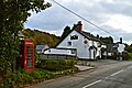
 Sign at the Royal George (Lingen) - geograph.org.uk - 6414920.jpg 3,648 × 2,736; 3.93 MB
-
 Small pond at Lingen Castle - geograph.org.uk - 905453.jpg 640 × 480; 98 KB
-
 St. Michael ^ All Angels Church (Altar ^ Lingen) - geograph.org.uk - 6414551.jpg 3,648 × 2,736; 3.11 MB
-

-
 St. Michael ^ All Angels Church (Box Pew ^ Lingen) - geograph.org.uk - 6414578.jpg 3,648 × 2,736; 2.57 MB
-
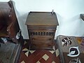
 St. Michael ^ All Angels Church (Box Pew ^ Organ ^ Lingen) - geograph.org.uk - 6414580.jpg 3,648 × 2,736; 3.35 MB
-
 St. Michael ^ All Angels Church (Lectern ^ Lingen) - geograph.org.uk - 6414575.jpg 3,648 × 2,736; 2.88 MB
-
 St. Michael ^ All Angels Church (Lingen) - geograph.org.uk - 6414614.jpg 3,648 × 2,736; 4.13 MB
-
 St. Michael ^ All Angels Church (Lingen) - geograph.org.uk - 6414622.jpg 3,648 × 2,736; 4.27 MB
-
 St. Michael ^ All Angels Church (Lingen) - geograph.org.uk - 6414695.jpg 2,560 × 1,440; 1.65 MB
-
 St. Michael ^ All Angels Church (Lingen) - geograph.org.uk - 6414742.jpg 3,648 × 2,736; 3.68 MB
-
 St. Michael ^ All Angels Church (Nave ^ Lingen) - geograph.org.uk - 6414559.jpg 3,648 × 2,736; 2.43 MB
-
 St. Michael ^ All Angels Church (Organ ^ Lingen) - geograph.org.uk - 6414584.jpg 3,648 × 2,736; 3.31 MB
-
 St. Michael ^ All Angels Church (Porch ^ Lingen) - geograph.org.uk - 6414739.jpg 3,648 × 2,736; 4.6 MB
-
 St. Michael ^ All Angels Church (Viewed from Lingen Castle) - geograph.org.uk - 6414645.jpg 2,560 × 1,440; 1.78 MB
-
 Start of the lane to Limebrook - geograph.org.uk - 2587592.jpg 640 × 480; 107 KB
-
 Stone at Lingen Castle (Bailey) - geograph.org.uk - 6414700.jpg 3,648 × 2,736; 5.13 MB
-
 Telephone Box at Lingen - geograph.org.uk - 6414797.jpg 3,648 × 2,736; 4.64 MB
-
 Telephone Box at Lingen - geograph.org.uk - 6414928.jpg 3,648 × 2,736; 4.92 MB
-
 The Barns (Lingen) - geograph.org.uk - 6414903.jpg 3,648 × 2,736; 3.89 MB
-
 The basic requirements for country living ..... - geograph.org.uk - 5573566.jpg 3,323 × 2,209; 2.15 MB
-
 The lane south from Lingen - geograph.org.uk - 2587588.jpg 640 × 480; 103 KB
-
 The Mount - geograph.org.uk - 905500.jpg 640 × 444; 56 KB
-
 The Royal George (Lingen) - geograph.org.uk - 6414804.jpg 3,648 × 2,736; 3.4 MB
-
 The Royal George (Lingen) - geograph.org.uk - 6414912.jpg 3,648 × 2,736; 3.91 MB
-
 The Village of Lingen - geograph.org.uk - 6414791.jpg 3,648 × 2,736; 4.2 MB
-
 The Village of Lingen - geograph.org.uk - 6414917.jpg 3,648 × 2,736; 4.08 MB
-
 Timber-Framed House (Lingen) - geograph.org.uk - 6414894.jpg 3,648 × 2,736; 3.9 MB
-
 Track to Lower Woodbatch - geograph.org.uk - 6299877.jpg 1,024 × 768; 294 KB
-
 View from Lingen Castle (Motte) - geograph.org.uk - 6414637.jpg 2,560 × 1,440; 1.78 MB
-
 View from Lingen Castle (Motte) - geograph.org.uk - 6414648.jpg 2,560 × 1,440; 1.58 MB
-
 View from Lingen Castle (Motte) - geograph.org.uk - 6414661.jpg 2,560 × 1,440; 1.57 MB
-
-

-
 View south from Limebrook - geograph.org.uk - 2587596.jpg 640 × 480; 97 KB
-
 View to a distant Black Mixen - geograph.org.uk - 6299511.jpg 1,024 × 768; 191 KB
-
 View to Harley's Mountain - geograph.org.uk - 6299513.jpg 1,024 × 768; 306 KB
-
 Village street at Lingen - geograph.org.uk - 905420.jpg 640 × 480; 60 KB
-

-
 Wye Valley Brewery Plaque at the Royal George (Lingen) - geograph.org.uk - 6414913.jpg 3,648 × 2,736; 4.52 MB
-
 Hillside south of Cwm-Crave Wood - geograph.org.uk - 60079.jpg 640 × 480; 91 KB
-
 Road junction at the centre of Lingen - geograph.org.uk - 44225.jpg 640 × 480; 146 KB
-
 The Farlands - geograph.org.uk - 63225.jpg 640 × 480; 69 KB
-
 The lane near Boresford Farm - geograph.org.uk - 44241.jpg 640 × 480; 150 KB
-
 The southern approach to Lingen - geograph.org.uk - 44222.jpg 640 × 480; 146 KB
_-_geograph.org.uk_-_6414754.jpg)


_-_geograph.org.uk_-_6414931.jpg)
_-_geograph.org.uk_-_6414891.jpg)


_-_geograph.org.uk_-_6414568.jpg)
_-_geograph.org.uk_-_6414573.jpg)


_-_geograph.org.uk_-_6414629.jpg)
_-_geograph.org.uk_-_6414555.jpg)


_-_geograph.org.uk_-_6414611.jpg)
_-_geograph.org.uk_-_6414654.jpg)
_-_geograph.org.uk_-_6414657.jpg)


_-_geograph.org.uk_-_6414606.jpg)
_-_geograph.org.uk_-_6414689.jpg)
_-_geograph.org.uk_-_6414698.jpg)


_-_geograph.org.uk_-_6414641.jpg)
_-_geograph.org.uk_-_6414671.jpg)
_-_geograph.org.uk_-_6414718.jpg)
_-_geograph.org.uk_-_6414719.jpg)
_-_geograph.org.uk_-_6414617.jpg)
_-_geograph.org.uk_-_6414709.jpg)
_-_geograph.org.uk_-_6414712.jpg)
_-_geograph.org.uk_-_6414713.jpg)
_-_geograph.org.uk_-_6414600.jpg)
_-_geograph.org.uk_-_6414615.jpg)


_-_geograph.org.uk_-_6414745.jpg)
_-_geograph.org.uk_-_6414942.jpg)


_-_geograph.org.uk_-_6414784.jpg)


_-_geograph.org.uk_-_6414747.jpg)

_-_geograph.org.uk_-_6414949.jpg)


_-_geograph.org.uk_-_6414907.jpg)


_-_geograph.org.uk_-_6414920.jpg)

_-_geograph.org.uk_-_6414551.jpg)
_-_geograph.org.uk_-_6414730.jpg)
_-_geograph.org.uk_-_6414578.jpg)
_-_geograph.org.uk_-_6414580.jpg)
_-_geograph.org.uk_-_6414575.jpg)
_-_geograph.org.uk_-_6414614.jpg)
_-_geograph.org.uk_-_6414622.jpg)
_-_geograph.org.uk_-_6414695.jpg)
_-_geograph.org.uk_-_6414742.jpg)
_-_geograph.org.uk_-_6414559.jpg)
_-_geograph.org.uk_-_6414584.jpg)
_-_geograph.org.uk_-_6414739.jpg)
_-_geograph.org.uk_-_6414645.jpg)

_-_geograph.org.uk_-_6414700.jpg)


_-_geograph.org.uk_-_6414903.jpg)


_-_geograph.org.uk_-_6414804.jpg)
_-_geograph.org.uk_-_6414912.jpg)


_-_geograph.org.uk_-_6414894.jpg)

_-_geograph.org.uk_-_6414637.jpg)
_-_geograph.org.uk_-_6414648.jpg)
_-_geograph.org.uk_-_6414661.jpg)


_-_geograph.org.uk_-_6414583.jpg)
_-_geograph.org.uk_-_6414913.jpg)


