Category:Linton-on-Ouse
Jump to navigation
Jump to search
village and civil parish in North Yorkshire, United Kingdom  | |||||
| Upload media | |||||
| Instance of | |||||
|---|---|---|---|---|---|
| Standort | Hambleton, North Yorkshire, Yorkshire and the Humber, England | ||||
| Population |
| ||||
| Area |
| ||||
 | |||||
English: Linton-on-Ouse is a village and civil parish in the Hambleton district of North Yorkshire, England, about eight miles north-west of York.
Nederlands: Linton-on-Ouse is een Engels dorpje in het district Hambleton in North Yorkshire, op ongeveer 8 mijl ten noordwesten van York. Linton-on-Ouse herbergt sinds 1937 de luchtmachtbasis RAF Linton-on-Ouse.
Subcategories
This category has the following 2 subcategories, out of 2 total.
L
- Linton Lock (11 F)
R
Media in category "Linton-on-Ouse"
The following 148 files are in this category, out of 148 total.
-
 A change of name for the river - geograph.org.uk - 5800587.jpg 640 × 480; 124 KB
-
 A dip in the road - geograph.org.uk - 6490283.jpg 3,888 × 5,184; 6.25 MB
-
 A novel kind of scarecrow - geograph.org.uk - 5981391.jpg 480 × 640; 162 KB
-
 Approaching Linton Woods Farm - geograph.org.uk - 5910172.jpg 4,000 × 3,000; 2.92 MB
-
 Arable land, Lodge Farm - geograph.org.uk - 5117305.jpg 1,024 × 683; 270 KB
-
 Barn near Boundary Farm - geograph.org.uk - 5981382.jpg 640 × 480; 392 KB
-
 BT hut near Newton-on-Ouse - geograph.org.uk - 5800297.jpg 640 × 480; 89 KB
-
 Building on Linton-on-Ouse Airfield - geograph.org.uk - 5004066.jpg 640 × 480; 69 KB
-
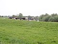
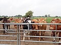
 Cattle beside Linton Woods Lane - geograph.org.uk - 5981373.jpg 640 × 480; 364 KB
-
 Cattle grazing by the Ouse - geograph.org.uk - 5800583.jpg 640 × 480; 71 KB
-
 Cattle grazing near Linton-on-Ouse - geograph.org.uk - 5910391.jpg 4,000 × 3,000; 2.48 MB
-
 Clouds of cow parsley - geograph.org.uk - 5797343.jpg 640 × 480; 116 KB
-
 College Arms, Linton on Ouse - geograph.org.uk - 1655389.jpg 640 × 427; 61 KB
-

-
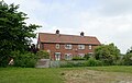
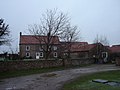 Converted farmhouse and buildings - geograph.org.uk - 1205006.jpg 640 × 480; 69 KB
-
 Drainage ditch near Linton Lock - geograph.org.uk - 5797259.jpg 640 × 480; 133 KB
-
 Drive to three properties on Linton Woods Lane - geograph.org.uk - 5910170.jpg 4,000 × 3,000; 2.88 MB
-
 End of Linton Woods Lane - geograph.org.uk - 5981420.jpg 640 × 480; 313 KB
-
 Entrance to Linton Woods Farm - geograph.org.uk - 1204974.jpg 640 × 480; 122 KB
-
 Farm buildings and silos, Linton Woods Farm - geograph.org.uk - 5910176.jpg 4,000 × 3,000; 2.84 MB
-
 Farm Buildings Linton Wood Farm - geograph.org.uk - 1204963.jpg 640 × 480; 53 KB
-
 Farm buildings, Linton Woods Farm - geograph.org.uk - 5910075.jpg 4,000 × 3,000; 2.8 MB
-
 Farm road at Hunters Lodge Farm - geograph.org.uk - 5981217.jpg 640 × 480; 257 KB
-
 Farmland east of Hunters Lodge - geograph.org.uk - 5004076.jpg 640 × 480; 82 KB
-
 Farmland near Linton-on-Ouse - geograph.org.uk - 2467679.jpg 1,600 × 1,200; 411 KB
-
 Farmland near Linton-on-Ouse - geograph.org.uk - 2467695.jpg 1,600 × 1,200; 478 KB
-
 Farmland near Linton-on-Ouse - geograph.org.uk - 2488140.jpg 640 × 480; 68 KB
-
 Field edge, Linton Woods - geograph.org.uk - 5117339.jpg 1,024 × 683; 302 KB
-
 Field near Linton on Ouse - geograph.org.uk - 5910387.jpg 4,000 × 3,000; 2.91 MB
-
 Field of maize, Linton-on-Ouse - geograph.org.uk - 5797255.jpg 640 × 480; 76 KB
-
-
 Footbridge to a mooring on the River Ouse - geograph.org.uk - 5910411.jpg 4,000 × 3,000; 2.29 MB
-
-

-

-
 Footpath past Linton Woods Farm - geograph.org.uk - 5910370.jpg 4,000 × 3,000; 2.39 MB
-
 Footpath round the back of Linton Woods Farm - geograph.org.uk - 5910374.jpg 4,000 × 3,000; 2.33 MB
-

-

-
 Former Lock House at Linton Lock - geograph.org.uk - 5910418.jpg 4,000 × 3,000; 2.95 MB
-

-
 From Linton to Newton - geograph.org.uk - 2084226.jpg 640 × 480; 248 KB
-
 From Linton Woods Lane - geograph.org.uk - 2084647.jpg 640 × 480; 234 KB
-
 Garth End Ings - geograph.org.uk - 5797236.jpg 640 × 480; 92 KB
-
 Grassland by the River Ure - geograph.org.uk - 5460232.jpg 800 × 600; 101 KB
-
 Hag Lane - geograph.org.uk - 2488147.jpg 1,600 × 1,200; 619 KB
-
 Heading towards Newton-on-Ouse - geograph.org.uk - 5797317.jpg 640 × 480; 88 KB
-
 Hedgerow off Linton Woods Lane - geograph.org.uk - 2084086.jpg 640 × 480; 257 KB
-
 Horses at Linton Woods Farm - geograph.org.uk - 5910174.jpg 4,000 × 3,000; 2.43 MB
-
 Houses off Linton Woods Lane - geograph.org.uk - 5981371.jpg 640 × 480; 246 KB
-
 Housing estate on Linton Woods Lane - geograph.org.uk - 5910393.jpg 4,000 × 3,000; 2.5 MB
-
 Hunter's Lodge - geograph.org.uk - 5801023.jpg 640 × 480; 75 KB
-
 Hunters Lodge Farm - geograph.org.uk - 2467676.jpg 1,600 × 1,200; 288 KB
-
 Ivy-clad tree - geograph.org.uk - 5801421.jpg 640 × 480; 106 KB
-
 Kayaks and tents by the river Ouse - geograph.org.uk - 5910413.jpg 4,000 × 3,000; 2.72 MB
-
 Keep left for Linton Lock - geograph.org.uk - 3115503.jpg 2,048 × 1,078; 378 KB
-
 Linton Lock - geograph.org.uk - 5981307.jpg 640 × 480; 251 KB
-
 Linton lock and Lock House - geograph.org.uk - 5796161.jpg 640 × 480; 86 KB
-
 Linton Lock and weir - geograph.org.uk - 2905498.jpg 640 × 480; 112 KB
-
 Linton Lock Marina - geograph.org.uk - 5796368.jpg 640 × 480; 66 KB
-
 Linton on Ouse - geograph.org.uk - 1330489.jpg 640 × 480; 155 KB
-
 Linton on Ouse - geograph.org.uk - 186503.jpg 640 × 479; 58 KB
-
 Linton on Ouse airfield - geograph.org.uk - 2376535.jpg 640 × 480; 85 KB
-

-
 Linton Stores - geograph.org.uk - 5797254.jpg 640 × 480; 75 KB
-
 Linton Woods - geograph.org.uk - 2084097.jpg 640 × 480; 258 KB
-
 Linton Woods - geograph.org.uk - 5117350.jpg 1,024 × 683; 329 KB
-
 Linton Woods Farm No. 3 - geograph.org.uk - 2488143.jpg 1,600 × 1,200; 417 KB
-
 Linton Woods Farm number 3 - geograph.org.uk - 5981394.jpg 640 × 480; 306 KB
-
 Linton Woods Farmhouse - geograph.org.uk - 1204978.jpg 640 × 480; 68 KB
-
 Linton Woods Lane - geograph.org.uk - 2084150.jpg 640 × 480; 242 KB
-
 Linton Woods Lane - geograph.org.uk - 2109261.jpg 480 × 640; 313 KB
-
 Linton Woods Lane - geograph.org.uk - 2488144.jpg 1,600 × 1,200; 734 KB
-
 Linton Woods Lane - geograph.org.uk - 5117343.jpg 1,024 × 683; 286 KB
-
 Linton Woods Lane heading east - geograph.org.uk - 2488142.jpg 1,600 × 1,200; 537 KB
-
 Linton-on-Ouse Airfield (2) - geograph.org.uk - 5003960.jpg 640 × 480; 72 KB
-
 Linton-on-Ouse Airfield (3) - geograph.org.uk - 5004051.jpg 640 × 480; 74 KB
-
 Linton-on-Ouse Airfield (4) - geograph.org.uk - 5004058.jpg 640 × 480; 75 KB
-
 Linton-on-Ouse Airfield - geograph.org.uk - 4985719.jpg 640 × 480; 75 KB
-
 Linton-on-Ouse Village Hall - geograph.org.uk - 2467683.jpg 1,600 × 1,200; 409 KB
-
 Linton-on-Ouse Village Hall - geograph.org.uk - 5797250.jpg 640 × 480; 67 KB
-

-
 Lodge Farm - geograph.org.uk - 2084648.jpg 640 × 480; 250 KB
-
 Lodge Farm - geograph.org.uk - 5910101.jpg 4,000 × 3,000; 2.82 MB
-

-
 Looking north towards Lodge Farm - geograph.org.uk - 5910108.jpg 4,000 × 3,000; 2.48 MB
-
 Looking towards Hunters Lodge - geograph.org.uk - 2544977.jpg 800 × 600; 173 KB
-
 Main Street, Linton on Ouse - geograph.org.uk - 1861205.jpg 3,264 × 2,448; 1.92 MB
-

-
 Minor road towards Linton-on-Ouse - geograph.org.uk - 2467677.jpg 1,600 × 1,200; 354 KB
-
 Minor road towards Linton-on-Ouse - geograph.org.uk - 2467681.jpg 1,600 × 1,200; 379 KB
-
 Minor road towards Newton-on-Ouse - geograph.org.uk - 2467698.jpg 1,600 × 1,200; 331 KB
-
 Neatly trimmed hedge and trees at Mill House - geograph.org.uk - 5910394.jpg 4,000 × 3,000; 2.36 MB
-
 Newton Bridge - geograph.org.uk - 5797372.jpg 640 × 480; 129 KB
-
 Nosy cattle at Linton Woods Farm - geograph.org.uk - 5910376.jpg 4,000 × 3,000; 2.4 MB
-
 Outlet sluice at Linton Lock - geograph.org.uk - 5797283.jpg 640 × 480; 126 KB
-
 Pair of semis at Linton Woods Farm - geograph.org.uk - 5910114.jpg 3,400 × 2,148; 1.54 MB
-
 Plough lines at Linton Wood - geograph.org.uk - 6490292.jpg 5,175 × 3,335; 3.45 MB
-
 Ploughing a straight furrow - geograph.org.uk - 5857553.jpg 4,000 × 3,000; 2.22 MB
-
 Private Fishing - geograph.org.uk - 5801027.jpg 640 × 480; 151 KB
-
 RAF base at Linton-on-Ouse - geograph.org.uk - 5797243.jpg 640 × 480; 76 KB
-
 RAF Linton on Ouse - geograph.org.uk - 2905500.jpg 640 × 480; 87 KB
-
 RAF Linton-on-Ouse - landing lights - geograph.org.uk - 5530795.jpg 800 × 600; 132 KB
-
 RAF Linton-on-Ouse - runway - geograph.org.uk - 5530791.jpg 800 × 600; 88 KB
-
 Recently ploughed field at Lodge Farm - geograph.org.uk - 5910104.jpg 3,875 × 2,907; 2.21 MB
-
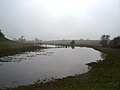
 River Ouse - geograph.org.uk - 207955.jpg 640 × 426; 106 KB
-
 River Ouse - geograph.org.uk - 2905499.jpg 640 × 480; 97 KB
-
 River Ouse from Linton Lock - geograph.org.uk - 5796362.jpg 640 × 480; 75 KB
-
 River Ouse from the embankment - geograph.org.uk - 5800573.jpg 640 × 480; 89 KB
-
 River Ouse near Thorpe Underwood - geograph.org.uk - 139522.jpg 640 × 424; 75 KB
-
 Riverside house at Cuddy Shaw Reach - geograph.org.uk - 5800584.jpg 640 × 480; 108 KB
-
 Riverview, Linton-on-Ouse heading east - geograph.org.uk - 2467692.jpg 1,600 × 1,200; 503 KB
-
 Road towards Linton on Ouse - geograph.org.uk - 6489922.jpg 5,164 × 3,676; 4.05 MB
-
 School at Linton on Ouse.jpg 600 × 450; 258 KB
-
 School Row, Linton-on-Ouse - geograph.org.uk - 5797246.jpg 640 × 480; 78 KB
-
 Segregated cycle path - geograph.org.uk - 5981302.jpg 640 × 480; 224 KB
-
 Segregated cycle path - geograph.org.uk - 5981330.jpg 640 × 480; 311 KB
-
-
 Sheep pastures, Hunters Lodge - geograph.org.uk - 1861195.jpg 3,264 × 2,448; 1.97 MB
-
 Sluice gates, Linton Lock Marina - geograph.org.uk - 5910399.jpg 4,000 × 3,000; 2.95 MB
-
 Squeeze stile near Linton-on-Ouse - geograph.org.uk - 5796534.jpg 640 × 480; 106 KB
-
 Steepwood - geograph.org.uk - 5981377.jpg 640 × 480; 253 KB
-
 Sugar Beet - geograph.org.uk - 2084173.jpg 640 × 480; 252 KB
-
 The College Arms - geograph.org.uk - 5797237.jpg 640 × 480; 68 KB
-
 The College Arms, Linton-on-Ouse - geograph.org.uk - 5460234.jpg 800 × 600; 104 KB
-
 The embankment footpath ends - geograph.org.uk - 5801025.jpg 640 × 480; 134 KB
-
 The end of The Island at Linton Lock - geograph.org.uk - 5800300.jpg 640 × 480; 77 KB
-

-
 The river Kyle at Newton bridge - geograph.org.uk - 5797374.jpg 640 × 480; 130 KB
-
 The river Ouse - geograph.org.uk - 5797291.jpg 640 × 480; 78 KB
-
 The River Ouse at Linton Lock Marina - geograph.org.uk - 5910410.jpg 4,000 × 3,000; 2.44 MB
-
 The River Ure becomes the River Ouse - geograph.org.uk - 3115499.jpg 2,048 × 1,536; 584 KB
-
 The road to Linton-on-Ouse - geograph.org.uk - 5981216.jpg 640 × 480; 238 KB
-
 The track to Linton Lock Marina - geograph.org.uk - 5910396.jpg 4,000 × 3,000; 3.05 MB
-
 Towards a distant spire - geograph.org.uk - 6490278.jpg 3,888 × 5,184; 3.75 MB
-
 Track to Hunter's Lodge - geograph.org.uk - 5801032.jpg 640 × 480; 107 KB
-
 Two swans on the Ouse at Linton - geograph.org.uk - 5800303.jpg 640 × 480; 71 KB
-
 Village street, Linton-on-Ouse - geograph.org.uk - 5981300.jpg 640 × 480; 226 KB
-
 War Memorial, Linton-on-Ouse - geograph.org.uk - 5797251.jpg 640 × 480; 119 KB
-
 War Memorial, Linton-on-Ouse - geograph.org.uk - 5797252.jpg 640 × 480; 85 KB
-
 Watersports on the river Ouse - geograph.org.uk - 5796529.jpg 640 × 480; 118 KB
-
 West Field - geograph.org.uk - 5981291.jpg 640 × 480; 309 KB
-
 Wheat field south of Aldwark Wood - geograph.org.uk - 5460230.jpg 1,024 × 768; 503 KB
-
 Blackberries surround the signpost - geograph.org.uk - 543608.jpg 480 × 640; 104 KB
-
 Bridleway nr Widdington Manor - geograph.org.uk - 543601.jpg 480 × 640; 97 KB
-
 Newton On Ouse, North Yorkshire - geograph.org.uk - 565721.jpg 640 × 480; 57 KB
-
 Out Barn - geograph.org.uk - 547869.jpg 640 × 480; 86 KB
-
 RAF Linton on Ouse - geograph.org.uk - 186509.jpg 640 × 479; 33 KB


_-_geograph.org.uk_-_5003960.jpg)
_-_geograph.org.uk_-_5004051.jpg)
_-_geograph.org.uk_-_5004058.jpg)


