Category:Maps of the history of Massachusetts
Jump to navigation
Jump to search
States of the United States: Alabama · Alaska · Arizona · Arkansas · California · Colorado · Connecticut · Delaware · Florida · Georgia · Hawaii · Idaho · Illinois · Indiana · Iowa · Kansas · Kentucky · Louisiana · Maine · Maryland · Massachusetts · Michigan · Minnesota · Mississippi · Missouri · Montana · Nebraska · Nevada · New Hampshire · New Jersey · New Mexico · New York · North Carolina · North Dakota · Ohio · Oklahoma · Oregon · Pennsylvania · Rhode Island · South Carolina · South Dakota · Tennessee · Texas · Utah · Vermont · Virginia · Washington · West Virginia · Wisconsin · Wyoming – Washington, D.C.
Puerto Rico
Puerto Rico
Subcategories
This category has the following 7 subcategories, out of 7 total.
H
M
- Maps of Plymouth Colony (12 F)
- Maps of the growth of Boston (2 F)
Media in category "Maps of the history of Massachusetts"
The following 19 files are in this category, out of 19 total.
-

-

-
-
 Boston 1630 1675.jpg 1,566 × 1,450; 648 KB
-
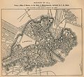 Boston 1814.jpg 1,580 × 1,444; 573 KB
-
 EB9 United States - historical maps (top).jpg 2,488 × 1,803; 997 KB
-
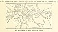
 Map of 1926 proposals for Boston rapid transit extensions.jpg 842 × 1,500; 540 KB
-
 MapRobertColesResidences.png 1,804 × 1,728; 839 KB
-
 Massachusetts H1N1 Flu Map By County.PNG 441 × 274; 88 KB
-
 Massachusetts municipal population flows.svg 1,000 × 619; 2.24 MB
-
 Masscolony.png 1,239 × 1,000; 618 KB
-
 Southern New England, 1620–22 (rev).jpg 8,973 × 9,746; 8.2 MB
-
 Territories and Boundaries of Pokanoket Tribe.jpg 1,601 × 1,225; 854 KB
-

-
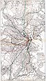
 Tremont Street Subway.jpg 1,152 × 800; 587 KB
-
 Tribal Territories Southern New England.png 1,701 × 1,169; 490 KB
-
 United States Central change 1785-04-19.png 2,046 × 1,321; 249 KB
-
 Wpdms province of maine 1622.png 347 × 393; 73 KB
-
 Wôpanâak Nation c 1620-01.svg 512 × 374; 79 KB
.jpg)
.jpg)
.jpg)


.jpg)


.jpg)


