Category:Maps showing 19th-century history
Jump to navigation
Jump to search
| Preceded by: 18th century maps |
19th century maps 1801 AD-1900 AD |
Succeeded by: 20th century maps |
Subcategories
This category has the following 36 subcategories, out of 36 total.
*
.
A
C
D
- Maps of the Durrani Empire (15 F)
E
G
M
- Maps of 19th-century Russia (45 F)
N
O
S
- Stielers Handatlas 1891 (2 P, 121 F)
- Maps of the Sonderbund War (8 F)
W
Media in category "Maps showing 19th-century history"
The following 200 files are in this category, out of 403 total.
(previous page) (next page)-

-
 1805 cary, crop.jpg 734 × 714; 304 KB
-
 1805 cary.jpg 2,163 × 1,939; 5.08 MB
-
 1813 pinkerton.jpg 2,829 × 2,082; 6.16 MB
-
 1845 trailmap.png 993 × 589; 37 KB
-
 1853 Łódź.jpg 1,853 × 1,388; 730 KB
-
 Constantinople conference west.jpg 2,000 × 3,804; 1.88 MB
-
 1897 Gov Stavropol ethno.jpg 974 × 555; 116 KB
-
 1897 Obl Kuban ethno.jpg 969 × 589; 168 KB
-
 8 Rockland, Westchester counties-crop.jpg 4,168 × 4,539; 4.06 MB
-
 8 Rockland, Westchester counties.jpg 11,031 × 6,873; 13.42 MB
-
 A Synvet 1877.jpg 1,339 × 1,381; 857 KB
-
 Adherents of Judaism in the Russian Empire 1897.png 4,664 × 5,336; 3.63 MB
-
 Adherents of the Armenian Apostolic Church in the Russian Empire 1897.png 4,664 × 5,336; 3.38 MB
-
 Administrative division of Russia 1848-1878.jpg 2,697 × 1,717; 1.03 MB
-
 Administrative map of Hungary in 1910.png 15,525 × 10,321; 6.76 MB
-
 Afghanistan during the First Anglo-Afghan War.gif 971 × 1,073; 45 KB
-
 Africa 1890.jpg 1,548 × 2,072; 1.2 MB
-
 Africamap1812.jpg 1,497 × 1,213; 396 KB
-
 Albania-ethnique1898.jpg 342 × 568; 81 KB
-
 Albany Bleecker Stadium.jpeg 435 × 331; 156 KB
-
 Alcolea map 1808.png 1,506 × 711; 139 KB
-
 Armenia, Late 18th century till late 19th century.png 700 × 480; 65 KB
-
 Armenian language in the Russian Empire (1897).svg 4,648 × 2,744; 1.4 MB
-
 ArmenianOblast.jpg 700 × 457; 87 KB
-
 Asia 1812 by Arrowsmith.jpg 4,150 × 3,356; 6.49 MB
-
 Asien Bd1.jpg 2,500 × 1,974; 1.96 MB
-
 Atlas Guerra Ind.jpg 2,315 × 2,964; 1.58 MB
-
 Austria-hungary (ja).png 822 × 416; 82 KB
-
 Austria-hungary.png 708 × 412; 119 KB
-
 Austria-Hungary1899.JPG 3,340 × 2,520; 1.89 MB
-
 Austrian Empire 1815.svg 450 × 456; 753 KB
-
 Austrian-Empire map es.svg 818 × 604; 416 KB
-
 Austrian-Empire map fr.png 810 × 600; 153 KB
-
 Avantage comparatif & commerce britannique.svg 1,200 × 400; 74 KB
-
 Avantage comparatif et commerce britannique.JPG 1,202 × 386; 65 KB
-
 Avantage comparatif et commerce britannique.PNG 1,061 × 280; 24 KB
-
 Azores-StMichael1845.jpg 851 × 1,539; 227 KB
-
 Baden-1802-1819-variant-es.svg 460 × 690; 251 KB
-
 Baden-1802-1819-variant.svg 460 × 690; 79 KB
-
 Baden-1802-1819.svg 460 × 690; 78 KB
-
 Balkans-ethnic (1861).jpg 6,280 × 5,072; 3.98 MB
-
 Balkans-ethnic (1877).jpg 2,020 × 2,084; 1.14 MB
-
 Balkans-ethnique.JPG 1,258 × 1,266; 457 KB
-
 Barres mapa.jpg 1,519 × 1,200; 775 KB
-
 Bashkir language in the Russian Empire (1897).svg 4,648 × 2,744; 1.39 MB
-
 Batalla Sagunto.jpg 400 × 485; 40 KB
-
 Belarusian language in the Russian Empire (1897).svg 4,648 × 2,744; 1.4 MB
-
 Blank map of Europe 1812.svg 450 × 456; 632 KB
-
 Blank map of Europe 1815.svg 450 × 456; 708 KB
-
 Blank map of Europe 1839.svg 450 × 456; 806 KB
-
 Blank map of Europe 1890.svg 450 × 456; 457 KB
-
 Boothia Peninsula and North Somerset map.jpg 1,247 × 1,146; 92 KB
-
 Borno in 1810-ar.svg 280 × 270; 468 KB
-
 Borno in 1810-es.svg 2,024 × 2,000; 230 KB
-
 Borno in 1810-pt.svg 280 × 270; 74 KB
-
 Borno in 1810.svg 280 × 270; 164 KB
-
 Braggville 1850-1880, Map of.svg 2,217 × 1,478; 688 KB
-
 Brandenburg 1806.jpg 1,467 × 1,275; 1.2 MB
-
 Brighton Railway development.gif 600 × 427; 38 KB
-
 British India-es.svg 512 × 394; 849 KB
-
 British India.png 1,600 × 1,235; 680 KB
-
 Brunswick 1876 Small.png 3,700 × 2,798; 8.8 MB
-
 Buddhists in the Russian Empire 1897.png 4,664 × 5,336; 3.36 MB
-
 Buffalo soldiers map 1860-1900.jpg 2,750 × 1,886; 770 KB
-
 CaliforniaGoldRush.png 440 × 616; 117 KB
-
 Canton Rohrbach-les-Bitche.jpg 5,983 × 5,977; 19.75 MB
-
 Cape Town & Table Bay 1882.jpg 966 × 1,581; 365 KB
-
 CarlSaxET1877.jpg 3,100 × 2,968; 7.57 MB
-
 Carta da Capital de São Paulo (1842).jpg 7,136 × 5,366; 3.92 MB
-
 CentralAmerica1892.jpg 1,547 × 1,135; 702 KB
-
 Chuvash language in the Russian Empire (1897).svg 4,648 × 2,744; 1.4 MB
-
 Civil war battlefield maps - nashville and franklin 1895.jpg 10,056 × 6,183; 19.72 MB
-
 Cochinchine 1872.png 1,887 × 1,260; 1.81 MB
-

-
 Conflictos en la I República Española.svg 685 × 600; 818 KB
-
 Constantinople conference east.jpg 2,000 × 3,752; 1.73 MB
-
 Coppermine expedition map.jpg 1,250 × 1,142; 121 KB
-
 Cordova-mapa Norte.jpg 1,506 × 1,240; 947 KB
-
 Counties of the Kingdom of Hungary claimed by the Kingdom of Romania.png 779 × 513; 183 KB
-

-
 De Mi'kmaq.png 2,360 × 1,650; 996 KB
-
 Deutsches Reich Konfessionskarte.jpg 2,400 × 1,942; 1.68 MB
-
 Dobrogea-Bugeac harta etnica (1861).JPG 1,722 × 1,516; 505 KB
-
 East Slavic languages in the Russian Empire (1897).svg 4,648 × 2,744; 1.4 MB
-
 Elbe weser mündung.jpg 4,572 × 3,956; 6.37 MB
-
 Els Micmac.png 2,360 × 1,650; 985 KB
-
 Ernst-Ravenstein-Balkans-Ethnic-Map-1880.jpg 716 × 563; 160 KB
-
 Espagnacarlista.jpg 503 × 393; 169 KB
-
 Estonian language in the Russian Empire (1897).svg 4,648 × 2,744; 1.4 MB
-
 Esztergom-19th c.jpg 447 × 711; 59 KB
-
 Ethnographic map Ami Boué, 1847.jpg 2,364 × 2,348; 1.83 MB
-
 Ethnographic map of the South Balkans, Pallas Nagy Lexikon, 1897.jpg 613 × 791; 580 KB
-

-
 Europa w czasach Napoleona (Ultima Thule).png 781 × 602; 1.01 MB
-
 Europa1899.JPG 3,111 × 2,574; 2.01 MB
-
 Everett 1864 TitlePage and Battle Map.JPG 1,024 × 768; 90 KB
-
 Expédition de Fanti et Cialdini.jpg 1,990 × 2,202; 575 KB
-
 Fhte1858.gif 999 × 798; 332 KB
-
 First French Empire 1812.svg 450 × 456; 464 KB
-
 Foun indian campaigns.jpg 776 × 679; 69 KB
-
 France Departement 1801.svg 1,345 × 1,412; 1.64 MB
-
 Free City of Kraków 1815.svg 450 × 456; 702 KB
-
 Friedrich List und die erste grosse Eisenbahn 2.jpg 1,683 × 2,064; 422 KB
-
 Fürstentum Erfurt 1812.svg 450 × 456; 445 KB
-
 German Confederation 1815.svg 450 × 456; 813 KB
-
 German language in the Russian Empire (1897).svg 4,648 × 2,744; 1.39 MB
-
 Gottleuba (1) Oberreit 1821.jpg 699 × 400; 172 KB
-
 Gran Molucas.jpg 2,869 × 2,158; 1.38 MB
-
 Grand Duchy of Baden 1815.svg 450 × 456; 812 KB
-
 Grand Duchy of Luxembourg 1815.svg 450 × 456; 812 KB
-
 Greek language in the Russian Empire (1897).svg 4,648 × 2,744; 1.39 MB
-
 Helvetische Republik (Nord) 1802.png 744 × 609; 136 KB
-
 Hindoostanmap1812.jpg 1,205 × 1,500; 400 KB
-
 Hisparevol.gif 470 × 608; 115 KB
-
 Historische Karte von der Umgebung Jerusalem MK1888.png 369 × 580; 59 KB
-
 History of Afghanistan 1839-1863 Gif.gif 500 × 286; 987 KB
-
 Holyoke Hadley Falls Plan 1853.png 4,576 × 3,531; 17.04 MB
-
 Huc, Gulot; Cesty missionářské, 1887.JPG 2,528 × 1,391; 1.06 MB
-
 I Mi'kmaq.png 2,360 × 1,650; 1,002 KB
-

-
 Imperial Russia - Asia.jpg 3,445 × 2,466; 1.48 MB
-
 Imperio do Brazil 1822.jpg 3,329 × 3,096; 1.77 MB
-
 Independence in the Americas c.1830.png 800 × 800; 66 KB
-
 Indochina Francesa - Organizacion territòriala.png 854 × 1,145; 200 KB
-
 Indonesia - Conquista neerlandesa après 1824.png 1,203 × 586; 239 KB
-
 Inland Customs Line India.png 880 × 1,192; 486 KB
-
 Irishin1871.jpg 793 × 967; 614 KB
-
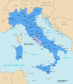
 Italia 1843 ko.svg 3,500 × 4,200; 880 KB
-
 Italia 1843-ca.svg 3,500 × 4,200; 2.74 MB
-
 Italia 1843-en.svg 3,500 × 4,200; 904 KB
-
 Italia 1843-es.svg 3,500 × 4,200; 2.66 MB
-
 Italia 1843-fr.png 885 × 909; 70 KB
-
 Italia 1843-fr.svg 3,500 × 4,200; 900 KB
-
 Italia 1843-hu.svg 3,500 × 4,200; 1.25 MB
-
 Italia 1843.svg 3,500 × 4,200; 1.4 MB
-
 ItaliaUnità.png 387 × 2,293; 60 KB
-
 Italien 1843–1870.png 924 × 953; 215 KB
-
 Italy 1843 de.svg 924 × 1,075; 1.73 MB
-
 Italy 1843-es.svg 3,500 × 4,200; 1.71 MB
-
 Italy 1843-et.svg 3,500 × 4,200; 868 KB
-
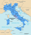
 Italy 1843.svg 3,500 × 4,200; 879 KB
-
 Italy 1864 ca.svg 3,311 × 3,855; 952 KB
-
 Italy 1864 de.svg 924 × 1,065; 1.65 MB
-
 Italy 1864 es.svg 3,311 × 3,855; 1.7 MB
-
 Italy 1870 ca.svg 924 × 1,065; 775 KB
-
 Italy 1870 de.svg 924 × 1,065; 1.03 MB
-
 Italy 1870-ar.svg 924 × 1,065; 1.47 MB
-
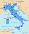
 Italy 1870.svg 924 × 1,065; 895 KB
-
 Italy 1871.svg 924 × 1,065; 887 KB
-
 Jedediah Smith-fr.png 950 × 594; 1,016 KB
-
 JedediahSmithEnglishVersion.png 950 × 594; 940 KB
-
 JedediahSmithGermanVersion.png 950 × 594; 897 KB
-
 JedediahSmithLanguageIndependentVersion.png 950 × 594; 916 KB
-
 Jerusalem1883.jpg 1,444 × 2,064; 712 KB
-
 Jewish languages in the Russian Empire (1897).svg 4,648 × 2,744; 1.4 MB
-
 Kadavu-Fiji 1889.jpg 1,692 × 1,269; 368 KB
-
 KaisertumOsterreich-es.svg 855 × 642; 321 KB
-
 KaisertumOsterreich.png 800 × 593; 213 KB
-
 Karte Baden Hohenzollern Wuerttemberg 1892.jpg 2,000 × 2,636; 4.35 MB
-
 Karte Helvetik 4 Malmaison.png 2,500 × 1,570; 465 KB
-
 Karte Helvetik 4 Malmaison2.png 2,500 × 1,570; 459 KB
-
 Karte Helvetik 4-fr.svg 2,478 × 1,549; 575 KB
-
 Karte Helvetik 4.png 2,500 × 1,570; 448 KB
-
 Karte Mediation-es.svg 2,478 × 1,549; 607 KB
-
 Karte Mediation-fr.svg 2,478 × 1,549; 607 KB
-
 Karte Schweiz 1815.png 2,500 × 1,570; 645 KB
-
 Karte Stockholm MK1888.png 800 × 508; 133 KB
-
 Karte Stockholm Umgebung MK1888.png 773 × 482; 124 KB
-
 Karte vom Amerikanischen Polynesien 1859.jpg 2,034 × 1,564; 546 KB
-
 Kartvelian languages in the Russian Empire (1897).svg 4,648 × 2,744; 1.25 MB
-
 Kazakh language in the Russian Empire (1897).svg 4,648 × 2,744; 1.4 MB
-
 Killikiadana.gif 700 × 520; 52 KB
-
 Kingdom of Bavaria 1812.svg 450 × 456; 607 KB
-
 Kingdom of Bavaria 1815.svg 450 × 456; 812 KB
-
 Kingdom of Hanover 1815.svg 450 × 456; 812 KB
-
 Kingdom of Hungary counties (sk).svg 1,772 × 1,166; 314 KB
-
 Kingdom of Hungary counties (sk-Abovsko-turnianska).svg 1,772 × 1,166; 314 KB
-
 Kingdom of Hungary counties (sk-Aradská).svg 1,772 × 1,166; 314 KB
-
 Kingdom of Hungary counties (sk-Bihárska).svg 1,772 × 1,166; 314 KB
-
 Kingdom of Hungary counties (sk-Bjelovarsko-križevetská).svg 1,772 × 1,166; 314 KB
-
 Kingdom of Hungary counties (sk-Boršodská).svg 1,772 × 1,166; 314 KB
-
 Kingdom of Hungary counties (sk-Brašovská).svg 1,772 × 1,166; 1.21 MB
-
 Kingdom of Hungary counties (sk-Bystricko-nasodská).svg 1,772 × 1,166; 1.21 MB
-
 Kingdom of Hungary counties (sk-Dolnobelehradská).svg 1,772 × 1,166; 314 KB
-
 Kingdom of Hungary counties (sk-Fogarašská).svg 1,772 × 1,166; 315 KB
-
 Kingdom of Hungary counties (sk-Gemersko-malohontská).svg 1,772 × 1,166; 314 KB
-
 Kingdom of Hungary counties (sk-Hajducká).svg 1,772 × 1,166; 314 KB
-
 Kingdom of Hungary counties (sk-Hevešská).svg 1,772 × 1,166; 314 KB
-
 Kingdom of Hungary counties (sk-Hontianska).svg 1,772 × 1,166; 314 KB
-
 Kingdom of Hungary counties (sk-Huňadská).svg 1,772 × 1,166; 1.21 MB
-
 Kingdom of Hungary counties (sk-Háromsecká).svg 1,772 × 1,166; 1.21 MB
-
 Kingdom of Hungary counties (sk-Jasovsko-veľkokumánsko-solnocká).svg 1,772 × 1,166; 314 KB
-
 Kingdom of Hungary counties (sk-Klužská).svg 1,772 × 1,166; 314 KB
-
 Kingdom of Hungary counties (sk-Komárňanská).svg 1,772 × 1,166; 314 KB
-
 Kingdom of Hungary counties (sk-Krasovsko-severinská).svg 1,772 × 1,166; 2.36 MB
-
 Kingdom of Hungary counties (sk-Licko-krbavská).svg 1,772 × 1,166; 314 KB
-
 Kingdom of Hungary counties (sk-Liptovská).svg 1,772 × 1,166; 315 KB
-
 Kingdom of Hungary counties (sk-Malokykulská).svg 1,772 × 1,166; 1.21 MB
-
 Kingdom of Hungary counties (sk-Marmarošská).svg 1,772 × 1,166; 1.21 MB
.jpg)


.svg)


.png)


.jpg)
.jpg)


.svg)

.svg)


.jpg)

.svg)


_1851.jpg)


.jpg)


.JPG)
.svg)


.svg)


_-_Kiepert.jpg)
.png)


.svg)
_Oberreit_1821.jpg)


.svg)
_1802.png)


.jpg)


.svg)


.svg)
.svg)


.svg)
.svg)
.svg)
.svg)
.svg)
.svg)
.svg)
.svg)
.svg)
.svg)
.svg)
.svg)
.svg)
.svg)
.svg)
.svg)
.svg)
.svg)
.svg)
.svg)
.svg)
.svg)
.svg)
.svg)