Category:Maps showing history of the Late Middle Ages
Jump to navigation
Jump to search
- other Main Articles: Late Middle Ages
- See also: High Middle Ages, Early Middle Ages and Atlas of the Middle Ages
The purpose of this category is to provide narrower grouping of events, personages, and places into their more specific traditional third division of the overall Middle Ages. Some entities will necessarily span more than one of these categories.
Historical epoch
[edit]Roughly spans the years: 1300 AD–1520 AD; (From about 1308 - Avignon Papacy established, which splits and weakens the Catholic church, to 1492 with Columbus discovering a New World and to the nascent Reformation when Martin Luther nails his 95 theses to the door)
See also
[edit]- Category:Maps showing the history of the Middle Ages and
- Category:Maps of the history of Europe, Category:History of the Middle East and Category:Maps of the history of Asia, Category:Maps of the history of Africa for following modern era in that region
Subcategories
This category has the following 6 subcategories, out of 6 total.
1
M
- Maps of the Western Schism (15 F)
Media in category "Maps showing history of the Late Middle Ages"
The following 45 files are in this category, out of 45 total.
-
 1346-1353 spread of the Black Death in Europe map-ca.svg 992 × 866; 1.78 MB
-
 1346-1353 spread of the Black Death in Europe map.svg 992 × 866; 1.87 MB
-
 1390 Italien colonies.png 1,652 × 1,221; 1.17 MB
-
 Angevin Europe 1360.jpg 649 × 498; 170 KB
-
 Charles I and V empire.png 782 × 699; 335 KB
-
 Eastern Europe around 1250.jpg 2,049 × 1,621; 2.05 MB
-
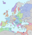
 Europa 1400.jpg 3,054 × 2,436; 2.01 MB
-
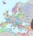
 Europa 1477.JPG 3,036 × 2,418; 2.08 MB
-
 Europe in 1328 (cropped).png 508 × 330; 6 KB
-
 Europe in 1328 112619.png 2,150 × 2,337; 208 KB
-
 Europe in 1328-ko.svg 1,075 × 1,168; 160 KB
-
 Europe in 1328.png 2,150 × 2,336; 761 KB
-
 Europe in 1345.png 1,075 × 1,168; 114 KB
-
 Europe in 1470 (SW crop).png 306 × 291; 12 KB
-
 Europe-1328.png 1,075 × 1,168; 48 KB
-
 Europein Trade 1328.png 1,075 × 1,168; 63 KB
-
 EuropeMap1328-ar.png 1,075 × 1,168; 917 KB
-
 Frieslande.png 2,599 × 1,423; 280 KB
-
 GenoanBlackSea1400.png 432 × 296; 46 KB
-
 Guèrra de Cent Ans (1337-1453).png 563 × 674; 114 KB
-
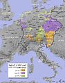 HRR 14Jh-ar.jpg 1,384 × 1,760; 832 KB
-
 HRR 14Jh.jpg 1,384 × 1,760; 728 KB
-
 HRR 14Jh.png 1,384 × 1,760; 2.3 MB
-
 Jagiellon countries 1490m9.PNG 1,214 × 931; 927 KB
-
 Kingdom of Bohemia in 14th Century (German).jpg 591 × 441; 128 KB
-
 Lands under Louis the Great in the middle of the 14th century.jpg 2,304 × 1,800; 922 KB
-
 Late Medieval Trade Routes hu.svg 1,457 × 1,088; 523 KB
-
 Late Medieval Trade Routes.jpg 1,457 × 1,088; 372 KB
-
 Mapamondi Vol Dir Aytant Con Ymage Del Mon E De Les Regions Que.jpg 6,517 × 5,113; 8.44 MB
-
 Mediterranean1400.png 1,215 × 549; 187 KB
-
 Mediterraneans 1328.png 806 × 454; 39 KB
-
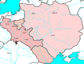
 Princedom of Albania.JPG 458 × 202; 12 KB
-
 Public Schools Historical Atlas - Europe 14th century.jpg 2,023 × 1,552; 1.08 MB
-
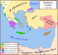 Se Easterna Wendelsæ in 1450.svg 2,529 × 2,395; 278 KB
-
 SerbianEmpire.jpg 640 × 760; 401 KB
-
 South East Europe 1340.gif 1,113 × 854; 363 KB
-
 Sweden Settlement Late Middle Ages Sv.svg 383 × 660; 64 KB
-
 Sweden Settlement Late Middle Ages.svg 393 × 660; 87 KB
-
 Via Imperii.png 376 × 580; 47 KB
-
 Western schism 1378-1417 de.svg 1,000 × 770; 92 KB
-
 Western schism 1378-1417-hu.svg 1,000 × 770; 101 KB
-
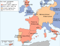
 Western schism 1378–1417 de.png 2,000 × 1,540; 859 KB
-

-
 Índico e rota da Seda século XIV.png 800 × 800; 357 KB
-
 Índico e rota da Seda século XIV.svg 800 × 800; 690 KB


.png)


.png)


.png)


.jpg)


