Category:Newton Valence
Jump to navigation
Jump to search
village in United Kingdom  | |||||
| Upload media | |||||
| Instance of | |||||
|---|---|---|---|---|---|
| Standort | East Hampshire, Hampshire, South East England, England | ||||
 | |||||
English: Newton Valence is a village and civil parish in the East Hampshire district of Hampshire, England. It is 4.4 miles (7.1 km) south of Alton, just off the A32 road.
Subcategories
This category has the following 3 subcategories, out of 3 total.
N
- Newton Valence war memorial (4 F)
Media in category "Newton Valence"
The following 195 files are in this category, out of 195 total.
-
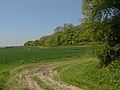
 2016, a year on Geograph (Day 254) - geograph.org.uk - 5111228.jpg 640 × 480; 87 KB
-
 A big puddle - geograph.org.uk - 4810236.jpg 640 × 480; 174 KB
-

-
 A View of Noar Hill, Selborne, Hampshire - geograph.org.uk - 6350937.jpg 2,048 × 1,536; 772 KB
-
 A32 approaches junction with Kitcombe Lane - geograph.org.uk - 3248863.jpg 3,270 × 2,346; 1.27 MB
-
 A32 crossroads with Mary Lane ^ Newton Lane - geograph.org.uk - 3248861.jpg 3,648 × 2,432; 1.35 MB
-
 An autumnal scene on the Noar Road - geograph.org.uk - 3178215.jpg 450 × 640; 83 KB
-
 Approaching the summit of Noar Hill - geograph.org.uk - 3178375.jpg 640 × 480; 84 KB
-
 Autumn on Newton Lane - geograph.org.uk - 3743106.jpg 640 × 480; 167 KB
-
 Bend on Newton Lane - geograph.org.uk - 3797915.jpg 800 × 600; 94 KB
-
 Between Four Marks ^ East Tisted - geograph.org.uk - 3931115.jpg 640 × 480; 73 KB
-
 Bridleway sign near Selborne - geograph.org.uk - 2199747.jpg 800 × 600; 204 KB
-
 Button's Lane - geograph.org.uk - 5403616.jpg 4,000 × 3,000; 4.93 MB
-
 Charity Farm - geograph.org.uk - 2966498.jpg 2,048 × 1,536; 854 KB
-
 Common Lane - geograph.org.uk - 2966869.jpg 2,048 × 1,536; 1.44 MB
-
 Common Lane, Selborne - geograph.org.uk - 2966489.jpg 2,048 × 1,536; 1.33 MB
-
 Concrete road to pumping station - geograph.org.uk - 3746885.jpg 640 × 480; 140 KB
-
 Country road, Selborne - geograph.org.uk - 2966493.jpg 1,796 × 1,347; 576 KB
-
 Cows at Vann Farm - geograph.org.uk - 3178165.jpg 640 × 480; 76 KB
-
 Cyclist in Button's Lane - geograph.org.uk - 3178170.jpg 480 × 640; 127 KB
-
 Cyclist just north of Vann Farm - geograph.org.uk - 3178462.jpg 480 × 640; 105 KB
-
 Descending from High Wood Hanger - geograph.org.uk - 2837578.jpg 4,288 × 3,216; 3.77 MB
-
 Dew Pond, Newton Valence - geograph.org.uk - 2842032.jpg 4,288 × 3,216; 3.36 MB
-
 Disused railway bridge - geograph.org.uk - 3743125.jpg 640 × 480; 158 KB
-
 Downland by Goldridge Plantation - geograph.org.uk - 2843572.jpg 4,288 × 3,216; 3.42 MB
-
 Downland Spring, Farringdon - geograph.org.uk - 2843616.jpg 4,288 × 3,216; 3.7 MB
-
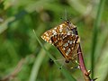 Duke of Burgundy - geograph.org.uk - 2966896.jpg 2,816 × 2,112; 2.04 MB
-
 East Tisted - Pelham Place - geograph.org.uk - 2225807.jpg 3,504 × 2,336; 615 KB
-
 East Tisted, Hampshire - geograph.org.uk - 2255783.jpg 1,800 × 1,200; 985 KB
-
 East Tisted, Hampshire - geograph.org.uk - 2255787.jpg 3,504 × 2,336; 893 KB
-
 Eastern end of Button's Lane - geograph.org.uk - 5403612.jpg 4,000 × 3,000; 5 MB
-
 Empshott Green Ford - geograph.org.uk - 3744788.jpg 3,872 × 2,592; 4.77 MB
-
 Entrance to Goleigh Manor - geograph.org.uk - 2199722.jpg 800 × 600; 150 KB
-
 Ewe Beauty - geograph.org.uk - 2843465.jpg 4,288 × 3,216; 3.54 MB
-

-
 Farmland at Empshott Green - geograph.org.uk - 3178388.jpg 640 × 480; 58 KB
-
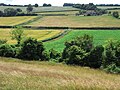 Farmland below Newton Valence - geograph.org.uk - 1590757.jpg 640 × 480; 168 KB
-
 Farmland, Newton Valence - geograph.org.uk - 2229889.jpg 640 × 480; 139 KB
-
 Field at Charity Farm - geograph.org.uk - 3178220.jpg 640 × 480; 74 KB
-
 Field Path, Shotters Farm - geograph.org.uk - 2843267.jpg 4,288 × 3,216; 3.38 MB
-
 Field south of Selborne Hill - geograph.org.uk - 5690395.jpg 640 × 427; 81 KB
-
 Fields below Northfield Hill - geograph.org.uk - 4810188.jpg 640 × 480; 125 KB
-
 Fields near Newton Valence (May 2021).JPG 3,600 × 2,600; 1.7 MB
-
-
 Footpath between Newton Valence and Upper Farringdon (May 2021).JPG 3,600 × 2,600; 1.59 MB
-
 Footpath from Shotters Farm - geograph.org.uk - 2843290.jpg 4,288 × 3,216; 3.67 MB
-

-
 Footpath near Newton Valence - geograph.org.uk - 5048887.jpg 1,600 × 1,200; 973 KB
-

-

-
 Footpath towards Selborne Common - geograph.org.uk - 5048884.jpg 1,600 × 1,200; 850 KB
-
 Footpath west of Selborne - geograph.org.uk - 2218256.jpg 800 × 600; 91 KB
-
 Frog Crossing - geograph.org.uk - 2843249.jpg 4,288 × 3,216; 3.66 MB
-
 Frozen pond, Newton Valence - geograph.org.uk - 1099809.jpg 640 × 480; 71 KB
-
 Gateway to Newton House - geograph.org.uk - 3797912.jpg 800 × 600; 149 KB
-
 Gosport Road south of Farringdon - geograph.org.uk - 5043862.jpg 2,304 × 1,728; 1.57 MB
-
 Half way up Noar Hill - geograph.org.uk - 3178363.jpg 640 × 480; 118 KB
-
 Hampshire, Newton Valence - geograph.org.uk - 2842013.jpg 4,288 × 3,216; 3.5 MB
-
 Hampshire, Newton Valence - geograph.org.uk - 2843318.jpg 4,288 × 3,216; 3.53 MB
-
 Hay Bales, Newton Valence - geograph.org.uk - 2843448.jpg 4,288 × 3,216; 3.6 MB
-
 High Common in mid October - geograph.org.uk - 3178370.jpg 640 × 480; 147 KB
-
 High Wood Hanger - geograph.org.uk - 2837541.jpg 4,288 × 3,216; 3.44 MB
-
 High Wood Hanger - geograph.org.uk - 2966552.jpg 2,048 × 1,536; 1.4 MB
-
 House Lands Plantation - geograph.org.uk - 3746922.jpg 640 × 480; 205 KB
-
 In Field and Out Fields - geograph.org.uk - 2837533.jpg 4,288 × 3,216; 3.47 MB
-
 It's wet and windy... - geograph.org.uk - 3797721.jpg 800 × 600; 168 KB
-
 Ivy Cottage in Newton Valence.jpg 5,184 × 3,888; 6.56 MB
-
 King's Farm - geograph.org.uk - 2966504.jpg 2,048 × 1,536; 1.43 MB
-
 Kitcombe Lane goes west from bend - geograph.org.uk - 3874361.jpg 800 × 600; 236 KB
-
 Lane near Charity Farm - geograph.org.uk - 3178226.jpg 480 × 640; 76 KB
-
 Lines and Stripes - geograph.org.uk - 2843505.jpg 4,288 × 3,216; 3.61 MB
-
-

-

-

-
 Looking into Kitcombe Lane - geograph.org.uk - 3797838.jpg 800 × 600; 123 KB
-

-
 Looking towards Common Lane - geograph.org.uk - 3178349.jpg 640 × 480; 100 KB
-
 Lower Noar Hill Farm - geograph.org.uk - 2837549.jpg 4,288 × 3,216; 3.73 MB
-
 Lower Noar Hill Farm - geograph.org.uk - 2966882.jpg 2,048 × 1,536; 1.48 MB
-
 Mary Lane - geograph.org.uk - 4610726.jpg 3,872 × 2,592; 4.85 MB
-
 Mary Lane - geograph.org.uk - 5020246.jpg 2,304 × 1,728; 811 KB
-
 Mary Lane at the junction of Gosport Road - geograph.org.uk - 5020244.jpg 2,304 × 1,728; 828 KB
-
 Mary Lane at the junction of Gosport Road - geograph.org.uk - 5020245.jpg 2,304 × 1,728; 807 KB
-
 New Year's Eve in Newton Valence - geograph.org.uk - 1099816.jpg 640 × 480; 71 KB
-
 Newton Lane at Inadown Farm - geograph.org.uk - 3797916.jpg 800 × 600; 144 KB
-
 Newton Lane at the junction of Gosport Road - geograph.org.uk - 5020247.jpg 2,304 × 1,728; 817 KB
-
 Newton Lane enters Newton Valence - geograph.org.uk - 2218281.jpg 800 × 600; 138 KB
-
 Newton Valance church - geograph.org.uk - 3743100.jpg 640 × 480; 116 KB
-
 Newton Valence - geograph.org.uk - 2843345.jpg 4,288 × 3,216; 3.5 MB
-
 Newton Valence Church - geograph.org.uk - 2842038.jpg 4,288 × 3,216; 3.22 MB
-
 Newton Valence Farm - geograph.org.uk - 2218266.jpg 800 × 600; 153 KB
-

-
 Newton Valence Place Farm - geograph.org.uk - 2843334.jpg 4,288 × 3,216; 3.36 MB
-
 Newton Valence Place, Newton Valence (May 2021).JPG 2,600 × 2,000; 1.15 MB
-
 Newton Valence pond - geograph.org.uk - 2218294.jpg 800 × 600; 134 KB
-
 Newton Valence war memorial - geograph.org.uk - 4810227.jpg 640 × 428; 194 KB
-
 Newton Valence, Hampshire - panoramio (1).jpg 1,024 × 683; 744 KB
-
 Newton Valence, Hampshire - panoramio.jpg 1,024 × 683; 818 KB
-
 Newton Valence, Hampshire, St Mary - geograph.org.uk - 5907438.jpg 4,608 × 3,456; 5.39 MB
-
 Newton Valence, Modern Font - geograph.org.uk - 2842050.jpg 3,216 × 4,288; 2.77 MB
-
 Newton Valence, Old Font - geograph.org.uk - 2842090.jpg 3,216 × 4,288; 2.14 MB
-
 Noar Hill - geograph.org.uk - 2966516.jpg 2,048 × 1,536; 691 KB
-
 Noar Hill - geograph.org.uk - 2966526.jpg 2,048 × 1,536; 1.43 MB
-
 Noar Hill Common - geograph.org.uk - 2966510.jpg 2,048 × 1,536; 1.44 MB
-
 Noar Hill Hanger - geograph.org.uk - 2947233.jpg 4,288 × 3,216; 3.42 MB
-
 Noar Hill nature reserve - geograph.org.uk - 2966534.jpg 2,048 × 1,536; 1.44 MB
-
 Noar Hill nature reserve - geograph.org.uk - 2966540.jpg 2,025 × 1,517; 849 KB
-
 Noar Hill nature reserve - geograph.org.uk - 2966548.jpg 2,048 × 1,536; 1.42 MB
-
 Noar Hill nature reserve - geograph.org.uk - 2966856.jpg 2,048 × 1,536; 1.42 MB
-
 Noar Hill nature reserve - geograph.org.uk - 2966865.jpg 2,048 × 1,536; 1.43 MB
-
 Noar Hill nature reserve - geograph.org.uk - 2966878.jpg 2,048 × 1,536; 1.49 MB
-
 Old Post Office Cottage in Newton Valence (a bit blurry).jpg 5,184 × 3,888; 5.34 MB
-
 Old Post Office Cottage in Newton Valence.jpg 5,184 × 3,888; 4.61 MB
-
 Path near Goldridge Plantation - geograph.org.uk - 5048074.jpg 1,600 × 1,200; 1.15 MB
-
 Path through High Common - geograph.org.uk - 3178383.jpg 640 × 480; 186 KB
-
 Path to Noar Plantation atop Northfield Hill - geograph.org.uk - 4775554.jpg 1,600 × 1,067; 449 KB
-
 Paths meet, Noar Hill Hanger - geograph.org.uk - 2966520.jpg 2,048 × 1,536; 1.38 MB
-
 Pedestrian Access to Church and Walks - geograph.org.uk - 2218304.jpg 800 × 600; 127 KB
-
 Ploughed field and pylon - geograph.org.uk - 3743135.jpg 640 × 480; 102 KB
-
 Pond at Vann Farm - geograph.org.uk - 3178167.jpg 480 × 640; 129 KB
-
 Pond, Newton Valence - geograph.org.uk - 1338451.jpg 640 × 480; 149 KB
-
 Road forks at Newton Valence - geograph.org.uk - 1099821.jpg 640 × 480; 114 KB
-
 Road junction near Hawkley - geograph.org.uk - 2199717.jpg 800 × 600; 187 KB
-

-
 Rookery Nook - geograph.org.uk - 2841995.jpg 4,288 × 3,216; 3.35 MB
-
 Round the Bend - geograph.org.uk - 2843542.jpg 4,288 × 3,216; 3.63 MB
-
 Selborne Hill - geograph.org.uk - 2837556.jpg 4,288 × 3,216; 3.35 MB
-
 Shotters Lane - geograph.org.uk - 2843301.jpg 4,288 × 3,216; 3.73 MB
-
 Signposts at Newton Valence - geograph.org.uk - 4564923.jpg 4,608 × 3,456; 6.11 MB
-
 Spring on the Downs - geograph.org.uk - 2843594.jpg 4,288 × 3,216; 3.67 MB
-
 St Mary's, Newton Valence - geograph.org.uk - 2842066.jpg 4,288 × 3,216; 3.06 MB
-

-

-

-
-

-

-

-

-
-

-
-

-

-

-

-

-

-

-

-

-

-
-

-

-

-
-

-

-

-
-

-

-

-

-

-
-
 St Mary’s Church, Newton Valence - geograph.org.uk - 4564933.jpg 3,456 × 4,608; 4.98 MB
-

-
 The Barns in Newton Valence.jpg 5,184 × 3,888; 6.87 MB
-
 The village pond, Newton Valence - geograph.org.uk - 4564955.jpg 4,608 × 3,456; 6.06 MB
-
 The way to Newton Lane - geograph.org.uk - 2218171.jpg 800 × 600; 158 KB
-
 The way to Selborne - geograph.org.uk - 2199713.jpg 800 × 556; 171 KB
-
 The yard at Inadown Farm - geograph.org.uk - 3797922.jpg 800 × 600; 121 KB
-
 Track from Newton Valence - geograph.org.uk - 2843483.jpg 4,288 × 3,216; 3.48 MB
-
 Track to Goldridge Plantation - geograph.org.uk - 2843522.jpg 4,288 × 3,216; 3.89 MB
-
 Track towards Newton Valence - geograph.org.uk - 5048067.jpg 1,600 × 1,200; 826 KB
-
 Upper Farringdon Downland - geograph.org.uk - 2843641.jpg 4,288 × 3,216; 3.49 MB
-
 View from Button's Lane - geograph.org.uk - 5403618.jpg 4,000 × 3,000; 4.62 MB
-

-

-
-
 War memorial, Newton Valence - geograph.org.uk - 4564928.jpg 4,608 × 3,456; 5.99 MB
-
 Waterlogged bend on Kitcombe Lane - geograph.org.uk - 3874360.jpg 800 × 600; 227 KB
-
 When is a ford not a ford - geograph.org.uk - 3178418.jpg 640 × 480; 119 KB
-
 Winter Footpath - geograph.org.uk - 2841967.jpg 4,288 × 3,216; 3.79 MB
-
 Winter sky near Selborne - geograph.org.uk - 2199738.jpg 800 × 600; 97 KB
-
 Country Lane, Inadown - geograph.org.uk - 368673.jpg 640 × 480; 136 KB
-
 Inadown from the West - geograph.org.uk - 368683.jpg 640 × 480; 146 KB
-
 Lane Passing Inadown Farm Stables - geograph.org.uk - 368661.jpg 640 × 480; 126 KB
-
 Looking towards Herrings Land Copse - geograph.org.uk - 286288.jpg 640 × 437; 58 KB
-
 Pony Trekking at Inadown - geograph.org.uk - 370981.jpg 640 × 294; 72 KB
-
 Railway Bridge Near Inadown - geograph.org.uk - 368651.jpg 640 × 480; 175 KB
-
 Railway Embankment by Inadown - geograph.org.uk - 368696.jpg 640 × 480; 160 KB
_-_geograph.org.uk_-_5111228.jpg)


.JPG)

.JPG)


_(May_2021).JPG)

.JPG)


.jpg)


.jpg)


_-_geograph.org.uk_-_5116306.jpg)
_-_geograph.org.uk_-_5116308.jpg)
_-_geograph.org.uk_-_5115123.jpg)
_-_geograph.org.uk_-_5115147.jpg)
_-_geograph.org.uk_-_5116090.jpg)
_-_geograph.org.uk_-_5116105.jpg)
_-_geograph.org.uk_-_5116162.jpg)
_-_geograph.org.uk_-_5116179.jpg)
_-_geograph.org.uk_-_5116183.jpg)
_-_geograph.org.uk_-_5116190.jpg)
_-_geograph.org.uk_-_5116200.jpg)
_-_geograph.org.uk_-_5116210.jpg)
_-_geograph.org.uk_-_5115135.jpg)
_-_geograph.org.uk_-_5116225.jpg)
_-_geograph.org.uk_-_5116230.jpg)
_-_geograph.org.uk_-_5116235.jpg)
_-_geograph.org.uk_-_5116239.jpg)
_-_geograph.org.uk_-_5116242.jpg)
_-_geograph.org.uk_-_5116249.jpg)
_-_geograph.org.uk_-_5116252.jpg)
_-_geograph.org.uk_-_5116257.jpg)
_-_geograph.org.uk_-_5116264.jpg)
_-_geograph.org.uk_-_5116278.jpg)
_-_geograph.org.uk_-_5116279.jpg)
_-_geograph.org.uk_-_5115137.jpg)
_-_geograph.org.uk_-_5116282.jpg)
_-_geograph.org.uk_-_5116291.jpg)
_-_geograph.org.uk_-_5116295.jpg)
_-_geograph.org.uk_-_5116300.jpg)
_-_geograph.org.uk_-_5115138.jpg)
_-_geograph.org.uk_-_5115140.jpg)
_-_geograph.org.uk_-_5115142.jpg)
_-_geograph.org.uk_-_5115146.jpg)
_-_geograph.org.uk_-_5115145.jpg)


_-_geograph.org.uk_-_5177854.jpg)
_-_geograph.org.uk_-_5177863.jpg)
_-_geograph.org.uk_-_5177867.jpg)


