Category:October 2015 in Georgia (U.S. state)
Jump to navigation
Jump to search
English: Images/pictures taken in Georgia (U.S. state) during October 2015. Note this is not the date of the upload, nor the date a photo was scanned.
States of the United States: Alabama · Alaska · Arizona · Arkansas · California · Colorado · Connecticut · Delaware · Florida · Georgia · Hawaii · Idaho · Illinois · Indiana · Iowa · Kansas · Louisiana · Maine · Maryland · Massachusetts · Michigan · Minnesota · Mississippi · Missouri · Nebraska · Nevada · New Hampshire · New Jersey · New Mexico · New York · North Carolina · Ohio · Oklahoma · Oregon · Pennsylvania · South Carolina · South Dakota · Tennessee · Texas · Utah · Vermont · Virginia · Washington · West Virginia · Wisconsin · Wyoming – Washington, D.C.
Puerto Rico
Puerto Rico
| October 2014 | ← | October 2015 | → | October 2016 | |||||||||
| Jan | Feb | Mar | Apr | May | Jun | Jul | Aug | Sep | Oct | Nov | Dec | ||
| ← | 235 | 47 | 291 | 251 | 407 | 659 | 249 | 438 | 277 | 245 | 188 | 300 | → |
|---|---|---|---|---|---|---|---|---|---|---|---|---|---|
Subcategories
This category has the following 4 subcategories, out of 4 total.
2
H
- Hahira Honeybee Festival 2015 (27 F)
P
- 2015 Petit Le Mans (48 F)
V
- Valdosta Mall Fall Carnival 2015 (28 F)
Media in category "October 2015 in Georgia (U.S. state)"
The following 200 files are in this category, out of 241 total.
(previous page) (next page)-
 100 Mile Peanut Pickin' Yard Sale, Courthouse Square, Moultrie.JPG 5,152 × 3,864; 7.79 MB
-
 100 Mile Peanut Pickin' Yard Sale, from outside Courthouse Square, Moultrie.JPG 5,152 × 3,864; 7.82 MB
-
 100 Mile Peanut Pickin' Yard Sale, Old Adel Rd, Moultrie.JPG 5,152 × 3,864; 7.66 MB
-
 15-26-083, st. joseph catholic church - panoramio.jpg 3,066 × 2,048; 1.82 MB
-
 1898 gun emplacement on Sapelo Island, GA, US.jpg 6,000 × 4,000; 17.53 MB
-
 Panda Express, GA133, Valdosta.JPG 5,152 × 3,864; 7.81 MB
-
 4s During Take Off (31948403304).jpg 2,400 × 1,600; 2.6 MB
-
 A Sherman Necktie, Ft. McAllister. GA. US.jpg 6,000 × 4,000; 14.29 MB
-
 Alapaha Colored School, Alapaha, GA, US.jpg 6,000 × 3,148; 14.85 MB
-
 Alma Depot, Alma, GA, US.jpg 5,850 × 2,750; 7.32 MB
-
 Ashburn commercial HD, Main st, Ashburn, GA, US.jpg 5,989 × 3,261; 10.54 MB
-
 Aspen Dental, Valdosta.JPG 5,152 × 3,864; 7.82 MB
-
 Atlanta Navy Week 151028-N-QH078-019.jpg 1,500 × 2,100; 473 KB
-
 Atlanta Navy Week 151028-N-QH078-184.jpg 2,100 × 1,500; 785 KB
-
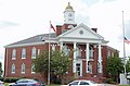 Bacon County Courthouse, Alma, GA, US.jpg 5,636 × 3,693; 9.36 MB
-
 Benton MacKaye Trail, Gilmer County, Georgia.JPG 3,456 × 2,304; 6.86 MB
-
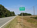 Berlin City Limits, GA 133 NB.JPG 5,152 × 3,864; 7.89 MB
-
 Bird's Eye 75 (31948398834).jpg 1,600 × 2,400; 2.2 MB
-

-
 Brick street in Waycross Historic District, GA, US.jpg 6,000 × 4,000; 13.53 MB
-
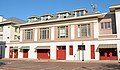
 Brooks County Fire Engine.JPG 5,152 × 3,864; 7.8 MB
-
 Brooks County limit, GA133SB.JPG 5,152 × 3,864; 7.93 MB
-
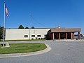
 Brooks County Quitman Fire Rescue.JPG 5,152 × 3,864; 7.8 MB
-
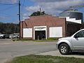
 Bryan Transfer and Storage wide view.JPG 640 × 480; 66 KB
-
 Building @ Poplar St. Lane and 5th.JPG 640 × 480; 67 KB
-
 Building at 5th and Poplar Street Lane Corner.JPG 640 × 480; 66 KB
-
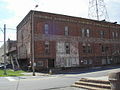 Building at Poplar Street and 5th corner.JPG 640 × 480; 66 KB
-
 Buildings at corner of Pendelton and Elizabeth, Waycross Historic District, GA, US.jpg 6,000 × 2,579; 9.92 MB
-
 Burns Brick Kiln.JPG 640 × 480; 70 KB
-
 Burns Brick Shed.JPG 640 × 480; 76 KB
-
 Burns Brick Signage on Kiln.JPG 640 × 480; 72 KB
-
 Burns Brick South View.JPG 640 × 480; 78 KB
-
 Burns Brick Wide View.JPG 640 × 480; 70 KB
-
 Cannon on earth works at Fort McAllister, GA, US.jpg 6,000 × 4,000; 19.89 MB
-
 Central of Gerogia Coal Tower and Chute.JPG 480 × 640; 64 KB
-
 Cherokee Brick and Tile signage on building.JPG 640 × 480; 66 KB
-
 City Cemetery Alternate View.JPG 640 × 480; 64 KB
-
 City Cemetery Archway.JPG 640 × 480; 65 KB
-
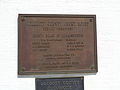
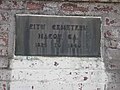 City Cemetery Plaque.JPG 640 × 480; 65 KB
-
 City Cemetery View.JPG 640 × 480; 65 KB
-
 Colquitt County Courthouse Annex (SW corner).JPG 5,152 × 3,864; 7.81 MB
-
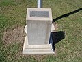
 Colquitt County Courthouse, Geodetic Survey Bench Mark.JPG 5,152 × 3,864; 7.71 MB
-
 Colquitt County Courthouse, rebuilt plaque.JPG 5,152 × 3,864; 7.89 MB
-
 Colquitt County Line, GA 133 NB.JPG 5,152 × 3,864; 7.94 MB
-
 Colquitt Regional Medical Center.JPG 5,152 × 3,864; 7.94 MB
-
 Columbiad cannon (1964 reproduction) at Fort McAllister, GA, US.jpg 6,000 × 4,000; 15.5 MB
-
 Conagra, Inc.JPG 480 × 640; 66 KB
-
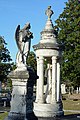
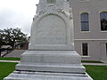 Confederate Soldiers Obelisk inscription, Thomas County Courthouse lawn.JPG 5,152 × 3,864; 7.82 MB
-
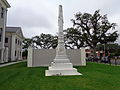 Confederate Soldiers Obelisk, Thomas County Courthouse lawn.JPG 5,152 × 3,864; 7.92 MB
-
 Confederate Statue (East face), Quitman.JPG 5,152 × 3,864; 7.84 MB
-
 Confederate Statue, Quitman.JPG 5,152 × 3,864; 7.81 MB
-
 Convenient Care Pharmacy, Moultrie.JPG 5,152 × 3,864; 7.9 MB
-
 Cotton field, Berlin.JPG 5,152 × 3,864; 7.92 MB
-
 Cotton field, Ware County, GA, US.jpg 6,000 × 4,000; 17.26 MB
-
 Cotton picker and farm equipment, Brooks County cotton field.JPG 5,152 × 3,864; 7.87 MB
-
 Cotton picker on GA122, Brooks County.JPG 3,264 × 2,448; 1.09 MB
-
 Cotton picker, Brooks County cotton field.JPG 5,152 × 3,864; 7.81 MB
-
 Cotton plant, Ware County, GA, US.jpg 6,000 × 4,000; 9.57 MB
-
 Cowpen Mountain, Georgia Oct 2015.jpg 3,456 × 2,304; 3.31 MB
-
 Ditch with wooden spikes at Fort McAllister, GA, US.jpg 6,000 × 4,000; 23.79 MB
-
 Downtown Waycross Historic District details (1).JPG 4,000 × 6,000; 11.76 MB
-
 Downtown Waycross Historic District details (15).JPG 6,000 × 4,000; 14.89 MB
-
 Downtown Waycross Historic District details (17).JPG 4,000 × 6,000; 17.2 MB
-
 Downtown Waycross Historic District details (18).JPG 6,000 × 4,000; 11.6 MB
-
 Downtown Waycross Historic District details (2).JPG 4,000 × 6,000; 10.74 MB
-
 Downtown Waycross Historic District details (23).JPG 4,000 × 6,000; 8.66 MB
-
 Downtown Waycross Historic District details (24).JPG 4,000 × 6,000; 8.38 MB
-
 Downtown Waycross Historic District details (25).JPG 6,000 × 4,000; 10.81 MB
-
 Downtown Waycross Historic District details (26).JPG 6,000 × 4,000; 9.8 MB
-
 Dulpin River, McIntosh County, GA, US.jpg 6,000 × 4,000; 15.58 MB
-
 Earth works at Fort McAllister, GA, US.jpg 6,000 × 4,000; 20.34 MB
-
 Fire Ant Festival sign, Ashburn, GA, US.jpg 3,540 × 3,900; 7.03 MB
-
 First African Baptist Church, corner detail, Waycross, GA, US.jpg 4,000 × 6,000; 13.7 MB
-
 First African Baptist Church, corner, Waycross, GA, US.jpg 3,532 × 5,816; 11.16 MB
-
 First African Baptist Church, detail above entrance, Waycross, GA, US.jpg 6,000 × 4,000; 11.03 MB
-
 First African Baptist Church, entrance, Waycross, GA, US.jpg 6,000 × 4,000; 10.38 MB
-
 First African Baptist Church, front closer, Waycross, GA, US.jpg 4,000 × 6,000; 11.31 MB
-
 First African Baptist Church, front door, Waycross, GA, US.jpg 4,000 × 6,000; 10 MB
-
 First African Baptist Church, front, Waycross, GA, US.jpg 5,016 × 3,797; 10.89 MB
-
 First African Baptist Church, side, Waycross, GA, US.jpg 5,991 × 3,749; 13.25 MB
-
 First African Baptist Church, spire detail, Waycross, GA, US.jpg 4,000 × 6,000; 11.86 MB
-
 Flag of Fort McAllister, GA, US.jpg 5,748 × 3,664; 13.22 MB
-
 Former school, Morven.JPG 5,152 × 3,864; 7.72 MB
-
 Fort McAllister battle flag, GA, US.jpg 5,569 × 3,888; 14.62 MB
-
 Georgia National Guard filling sandbags.jpg 2,048 × 1,464; 554 KB
-
 Georgia State Parks seal.jpg 4,397 × 3,900; 13.08 MB
-
 Georgia State Route 2 in Young Harris, Georgia.JPG 3,456 × 2,304; 5.66 MB
-
 Goo Goo Car Wash, Valdosta.JPG 5,152 × 3,864; 7.89 MB
-
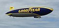 Goodyear N1A Wingfoot One Airship (a).JPG 1,556 × 755; 207 KB
-
 Goodyear N1A Wingfoot One Airship.JPG 3,264 × 2,448; 1.21 MB
-
 Gorgeous Cemetery Lily Koi Pond.jpg 2,432 × 4,320; 3.21 MB
-
 Halloween snacks, Valdosta office 2015.JPG 5,152 × 3,864; 7.78 MB
-
 Hightower Bald (22016608280).jpg 3,456 × 2,304; 5.3 MB
-
 Hightower Bald (22016932848).jpg 3,456 × 2,304; 5.27 MB
-
 Hightower Bald 1.JPG 3,456 × 2,304; 4 MB
-
 Hightower Bald 2.JPG 3,456 × 2,304; 6.65 MB
-
 Hightower Bald 3.JPG 3,456 × 2,304; 5.56 MB
-
 Hog Hammock store and Post Office, Sapelo Island, GA, US.jpg 6,000 × 4,000; 12.76 MB
-
 Hot Shot furnace at Fort McAllister, GA, US.jpg 6,000 × 4,000; 16.56 MB
-
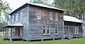
 House at 414 Park Ave in the Tifton Residential Historic District, Tifton, GA, US.jpg 6,000 × 4,000; 13.77 MB
-
 House at 424 Park Ave in the Tifton Residential Historic District, Tifton, GA, US.jpg 6,000 × 4,000; 14.43 MB
-

-
 House at 602 Park Ave, in Tifton Residential Historic District, Tifton, GA, US.jpg 6,000 × 4,000; 13.49 MB
-
 House at 614 N Park Ave in the Tifton Residential Historic District, Tifton, GA, US.jpg 5,884 × 3,502; 13.34 MB
-
 James W Wagner Oct2015.jpg 839 × 808; 79 KB
-
 Jeff Davis marker by United Daughters of the Confederacy, Irwin county, GA, US.jpg 6,000 × 4,000; 19.41 MB
-
 Jefferson Davis Highway marker, Irwin County, GA, US.jpg 4,000 × 6,000; 16.09 MB
-
 Jefferson Davis Memorial left marker, Irwin County, GA, US.jpg 4,475 × 3,978; 9.19 MB
-
 Jefferson Davis Memorial right marker, Irwin County, GA, US.jpg 4,723 × 3,995; 8.39 MB
-
 Jet at Moultrie Municipal Airport.JPG 5,152 × 3,864; 7.85 MB
-
 Kennesaw Mountain High School - panoramio.jpg 3,456 × 2,304; 3.41 MB
-
 Kim's Kitchen, Valdosta.JPG 5,152 × 3,864; 7.75 MB
-
 Library, Poulan, GA, US.jpg 6,000 × 4,000; 15.89 MB
-
 Lonnie A. Pope House, Douglas, GA, US.jpg 4,442 × 3,978; 11.24 MB
-
 Lott Cemetery -1, Waycross, GA, US.jpg 4,000 × 6,000; 13.54 MB
-
 Lott Cemetery -2, Waycross, GA, US.jpg 6,000 × 4,000; 17.03 MB
-
 Lott Cemetery -3, Waycross, GA, US.jpg 6,000 × 4,000; 14.91 MB
-
 Lott Cemetery -4, Waycross, GA, US.jpg 6,000 × 4,000; 19.64 MB
-
 Lott Cemetery -5, Waycross, GA, US.jpg 4,000 × 6,000; 16.17 MB
-
 Lyric Theater, Waycross Historic District, GA, US.jpg 6,000 × 4,000; 17.55 MB
-
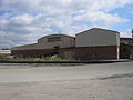
 Macon Grocery Company wide view.JPG 640 × 480; 66 KB
-
 Macon Public Works - Bass Bldg.JPG 640 × 480; 67 KB
-
 Macon Public Works - Hardy Bldg.JPG 640 × 480; 66 KB
-
 Macon Public Works - Vehicle Maintenance.JPG 640 × 480; 66 KB
-
 Martin Stadium, Valdosta.JPG 5,152 × 3,864; 7.85 MB
-
 Miles Wilsey house, near Fitzgerald, GA, US.jpg 5,894 × 3,378; 14.1 MB
-
 More buildings at Cherokee Brick and Tile.JPG 640 × 480; 67 KB
-
 Morven City limit, GA133NB.JPG 5,152 × 3,864; 7.88 MB
-
 Morven City limit, GA133SB.JPG 5,152 × 3,864; 7.94 MB
-
 Morven water tower from Siloam St.JPG 5,152 × 3,864; 7.83 MB
-
 Moultrie Commercial Building, Geodetic Survey Bench Mark.JPG 5,152 × 3,864; 7.85 MB
-
 Moultrie Commercial Building, tiled entryway at top of steps.jpg 5,152 × 3,864; 7.78 MB
-
 Moultrie Municipal Airport terminal.JPG 5,152 × 3,864; 7.98 MB
-
 Moultrie Municipal Airport, flagpole Woodmen of the World plaque.JPG 5,152 × 3,864; 7.87 MB
-
 Moultrie Municipal Airport.JPG 5,152 × 3,864; 7.91 MB
-
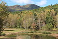
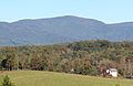 Mount Oglethorpe October 2015.jpg 2,670 × 1,726; 3.11 MB
-
 Mt. Calvary Universal Holiness Church.JPG 5,152 × 3,864; 7.87 MB
-
 Munitions at Fort McAllister, GA, US.jpg 5,722 × 3,570; 9.44 MB
-
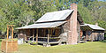 Obediah Barber homestead - house, kitchen, and well, Ware County, GA, US.jpg 5,987 × 3,006; 16.95 MB
-
 Obediah Barber Homestead well, Ware County, GA, US.jpg 4,000 × 6,000; 16.33 MB
-
 Obediah Barber Homestead, inside, Ware County, GA, US.jpg 6,000 × 4,000; 17.45 MB
-
 Obediah Barber Homestead, log details, Ware County, GA, US.jpg 6,000 × 4,000; 17.97 MB
-
 Obediah Barber Homestead, main house, Ware County, GA, US.jpg 6,000 × 4,000; 22.02 MB
-
 Obediah Barber Homestead, porch, Ware County, GA, US.jpg 6,000 × 4,000; 12.71 MB
-
 Obediah Barber Homestead, side details, Ware County, GA, US.jpg 6,000 × 4,000; 17.15 MB
-
 Old hospital, back, Waycross, GA, US.jpg 5,873 × 2,657; 12.69 MB
-
 Old hospital, Waycross, GA, US.jpg 5,915 × 3,996; 15.3 MB
-
 Old Kress building and other stores, Waycross Historic District, GA, US.jpg 6,000 × 3,546; 12.27 MB
-

-
 Phoenix Hotel detail 1, Waycross, GA, US.jpg 3,973 × 4,875; 9.69 MB
-
 Phoenix Hotel detail 2, Waycross, GA, US.jpg 4,000 × 6,000; 11.55 MB
-
 Phoenix Hotel detail 3, Waycross, GA, US.jpg 4,000 × 6,000; 9.9 MB
-
 Phoenix Hotel detail 4, Waycross, GA, US.jpg 4,000 × 6,000; 13.49 MB
-
 Phoenix Hotel detail 5, Waycross, GA, US.jpg 4,000 × 6,000; 9.34 MB
-
 Phoenix Hotel entrance, Waycross, GA, US.jpg 6,000 × 4,000; 12.64 MB
-
 Phoenix Hotel front, Waycross, GA, US.jpg 6,000 × 4,000; 11.89 MB
-
 Phoenix Hotel south side, Waycross, GA, US.jpg 6,000 × 4,000; 13.81 MB
-
 Phoenix Hotel west side, Waycross, GA, US.jpg 5,986 × 3,499; 10.46 MB
-
 Pine Log Mountain in the clouds (22103551822).jpg 3,456 × 2,304; 2.91 MB
-
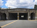 Poplar Street Underpass.JPG 640 × 480; 77 KB
-
 Possum Poke, building near one entrance, Poulan, GA, US.jpg 5,995 × 3,362; 13.59 MB
-
 Pumpkin Patch on N Patterson St, Valdosta, 2015.JPG 5,152 × 3,864; 7.79 MB
-
 Pumpkin Patch, Park Avenue United Methodist Church 1, Valdosta, 2015.JPG 5,152 × 3,864; 7.83 MB
-
 Pumpkin Patch, Park Avenue United Methodist Church 2, Valdosta, 2015.JPG 5,152 × 3,864; 7.87 MB
-
 Quitman Fire Engine 1.JPG 5,152 × 3,864; 7.88 MB
-
 Railtracks on 5th.JPG 640 × 480; 66 KB
-
 Rich Mountain (21528880133).jpg 3,456 × 2,304; 4.21 MB
-
 Rich Mountain Road (22243153092).jpg 3,456 × 2,304; 6.56 MB
-
 Rich Mountain Road (22266436591).jpg 3,456 × 2,304; 6.08 MB
-
 Rich Mountain Road entrance (21634930943).jpg 3,456 × 2,304; 6.34 MB
-
 Rich Mountain viewed from GA SR 515.jpg 2,179 × 1,408; 2.1 MB
-
 Rich Mountains (22229661866).jpg 3,456 × 2,304; 3.67 MB
-
 Ritz Theater, Waycross Historic District, GA, US.jpg 6,000 × 4,000; 12.18 MB
-
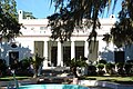 RJ Reynolds mansion, Sapelo Island, GA, US.jpg 6,000 × 4,000; 15.79 MB
-
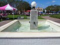 Roswell Gustavus Clark fountain, Moultrie.JPG 5,152 × 3,864; 7.77 MB
-
 Round bales of cotton, Brooks County cotton field.JPG 5,152 × 3,864; 7.92 MB
-
 Row of stores, Waycross Historic District, GA, US.jpg 5,996 × 3,006; 9.6 MB
-
 RR Bridge on Lower Popular at Macon Publc Works.JPG 640 × 480; 67 KB
-
 Russula ballouii 570494.jpg 4,000 × 2,370; 3.5 MB
-
 Russula ballouii Peck 570495.jpg 4,000 × 2,667; 3.3 MB
-
 Russula ballouii Peck 570497.jpg 4,000 × 2,863; 3.8 MB
-
 Russula ballouii Peck 570498.jpg 4,000 × 2,667; 3.2 MB
-
 Russula ballouii Peck 570499.jpg 4,000 × 3,280; 3.73 MB
-
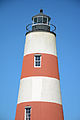
 Salelo Island Lighthouse - current light, GA, US.jpg 3,809 × 5,972; 11.58 MB
-
 Sapelo Island Lighthouse building, GA, US.jpg 6,000 × 4,000; 15.65 MB
-
 Sapelo Island Lighthouse cistern, GA, US.jpg 6,000 × 4,000; 15.88 MB
-
 Sapelo Island Lighthouse inside, GA, US.jpg 4,000 × 6,000; 16.17 MB
-
 Sapelo Island Lighthouse top, GA, US.jpg 4,000 × 6,000; 13.59 MB
-
 Sapelo Island Lighthouse, GA, US.jpg 2,366 × 5,707; 7.93 MB
-
 Sapelo Island Range Light (1), GA, US.jpg 4,000 × 6,000; 14.82 MB
-
 Sapelo Island Range Light (2), GA, US.jpg 4,000 × 6,000; 15.87 MB
-
 Smok'n Pig, Norman Dr, Valdosta.JPG 5,152 × 3,864; 7.81 MB
-
 Spirit N505NK Airbus A320 (24232841215).jpg 2,400 × 1,600; 1.59 MB
-
 Springer Mountain and Black Mountain seen from East Ellijay.jpg 2,383 × 1,395; 2.28 MB
-
 Springer Mountain viewed from East Ellijay.jpg 1,846 × 1,060; 1.42 MB
-
 St. Lukes Church, Sapelo Island, GA, US.jpg 3,921 × 3,560; 11.07 MB
-
 Stone's, Moultrie.JPG 5,152 × 3,864; 7.96 MB
-
 Sunbury Road marker, Midway, GA, US.jpg 4,835 × 4,000; 13.36 MB
-
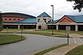
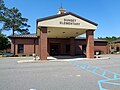 Sunset Elementary School, Moultrie.JPG 5,152 × 3,864; 7.91 MB
-
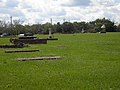
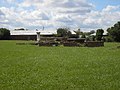
 Tabby ruins of 1809 sugar mill, Sapelo Island, GA, US.jpg 6,000 × 3,337; 13.95 MB


.jpg)


.jpg)
.jpg)


.JPG)


_at_Fort_McAllister,_GA,_US.jpg)


,_Quitman.JPG)


.JPG)
.JPG)
.JPG)
.JPG)
.JPG)
.JPG)
.JPG)
.JPG)
.JPG)


.JPG)


.jpg)
.jpg)


.jpg)


.jpg)
.jpg)
.jpg)
.jpg)

.jpg)


,_GA,_US.jpg)
,_GA,_US.jpg)

.jpg)


&filefrom=Taylor+Iron+Works+other+side.JPG#mw-category-media)