Category:Pictured Rocks National Lakeshore
Jump to navigation
Jump to search
U.S. National Lakeshore on Lake Superior  | |||||
| Upload media | |||||
| Instance of | |||||
|---|---|---|---|---|---|
| Location | Michigan | ||||
| Located in or next to body of water | |||||
| Operator | |||||
| IUCN protected areas category | |||||
| Visitors per year |
| ||||
| official website | |||||
 | |||||
English: Pictured Rocks National Lakeshore — in Alger County, Upper Michigan.
- Located on Lake Superior in the Upper Peninsula of Michigan.
Subcategories
This category has the following 21 subcategories, out of 21 total.
Media in category "Pictured Rocks National Lakeshore"
The following 200 files are in this category, out of 502 total.
(previous page) (next page)-
 19970720 12 Pictured Rocks National Lakeshore, MI (5882478922).jpg 1,799 × 1,128; 310 KB
-
 19970720 14 Pictured Rocks National Lakeshore, MI (5881919639).jpg 1,799 × 1,128; 209 KB
-
 A bit of color hidden in the dunes. (b838d79f-f2f1-42a3-a3b3-f470bf8b8c34).jpg 4,608 × 3,055; 2.61 MB
-

-
 A section called Coves on Lake Superior (94c58527-c29d-425e-96d4-bd1390d4ff50).JPG 4,032 × 3,024; 3.77 MB
-
 Amer0277 (9719177010).jpg 4,288 × 2,848; 10.7 MB
-

-
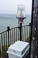
 Au Sable Light Station (a5e2aac3-c784-4586-8131-d4010569a26f).JPG 5,472 × 3,648; 14.25 MB
-

-

-

-

-

-

-

-
 Pictured Rocks, Lake Superior, Michigan (NYPL b12647398-69701).tiff 2,408 × 1,579; 10.88 MB
-
 Pictured Rocks, Lake Superior, Michigan (NYPL b12647398-69702).tiff 2,400 × 1,599; 10.99 MB
-
 Pictured Rocks, Lake Superior, Michigan (NYPL b12647398-69703).tiff 1,579 × 2,368; 10.72 MB
-

-

-
 Beach at Lake Superior Overlook (83254bde-3905-46f6-8ceb-c6d7415cc99b).jpeg 3,264 × 2,448; 3.78 MB
-
 Beach near the Beaver Basin WIlderness Area (8838030e-2146-4221-8847-a8ecbb4aec57).JPG 4,032 × 3,024; 2.13 MB
-
 Beaver Basin Overlook in the fall (e7be8d78-d557-4960-a8b5-f30989257a7b).jpg 3,264 × 2,448; 2.55 MB
-
 Beaver Basin Wilderness Overlook (07c22132-9014-44d0-bca3-1ee393480b4e).JPG 4,032 × 3,024; 3.02 MB
-
 Beaver Lake in the Wilderness (df8768cb-140f-4c06-aeac-a32b5ea19773).JPG 3,264 × 2,448; 2.52 MB
-
 Beaver Lake to Little Beaver Lake (98843e5d-7679-46a4-b87e-df08aee6d878).JPG 3,024 × 4,032; 5.02 MB
-
 Beaver Lake view from a trail. (2c171034-2117-4fed-a540-08de8d5472b4).JPG 3,264 × 2,448; 3.23 MB
-
 Birch Trees Overlooking Pictured Rocks.jpg 3,130 × 2,075; 7.59 MB
-
 Black streaked cliffs in the fall (72ee23e3-dbac-44da-b6fa-2a39f9c32d52).jpg 4,068 × 2,484; 6.25 MB
-
-
 Boat Tour along the Cliffs (e10c4feb-7e35-42fb-89d7-48265144cc87).JPG 4,000 × 3,000; 4.03 MB
-
 Boat Tour Along the Cliffs (f33d21d2-151d-4f20-a9c7-f73feb01e74b).TIF 1,080 × 1,920; 3.9 MB
-
 Boat Tour along the cliffs in fall (e1553e9e-d02e-432b-b276-43d7ef4862df).JPG 4,032 × 3,024; 2.91 MB
-
 Camping at Twelvemile Beach Campground (b1fffbd3-4c4e-4c49-b72e-f23cb7e9c8df).JPG 3,944 × 2,887; 8.34 MB
-
 Canoeing at Beaver Basin Wilderness (3cb10986-2c90-417d-9ce7-5898bf906163).jpg 1,653 × 1,996; 460 KB
-
 Chapel Beach (6edf50e9-7413-4434-a871-6aa6305743c8).jpg 3,008 × 2,000; 4.32 MB
-

-
 Cliff at Pictured Rocks.jpg 3,648 × 2,736; 2.51 MB
-
 Cliff wall along Lake Superior (b49a0771-68b2-4fa1-9a15-32b631abc97e).JPG 4,608 × 3,456; 3.39 MB
-
 Cliff-line at Pictured Rocks NL (ac2cec5d-a41d-4379-bd89-9518485099c6).JPG 3,264 × 2,448; 3.28 MB
-
 Cliffs near Spray Falls (4a03645f-bf0d-43f4-b614-b69741ef9ca0).JPG 3,264 × 2,448; 2.44 MB
-
 Cliffs of Pictured Rocks National Lake Shore.jpg 4,000 × 2,857; 5.93 MB
-

-
-
 Coast Guard Rescue Boat Grand Marias (40222114-99ae-46cf-913b-6a3cc6198445).JPG 1,753 × 2,337; 813 KB
-
 Colorful Cliffs at Pictured Rocks NL (0541c840-6f8b-4c7c-b7d4-460ef2d2e8de).JPG 4,608 × 3,456; 3.58 MB
-
 Coves along Lake Superior (adb020e4-ce28-425d-8eed-dd14b3b07dc4).JPG 4,032 × 3,024; 4.76 MB
-
 Cross Country Ski Trail (c643db67-db0b-4172-b869-04232201f9d3).JPG 2,448 × 3,264; 2.98 MB
-
 DMP sampling at PIRO (77078185-98ce-46e3-87cf-5fe5b90e6915).JPG 3,264 × 2,448; 1.39 MB
-
 Dryer Hose Ice Formation (4dbd74b6-87cd-472d-9106-749ff4b7a107).JPG 3,896 × 5,348; 4.74 MB
-
 East end of Miners (67b96ce0-d16a-44cd-a1a3-406bec1544af).JPG 4,032 × 3,024; 4.01 MB
-
 Enjoying a Boat Tour (c1881687-9909-436c-9a38-c06fe67c108b).JPG 4,032 × 3,024; 2.92 MB
-
 Enjoying the Boat Tour (3883e3af-40db-4890-ae19-41159c7efff7).jpg 2,669 × 1,985; 712 KB
-
 Entering Beaver Basin Wilderness Michigan (30767570610).jpg 5,760 × 3,840; 12.11 MB
-
 Fall near Miners Beach East (7f9c1835-1397-410e-b3f6-e369e9e19558).JPG 4,608 × 3,456; 3.97 MB
-
 Fishing the Miners River (200fea21-a0bf-4a48-838d-262cbb994b18).JPG 3,008 × 2,000; 3.12 MB
-

-
 Frozen Lake Superior shoreline (6264ee06-e64a-49e9-ac7f-0e8d9dc53694).JPG 4,032 × 3,024; 2.82 MB
-
 Frozen Lake Superior shoreline (861d3d4d-5db7-44db-b660-53769225c20c).JPG 4,032 × 3,024; 2.33 MB
-
 Frozen Munising Bay Looking at Grand Island (1b6ff441-8d5d-4551-a826-665d71308e0a).JPG 3,264 × 2,448; 1.61 MB
-
 Frozen Sable Creek (4b8f97a5-5fcb-436b-860a-652e6195732d).JPG 4,608 × 3,456; 7.28 MB
-
 Getting Ready to go Kayaking (e0a9281a-74ae-4856-be4d-ef634918db52).JPG 3,264 × 2,448; 3.08 MB
-
 Gfp-michigan-pictured-national-lakeshore-red-skies-over-the-forest.jpg 3,413 × 2,169; 1.11 MB
-
 Gfp-michigan-pictured-rocks-national-lakeshore-afternoon-sun-on-the-dune.jpg 3,365 × 2,225; 727 KB
-
 Gfp-michigan-pictured-rocks-national-lakeshore-another-sunset-over-the-dunes.jpg 3,370 × 2,188; 899 KB
-
-
 Gfp-michigan-pictured-rocks-national-lakeshore-colorful-sunset-over-lake-superior.jpg 3,392 × 2,243; 683 KB
-
 Gfp-michigan-pictured-rocks-national-lakeshore-creek0on-the-trail.jpg 3,348 × 2,196; 2.08 MB
-
 Gfp-michigan-pictured-rocks-national-lakeshore-dusk-over-lake.jpg 3,247 × 2,083; 1,014 KB
-
 Gfp-michigan-pictured-rocks-national-lakeshore-dusk-over-the-dunes.jpg 3,138 × 2,236; 538 KB
-
 Gfp-michigan-pictured-rocks-national-lakeshore-horizon-on-a-cold-lake.jpg 3,173 × 2,089; 586 KB
-
 Gfp-michigan-pictured-rocks-national-lakeshore-ice-on-the-lake.jpg 3,352 × 2,223; 1.03 MB
-
 Gfp-michigan-pictured-rocks-national-lakeshore-icy-bay.jpg 3,258 × 2,252; 985 KB
-
 Gfp-michigan-pictured-rocks-national-lakeshore-lake-landscape.jpg 3,311 × 2,197; 731 KB
-
 Gfp-michigan-pictured-rocks-national-lakeshore-lake-superior-between-the-dunes.jpg 3,373 × 2,199; 1.06 MB
-
 Gfp-michigan-pictured-rocks-national-lakeshore-lake-through-the-trees.jpg 3,315 × 2,203; 1.72 MB
-
 Gfp-michigan-pictured-rocks-national-lakeshore-lakeshore-and-beach.jpg 3,405 × 2,228; 739 KB
-
 Gfp-michigan-pictured-rocks-national-lakeshore-lakeshore-at-dusk.jpg 3,283 × 2,206; 1.02 MB
-
 Gfp-michigan-pictured-rocks-national-lakeshore-lakeshore-of-superior.jpg 3,387 × 2,240; 787 KB
-
 Gfp-michigan-pictured-rocks-national-lakeshore-mouth-of-the-hurricane-river.jpg 3,337 × 2,136; 1.97 MB
-
 Gfp-michigan-pictured-rocks-national-lakeshore-red-sunset-over-the-lake.jpg 3,373 × 2,165; 720 KB
-
 Gfp-michigan-pictured-rocks-national-lakeshore-scenic-shoreline.jpg 3,373 × 2,201; 582 KB
-
 Gfp-michigan-pictured-rocks-national-lakeshore-shore-and-sand-point.jpg 3,347 × 2,203; 787 KB
-
 Gfp-michigan-pictured-rocks-national-lakeshore-skies-over-the-dunes.jpg 3,361 × 2,224; 910 KB
-
 Gfp-michigan-pictured-rocks-national-lakeshore-stream-at-munising-falls.jpg 3,351 × 2,239; 2.22 MB
-
 Gfp-michigan-pictured-rocks-national-lakeshore-sunset-over-lake-and-forest.jpg 3,456 × 2,304; 604 KB
-
 Gfp-michigan-pictured-rocks-national-lakeshore-sunset-over-pine-forest-and-sky.jpg 3,368 × 2,244; 959 KB
-
 Gfp-michigan-pictured-rocks-national-lakeshore-sunset-over-the-dune.jpg 3,358 × 2,196; 713 KB
-
 Gfp-michigan-pictured-rocks-national-lakeshore-sunset-over-the-dunes-and-forest.jpg 3,367 × 2,208; 2.32 MB
-
 Gfp-michigan-pictured-rocks-national-lakeshore-sunset-over-the-dunes.jpg 3,347 × 2,016; 715 KB
-
 Gfp-michigan-pictured-rocks-national-lakeshore-the-water-of-alek-superior.jpg 3,304 × 2,170; 679 KB
-
 Gfp-michigan-pictured-rocks-national-lakeshore-water-and-snow.jpg 3,376 × 2,227; 576 KB
-
 Gfp-michigan-pictured-rocks-national-lakeshore.jpg 3,393 × 2,251; 1,008 KB
-
 Glorious Oranges, Yellows, and Reds of the H-58 Roadside Trees.jpg 4,608 × 3,456; 3.73 MB
-
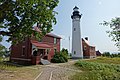
 Grand Marais Ranger Station (a72a2f98-cadd-456e-9741-375be96e3128).JPG 4,032 × 3,024; 4.16 MB
-
 Grand Marais ranger station (June 2021).jpg 5,183 × 2,916; 3.16 MB
-
 Green Frog (Rana clamitans melanota) (a2675b22-21c8-4269-a5fc-a8e9ed675a39).JPG 4,608 × 2,592; 2.94 MB
-

-
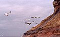
 Gull at Hurricane River (c02ff0d6-bbf1-e724-dbce-8acd0aaf9b6d).jpg 3,264 × 2,448; 1.47 MB
-
 H-58 in Fall (e9e52827-1d4f-4c4c-86ac-3bcb7344efd8).JPG 3,264 × 2,448; 4.29 MB
-
 Hurricane Beach (5bd424b5-988c-4286-a39b-4ccd2731e624).jpg 3,973 × 2,958; 7.56 MB
-

-
 Hurricane Beach at the mouth of Hurricane River (6154f3db-2f5f-43a1-8fea-f5ee9e54c47d).JPG 3,264 × 2,448; 1.84 MB
-
 Hurricane Beach on a stormy fall day (8a9de4b8-a16f-4366-a8ed-cd87f96bdec9).JPG 3,264 × 2,448; 2.18 MB
-
 Hurricane Beach towards Au Sable (863a578b-e96e-4778-948e-81e78eda420d).JPG 3,024 × 4,032; 4.46 MB
-
 Hurricane Beach towards Au Sable Lighthouse (3b912f49-98b2-4bdf-8611-22255f230caf).JPG 4,032 × 3,024; 4.21 MB
-
 Hurricane River as it flows into Lake Superior (89e0b574-5c3d-4ca7-940e-23e7283996dc).JPG 4,032 × 3,024; 5.38 MB
-
 Hurricane River Flowing into Lake Superior (6a2cb927-d675-41b2-8804-17308b627143).JPG 4,032 × 3,024; 5.12 MB
-
 Ice along Lake Superior (1c79e9e3-cee2-42c8-9ca3-d4300b9991a8).JPG 2,272 × 1,704; 2.41 MB
-
 Ice Climbing at Pictured Rocks (e1dceeca-9505-4331-bedf-bbf295f15ccb).JPG 5,472 × 3,648; 9.73 MB
-
 Ice Climbing on the Dryer Hose (bd71f8e3-e675-4a6b-bb6a-2e228d9038cb).JPG 3,456 × 4,608; 7.41 MB
-
 Ice Curtains (c61bb7ae-e398-4a4e-858e-ae458ee5b66a).JPG 4,032 × 3,024; 3.28 MB
-
 Ice Curtains (e5f3f3ad-892a-45b5-8c8d-c035b5942dea).JPG 3,024 × 4,032; 3.18 MB
-
 Ice flow (7048da26-acf6-41b4-abfc-c619088ce6ed).JPG 4,032 × 3,024; 2.93 MB
-
 Ice flows in Lake Superior (1d4f6852-b76c-4112-8b94-81c51dd7eaeb).JPG 4,032 × 3,024; 3.36 MB
-

-
 Icebergs at Sand Point (75cd635b-8ddb-4d6d-8c2a-11b8715c58bb).JPG 3,112 × 2,029; 2.37 MB
-
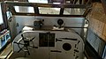
 Inside of Coast Guard rescue boat (215a1440-edc9-46e8-b685-17189d4905e8).JPG 2,048 × 1,536; 524 KB
-

-
 Kayakers along the colorful Pictured Rocks Cliffs (c816ae6f-8c34-4951-9b89-be140cab73c6).jpg 5,472 × 3,648; 11.73 MB
-
 Kayakers along the Pictured Rocks Cliffs (73b50073-4830-4003-8de6-fdca0a4dd100).JPG 5,472 × 3,648; 6.91 MB
-
 Kayakers on Lake Superior by the cliffs (9642883c-9921-4f12-9699-ef43e4b085ef).jpg 3,739 × 2,692; 6.68 MB
-
 Kayaking along the Pictured Rocks Cliffs (c2dc18e5-cdd1-489f-b19b-860b6f061f7f).JPG 4,160 × 3,120; 6.02 MB
-
 Kayaks at Mosquito Beach on an Overcast Day (46c5e2ab-6da8-41b4-84e3-b0c13818b39f).JPG 3,264 × 2,448; 2.24 MB
-
 Kayaks on Lake Superior.jpg 910 × 1,213; 316 KB
-
 Lake Superior at Pictured Rocks National Lakeshore.jpg 910 × 1,213; 392 KB
-

-
 Lake Superior Coast - Grand Marais, Michigan (31671044725).jpg 5,760 × 3,764; 14.11 MB
-
 Lake Superior from Pictured Rocks National Lakeshore.jpg 1,617 × 1,213; 389 KB
-
 Lake Superior Picture from Pictured Rocks National Lakeshore.jpg 1,617 × 1,213; 527 KB
-

-
 Lake Superior Shoreline near Au Sable Point (6b9900e9-ffb7-43b9-a3ea-a88743e762d8).JPG 3,024 × 4,032; 5.23 MB
-
 Lake superior tropical green.webp 5,152 × 3,864; 3.24 MB
-

-
 Life saving cart at Sand Point (631ceabe-55b5-410d-9719-0ed1de324f4f).jpg 6,016 × 4,000; 17.56 MB
-
 Little Beaver Lake - Beaver Basin Wilderness (01cf145b-4f75-4baf-97d0-51de02f74c11).JPG 4,000 × 3,000; 4.28 MB
-
 Little Beaver to Beaver Lake (f4eb176c-8939-4a6d-83e5-5171add5f389).JPG 3,456 × 2,304; 2.15 MB
-
 Little Elliot Falls (6906b08b-fb01-40a2-895b-4bc4b9b033e8).jpg 2,160 × 1,440; 802 KB
-
 Looking down on the rocks below (1045ceab-3450-408f-bc1f-41a706ddf448).JPG 3,456 × 4,608; 7.75 MB
-

-
 Looking out from the Miners Castle Area (cdb6f59d-67ac-4a9b-b6d6-8dc129196f47).JPG 4,608 × 3,456; 3.58 MB
-
 Lovers Leap looking east (e4658ee6-4583-423f-869b-12d89840c060).JPG 4,608 × 3,456; 4.02 MB
-
 Michigan UpperPeninsula LakeSuperior.jpg 1,280 × 851; 143 KB
-
 Miner River (36a47ebc-9778-4097-b4c6-749c320edbcd).JPG 7,546 × 3,908; 7.69 MB
-
 Miners Beach - East (b1658e61-2954-434d-a932-c5a25bbe9e44).JPG 4,032 × 3,024; 5.22 MB
-

-
 Miners Beach East (d0c3af35-6c35-4fba-911f-f1508b83e6b3).JPG 5,472 × 3,648; 7.37 MB
-
 Miners Beach in early spring. (1f659bc0-2c1c-4a54-a10f-7932816d66ad).JPG 3,264 × 2,448; 2.54 MB
-
 Miners Beach in Early Winter (5b88c669-428d-493f-9dc6-143faaccccd9).JPG 4,032 × 3,024; 3.07 MB
-
 Miners Beach Kayaking, Pictured Rocks, Michigan (30475341876).jpg 5,730 × 3,820; 13.88 MB
-
 Miners Beach Looking Toward's Miners Castle (184ce715-9800-4385-a7dd-ec1a1b5687c9).JPG 3,264 × 2,448; 1.74 MB
-
 Miners Beach on a windy day (b5e88f60-209c-4488-8bfc-01b43255bc17).jpg 4,102 × 2,991; 6.45 MB
-
 Miners Beach with the cliffs in the distance (55e5ad57-dbd8-402c-890f-99b9492547f0).JPG 3,264 × 2,448; 2.46 MB
-
 Miners Beach with the cliffs in the distance (8a2ddede-f645-44d8-9285-abc9e92a3336).JPG 2,272 × 1,704; 2.56 MB
-
 Miners Beach with waves (f3c7c9ae-dbf9-4264-a066-ac4af0c5d0ea).jpg 5,826 × 3,874; 13.03 MB
-

-
 Miners Castle Road in Winter (200403e2-4865-489e-a96a-1b470d0a119f).JPG 4,000 × 3,000; 4.02 MB
-
 Miners River 1.jpg 3,008 × 2,000; 988 KB
-
 Miners River 2.jpg 2,000 × 3,008; 1.19 MB
-
 Miners River 3.jpg 2,000 × 3,008; 1.76 MB
-
 Miners River in Spring (81c5f245-2516-4d96-8c67-08c4b3cafc4c).JPG 4,032 × 3,024; 4.59 MB
-
 Miners' Castle - panoramio.jpg 3,326 × 2,218; 1.53 MB
-
 Morning at Sand Point (8873beb6-1d92-4287-9366-e10184024e5e).JPG 5,472 × 3,648; 6.19 MB
-
 Mosaic of Color Along H-58.jpg 4,608 × 3,456; 4.01 MB
-

-
 Mosquito Beach in early Fall (e588d797-9ea4-4656-99b2-3f7df23283a0).jpg 3,972 × 2,496; 6.21 MB
-
 Mosquito River (237c12a5-bd5a-4435-8c6c-99e808a72162).JPG 4,608 × 3,456; 7.07 MB
-
 Mosquito River Michigan.jpg 5,472 × 3,648; 18.33 MB
-
 Mosquito River, Pictured Rocks.JPG 3,072 × 2,304; 2.55 MB
-
 Munising Bay Ice Breakup (14339ead-a5be-4dd2-954e-8383770df5e5).JPG 4,000 × 3,000; 4.1 MB
-
 November storm at Miners Castle (a355b103-cca0-4ea3-a088-b514f0dcaadb).JPG 4,608 × 3,456; 6.32 MB
-

-
 Pancake Ice on Lake Superior (d43a1dcb-c834-4bb1-850b-3dd19cfdd7b7).JPG 2,272 × 1,704; 2.33 MB
-
 Park Ranger at Munising Falls (1763b66d-75c0-43ad-a178-8cbddecd9022).JPG 3,648 × 5,472; 7.73 MB
-

-
 Person and Dog Enjoying the View at Miners Castle (70f9b129-6f29-48ac-bbcc-3618d06a6680).jpg 2,284 × 2,724; 2.02 MB
-

-
 Pictured Rocks (221060049).jpeg 2,048 × 1,371; 633 KB
-
 Pictured Rocks - panoramio (1).jpg 1,840 × 3,264; 822 KB
-
 Pictured Rocks - panoramio (10).jpg 3,264 × 1,840; 1.46 MB
-
 Pictured Rocks - panoramio (11).jpg 1,840 × 3,264; 1.8 MB
-
 Pictured Rocks - panoramio (12).jpg 1,891 × 1,065; 338 KB
-
 Pictured Rocks - panoramio (13).jpg 2,048 × 1,154; 282 KB
-
 Pictured Rocks - panoramio (14).jpg 1,859 × 1,047; 482 KB
-
 Pictured Rocks - panoramio (15).jpg 1,840 × 3,264; 1.67 MB
-
 Pictured Rocks - panoramio (16).jpg 3,264 × 1,840; 960 KB
-
 Pictured Rocks - panoramio (17).jpg 3,264 × 1,840; 1.1 MB
-
 Pictured Rocks - panoramio (18).jpg 1,840 × 3,264; 1.1 MB
-
 Pictured Rocks - panoramio (19).jpg 3,264 × 1,840; 1.64 MB
-
 Pictured Rocks - panoramio (2).jpg 1,971 × 1,111; 398 KB
-
 Pictured Rocks - panoramio (20).jpg 3,264 × 1,840; 1.16 MB
-
 Pictured Rocks - panoramio (21).jpg 3,264 × 1,840; 1.75 MB
-
 Pictured Rocks - panoramio (22).jpg 3,264 × 1,840; 1.69 MB
-
 Pictured Rocks - panoramio (23).jpg 3,264 × 1,840; 1.76 MB
-
 Pictured Rocks - panoramio (24).jpg 3,264 × 1,840; 1.42 MB
-
 Pictured Rocks - panoramio (26).jpg 1,840 × 3,264; 1.71 MB
-
 Pictured Rocks - panoramio (27).jpg 3,264 × 1,840; 1 MB
-
 Pictured Rocks - panoramio (28).jpg 3,264 × 1,840; 1.41 MB
-
 Pictured Rocks - panoramio (30).jpg 3,264 × 1,840; 867 KB
-
 Pictured Rocks - panoramio (31).jpg 3,264 × 1,840; 1.41 MB
.jpg)
.jpg)
.jpg)
.JPG)
.JPG)
.jpg)
.jpg)
.JPG)
.jpg)
.jpg)
.jpg)
.jpg)
.jpg)
.jpg)
.jpg)
.JPG)
.JPG)
.jpeg)
.JPG)
.jpg)
.JPG)
.JPG)
.JPG)
.JPG)

.jpg)
.JPG)
.JPG)
.JPG)
.JPG)
.jpg)
.jpg)
.JPG)

.JPG)
.JPG)
.JPG)

.JPG)
.JPG)
.JPG)
.JPG)
.JPG)
.JPG)
.JPG)
.JPG)
.JPG)
.JPG)
.jpg)
.jpg)
.JPG)
.JPG)
.JPG)
.JPG)
.JPG)
.JPG)
.JPG)
.JPG)


.JPG)
.jpg)
_(a2675b22-21c8-4269-a5fc-a8e9ed675a39).JPG)
.jpg)
.jpg)
.JPG)
.jpg)
.JPG)
.JPG)
.JPG)
.JPG)
.JPG)
.JPG)
.JPG)
.JPG)
.JPG)
.JPG)
.JPG)
.JPG)
.JPG)
.JPG)
.JPG)
.JPG)
.JPG)
.JPG)
.jpg)
.JPG)
.jpg)
.JPG)
.JPG)


.jpg)
.jpg)


.JPG)
.JPG)

.JPG)
.jpg)
.JPG)
.JPG)
.jpg)
.JPG)
.JPG)
.JPG)
.JPG)

.JPG)
.JPG)
.JPG)
.JPG)
.JPG)
.JPG)
.jpg)
.JPG)
.jpg)
.JPG)
.JPG)
.jpg)
.JPG)
.JPG)


.JPG)

.JPG)

.JPG)
.jpg)
.JPG)


.JPG)
.JPG)
.JPG)
.JPG)
.JPG)
.jpg)
.jpg)
.JPG)
.jpeg)
.jpg)
.jpg)
.jpg)
.jpg)
.jpg)
.jpg)
.jpg)
.jpg)
.jpg)
.jpg)
.jpg)
.jpg)
.jpg)
.jpg)
.jpg)
.jpg)
.jpg)
.jpg)
.jpg)
.jpg)
.jpg)
.jpg)
Categories:
- Protected areas of Michigan
- National Lakeshores of the United States
- Michigan State Historic Sites in Alger County, Michigan
- Lake Superior
- Protected areas of the Upper Peninsula
- Rock formations in Michigan
- National Park Service in Michigan
- 1966 establishments in the United States
- Protected areas established in 1966
- IUCN Category III
- IUCN Protected areas of the United States
- Western Great Lakes forests