Category:Tehri Garhwal district
Jump to navigation
Jump to search
district of Uttarakhand, India .svg) | |||||
| Upload media | |||||
| Instance of | |||||
|---|---|---|---|---|---|
| Location |
| ||||
| Capital | |||||
| Population |
| ||||
| Area |
| ||||
| official website | |||||
 | |||||
Subcategories
This category has the following 5 subcategories, out of 5 total.
Media in category "Tehri Garhwal district"
The following 22 files are in this category, out of 22 total.
-
 1832-25-Grass Rope Bridge at Teree, Gurwall.png 980 × 614; 903 KB
-
 A protest message against Tehri dam, Garhwal, Uttarakhand.jpg 800 × 600; 119 KB
-
 Basartaal bugyal.jpg 2,711 × 1,220; 952 KB
-
 Devprayag sangam.jpg 4,032 × 3,024; 3.86 MB
-
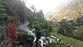
 Drive from Haridwar to Joshimath (43366574065).jpg 5,184 × 3,456; 11.18 MB
-
 Forest Levitation (Unsplash).jpg 6,000 × 3,612; 1.78 MB
-
 Jakhnayali village, tehri district, Uttrakhand, India.jpg 3,264 × 1,840; 1.55 MB
-
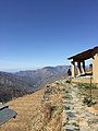
 Kaudia Range, Uttarakhand.jpg 4,608 × 2,184; 1.6 MB
-
 Ludgarh bugyal.jpg 2,711 × 1,220; 1.65 MB
-
 NagTibba.jpg 4,032 × 3,024; 2.61 MB
-
 Nagtippa Village.jpg 2,448 × 3,264; 2.62 MB
-
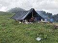 Nomads hut.jpg 4,032 × 3,024; 4.5 MB
-
 P 20170517 125316 02.jpg 4,096 × 2,304; 2.34 MB
-
 Panwali bugyal.jpg 2,711 × 1,220; 1.08 MB
-
 Panwali kantha temple.jpg 2,711 × 1,220; 1.42 MB
-

-
 Sri Gadwall District Map.png 350 × 231; 46 KB
-
 Sunset- Ghansali.jpg 2,227 × 1,485; 574 KB
-
 Tehri Dam India.jpg 4,032 × 2,568; 9.09 MB
-
 Tehri Garhwal district.svg 1,250 × 1,125; 137 KB
-
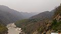
 The river ^ highway - panoramio.jpg 2,920 × 2,243; 2.61 MB
-
 Village life.jpg 4,160 × 2,340; 1.95 MB


.jpg)


.jpg)


.jpg)