Category:Thrintoft
Jump to navigation
Jump to search
village in United Kingdom  | |||||
| Upload media | |||||
| Instance of | |||||
|---|---|---|---|---|---|
| Standort | Hambleton, North Yorkshire, Yorkshire and the Humber, England | ||||
| Population |
| ||||
| Area |
| ||||
 | |||||
Subcategories
This category has only the following subcategory.
Media in category "Thrintoft"
The following 48 files are in this category, out of 48 total.
-
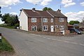 'Rose Cottage' at Thrintoft crossroads - geograph.org.uk - 3718128.jpg 1,024 × 683; 156 KB
-
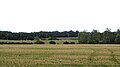
 Arable field near Scruton - geograph.org.uk - 636546.jpg 640 × 480; 51 KB
-
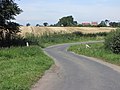
 B6271 towards Yafforth - geograph.org.uk - 2711218.jpg 640 × 480; 84 KB
-
 Barn off Mill Lane - geograph.org.uk - 2709251.jpg 640 × 480; 49 KB
-
 Benchmark on building at Bramper Farm - geograph.org.uk - 3719418.jpg 683 × 1,024; 227 KB
-
 Benchmark on parapet of Halliken Bridge - geograph.org.uk - 3719393.jpg 683 × 1,024; 228 KB
-
 Bramper Lane - geograph.org.uk - 2709256.jpg 640 × 480; 51 KB
-
 Bramper Lane towards Great Langton - geograph.org.uk - 2709265.jpg 640 × 480; 79 KB
-
 Farm lane, Thrintoft - geograph.org.uk - 5920916.jpg 4,036 × 2,700; 2.56 MB
-
 Farm track, Yafforth Moor - geograph.org.uk - 2711217.jpg 640 × 480; 71 KB
-
 Farmland off Bramper Lane - geograph.org.uk - 2709262.jpg 640 × 480; 45 KB
-
 Farmland off Mill Lane - geograph.org.uk - 2709252.jpg 640 × 480; 44 KB
-
 Farmland, Thrintoft - geograph.org.uk - 2709221.jpg 640 × 480; 65 KB
-
 Fenced gap in hedge beside Bramper Lane - geograph.org.uk - 3721790.jpg 1,024 × 683; 158 KB
-
 Fields off Bramper Lane - geograph.org.uk - 5920921.jpg 4,319 × 2,405; 1.58 MB
-
 Footpath, Thrintoft - geograph.org.uk - 2709230.jpg 640 × 480; 86 KB
-
 Gateway at Bramper Lane bend - geograph.org.uk - 3721861.jpg 1,024 × 683; 167 KB
-
 Halliken Bridge, Bramper Lane - geograph.org.uk - 3719402.jpg 1,024 × 683; 210 KB
-
 Leaving Thrintoft - geograph.org.uk - 500879.jpg 640 × 480; 113 KB
-
 Moor House Farm - geograph.org.uk - 2709241.jpg 640 × 480; 41 KB
-
 Moor House Farm - geograph.org.uk - 367420.jpg 640 × 480; 124 KB
-
 Myers Lane - geograph.org.uk - 500854.jpg 640 × 480; 114 KB
-
 Myers Lane near Thrintoft - geograph.org.uk - 500862.jpg 640 × 480; 108 KB
-
 New Dike - geograph.org.uk - 500994.jpg 640 × 480; 98 KB
-
 New Inn - geograph.org.uk - 500874.jpg 640 × 480; 96 KB
-
 New Inn, Thrintoft - geograph.org.uk - 144060.jpg 640 × 480; 107 KB
-
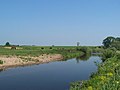
 North Bridge, Thrintoft - geograph.org.uk - 2056519.jpg 3,648 × 2,736; 3.39 MB
-
 Northallerton Equestrian Centre - geograph.org.uk - 376497.jpg 640 × 480; 62 KB
-
 Northallerton Equestrian Centre - geograph.org.uk - 376499.jpg 640 × 480; 83 KB
-
 Outbuildings at Bramper Farm - geograph.org.uk - 3719439.jpg 1,024 × 683; 250 KB
-
 Ploughed field - geograph.org.uk - 144056.jpg 640 × 480; 106 KB
-
 Public Footpath, Thrintoft - geograph.org.uk - 500984.jpg 640 × 480; 116 KB
-

-
-

-
 Sheep pasture, Yafforth Moor - geograph.org.uk - 5920943.jpg 4,320 × 2,883; 1.56 MB
-
 The New Inn, Thrintoft - geograph.org.uk - 2709226.jpg 640 × 480; 49 KB
-
 The west end of Myers Lane - geograph.org.uk - 6506731.jpg 3,888 × 5,184; 3.54 MB
-
 Approaching Thrintoft - geograph.org.uk - 500867.jpg 640 × 480; 99 KB
-
 Thrintoft Moor Lane - geograph.org.uk - 2709219.jpg 640 × 480; 77 KB
-
 Thrintoft Moor Lane - geograph.org.uk - 3724069.jpg 725 × 1,024; 193 KB
-
 Thrintoft Moor Lane - geograph.org.uk - 5920951.jpg 4,176 × 2,666; 2.58 MB
-
 Thrintoft Moor Lane heading north - geograph.org.uk - 2709243.jpg 640 × 480; 56 KB
-
 Thrintoft village - geograph.org.uk - 144054.jpg 640 × 480; 97 KB
-
 View north-east from Bramper Farm - geograph.org.uk - 144055.jpg 640 × 480; 79 KB
-
 Village Pump, Thrintoft. - geograph.org.uk - 561210.jpg 480 × 640; 104 KB
-
 Village Street, Thrintoft.jpg 640 × 480; 75 KB
-
 Welcome to Thrintoft - geograph.org.uk - 2056512.jpg 2,977 × 2,238; 4.63 MB


