Uploads by Phirosiberia
Jump to navigation
Jump to search
For Phirosiberia (talk · contributions · Move log · block log · uploads · Abuse filter log)
This special page shows all uploaded files that have not been deleted; for those see the upload log.
| Date | Name | Thumbnail | Size | Description |
|---|---|---|---|---|
| 10:55, 3 September 2019 | Rótulo en el centro de Interpretación de la Alcarria madrileña.png (file) |  |
2.73 MB | User created page with UploadWizard |
| 10:55, 3 September 2019 | Carro en el centro de Interpretación de la Alcarria madrileña.png (file) |  |
2.91 MB | User created page with UploadWizard |
| 10:55, 3 September 2019 | Maquinaria en el centro de Interpretación de la Alcarria madrileña.png (file) |  |
3.04 MB | User created page with UploadWizard |
| 10:55, 3 September 2019 | Interior del centro de Interpretación de la Alcarria madrileña.png (file) |  |
2.87 MB | User created page with UploadWizard |
| 10:55, 3 September 2019 | Centro de Interpretación de la Alcarria madrileña.png (file) |  |
3.05 MB | User created page with UploadWizard |
| 16:59, 19 December 2010 | AreaAtlasCam.PNG (file) |  |
11 KB | Colmenar Viejo |
| 16:34, 19 December 2010 | Ruta de la Seda en Asia central.png (file) |  |
1.63 MB | {{Information |Description={{en|1=Map of the Silkroad through central Asia and major cities .}} {{es|1=Mapa de la Ruta de la seda a su paso por Asia central y principales ciudades.}} |Source=Own work, based on [http://upload.wikimedia.org/wikipedia/common |
| 03:32, 19 December 2010 | Puerta de Zungaria.png (file) |  |
1.55 MB | Mistake! |
| 19:51, 3 January 2010 | Metal production in Ancient Middle East (easy translation).svg (file) | 255 KB | {{translation possible}} {{inkscape}} {{Information |Description='''Easly translated (object isn't converted to a path)''' {{en|Metal production in Ancient Middle East.}} {{es|Regiones productoras de metales utilizados en Mesopotamia.}} {{it|Produzione d | |
| 19:46, 3 January 2010 | Metal production in Ancient Middle East.svg (file) |  |
422 KB | {{inkscape}} {{Information |Description={{en|Metal production in Ancient Middle East.}} {{es|Regiones productoras de metales utilizados en Mesopotamia.}} {{it|Produzione di metalli nell'antico Medio Oriente.}} |Source=*[[:File:Regs_productoras_de_metales_ |
| 19:28, 3 January 2010 | Produzione di metalli nell'antico Medio Oriente.svg (file) |  |
424 KB | "Object to Path" with Inkscape (to better view) |
| 19:24, 3 January 2010 | Regs productoras de metales en la Edad Antigua en Oriente Medio.svg (file) |  |
460 KB | Objeto a trayecto |
| 13:48, 28 December 2009 | Cruz Trinitaria.PNG (file) |  |
392 bytes | Right position. |
| 11:41, 19 September 2009 | Early Dynastic-es.svg (file) |  |
39 KB | {{Information |Description={{en|1=Main cities of Sumer during Early Dynastic period.}} {{es|1=Principales ciudades de Sumeria durante el período dinástico arcaico.}} |Source=Leick, Gwendolyn (2002) «''Mesopotamia: La invención de la ciudad''» ISBN 84 |
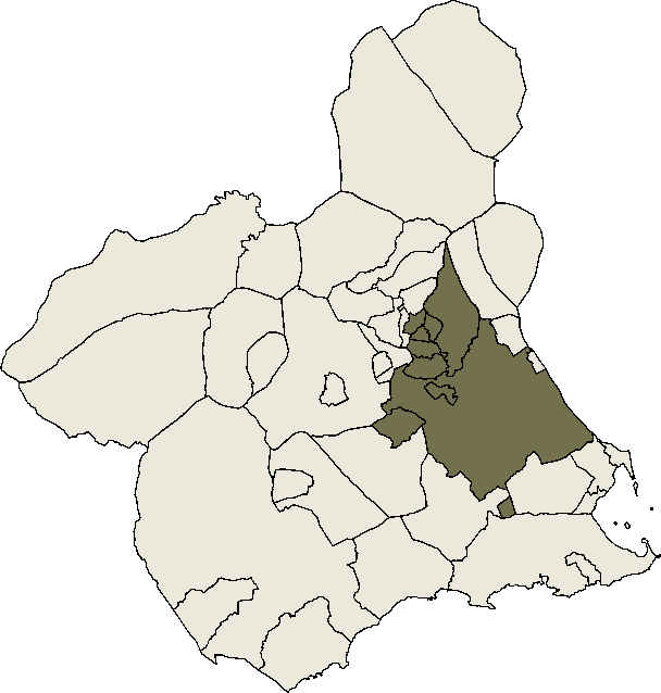
| 17:33, 16 September 2009 | Murcia metropolitan area.png (file) |  |
16 KB | {{Information |Description={{en|Murcia metropolitan area acording to {{cite web|url=http://alarcos.inf-cr.uclm.es/per/fruiz/pobesp/dat/arc/areas-mun.pdf |title=Municipios que forman las áreas urbanas y metropolitanas|author=[http://alarcos.inf-cr.uclm.es |
| 22:31, 13 September 2009 | Colegiata de Vigo.jpg (file) |  |
20 KB | {{Information |Description={{es|Colegiata de Santa María de Vigo}} |Source=*File:Colegiata.jpg |Date=2009-09-13 22:31 (UTC) |Author=*File:Colegiata.jpg: {{#if:28340512@N07|[http://flickr.com/photos/28340512@N07 Pablo]|{{#if:|[{{{2}}} Pablo]|P |
| 11:48, 10 August 2009 | Division administrativa del Líbano.svg (file) |  |
292 KB | Texto a trayecto. |
| 12:08, 9 July 2009 | Distribution Haplogroup J Y-DNA.svg (file) |  |
896 KB | Fixed mistake in Sadinia. |
| 11:05, 28 June 2009 | Neolitico-ganaderia.svg (file) |  |
1.55 MB | title |
| 17:51, 17 June 2009 | Característica idealizada de un transistor bipolar.svg (file) | 15 KB | {{Information |Description={{en|Ideal I-V characteristics of a BJT}}{{es|Característica idealizada de un transistor bipolar}} {{fr|Caractéristiques idéalisées d'un transistor bipolaire}} |Source=*[[:File:Caractéristiques_idéalisées_d'un_transistor_ | |
| 15:41, 17 June 2009 | Comparison between field-effect transistors en.svg (file) | 102 KB | Labels possition | |
| 15:37, 17 June 2009 | Comparison between field-effect transistors.svg (file) | 102 KB | upload error | |
| 15:24, 17 June 2009 | MOSFET depletion-mode n-channel en.svg (file) |  |
34 KB | Upload error |
| 15:23, 17 June 2009 | MOSFET depletion-mode n-channel.svg (file) |  |
34 KB | Plot possition |
| 14:50, 17 June 2009 | MOSFET enhancement-mode n-channel en.svg (file) |  |
32 KB | {{Information |Description={{en|1=I–V characteristics and output plot of a MOSFET enhancement-mode n-channel transistor.}} {{es|1=Curvas característica y de salida de un transistor MOSFET de acumulación canal n.}} |Source=Dispositivos Electrónicos II |
| 14:48, 17 June 2009 | MOSFET enhancement-mode n-channel.svg (file) |  |
32 KB | {{Information |Description={{en|1=I–V characteristics and output plot of a MOSFET enhancement-mode n-channel transistor.}} {{es|1=Curvas característica y de salida de un transistor MOSFET de acumulación canal n.}} |Source=Dispositivos Electrónicos II |
| 20:17, 16 June 2009 | JFET n-channel.svg (file) |  |
34 KB | Lines position |
| 20:15, 16 June 2009 | JFET n-channel en.svg (file) |  |
34 KB | {{Information |Description={{en|1=I–V characteristics and output plot of a JFET n-channel transistor}} {{es|1=Curvas característica y de salida de un transistor JFET canal n}} {{fr|1=Caractéristiques courant-tension d'un JFET à canal N}} |Source=*[[: |
| 20:36, 14 June 2009 | Sumafasores.gif (file) |  |
617 KB | {{Information |Description={{en|Phasors addition}}{{en|Suma fasorial}} |Source=[http://en.wikipedia.org/wiki/File:Sumafasores.gif en wikipedia] |Date=27 February 2009 |Author=[http://en.wikipedia.org/wiki/User:Gonfer Gonfer] |Permission=Creative Commons A |
| 18:37, 13 June 2009 | Inductor with terminal marked.svg (file) |  |
4 KB | {{Information |Description={{en|1=Inductor symbol}} {{es|1=Símbolo de una bobina}} |Source=trabajo propio (own work) based in a section of this file |Author=Phirosiberia |Date=June |
| 22:08, 12 June 2009 | Atmosphere with Ionosphere es.svg (file) |  |
29 KB | {{Information |Description=Capas de la atmósfera e ionosfera. Temperatura y densidad de electrones con respecto a la altura. |Source=*File:Atmosphere_with_Ionosphere.svg |Date=2009-06-12 23:07 (UTC) |Author=*[[:File:Atmosphere_with_Ionosphere.svg|] |
| 20:40, 12 June 2009 | Ionosphere Layers es.svg (file) |  |
44 KB | {{Information |Description={{es|1=Capas de la ionosfera. Por la noche, están presentes las capas E y F. Por la dia se forma la capa D, las capas E y F se hacen más fuertes y además está última se diferencia entre la F1 y la F2}} |Source=*[[:File:Iono |
| 20:32, 12 June 2009 | Ionosphere Layers en.svg (file) |  |
44 KB | {{Information |Description={{en|1=Ionospheric layers. At night the E layer and F layer are present. During the day, a D layer forms and the E and F layers become much stronger. Often during the day the F layer will differentiate into F1 and F2 layers.}} | |
| 13:42, 2 May 2009 | Propagación por onda ionosférica.svg (file) |  |
16 KB | Fondo |
| 15:30, 5 March 2009 | Maps - ES - Madrid - Zofio.PNG (file) |  |
14 KB | Colors |
| 17:13, 4 February 2009 | Ruta Imperial mapa.svg (file) |  |
457 KB | {{Information |Description=Ruta Imperial de la Comunidad de Madrid, mapa (SVG) |Source=*File:Ruta_Imperial_mapa.png |Date=2009-02-04 17:11 (UTC) |Author=*File:Ruta_Imperial_mapa.png: Esetena *derivative work: ~~~ |Permission=see below |other_v |
| 21:49, 31 January 2009 | European-union-renewables-es.svg (file) |  |
295 KB | {{Information |Description={{en|Figures of 2004 of the part of renewable energy in the European Union. Source of figures from [http://www.bmu.de/english/renewable_energy/downloads/doc/5996.php Bundesministerium für Umwelt (BMU) in a 2005 report].}} |Sour |
| 21:40, 31 January 2009 | European-union-renewables-fr.svg (file) |  |
169 KB | Text to path. |
| 20:28, 28 January 2009 | Distribution Haplogroup J1 Y-DNA.svg (file) |  |
1.01 MB | {{Information |Description={{en|1=Distribution of haplogroup J1}} {{es|1=Distribución del haplogrupo J1}} |Source=trabajo propio (own work) |Author=Crates |Date=2009-01-28 |Permission= |other_versions= }} <!--{{ImageUpload|full}}--> [[Ca |
| 19:52, 28 January 2009 | Blank map europe no borders.svg (file) | 302 KB | Only one object. | |
| 00:59, 27 January 2009 | Maps - ES - Madrid - Villaverde.PNG (file) |  |
13 KB | {{Information |Description= |Source= |Date= |Author= |Permission= |other_versions= }} |
| 00:59, 27 January 2009 | Maps - ES - Madrid - Villa de Vallecas.PNG (file) |  |
14 KB | {{Information |Description= |Source= |Date= |Author= |Permission= |other_versions= }} |
| 00:59, 27 January 2009 | Maps - ES - Madrid - Vicalvaro.PNG (file) |  |
14 KB | {{Information |Description= |Source= |Date= |Author= |Permission= |other_versions= }} |
| 00:59, 27 January 2009 | Maps - ES - Madrid - Usera.PNG (file) |  |
13 KB | {{Information |Description= |Source= |Date= |Author= |Permission= |other_versions= }} |
| 00:59, 27 January 2009 | Maps - ES - Madrid - Tetuan.PNG (file) |  |
14 KB | {{Information |Description= |Source= |Date= |Author= |Permission= |other_versions= }} |
| 00:59, 27 January 2009 | Maps - ES - Madrid - San Blas.PNG (file) |  |
14 KB | {{Information |Description= |Source= |Date= |Author= |Permission= |other_versions= }} |
| 00:59, 27 January 2009 | Maps - ES - Madrid - Salamanca.PNG (file) |  |
14 KB | {{Information |Description= |Source= |Date= |Author= |Permission= |other_versions= }} |
| 00:59, 27 January 2009 | Maps - ES - Madrid - Retiro.PNG (file) |  |
14 KB | {{Information |Description= |Source= |Date= |Author= |Permission= |other_versions= }} |
| 00:59, 27 January 2009 | Maps - ES - Madrid - Puente de Vallecas.PNG (file) |  |
14 KB | {{Information |Description= |Source= |Date= |Author= |Permission= |other_versions= }} |
| 00:53, 27 January 2009 | Maps - ES - Madrid - Ciudad Lineal.PNG (file) |  |
14 KB | {{Information |Description= |Source= |Date= |Author= |Permission= |other_versions= }} |
.svg)