
Highlighted Activity
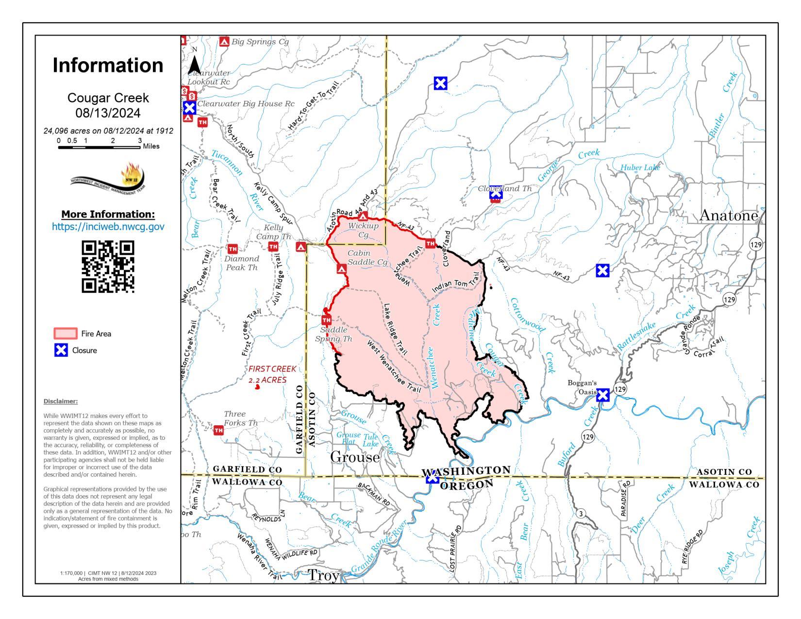
The Cougar Creek Fire began July 15, 2024 and is currently being managed under a full suppression strategy. Northeast Washington Interagency Incident Management Team 1, with Incident Commander Braden Britt, assumed command of this fire at 7 p.m. PST on August 13th, 2024.
The Washington Department of Natural Resources, Oregon Department of Forestry, US Forest Service, and Bureau of Land Management are cooperating to manage this fire.
| Current as of | Mon, 08/19/2024 - 11:26 |
|---|---|
| Incident Time Zone | America/Los_Angeles |
| Incident Type | Wildfire |
| Cause | Undetermined |
| Date of Origin | |
| Standort | 1 mile west of Hwy 129 and Grand Ronde river intersection |
| Incident Commander | Braden Britt, Incident Commander Northeast Washington Incident Management Type 3 Team 1 |
| Coordinates |
46° 2' 20'' Latitude
-117° 19' 4
'' Longitude
|
| Total Personnel: | 226 |
|---|---|
| Size | 24,091 Acres |
| Percent of Perimeter Contained | 80% |
| Estimated Containment Date | 10/01/2024 |
| Fuels Involved | Timber (Litter and Understory) Brush (2 feet) Timber (Grass and Understory) In the lower elevations, the primary carrier of the fire was grass when enough fuel loading was present. In the mid and upper elevation, the primary carrier of the fire is in timber litter under timber stands and timber stringers with down and dead woody material and needle litter. On mid-slopes and above, grass and shrub fuels have various levels of greenness, dependent on aspect and elevation and are barriers to fire spread. Near the fire perimeter in the mid to upper elevations, sub alpine fir exists. Moss and lichen are present in some mature trees. |
| Significant Events | Minimal Smoldering This fire lies north of the Grande Ronde River and upslope to the 43 Road. The overall aspect is SE with steep incised canyons dissecting a mixed topography of ridgelines, benches, plateaus and secondary drainages. |