Newsletter Signup
Stay up to date on all the latest news from Boston.com
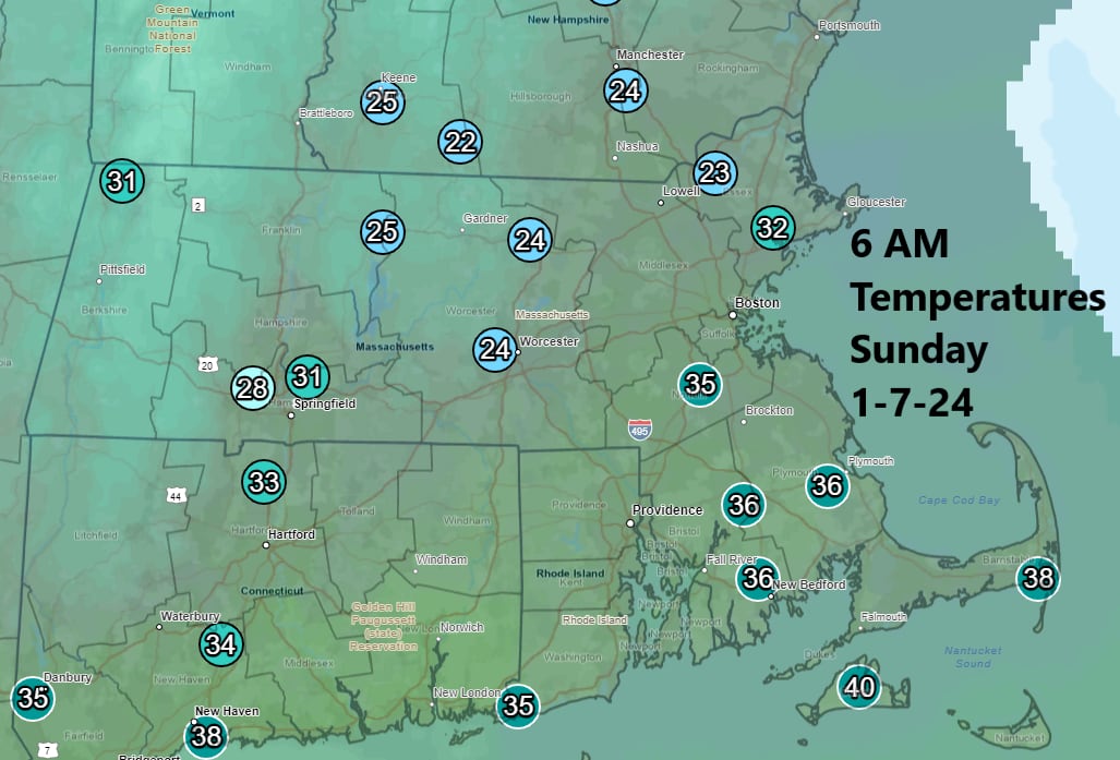
The heaviest snow in the Boston area so far has fallen west of Interstate 495 in a cold zone where temperatures dropped into the 20s Sunday morning. From Springfield to Worcester and on through western Essex County, anywhere from 4 to 8 inches has piled up, a sharp contrast with Boston, which has seen very little accumulation.
Mild marine air kept the snow from accumulating overnight as the first wave of precipitation moved through.
For the rest of the day, wet snow and rain will transition to snow nearly everywhere except the Cape and the islands. This means additional accumulation is likely, though it will be heavy and wet. It’s somewhat tough to predict exactly how much snow is going to end up on the ground because of these marginal temperatures.
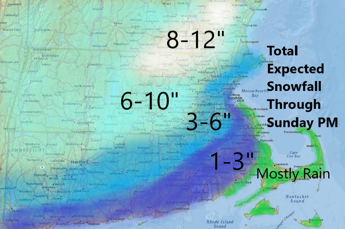
The map below shows total predicted snowfall, including what fell overnight and what we expect to receive through this afternoon and evening.
The short-range models have a burst of heavier snow later this morning into the first part of the afternoon, and this is when Boston should receive its accumulation. If temperatures are just a degree or two warmer, the snow won’t accumulate, and the city will end up with virtually nothing besides some slush.
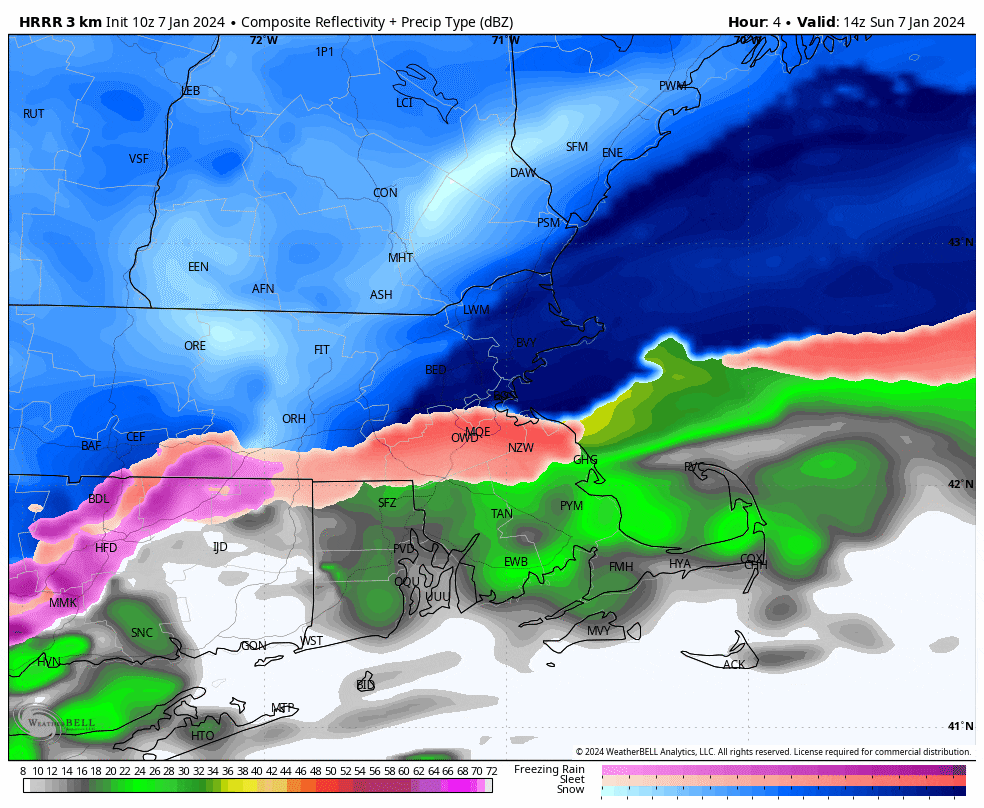
The radar prediction loop below shows the mixed precipitation noted in orange-pink transitioning over to snow even in Boston, at least for a few hours. No matter what happens, you’ll still be able to get around regardless of where you are today, although travel will be slower the farther north and west you’re located.
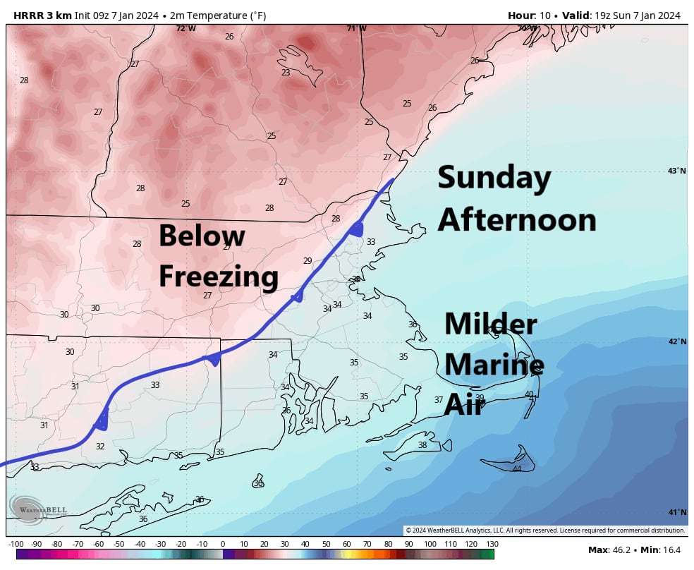
The final bits of snow should come to an end between 4 p.m. and 7 p.m., and at that point temperatures will also fall below freezing. Notice on the map below that in the early afternoon it will be above freezing, but that colder air is going to work into Boston probably between 3 p.m. and 4 p.m. at which point temperatures will be cold enough for everything to freeze.
In a typical year, I would be concerned that if you didn’t clean up the snow and slush on the ground, it might stick around awhile. However, we have another warmer weather system coming in Tuesday night. So if there’s ice around, it’s going to disappear pretty quickly Tuesday night and Wednesday. That system will bring very mild air for January, along with heavy rain and possibly some street and basement flooding as snow melts.
Stay up to date on all the latest news from Boston.com


Conversation
This discussion has ended. Please join elsewhere on Boston.com