Newsletter Signup
Stay up to date on all the latest news from Boston.com

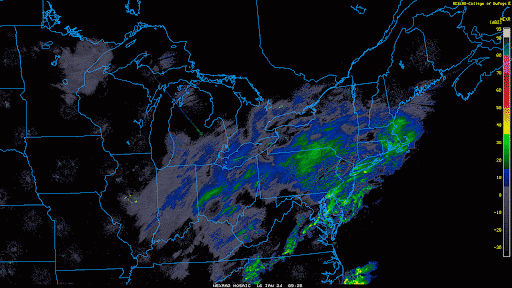
If you head out this morning, you can expect roads to be anywhere from just wet to snow covered. There was an inch or two of snow in many spots overnight, and with temperatures below freezing those areas that are still untreated are slippery.
Of course, there’s also the treated surfaces where the spray will be hitting your windshield, so be sure that your washer reservoir is full, you’ll likely need it.
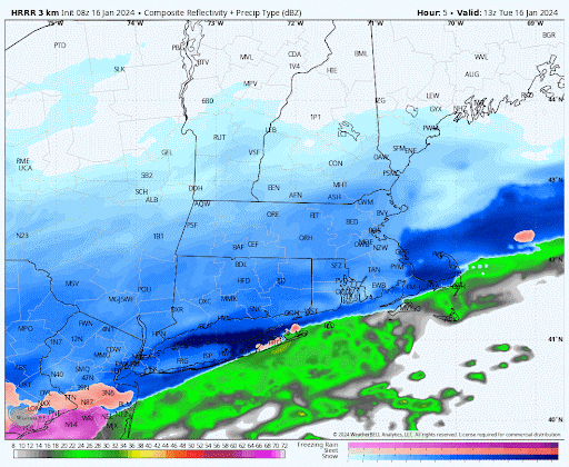
Throughout the day Tuesday we’re going to see precipitation at varying rates, but temperatures are going to warm up especially from the Mass. Pike south. This is going to change the snow over to a mixed bag of rain, sleet, and even some freezing rain at the end.
This is certainly not a big event, and treated roadways will be fine throughout the entire day.
The map below shows expected total snowfall — most of this will fall in the morning. There might be a little coating when it comes to an end this evening, but it certainly won’t add to the totals in a significant way.
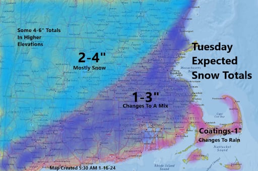
As you get north and west of the Mass. Pike and Interstate 495, totals will be a little higher, approaching up to half a foot in the highest elevations of the Berkshires, Vermont, and perhaps up into New Hampshire and Maine.
Tuesday afternoon, with readings above freezing, it may be a good chance to clean up any slush you have on your driveway or walkways.
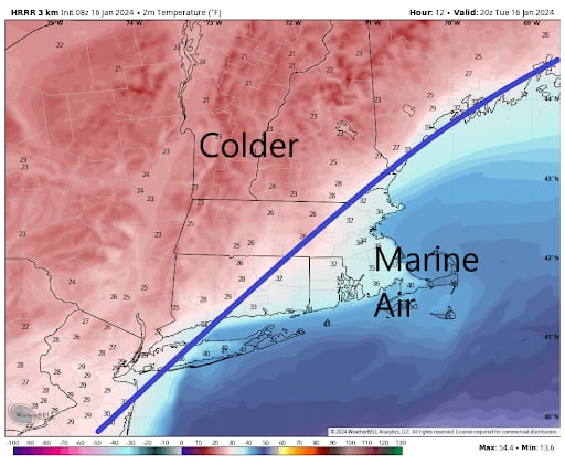
Notice the map below shows temperatures below freezing to the north and west and above freezing to the south and east of the line. That line will collapse toward the coastline overnight as temperatures get back down into the teens and lower 20s for the start of Wednesday. This is the beginning of a cold stretch.
Temperatures are going to remain below freezing into the weekend. This will allow ponds to freeze, and those backyard skating rinks which have not had much use should be able to be enjoyed over the weekend.
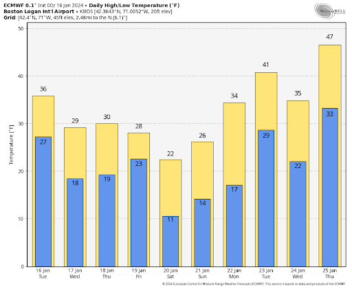
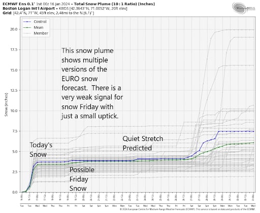
It is dry and cold Wednesday and Thursday with highs only 25 to 32 degrees. There is the possibility of another storm on Friday, although that possibility is shrinking.
I took a look at the European ensemble forecast for snow, and there’s a very small hint of snow on Friday, but certainly at the present time nothing significant. This is because the storm is likely to go out to sea rather than come up the coastline. This will set us up for a dry, cold weekend before a moderating trend takes place next week.
Stay up to date on all the latest news from Boston.com


Conversation
This discussion has ended. Please join elsewhere on Boston.com