 PTI
PTIWASHINGTON: The Zhada Basin of the high-rise Tibetan Plateau which helps bring monsoons over India lost 3,000 to 5,000 feet of elevation some 3 to 4 million years ago, a new study has found.
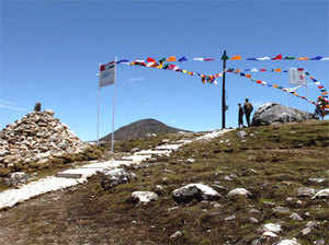
The Tibetan Plateau in south-central Asia, because of its size, elevation and impact on climate, is one of the world's greatest geological oddities, researchers said.
At about 960,000 square miles it covers slightly more land area than Alaska, Texas and California combined, and its elevation is on the same scale as Mount Rainier in the Cascade Range of Washington state.
Because it rises so high into the atmosphere, it helps bring monsoons over India and other nations to the south while the plateau itself remains generally arid, researchers said.
For decades, geologists have debated when and how the plateau reached such lofty heights, some 14,000 feet above sea level, about half the elevation of the highest Himalayan peaks just south of the plateau.
But new research led by a University of Washington scientist appears to confirm an earlier improbable finding - at least one large area in southwest Tibet, the plateau's Zhada Basin, actually lost 3,000 to 5,000 feet of elevation sometime in the Pliocene epoch.
"This basin is really high right now but we think it was a kilometre or more higher just 3 million to 4 million years ago," said Katharine Huntington, a UW associate professor of Earth and space sciences and the lead author of a paper describing the research.
The researchers studied snail shells dating from millions of years ago and from a variety of aquatic environments.
The work confirms results of a previous study involving Co-authors Joel Saylor of the University of Houston and Jay Quade of the University of Arizona that examined the ratio of heavy isotope oxygen-18 to light isotope oxygen-16 in ancient snail shells from the Zhada Basin.
They found the ratios were very low, which suggested the basin had a higher elevation in the past.
They also collected modern shell and water samples from a variety of environments for comparison.
Just why the elevation decline happened is open to speculation. One possibility is that as faults in the region spread, the Zhada Basin lowered, Huntington said.
It is unknown yet whether other parts of the southern plateau also lowered at the same time, but if elevation loss was widespread it could be because of broader fault spreading.
It also is possible the crust thickened and forced large rock formations even deeper into the Earth, where they heated until they reached a consistency at which they could ooze out from beneath the crust, like toothpaste squeezed from the tube, researchers said.
The study appears in the journal Geological Society of America Bulletin.
(Catch all the Business News, Breaking News, Budget 2024 Events and Latest News Updates on The Economic Times.)
Subscribe to The Economic Times Prime and read the ET ePaper online.
Read More News on
(Catch all the Business News, Breaking News, Budget 2024 Events and Latest News Updates on The Economic Times.)
Subscribe to The Economic Times Prime and read the ET ePaper online.